The main purpose of this ongoing blog will be to track planetary extreme, or record temperatures related to climate change. Any reports I see of ETs will be listed below the main topic of the day. I’ll refer to extreme or record temperatures as ETs (not extraterrestrials).😜
Main Topic: Little Snow in California and the West as a Warm Winter Ends
Dear Diary. Today is the first day of meteorological spring across the Northern Hemisphere. Across the Midwest and much of the East conditions have been described by the media as being very harsh and brutally cold, but in reality have been comparable to traditional winters from the mid 20th century. Not so out West where a near warmest winter on record has led to a snow drought with worries about what the warm season might do regarding the growing season and chance for extremely bad wildfires.
California isn’t that badly affected, but the rest of the West could experience water issues later this summer:
Here is a good summary on this western winter warmth from the Los Angeles Times:
California’s warm winter has brought very little snow – Los Angeles Times
Little snow in California and the West as a warm winter nears end
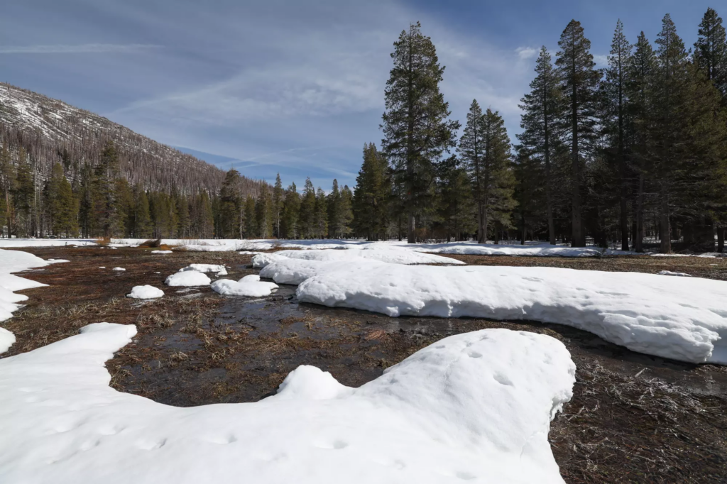
Snow blankets the meadow where the California Department of Water Resources conducted the third snow survey of the 2026 season at Phillips Station in the Sierra Nevada on Feb. 27. (Xavier Mascareñas / California Department of Water Resources)

By Ian James
Feb. 27, 2026 4:18 PM PT
February storms brought fresh snow to the Sierra Nevada, but California’s snowpack remains far smaller than average during a winter that has brought record warmth across much of the West.
California water officials said Friday that the Sierra snowpack is at 66% of average for this time of year.
“We’re ahead of where we were last month, but still way behind where we would hope to be,” said Andy Reising, manager of snow surveys for the California Department of Water Resources.
Reising wore skis as he and other officials measured snow in a slushy meadow at Phillips Station near South Lake Tahoe, where rains in the last week began to melt the snow.
“I fell into a stream this morning because of the water that’s flowing under the snowpack,” he said.
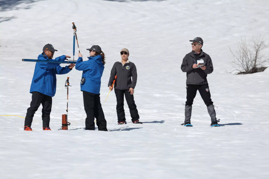
California Department of Water Resources engineer Derick Louie, from left, engineer Jordan Thoennes, hydrometeorologist Angelique Fabbiani-Leon and Snow Survey and Water Supply Forecasting Unit Manager Andy Reising conduct the third snow survey of the 2026 season at Phillips Station in the Sierra Nevada on Feb. 27. (Xavier Mascareñas/California Department of Water Resources)
California relies on the Sierra snowpack for about 30% of its water.
But extreme warmth across the West this winter has meant more precipitation falling as rain, not snow — a symptom of global warming, which in recent years has been pushing average snow lines higher in the mountains and changing the timing of runoff.
There are 130 monitoring stations across the Sierra Nevada mountains that provide electronic readings. The northern Sierra is currently at 46% of average and the southern Sierra 90% of average.
California’s snow season typically peaks around April 1.
Although much of it hasn’t fallen as snow, California has seen above-average precipitation this winter. According to the U.S. Drought Monitor website, no part of California is currently experiencing drought conditions.
But across 11 western states, 45% of the region is in at least a moderate drought, and large portions of the Colorado River watershed are in severe drought.
The snowpack in the Upper Colorado River Basin stands at 66% of average. That will mean less snowmelt feeding the river’s reservoirs, which are declining to critically low levels.
The western state with the most severe snow drought is Oregon. Its snowpack measures just 34% of average for this time of year, the second-worst since 1981.

Halfway through winter, heat is melting the California snowpack
Jan. 30, 2026
Temperatures from November through January were the warmest on record. “That’s really the big story about why our snowpack is so meager,” said Larry O’Neill, the Oregon state climatologist and an associate professor at Oregon State University.
“Projections show that our winters are going to look a lot more like this in the future,” O’Neill said. “So this is really a test of our resiliency, of our water supply.”
Ian James is a reporter who focuses on water and climate change in California and the West. Before joining the Los Angeles Times in 2021, he was an environment reporter at the Arizona Republic and the Desert Sun. He previously worked for the Associated Press as a correspondent in the Caribbean and as bureau chief in Venezuela. Follow him on Bluesky @ianjames.bsky.social and on X @ByIanJames.
Here are some “ETs” recorded from around the U.S. the last couple of days, their consequences, and some extreme temperature outlooks, as well as any extreme precipitation reports:
Here is More Climate News from Sunday:
(As usual, this will be a fluid post in which more information gets added during the day as it crosses my radar, crediting all who have put it on-line. Items will be archived on this site for posterity. In most instances click on the pictures of each tweet to see each article. The most noteworthy items will be listed first.)