The main purpose of this ongoing blog will be to track planetary extreme, or record temperatures related to climate change. Any reports I see of ETs will be listed below the main topic of the day. I’ll refer to extreme or record temperatures as ETs (not extraterrestrials).😉
Main Topic: Exceptionally Wet Pattern Forecast for the Southeast with Climate Change Signatures
Dear Diary. As I’m writing this morning’s post, the sun is shining brightly outdoors in Atlanta, and there is typical June weather with temperatures in the 80’s Fahrenheit. Today maybe the last precipitation free day here in quite some time, as well as for most of the Southeast. On a positive note, this means that there won’t be a heatwave for the southeastern states but at quite a price. Flooding will become a big issue during the coming week.
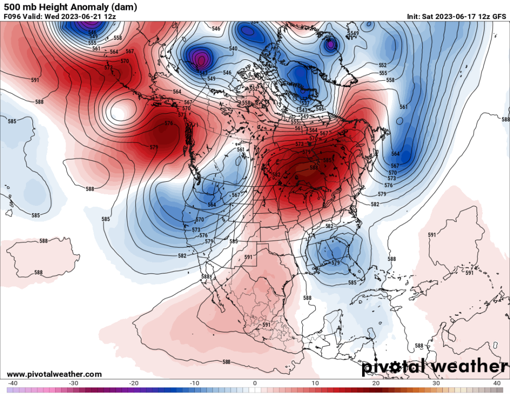
What we will have to contend with is the opposite of a heat dome. A weak cool upper low will get stuck over the Southeast and mill around there for days if not weeks:


Typically summer upper lows can get stuck in one place for three or four days. This one could be in place for more than a week. Upper level lows over the South can squeeze out copious amounts of rain when they form, entraining both Gulf of Mexico and Atlantic moisture.
This coming weather pattern has some climate change signatures since it will be caused by an extremely blocky pattern, one very much like those pointed out by Dr. Jennifer Francis and Dr. Michael Mann from their work with the polar vortex.
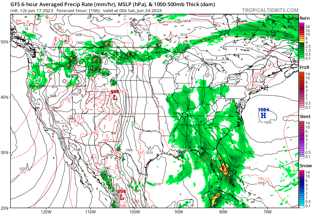
At the surface we see a very wet pattern:


On the last two panels we see that the wet pattern may spread north and east. Also, it should be noted that we are likely to see some extremely heavy reports of rain in keeping with the fact that warmer air does release heavier amounts of precipitation…another climate change signature.
We will see what takes place during the rest of June.
Here are some “ET’s” recorded from around the planet the last couple of days, their consequences, and some extreme temperature outlooks, as well as any extreme precipitation reports:
Here is more new May 2023 climatology:
Here is more climate and weather news from Saturday:
(As usual, this will be a fluid post in which more information gets added during the day as it crosses my radar, crediting all who have put it on-line. Items will be archived on this site for posterity. In most instances click on the pictures of each tweet to see each article. The most noteworthy items will be listed first.)