In my last piece I statistically broke down how warm the United States had gotten over the last five years in association with “the streak”. The streak is defined as the record number of consecutive months that daily record highs have outnumbered daily record lows from the National Center for Environmental Information database, which has now reached 29 months as of April 2017:

The streak began in December 2014. I have no doubt that carbon pollution is the culprit for the longevity of the streak. I would like to posit that this streak may not end until global temperatures cool below a certain threshold. What might that be?
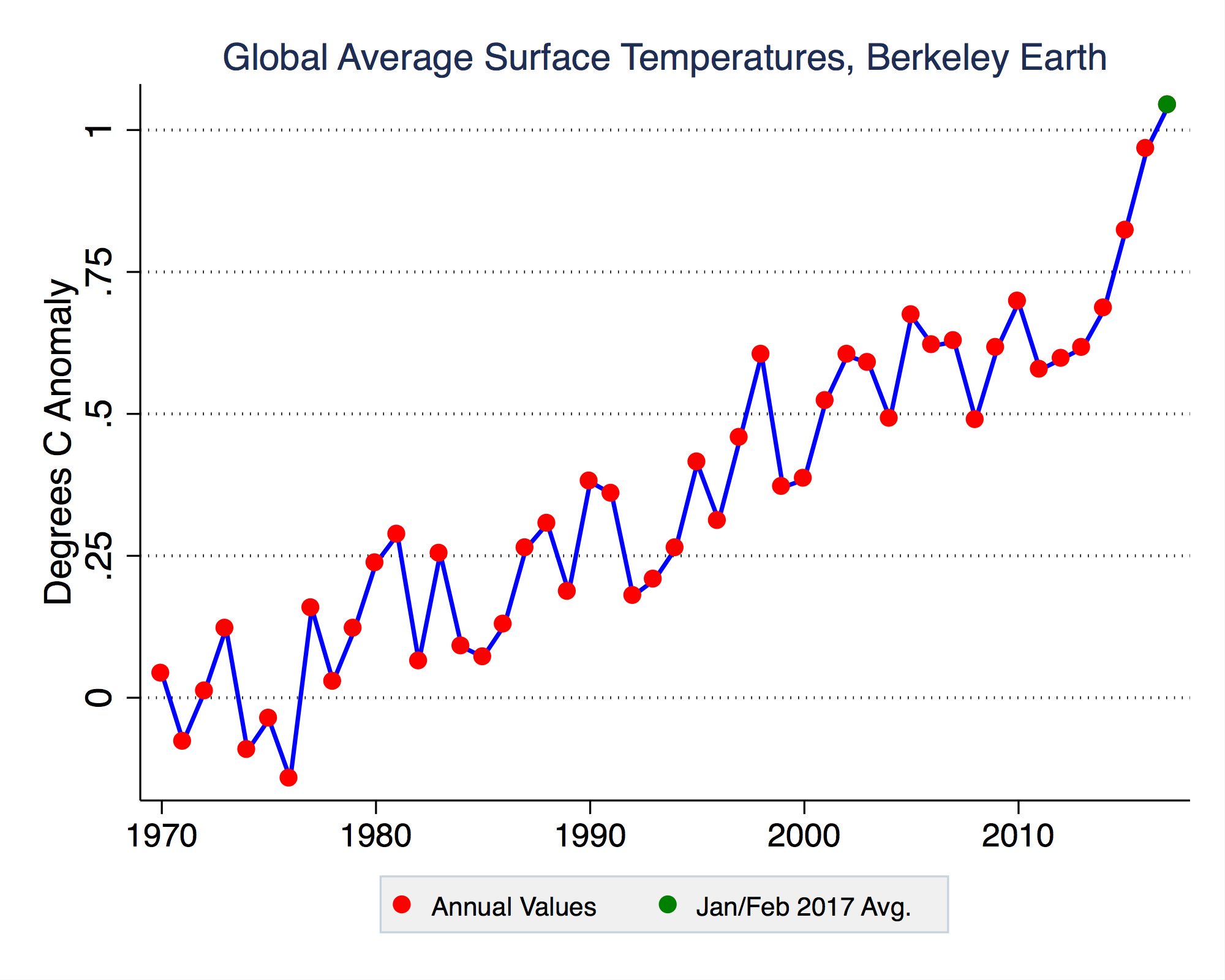
All reading know that I am fascinated with subtle dips and rises on graphs. This one from Berkeley University caught my eye last month:
(Image Credit: Zeke Hausfather)

Notice that, alarmingly, the Earth’s average surface global temperature passed a departure from average of +.75 degrees Celsius after mid 2014. This would coincide with the beginning of “the streak” in December 2014. I am going to stick my neck out (hopefully not to be chopped off😊) and state that the streak will continue until the planet’s average surface temperature falls back below that +.75 degrees Celsius anomaly. Looking at the trends with warming and carbon pollution, that may not happen for an exceptionally long time, but this month’s weather pattern may give the “cold team” a little hope. Perhaps the climate dice have a few cold box cars left to be rolled before it becomes about impossible to see a below average temperature month in the U.S.
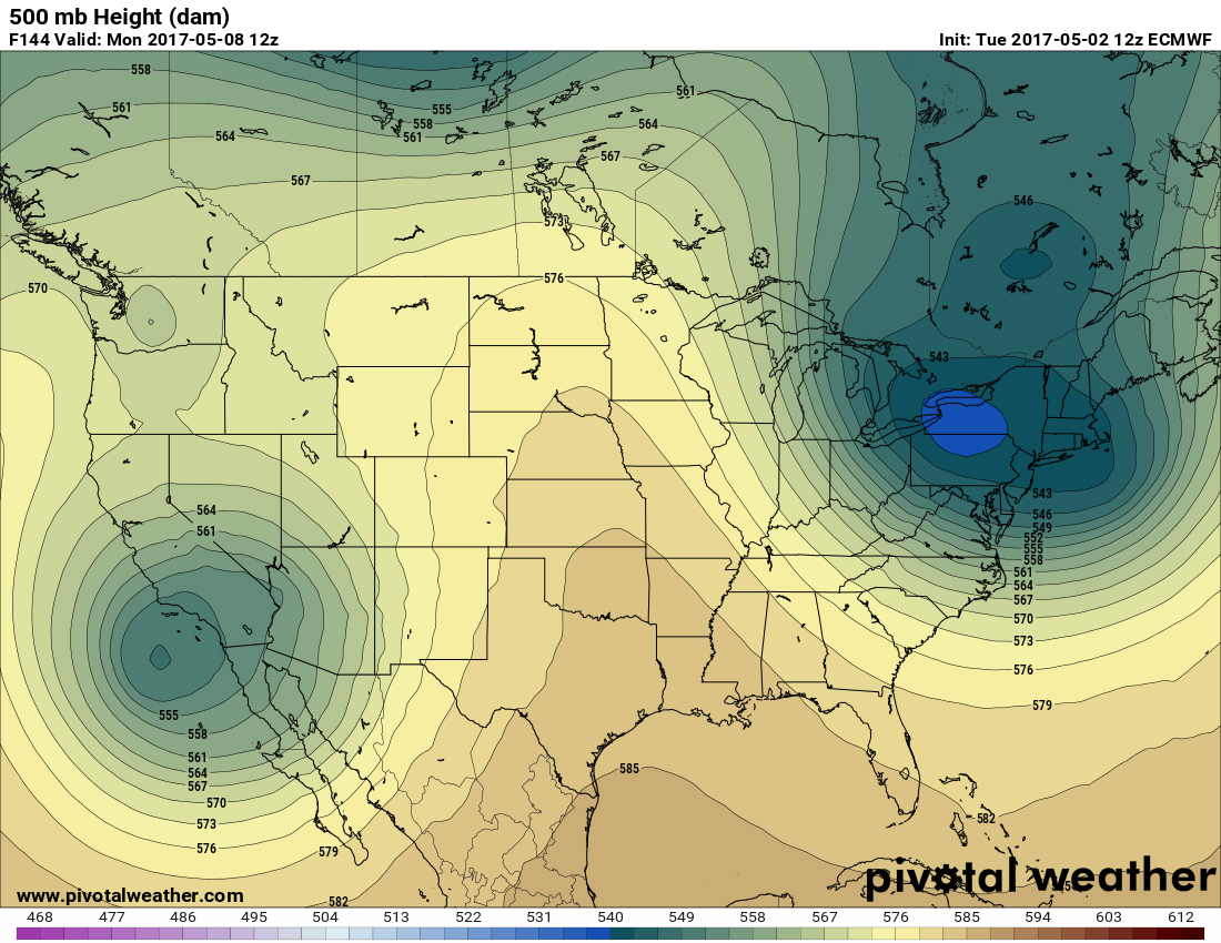
A wickedly strong negative phase of the North Atlantic Oscillation (or in meteorological terms a warm pocket aloft centered near Greenland) will develop later this week and trap a cold pocket over the eastern U.S. Meteorologically this pattern is also known as a Rex Block aloft, or warm air to the north of cold air. A Rex Block pattern is very slow to break down. The coming forecast pattern will bring cold, clammy weather to much of the East for days with perhaps some record cold conditions. (Image from Pennsylvania State University):


We will see if the forecast block in the East produces enough cold weather to break “the streak” by the end of May. Why is this significant? Because if a tipping point of more record daily highs than lows on a monthly basis has been breached in the U.S., then all should unfortunately look forward to a very toasty, brutal summer.
I would like to bring up one last point at the end of this post. Once more the statistics for April 2017 were in line with a very recurrent pattern of more daily record high minimums followed by daily record high maximums followed by record low maximums then record low minimums on a monthly and yearly basis. Walla for April 2017:
2,137 DHMN 989 DHMX 749 DLMX 213 DLMN
This falls in line with what I found here in association with nights warming faster than days:
https://guyonclimate.com/2017/03/13/nights-warming-faster-than-days/
The number of record reports was on the low side for April 2017 relative to the rest of the months for this decade.
I will present a few more Extreme Temperature Index calculations for April 2017 on the next post.
The Climate Guy