The worst hurricanes in the Atlantic Basin, so far, have made catastrophic landfalls. Two of them, Irma and Maria, took interesting paths from a research standpoint, that I’ll point out.
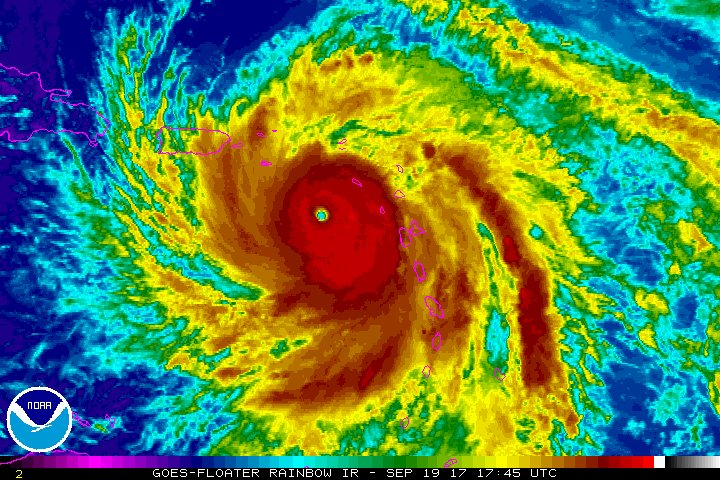
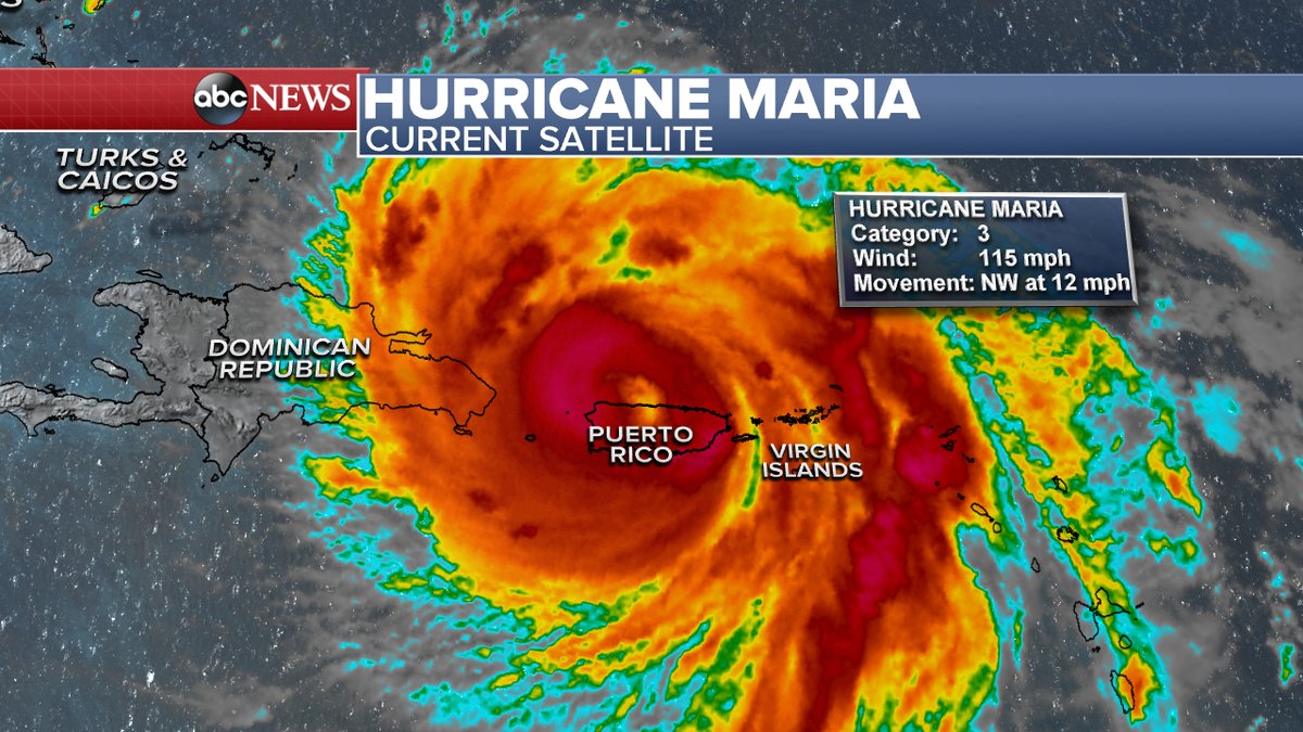
In the original 1960s Star Trek there was an episode involving a “doomsday” automated planet killer machine that Captain Kirk figured out how to stop once a small shuttlecraft rammed itself inside its huge cone-shape maw, which weakened the thing. At the end of this episode Kirk crashed a much larger debilitated star ship into the mouth of the planet killer permanently disabling the contraption. Looking at Maria move across Dominica and the Puerto Rico reminded me of the doomsday Star Trek episode, in which something physical could act like a monkey wrench in the internal workings of a system. In the case of killer, real world tropical cyclones this is dry land. The small landmass of Dominica wasn’t large enough to affect Maria, but much larger Puerto Rico brought the hurricane down from a CAT 5 to CAT 3 once the system had traversed the entire island:

(Maria attaining CAT 5 status on its way to Puerto Rico)

(Maria emerging from the northern coast of Puerto Rico after land interaction weakened the tropical cyclone to a category 3)
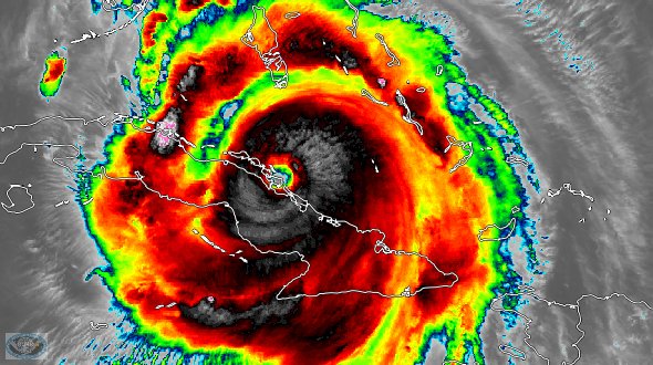
Maria has had very little interaction during its lifetime except for its unfortunate direct hit on Puerto Rico. Another interesting case was Irma which grazed the northern coast of Cuba, which also weakened the system from a CAT 5 to a CAT 3:

Just like with the Star Trek doomsday machine and the small shuttlecraft, the brief encounters with land weakened both Maria and Irma but did not dissipate those tropical cyclones. Obviously, as most TCs move over continents they wind down and die. The purpose for this post is a proposal for better hurricane models for forecasting purposes just on the land interaction issue.
Just following the European and GFS day after day with Irma and Maria I noticed numerous, glaring intensity errors. The European models was better, in particular with the forecast of Irma grazing northern Cuba. Companies like Weather Services International are beginning to design next generation, extremely highly sophisticated models for forecasting both the timing, movement and intensity of cyclones such as hurricanes for civil safety guidance. For example, refining and forecasting areas which need to be evacuated due to an impending TC landfall would potentially save many lives and billions of dollars.
What if a model was good enough to have predicted that due to Irma’s interaction with Cuba it would have made landfall as a weakened system in southwest Florida? Tampa may have not needed to be evacuated. Let’s say for argument’s sake that Irma stayed away from Cuba, went through the Keys as a CAT 5, then tracked a bit farther west due to a stronger associated ridge aloft making landfall just north of Tampa…a truly disastrous scenario that would wreck that city. If a sophisticated land interaction algorithm were added to a good next generation model the difference between these two scenarios might be forecast days in advance. Even the better European model wasn’t good enough in the very short term to forecast a faster landfall in southwest Florida.
So what physical variables would a land interaction algorithm need to address to greatly improve a TC intensify forecasts? Here’s all I can think of. Please drop me a note if you can think of more:
- Area of landmass at least partially under eye wall (like the not large enough land mass to be disruptive Dominica)
- Duration that eye wall is over landmass
- Size of eye wall
- Elevation of land mass interacting with TC
- Surrounding area of ocean
- Sea surface temperature of surrounding ocean
- Land temperature of surrounding land
The land interaction algorithm may be separate from dynamic parts of next generation models, which incorporate such other synoptic features like dry slots.
Please drop me a line if you know that a land interaction algorithm for tropical cyclones has already been produced or is in the works. If not and you are interested in a research thesis or know somebody who is, well here you go.
The Climate Guy