Monday February 25th… Dear Diary. The main purpose of this ongoing post will be to track United States extreme or record temperatures related to climate change. Any reports I see of ETs will be listed below the main topic of the day. I’ll refer to extreme or record temperatures as ETs (not extraterrestrials).😉
Wutip…First Cat 5 Typhoon Ever Recorded In The Northern Hemisphere
Starting last week and continuing through today we are seeing one climate change signal, a very warm Europe for late February. Now on the other side of the planet we have another odd climate change signal, a typhoon named Wutip that has attained winds of 160 mph, easily making the system the first cat 5 typhoon recorded in February in the Northern Hemisphere:
Dr. Jeff Masters goes into great detail about Wutip here:
Quoting some from Jeff’s article:
According to NOAA’s Historical Hurricane Tracks database, only seven January and February Category 4 or Category 5 typhoons have been recorded in the Northwest Pacific since records began in the late 1940s. Wutip is tied with Super Typhoon Ophelia of 1958 as the strongest typhoon ever observed these two months. Ophelia peaked as a Category 5 storm with 160 mph winds on January 13, 1958. The previous strongest February typhoon on record was Super Typhoon Higos, which hit 150 mph winds on February 10, 2015.
It is very rare to see a Category 5 storm form with such cool ocean temperatures. Sea surface temperatures (SSTs) were a mere 26 – 27°C (79 – 81°F) during Wutip’s rapid intensification to Category 5 strength, and the ocean had a low total heat content. Using thermodynamic theory, we can compute a quantity called the maximum potential intensity of a tropical cyclone, based on the prevailing temperatures in the atmosphere and ocean. The maximum potential intensity of Wutip on Monday morning was rated approximately as a high-end Category 4 storm with 150 mph winds, according to an analysis by Dr. Kerry Emanuel (Figure 1). Given that Wutip intensified to be about 5 – 10 mph stronger, this was an impressive feat. Wutip made up for its lack of favorable SSTs with some unusually favorable upper level winds: wind shear was almost non-existent, less than 5 knots, and the typhoon took advantage of two strong upper-level outflow channels, one to the north and one to the south.
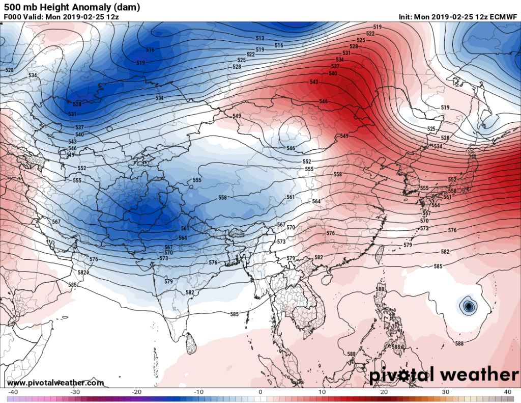
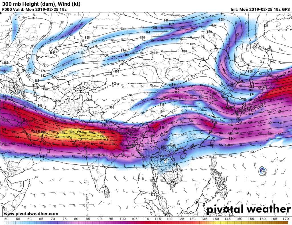
While it is somewhat surprising to see Wutip as a Cat 5 typhoon with such relatively low SSTs the system’s meteorological surroundings are quite warm allowing for good outflow with practically no shear:


The jet stream is far to the north for February over the western Pacific, but Wutip should move northwest into shear denoted by the above 300 millibar chart and be shared before any encounter with land. Nevertheless Wutip is just one more case for a changing climate, and not for the better.
Here is more recent research on Atlantic storms:
https://weather.com/storms/hurricane/news/2019-02-07-atlantic-hurricanes-getting-stronger-study
Mother Nature has dolled out a couple of benign climate signals this month. People may start to dread what the real summer across the Northern Hemisphere has in store…and rightly so.
……………………………………………………………………………………………..
Here is some more climate and weather news from Monday:
(As usual, this will be a fluid post in which more information gets added during the day as it crosses my radar, crediting all who have put it on-line. Items will be archived on this site for posterity. In most instances click on the pictures of each tweet to see each article.)
(If you like these posts and my work please contribute via the PayPal widget, which has recently been added to this site. Thanks in advance for any support.)
The Climate Guy