The main purpose of this ongoing blog will be to track planetary extreme, or record temperatures related to climate change. Any reports I see of ETs will be listed below the main topic of the day. I’ll refer to extreme or record temperatures as ETs (not extraterrestrials)😜
Here is a new feature for this blog, which I will add daily. This is the latest inciteful Green News Report from my friends Desi Doyen and Brad Friedman at Progressive Voices. Hit ‘continue reading,’ listen, then hit return to see my daily topics:
Dear Diary. The Heatwave that I dubbed Heatwave ConocoPhillips reached epic historic proportions on Sunday, so it got pegged s a CAT 4 using my system:
ConocoPhillips is unusual because it’s record heat under its heat dome will be focused on the northern tier of states instead of across the typical steamy South. Its heat dome will peak today at 8 PM EDT at just over 600 decameters at 500 millibars over southern Minnesota:

One thing that has me worried here is that extreme heat has been and will be happening in areas with the least density of A.C. units across the entire country. We mentioned that lack of air conditioning was a big problem in Europe yesterday:

Yesterday Heatwave ConocoPhillips set an all-time record at the major city of Salt Lake City at 109°F and other smaller locations northward through Montana.
ConocoPhillips’s hear dome will decrease but build into the Mid-Atlantic and Southeast over the course of this week:
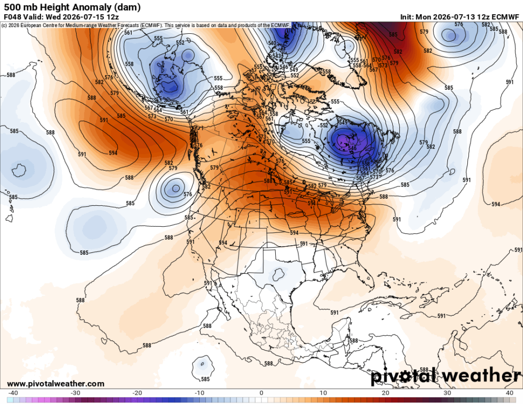

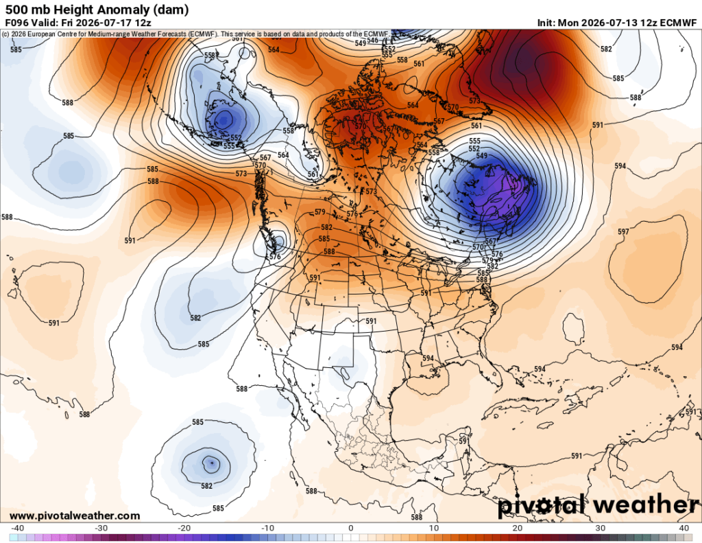
Here are more details from the New York Times (For charts that I did not repos, hit the following link.):
Another Heat Wave Brings Unbearable Temperatures to Parts of the U.S. – The New York Times
Another Heat Wave Brings Unbearable Temperatures to Parts of the U.S.
Salt Lake City reached its highest temperature ever recorded this weekend.

Nazaneen Ghaffar is a reporter on The Times’s weather team.
July 13, 2026, 11:55 a.m. ET
Millions of people across the United States are facing a prolonged spell of dangerous heat this week, as a sprawling heat dome that led to record-breaking temperatures in the West over the weekend spreads east.
Marc Chenard, a meteorologist at the Weather Prediction Center, said parts of the Upper Midwest were expected to experience surging temperatures on Monday, with highs of 95 to 105 degrees Fahrenheit or more possible, especially across parts of North and South Dakota.
“Then on Tuesday, it moves into the Northeast, from the Great Lakes into New York State, and even toward Boston,” he said. “On Wednesday, it begins to shift south into parts of the Mid-Atlantic, and by Thursday and Friday, it’ll move into the Southeast.”
Dangerous Heat Forecast in the U.S. ›
Across the northern Plains and northern Rockies, more than 20 million people from Utah, Wyoming and Montana to North and South Dakota, Minnesota, Wisconsin and Michigan remained under extreme heat warnings through at least the middle of the week.
Farther east, heat advisories stretched from Pennsylvania to Maine, including New York City and Boston. Temperatures in these areas are expected to climb into the 90s on Tuesday and Wednesday, while heat index values — which measures how hot it feels when humidity is combined with air temperature — could reach the low 100s.
Some daily record highs are possible, Mr. Chenard said, especially around Syracuse, N.Y., and Manchester, N.H.
It has already produced exceptional temperatures in parts of the West. On Sunday, Salt Lake City reached 109 degrees, while temperatures in Billings, Mont., climbed to 111 degrees, setting all-time temperature records in both cities.
Mr. Chenard said much of the West had reached its peak heat over the weekend, although temperatures above 100 degrees are expected to linger through at least the middle of the week in some areas, particularly in parts of Colorado and Wyoming, before easing somewhat, into the mid-to-high 90s by the weekend.
Relief should arrive more quickly in the Northeast and the Great Lakes, where a slow-moving weather system is expected to push the hottest air away by the middle of the week, allowing temperatures to return closer to normal for this time of year.
At the same time, however, the heat will shift into the Southeast by Friday. Areas from the Carolinas to Florida, including Kentucky, Tennessee, Mississippi, Alabama and Georgia, are expecting temperatures to rise into the low-to-mid 90s through the weekend.
Heat Waves

First Europe, Then North America: Welcome to Heat Dome Summer.

Without Climate Change, U.S. Heat Wave Called ‘Virtually Impossible’
Nazaneen Ghaffar is a Times reporter on the Weather team.
Here are some “ETs” recorded from around the U.S. the last couple of days, their consequences, and some extreme temperature outlooks, as well as any extreme precipitation reports:
Here is More Climate News from Monday:
(As usual, this will be a fluid post in which more information gets added during the day as it crosses my radar, crediting all who have put it on-line. Items will be archived on this site for posterity. In most instances click on the pictures of each tweet to see each article. The most noteworthy items will be listed first.)