Wednesday August 16th, 2017…
Dear diary. Heat is slowly building across the South, but conditions are pretty much par for the course for middle August. I’ve noticed a few heat advisories have been posted (in orange) today:
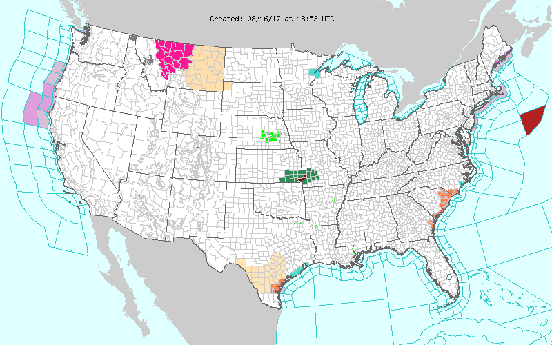
Typically this time of the year some of the worst heat can be found across the Southeast Atlantic and coastal areas of Texas where advisories are posted.
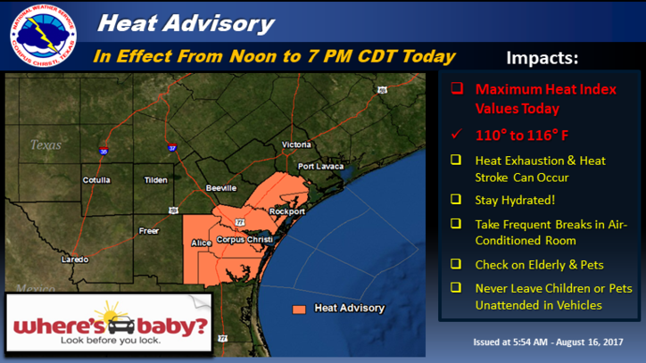
Here’s a good graphic reminder of what to do during episodes of high heat from NWS Corpus Christi:
So, has the outlook for temperatures along the path of the eclipse changed much for this coming Monday?
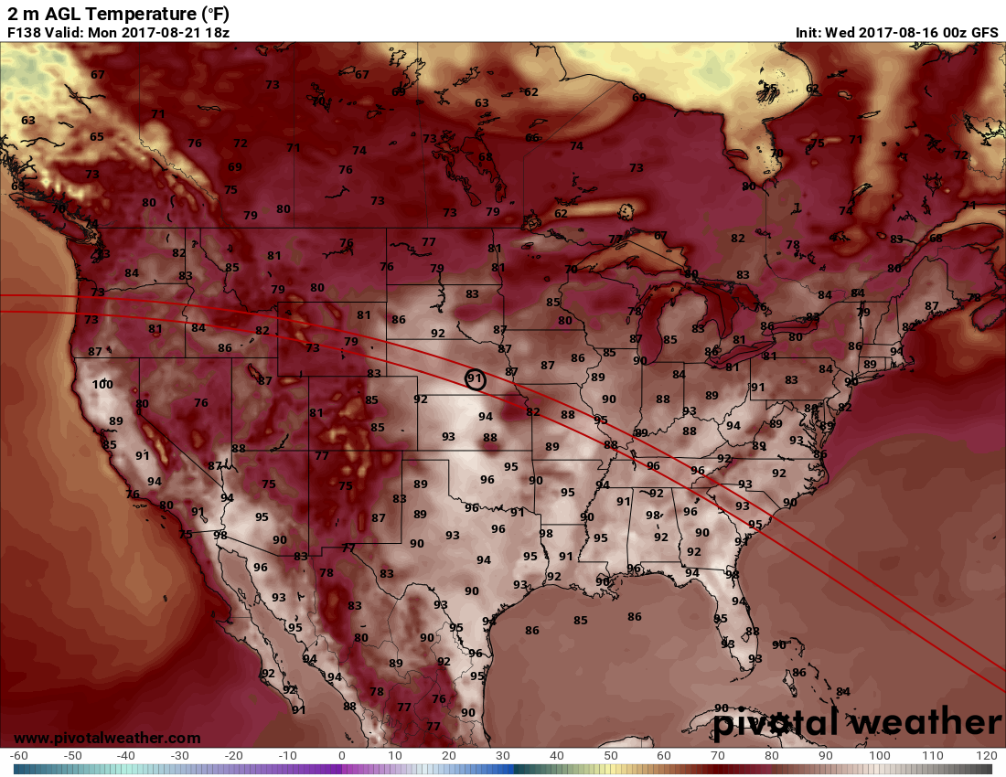
The cities I am most concerned for dangerous heat conditions for viewing the eclipse are 1) Charleston 2) Nashville and 3) St Louis. I’ll post some forecast temperature numbers for these locations by Saturday.
What about tomorrow? Here are the forecast maxes for Thursday:
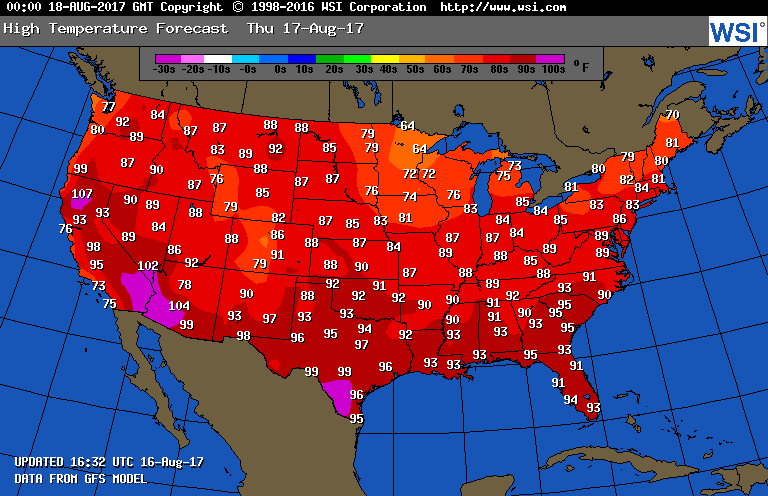
I’m on the cusp of declaring the next seven days a low level heat wave for the South given that maximum temperatures will be from 90-100 in many locations with high humidity… stay tuned!
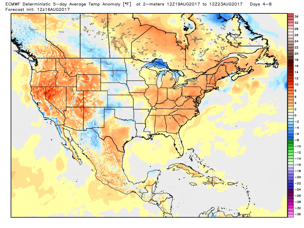
Here is an interesting tidbit from Joe Bastardi. The ever reliable European Model has underestimate the heat of this week. About a week ago here was its temperature forecast:
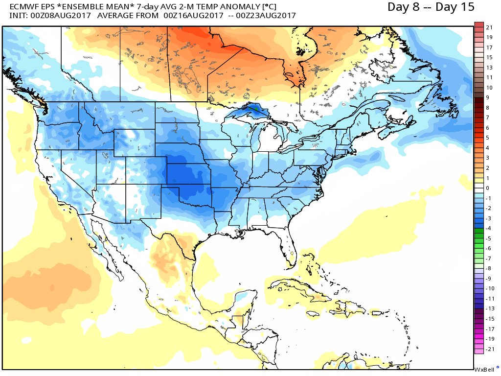
Now we see this:
Here are Wednesdays maxes:
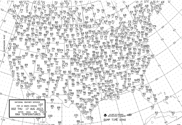
It was definitely a touch hotter across the southern half of the nation than on Tuesday. 90 degree plus readings were common as far north as Washington D.C, St. Louis, and Wichita. Pleasant conditions, as has been the case for much of this summer, occurred from the Upper Midwest into the Northeast.
The Climate Guy
Tuesday August 15th, 2017…
Dear diary. Next Monday portions of the United States will be experiencing a rare, much anticipated event…a total eclipse of the sun.
Here is the path and timing of the eclipse:
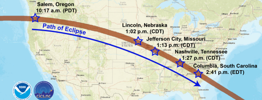
So what does this have to do with a heat diary post? Now that the eclipse is less than a week away meteorological models are getting a better sense of what the weather will be like along its path… and it could be very hot.
Here are the numbers this morning’s GFS has come up with:
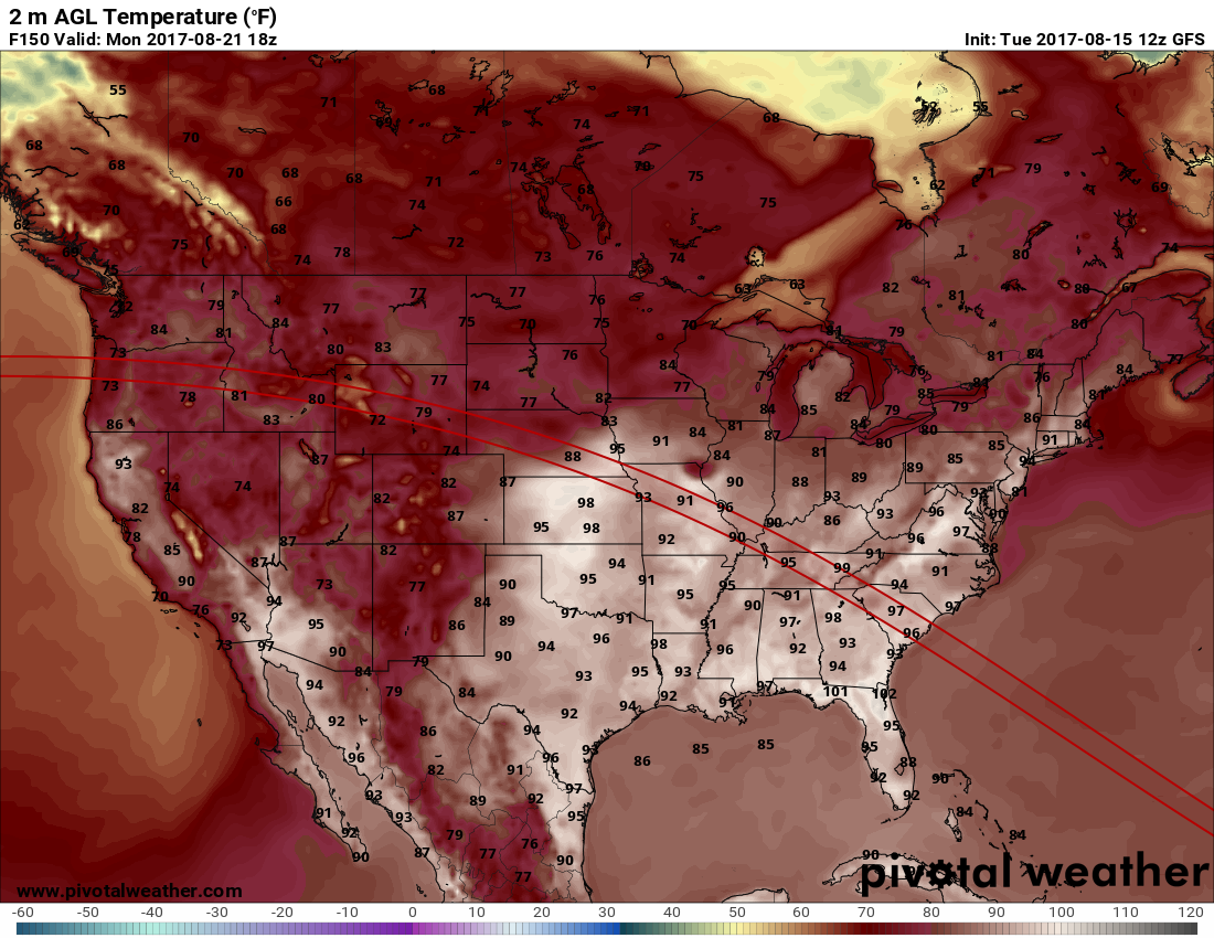
Granted, given the current state of the GFS, these temperatures might be a little on the toasty side, but people may want to start thinking about heat precautions near cities like St. Louis, Nashville and Charleston for outdoor viewing.
What might the heat dome over the U.S. look like by next Monday?
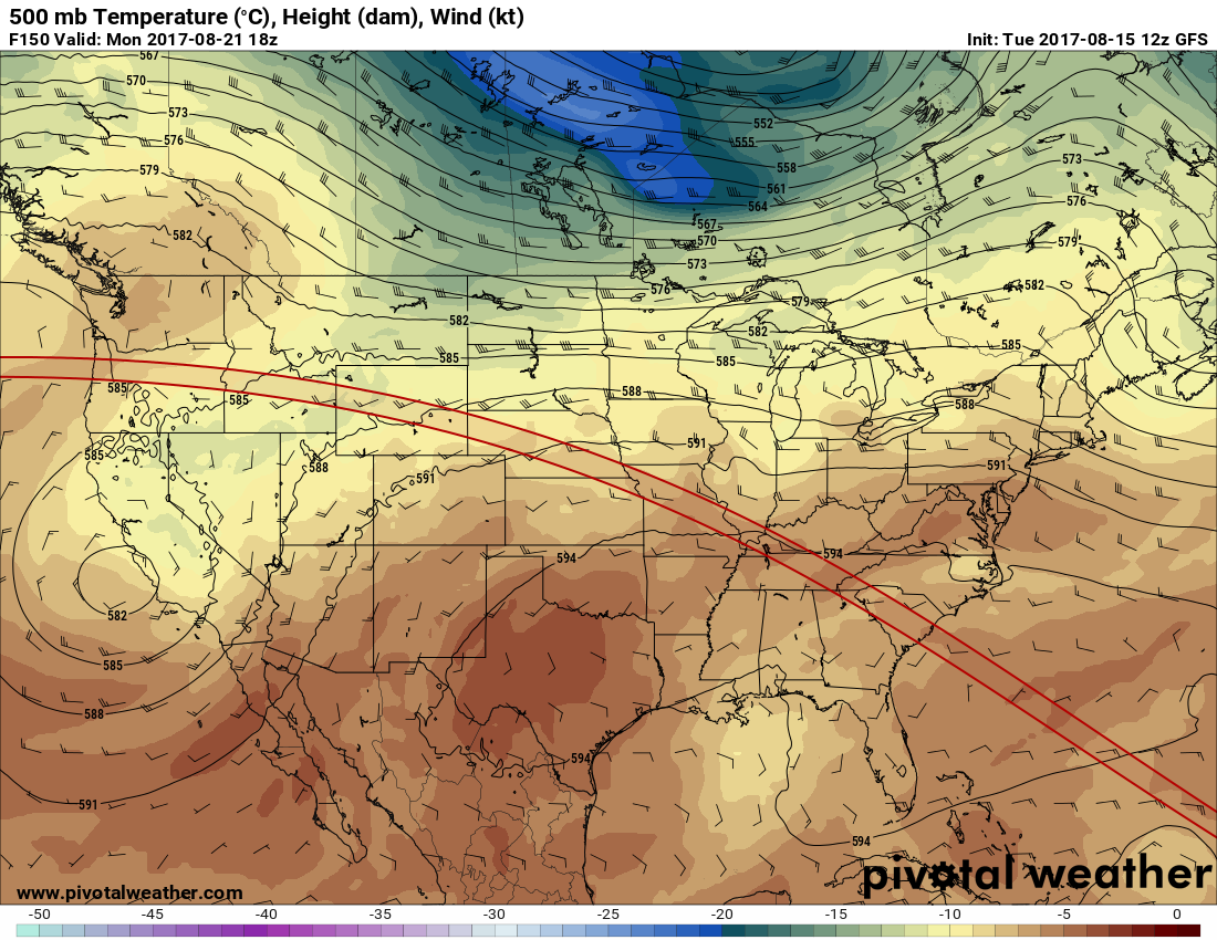
The above chart is probably a worst case scenario, but plausible. The GFS 2 meter temps definitely fit a 594 decameter ridge of this magnitude. I’ll let all know the forecast trends for next Monday in association with the heat for the eclipse forecast.
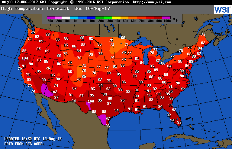
Temperatures are slowly trending upward this week across the South, but there are not heat advisories posted anywhere in the CONUS at the moment. Here are the expected highs for Wednesday:
Here are today’s maxes:
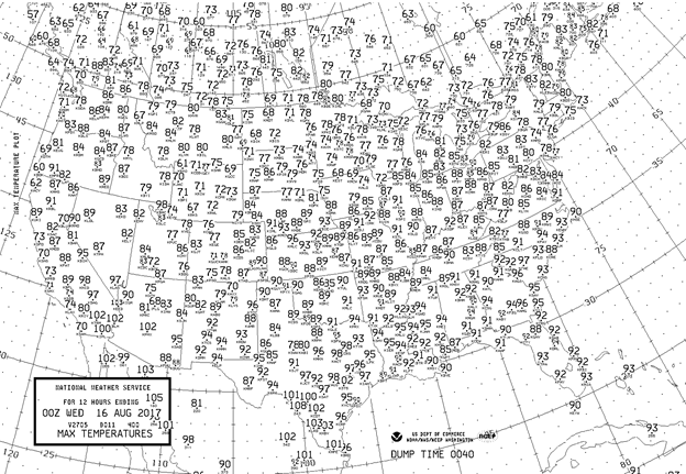
There’s was really not much heat to be concerned with at all on Tuesday. Warmer maxes near 90 did creep northward into the mid-Mississippi Valley and central Plains.
The Climate Guy
Monday August 14th, 2017…
Dear diary. Enough time has elapsed and enough data has gotten into the NCEI database to determine that the most recent Pacific Northwest heatwave produced more daily hot records than the cool air mass that settled in over the Midwest and Northeast produced cold records in early August. Now the race is on between the hot team and cold team to see if August 2017 will be the 33rd consecutive month in the U.S. of more daily record highs than lows, but the warm team is slightly ahead in the count as of today the 14th:

This week we are starting off with nearly a clean slate, advisory wise, across the U.S. There is only a teeny tiny area of heat advisories in southern Utah:

I don’t have much to write about do I. Wrong. It appears that some dangerous heat will be building across the southern U.S. this week looking at model guidance. These numbers are similar each day through this coming weekend:
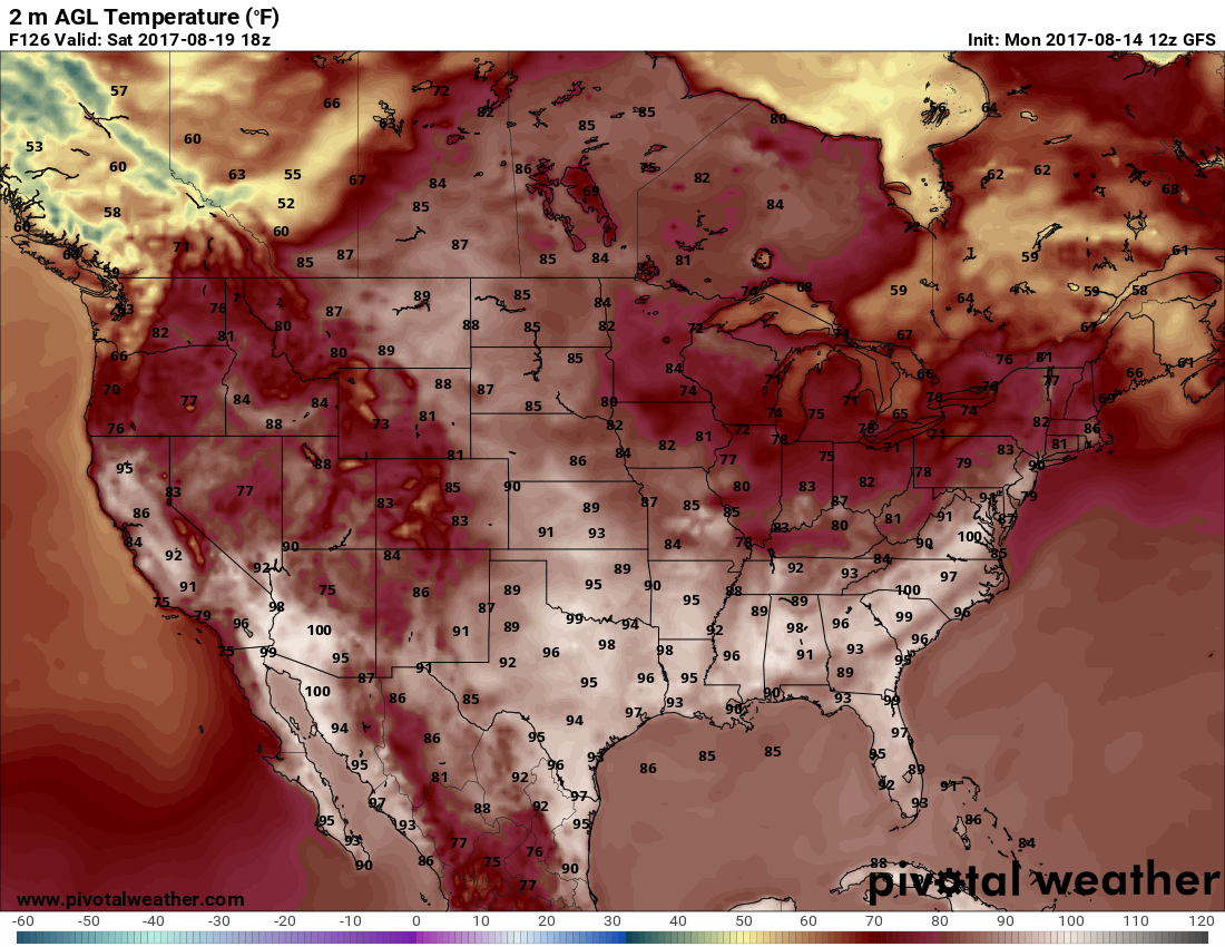
Model ensembles forecast a building heat dome over the South, but not too much stronger than what I have typically seen in August over the last thirty years:
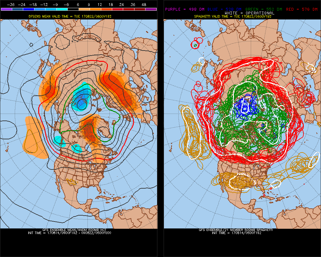
I suspect, as is often the case this time of the year, that the south-central states will see the brunt of this coming hot weather pattern. I’m not willing to arbitrarily declare this a heatwave quite yet. I would not expect many hot records to come from this forecast event, although heat advisories may be posted in some areas.
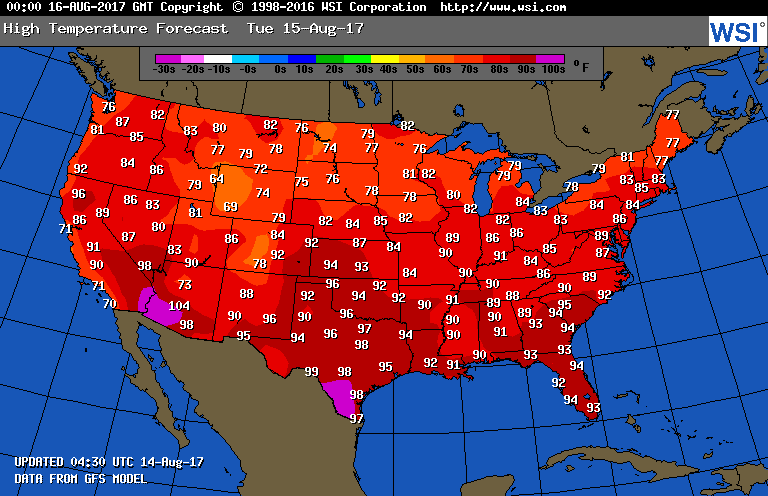
Tomorrow readings should be about the same as those of today across the South:
Here are today’s maxes:
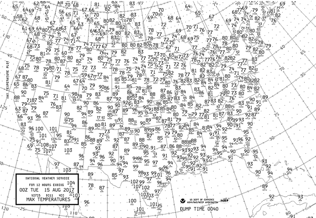
The only heat of any consequence occurred across the southern third of the U.S. We’ll see if the heat intensifies some in the mid-South the next few days.
To see all 2017 Heat Diary entries click:
https://guyonclimate.com/category/heatdiary2017/
The Climate Guy