Friday September 27th… Dear Diary. The main purpose of this ongoing blog will be to track United States extreme or record temperatures related to climate change. Any reports I see of ETs will be listed below the main topic of the day. I’ll refer to extreme or record temperatures as ETs (not extraterrestrials).😉
A Big Heat Wave Alert Going Into October
I thought that while living I would never write today’s main topic title, thinking that due to a climatological low sun angle we would not see July type heat in the U.S. going into October at least before about 2050, but here we are. For example, in my hometown of Atlanta I’m forecasting a max near 97F on Monday 9/30 and about 95F on Tuesday 10/1, both of which would be records. The following tweet from Jeff Berardelli is very eye opening:
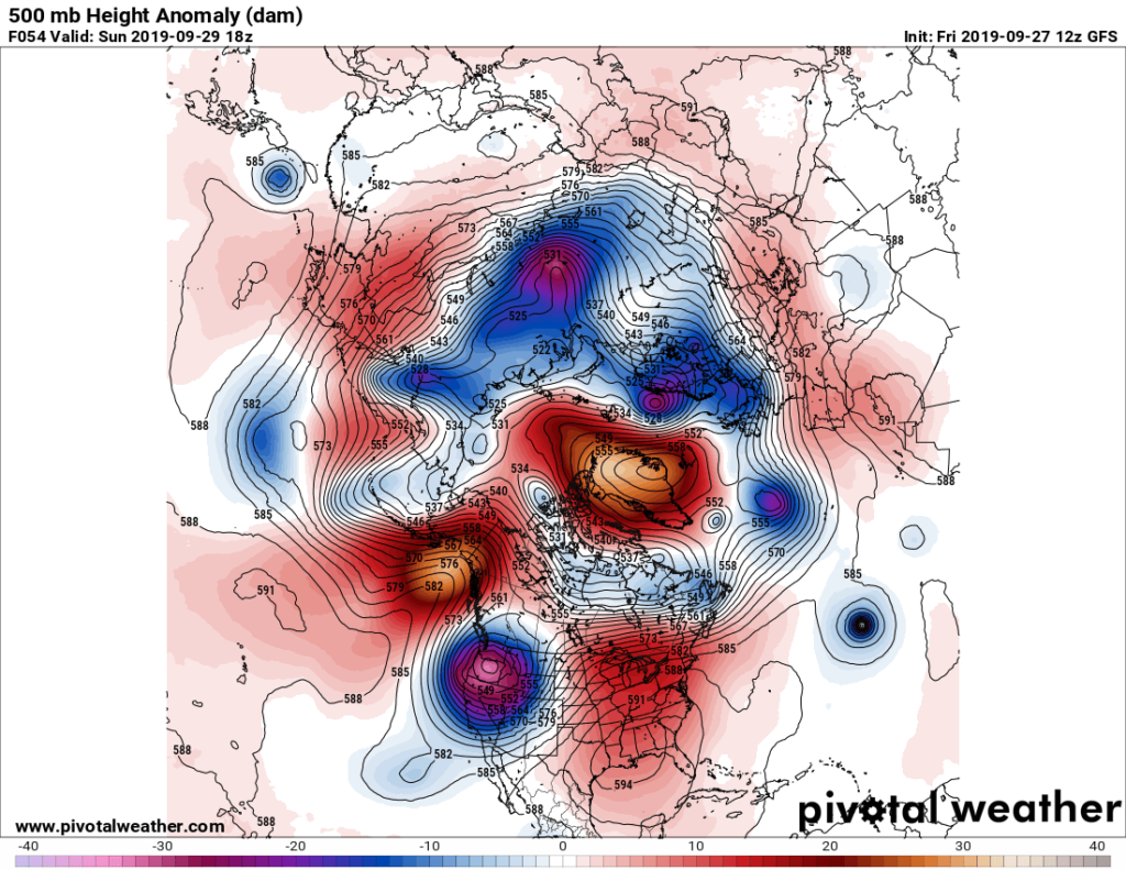
In all fairness, I am expecting some cold record reports from the northern Rockies area due to an early winter storm forecast there. The synoptic setup that will cause many extreme temperature reports is from our old friend the dipole setting up in the jet stream, which is obviously being affected by climate change looking at the following 500 millibar anomaly pattern:
We have a bit of bookkeeping today before this weekends’ events, so I wrote this tweet:
All of the southern heat that we’ve experienced across the American Southeast and points north is having other consequences. Another “flash drought” has occurred, which is, in turn, exacerbating the heat:
The drought situation is a lot worse than when I blogged on this a few days ago:
There is some good news here that this weather pattern occurred in September and not July when A) it potentially could be much hotter and B) this is the time of year for harvest, not for growing crops.
I’ll be adding much more on this topic from experts as Friday progresses.
Here is more climate and weather news from Friday:
(As usual, this will be a fluid post in which more information gets added during the day as it crosses my radar, crediting all who have put it on-line. Items will be archived on this site for posterity. In most instances click on the pictures of each tweet to see each article.)
Here are some “ET’s” from Thursday and Friday:
(If you like these posts and my work please contribute via the PayPal widget, which has recently been added to this site. Thanks in advance for any support.)
Guy Walton- “The Climate Guy”