Thursday June 11th… Dear Diary. The main purpose of this ongoing blog will be to track United States extreme or record temperatures related to climate change. Any reports I see of ETs will be listed below the main topic of the day. I’ll refer to extreme or record temperatures as ETs (not extraterrestrials).😉
Main Topic: Prospects For A Dangerous June Heat Wave Across The United States
Dear Diary. I hope you guys will play my Climate Lottery game as we move through summer as discussed yesterday. It will be like playing a three month long game of chess. Seriously though, the first item we need to look at to play the Climate Lottery will be the prospects for a dangerous heat wave that may very well develop as we move through June.
One note here. The United States has been fortunate not to see a widespread heat wave going from May into early June given that carbon pollution has “loaded the climate dice towards warmth,” as noted from my Summer Climate Lottery post:
My meteorological tea leaves are beginning to point to a prolonged heat wave but one that will develop slowly, mainly in the Intermountain West and Plains initially. The East Coast and Southeast will get protected from high heat through early next week due to an upper low developing in the Ohio Valley and meandering through the Middle Atlantic area:
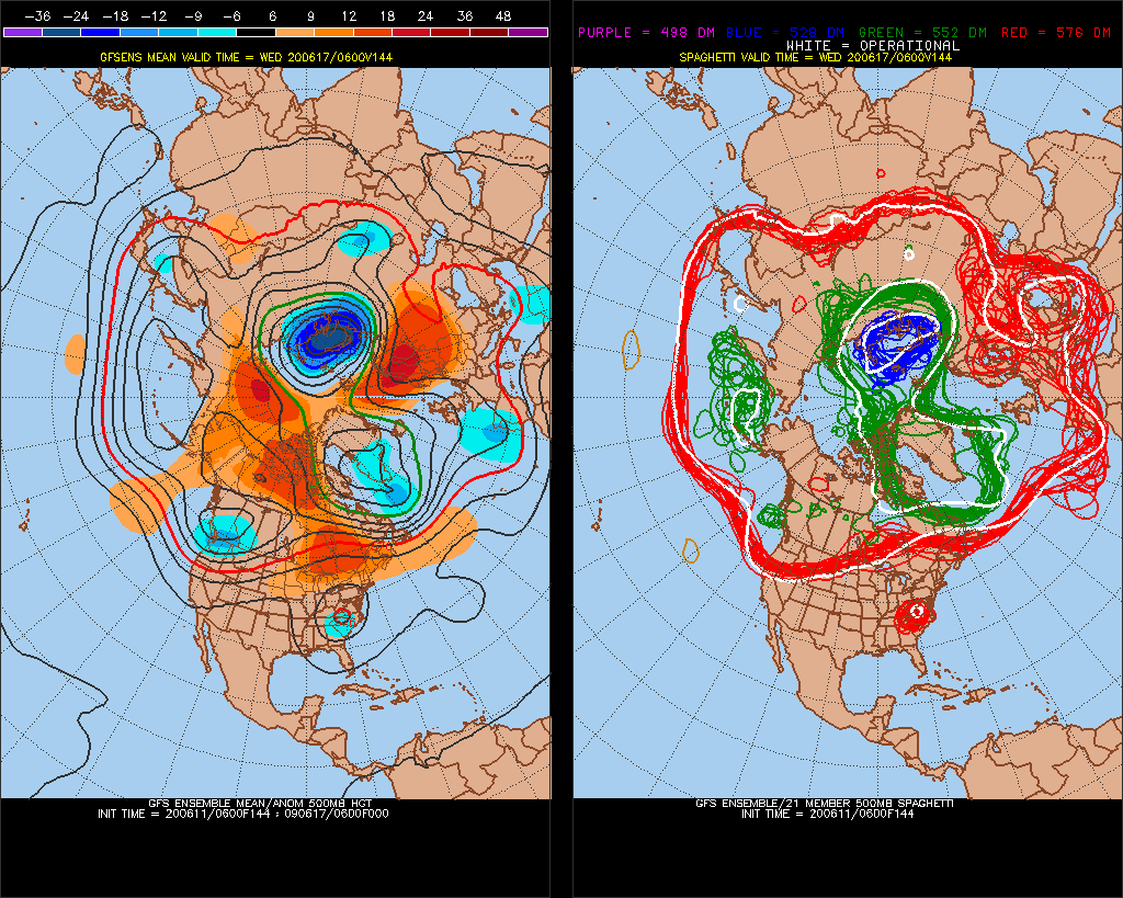
As depicted on the above Penn State chart a fairly strong cold trough should develop along the West Coast states tempering early summer heat there but will also aid in building a heat dome over the central U.S. Eventually this heat dome may expand eastward, dislodging our Middle Atlantic upper low such that we could see the following jet stream configuration:
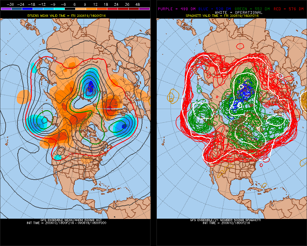
Such a pattern would lead to 90s and 100s for maxes across a wide area from the Rockies through much of the Midwest, Plains, and Southeast. The latest GFS model forecasts the following pattern at the surface by Friday June 19th:

Anywhere there is 576+ decameter 1000-500 millibar thickness on the above chart would be game for 90°+ heat a week from Friday. Current models indicate that heat would only intensify further in time, but we don’t know exactly how strong the ridge over the middle portion of the country will be. One relatively weak short buckling the jet in Canada could quickly put an end to any potential heat wave across the Midwest and Northeast in late June. This morning’s guidance doesn’t forecast this to happen though, but fickle models can change substantially from run to run, particularly past 168 hours out in time.
Meteorologist Jeff Berardelli does note near record heat forecast for the Plains:
Of course, I’ll be posting more on any dangerous, anomalous heat as we move towards the first official day of summer.
Here is more climate and weather news from Thursday:
(As usual, this will be a fluid post in which more information gets added during the day as it crosses my radar, crediting all who have put it on-line. Items will be archived on this site for posterity. In most instances click on the pictures of each tweet to see each article. The most noteworthy items will be listed first.)
Now here are some of today’s articles and notes on the horrid COVID-19 pandemic:
(As usual, the most noteworthy items will be listed first.)
(If you like these posts and my work please contribute via the PayPal widget, which has recently been added to this site. Thanks in advance for any support.)
Guy Walton “The Climate Guy”