The main purpose of this ongoing blog will be to track planetary extreme or record temperatures related to climate change. Any reports I see of ETs will be listed below the main topic of the day. I’ll refer to extreme or record temperatures as ETs (not extraterrestrials).😉
Is The Hottest Part Of The Summer Still Ahead For The Central, Southern, And Eastern States?
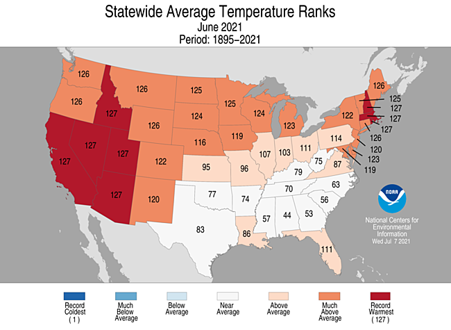
Dear Diary. The United States just experienced its hottest June on record, and July bas gotten off to a blazing start, as well. Most of this anomalous heat has come from the western and northeastern states going into mid July. Here is what we saw in June:
Back in May we could logically forecast what would happen in the West, or at least get a good idea that the West would experience the hottest conditions, looking at the U.S. Drought Monitor:

Now for the second half of summer the meteorological waters are getting a little more muddied for a forecast. Let’s take a look at that June 2021 verification again:

Most of the southern states have had a fairly typical summer temperature regime. In fact, a few major cities have seen below average conditions. Through 7/17/21 my home city of Atlanta has not seen a max temp. above 92°F, not that anyone is complaining in “Hotlanta.” Well, nature abhors a vacuum, or so the saying goes. And nature affected by carbon pollutiin really pushes seasonal and long term averages to the red. When July and August climate summaries are processed by the National Center for Environmental Information will those white average states on the above chart become orange if not red?
The first ingredient we would need to see above average temperatures east of the Rockies would be a fairly large heat dome with a zenith around 594 decameters sprawled out over the central Plains. This is now forecast to happen by most models around 216 hours out in time looking at ensembles:
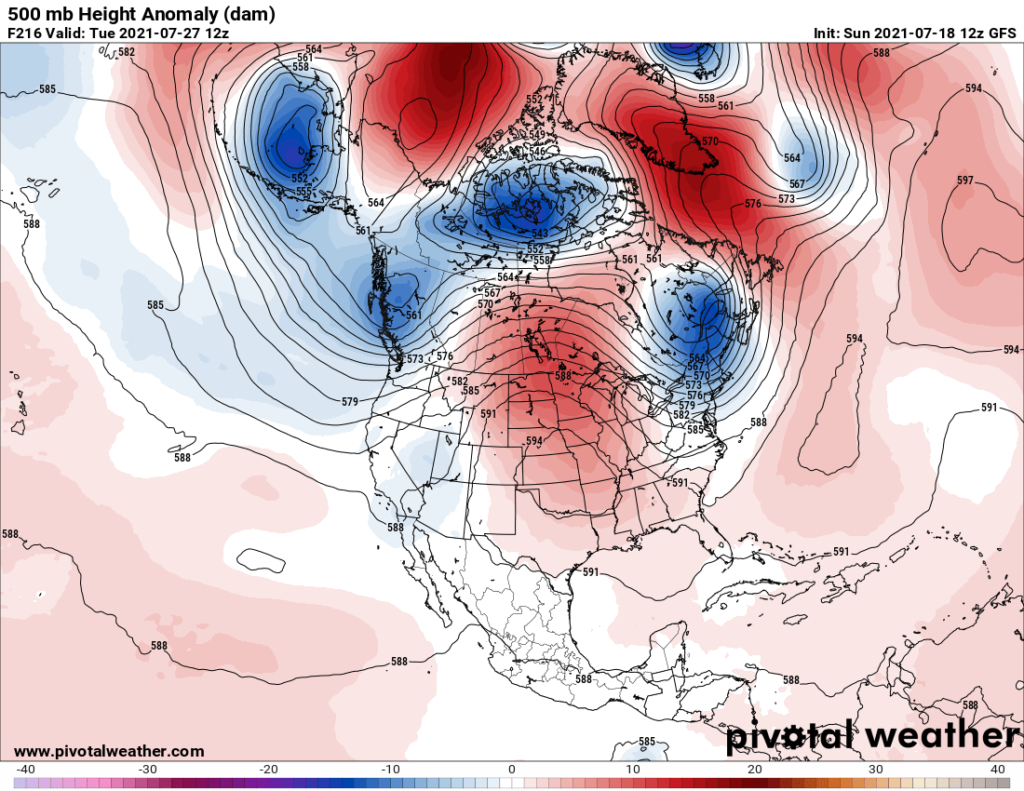
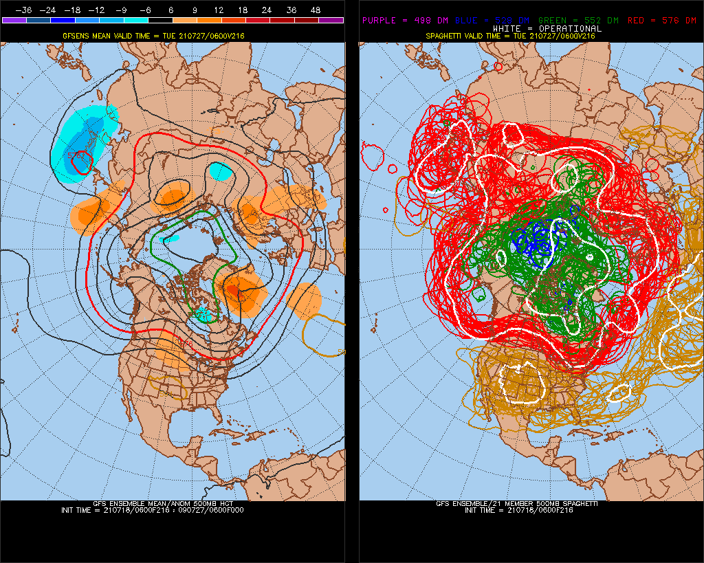
The second ingredient would be for the ridge to become quasi-stationary across the central Plains. If the ridge retrograded back to the West, as has been so common the last few years, any Plains, South or East heatwave would be short lived. Unfortunately models do not forecast this to happen beyond 240 hours out in time, with the ridge strengthening and expanding to truly monstrous proportions while keeping the thing in about the same spot for days:
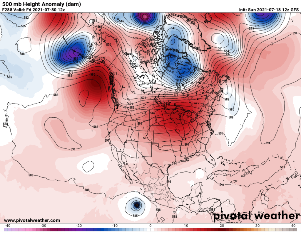
If this pattern were to verify there would be a widespread area of 100°F maxes over just about every corner of the U.S. except northern New England and the immediate Pacific Northwest coastal zone. At the surface we would see dry weather within the 594 decameter height contour where subsidence dynamics would be in control. Note the extensive area of 582 thickness on the below chart valid for when the ridge approaches 600 decameters in Illinois on the above Pivotal Weather Chart:
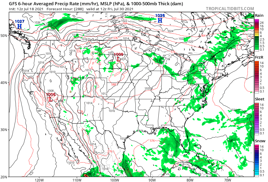
Fortunately, most of the bad, hot times ahead are forecast out more that 200 hours in time, a time in which models are usually unreliable. The reason why I am pointing this long range forecast out for the main topic of the day, though, is because ensembles are making me nervous:

Let’s hope that I’ve jinxed this scenario and that an eastern trough will put a kibosh on the ridge in late July. At least I’ve given you, my readers, a mini tutorial on what it would take to produce widespread near record heat east of the Rockies.
Here is one big “ET” from Sunday:
Here is more climate and weather news from Sunday:
(As usual, this will be a fluid post in which more information gets added during the day as it crosses my radar, crediting all who have put it on-line. Items will be archived on this site for posterity. In most instances click on the pictures of each tweet to see each article. The most noteworthy items will be listed first.)
Now here are some of today’s articles and notes on the horrid COVID-19 pandemic:
(If you like these posts and my work please contribute via the PayPal widget, which has recently been added to this site. Thanks in advance for any support.)
Guy Walton “The Climate Guy”