Dear Diary. The main purpose of this ongoing blog will be to track global extreme or record temperatures related to climate change. Any reports I see of ETs will be listed below the main topic of the day. I’ll refer to extreme or record temperatures as ETs (not extraterrestrials).😉
Main Topic: U.S. Average Temperature Winter Forecast
Dear Diary. Has meteorological fall really ended with winter beginning? The calendar says so, but the current mostly warm weather across the United States does not. We should see hundreds of warm records being set across the CONUS before this week is out. Anyway, welcome to boreal or meteorological winter if you live in the United States, or the three months that are December, January and February. It’s time for me to make another attempt at a forecast for average seasonal temperatures in the U.S. This forecast will be very broad and not specific for any one state comprising the continental United States (or lower 48 states).
So how will boreal Winter 2021/22 stack up compared to long term temperature averages across the United States? Will we continue to see the climate crisis signature of warmer than average conditions? Let’s try to make a forecast as usual at the start of a new season.
So how did the forecast work out for Fall 2021? Here is a link to the post for that forecast:
By December 7th the National Center for Environmental Information will finish their assessment for Fall 2021, so our verification is not complete as of December 1st. Let’s do fill in ranking numbers with 1 being the coldest and 127 warmest for a verification for 2021 months through October, which have already been assessed:
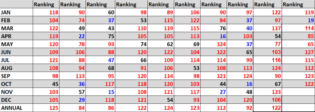
Here is the completed Winter 2021 verification for this post around after NCEI processed their numbers:

Here are my two cents for a broad, rough forecast for the U.S. for Winter 2021/22, which I guarantee to be cooler than this past fall, of course, as the amount of daylight decreases across the Northern Hemisphere continues to decrease. First, I like to look at water temperature anomalies surrounding North America just before the start of a season to get a sense of how much potential heat can be added to the atmosphere across the continent. Here is what we see:
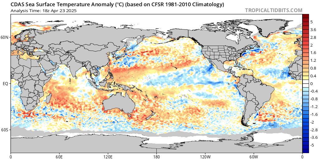
Water temperatures are mainly above average across the U.S. coasts. We also see a healthy, cool La Niña across the equatorial Pacific. These anomalies have not changed much since the beginning of fall. The way they have behaved during the fall leads me to believe that they will continue to have a positive effect on temperatures.
Second, I like to look at the strength of the Hudson Bay low or polar vortex at the start of any season:
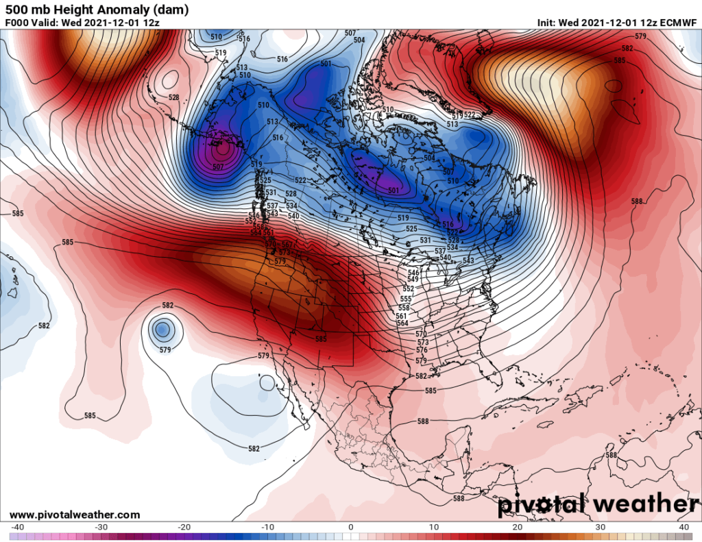
There is a relatively week cold low that has formed in and around Canada’s Hudson Bay, although troughs rotating around the system have been very weak in November allowing modified arctic air masses only to make inroads in the Upper Midwest and Northeast. This too should be a positive factor, although as winter goes on the La Niña may allow the Hudson Bay low to strengthen, leading me to believe that there could be an average temperature anomaly cooling trend. However, note the cold anomaly over Alaska, which has been entrenched over that state for most of the fall. When Alaska is cold, usually the lower 48 states are warm. Look for this effect to continue through much of this winter.
Here is the National Weather Service forecast for Winter 2021:
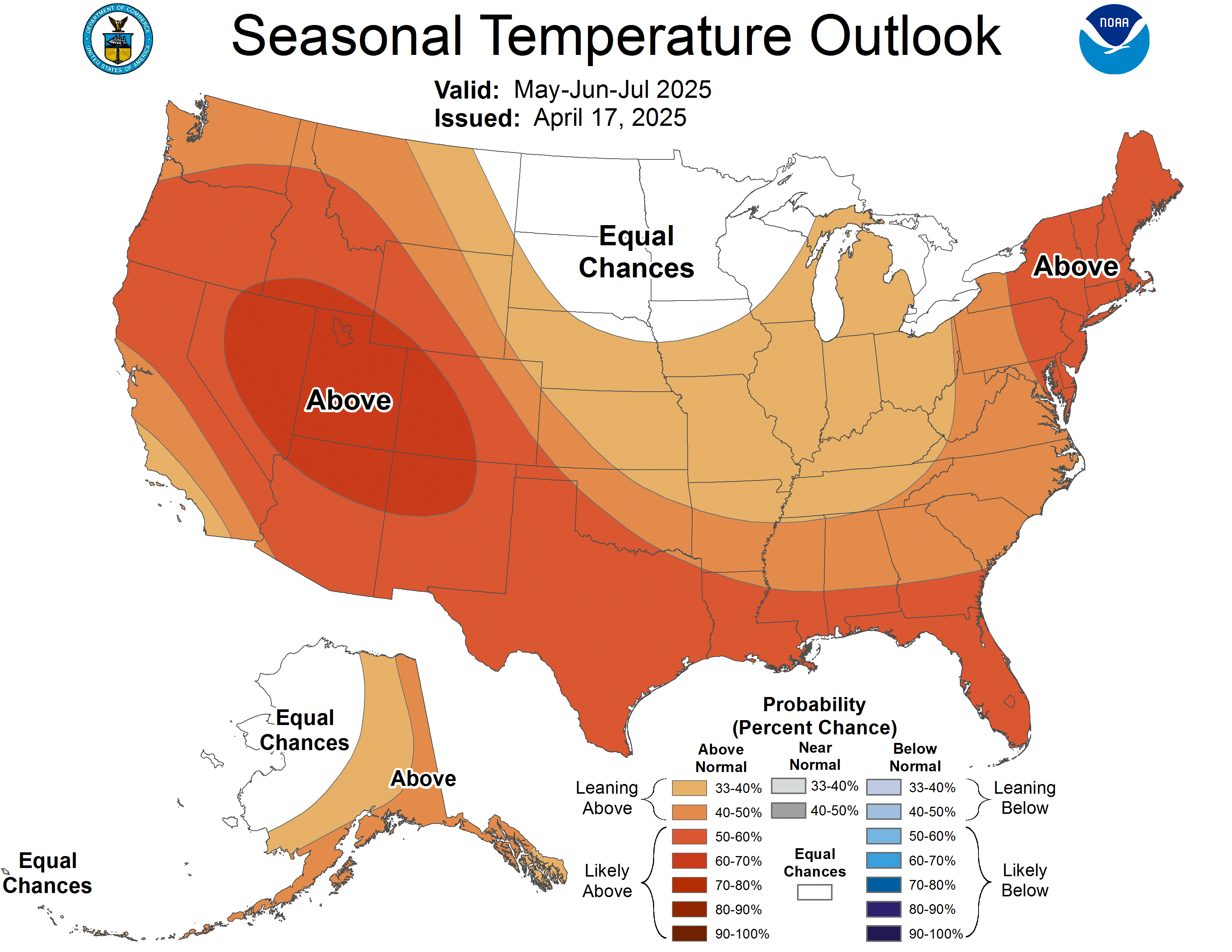
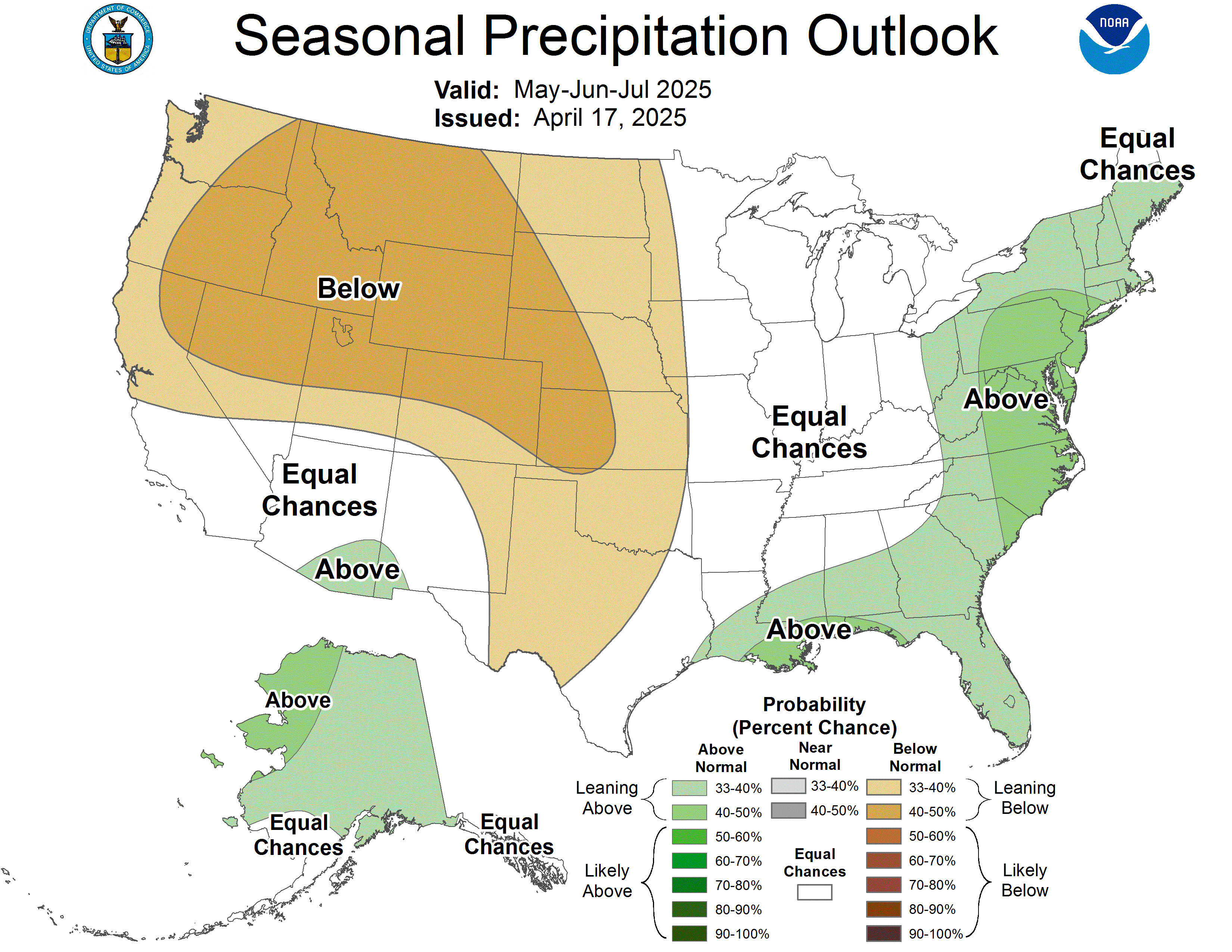
I can’t disagree at all with their assessment for this winter.
Overall, Winter 2021/22 will probably verify above average looking at trends from the rest of the planet.
Last, we can get another clue looking at prior National Center for Environmental Information ranking and temperature record count data. For this I like to drag out that “Record Scoreboard” (updated through 11/28/2021):

Notice that after 2-5 months of above average conditions we have been seeing a below average month. November 2021 bucked this trend, though, since we now have six consecutive above average months. During the spring May was a slightly cooler than average month. Summer was broiling hot. We are due for a cooler than average month after November, but met models indicate that we won’t see a colder than average December. It’s cringeworthy to think that once we see another strong El Niño these cool months will be all warm with our blue colors disappearing from my charts.
Two out of the three winter months should be above average, and it looks like December will approach a top ten ranking. Either January or February may see a colder than average ranking below 64, but of course I can’t tell which one. All three months may very well rank above average. (Here is the link to avg. rankings per year for the lower 48 states since 1895):
https://www.ncdc.noaa.gov/cag/national/rankings/110/tavg/202004
Not all seasons in the near future will see above average temperatures, but seasonal forecasters are beginning to ”chuck it,” discounting colder than average scenarios due to carbon pollution.
Again, here are all seasons ranked for the last decade:

Here is my bottom-line forecast for Winter 2021/22:
“I think that this winter will be ranked above average. Carbon pollution is definitely making below average seasons rarer. I’m going to forecast that the Winter 2021/22 ranking will be around 110 + or – 10, with above average confidence given all of the factors on this post. Given the forecast anomalous warmth, more serious climate crisis events, such as severe flooding, will be quite likely this fall.“
My forecast for Fall 2021 of a ranking of 95 was too cool.
Notice that the past seven winters had a ranking at or above 87. The big El Nino event of 2015/16 really spiked global temperatures as well as those for the U.S. My winter forecast for 2021/22 is similar to that of most of the last ten falls except for 2014.
As of 2021 the top ranking for any month or season would be 127 since climatological rankings for the United States started in the year 1895. Carbon pollution is definitely making below average seasons rarer. As stated, I’m going to guess that fall of 2021 gets ranked around 115 + or – 10, and with above average confidence given all of the factors in this post.
We will see how this forecast pans out around March 7th, 2022.
Here are some “ET’s” reported from Wednesday:
Here is more climate and weather news from Wednesday:
(As usual, this will be a fluid post in which more information gets added during the day as it crosses my radar, crediting all who have put it on-line. Items will be archived on this site for posterity. In most instances click on the pictures of each tweet to see each article. The most noteworthy items will be listed first.)
Now here are some of today’s articles and notes on the horrid COVID-19 pandemic:
(If you like these posts and my work please contribute via the PayPal widget, which has recently been added to this site. Thanks in advance for any support.)
Guy Walton “The Climate Guy”