The main purpose of this ongoing blog will be to track planetary extreme, or record temperatures related to climate change. Any reports I see of ETs will be listed below the main topic of the day. I’ll refer to extreme or record temperatures as ETs (not extraterrestrials).😉
Main Topic: Colder Than Average Temperatures Finally Affect the United States
Dear Diary. Once more a stubborn dipole pattern has developed across North America, with a warm upper-level ridge in the west and trough in the eastern portion of the continent:

I mention “stubborn” because we have noticed that time after time this pattern is very slow to break down no matter what season, particularly after a Hudson Bay vortex gets established, such as is the case on the above chart. As an aside, the high frequency of these patterns is why I believe this is why the United States is warming a tad slower than the rest of the globe.
The above 500 millibar pattern has a big cold vortex pushing through the Southeast. This is Winter Storm Izzy that is putting an end to Atlanta’s snow drought since December 2017, making roads a mess, but delighting children on this Sunday.
The jet pattern has created colder than average conditions for most of the area east of the Rockies. Here is what we see as of the midday hour:

Readings from the single digits through thirties across the East are below average despite this being the coldest time of the year.
So, will this cold pattern put an end to our streak of monthly warmth across the United States? That’s possible looking at the following outlook:

Here is that warm streak looking at my record scoreboard from NCEI data:

DHMX= Daily High Max Reports. DLMN= Daily Low Min Reports. DHMN= Daily High Min Reports. DLMX=Daily Low Max Reports.
For these data sets all monthly ratios of > 10 to 1 DHMX to DLMN or > 10 to 1 DLMN to DHMX are in bold type. The rankings are for the lower 48 states with the warmest ranking since 1895 of average temperatures being 127 and 1 being the coldest as of 2021. Blue colors represent cold months and red warm. Those months and years with counts close to a 1 to 1 ratio of highs to lows are colored black. Boldly colored months, such as December 2021, have ratios of more than 10 to 1 daily record highs to lows or lows to highs, and are either historically hot or cold, most of which have made news.
Since June 2021 we have witnessed seven consecutive highly anomalously warm months, with rankings above 110. January 2022 has gotten off to a warm start, as noted by how many more daily high max records have been logged than daily low mins. I doubt that we will see a ranking for this January above 100, so at least that streak will be broken. Whether or not we finally see an overall below average month will depend on continued western warmth vs. eastern chill.
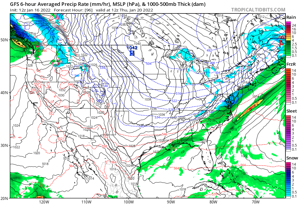
We will see a big Arctic cold outbreak this week, but I anticipate only a few records to be broken from this frigid episode:

A second significant winter storm is quite possible for the South next Sunday:

I’ll be reporting on any extreme cold temperatures from this weather pattern on this blog.
Here are some wintry reports from Izzy. I’m gratified to know that global warming has not put a stop to these southern storms…at least not yet:
Here are some recently reported “ET’s”:
Here is some more climatology from 2021:
Here is more climate and weather news from Sunday:
(As usual, this will be a fluid post in which more information gets added during the day as it crosses my radar, crediting all who have put it on-line. Items will be archived on this site for posterity. In most instances click on the pictures of each tweet to see each article. The most noteworthy items will be listed first.)
Now here are some of today’s articles and notes on the horrid COVID-19 pandemic:
(If you like these posts and my work please contribute via the PayPal widget, which has recently been added to this site. Thanks in advance for any support.)
Guy Walton “The Climate Guy”