The main purpose of this ongoing blog will be to track planetary extreme, or record temperatures related to climate change. Any reports I see of ETs will be listed below the main topic of the day. I’ll refer to extreme or record temperatures as ETs (not extraterrestrials).😉
Main Topic: Signs of Another Significant July American Heatwave
Dear Diary. June 2022 has been a very hot month across most areas of the lower 48 states except for the Pacific Northwest and Northeast. National temperature rankings will probably peg this month as one of the top 20 warmest since 1895, although we won’t know for sure until calculations are complete around July 8th. So, what will July offer? Let’s keep in mind that July and August are the months in which we see the greatest number of heat wave fatalities, and some very significant heatwaves have occurred during the middle of the summer when all-time records fell by the wayside by the dozens.
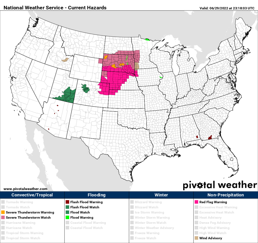
To start, for the first time this month there are not any National Weather Service heat advisories anywhere across the country on June 29th:
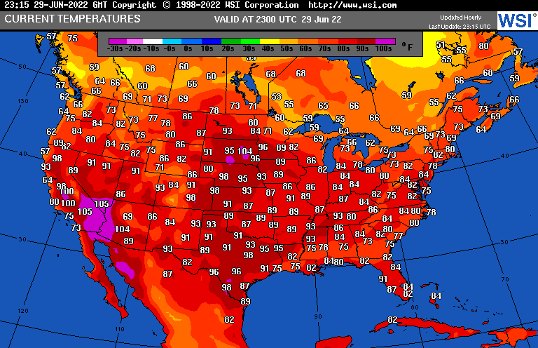
Temperatures aren’t too hard to take this afternoon on June 29th except for usually hot locations in the Desert Southwest, Texas, and ahead of a front in the northern Plains:
Relative mild days won’t last long though where it has been hot earlier this season:
Will it be as hot as a firecracker on July the 4th, our Independence Day holiday?
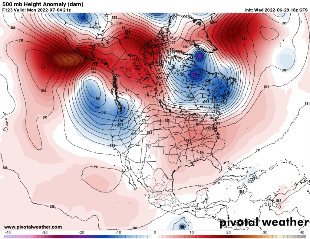
Looking at the above panel, a hot but not too impressive heat dome will be milling about the southeastern half of the country. By that point we should see the following max temperature regime:
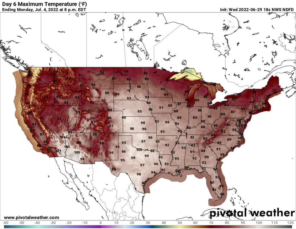
We should see some heat advisories in the Plains on the 4th, but it won’t be historically hot. A warming trend will take place after the 4th, though:

In the 6–10-day range we should see the same temperature pattern as has occurred in June:

I suspect if we are to have a CAT3 or higher heatwave named for the fire breathing dragon Bashe, it will occur in the Plains and Midwest, and perhaps briefly across the Southeast looking at model ensembles:
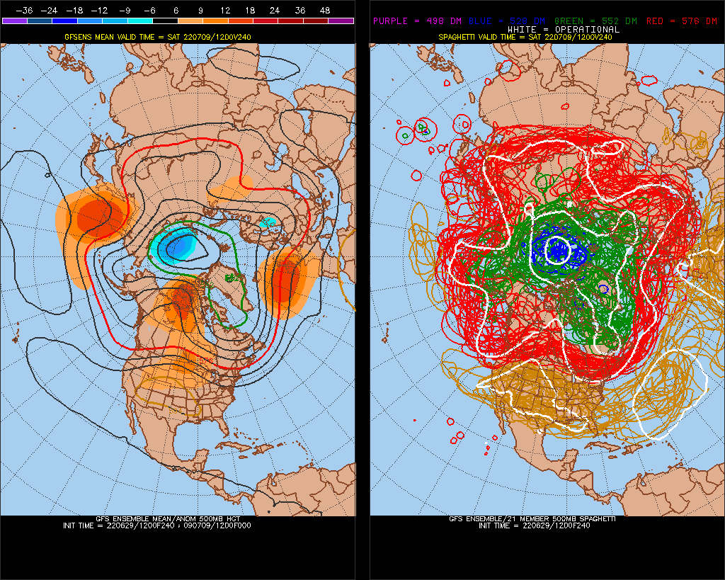
The operational GFS forecasts a whopper of a heat dome to set up from the Rockies into the Plains by the 9th, but I’ve seen worse, with these getting as high as near 602 decameters some summers:

As usual, I’ll keep everyone apprised to what transpires as we enter a new month on this site.
Here are some “ET’s” reported from around the planet the last couple of days, their consequences, and some extreme temperature outlooks:
Here is more climate and weather news from Wednesday:
(As usual, this will be a fluid post in which more information gets added during the day as it crosses my radar, crediting all who have put it on-line. Items will be archived on this site for posterity. In most instances click on the pictures of each tweet to see each article. The most noteworthy items will be listed first.)
(If you like these posts and my work please contribute via this site’s PayPal widget. Thanks in advance for any support.)
Guy Walton “The Climate Guy”