The main purpose of this ongoing blog will be to track planetary extreme, or record temperatures related to climate change. Any reports I see of ETs will be listed below the main topic of the day. I’ll refer to extreme or record temperatures as ETs (not extraterrestrials).😉
Main Topic: Australia’s Winter of Record Warmth
Dear Diary. While the Northern Hemisphere has been dealing with record summer warmth, the Southern Hemisphere has had a winter full of record heat during 2024. In Australia record winter warmth does not bode well for conditions going into summer, which is also likely to be hotter than average due to climate change.
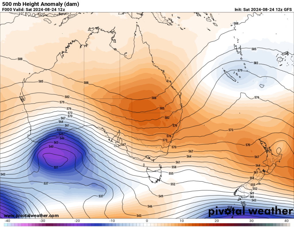
During the last week there have been plenty of records due to a heat dome developing over the island continent. The heat dome is quite anomalously large by end of August standards:

Under this heat dome weather historian Maximiliano Herrera could only describe 8/24/2024 this way:
Here is a recent writeup from ABC news on Australia’s non-winter with mire record stats:
Battle of the seasons erupts across Australia with record winter warmth and thunderstorms followed by polar blast and snow
By ABC meteorologist Tom Saunders
21h ago

Warmer-than-normal temperatures were recorded all across Australia this week. But forecasts of a polar blast could mean an icy end to winter. (ABC News: Berge Breiland)
Winter records are tumbling in multiple states as temperatures across Australia soar up to 17 degrees Celsius above the August average.
The unseasonable heat will also provide the fuel for a rare outbreak of winter thunderstorms, peaking across Victoria on Sunday when dangerous winds could uproot trees and cut power.
And while the prolonged spell of abnormal warmth will linger into next week, a blast of polar air may follow through the last days of winter, bringing ferocious gales, a sudden temperature drop, and much needed snow to the highlands.

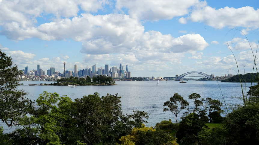
The sun rises on another mild morning along the NSW coast on Friday morning. (Supplied: Beth Bunn)
Early start to storm season
One impact of the unusual heat will be an outbreak of thunderstorms over south-east Australia on Sunday – rare in winter when surface temperatures are normally too cold for updrafts of rising air to produce storm clouds.
The atmosphere is even showing signs of supporting severe storms as tropical moisture from the north clashes with an approaching front, a pattern far more frequent in spring.
The most intense cells are likely to track over Victoria where 200 kilometre per hour winds above the surface could lead to dangerous gusts in excess of 100kph on the ground.
Winds of this speed are capable of uprooting trees and can also cause property damage and power outages.
Severe storms are also possible in neighbouring parts of eastern South Australia and southern New South Wales and may also generate hail and brief heavy rain.
The greatest risk of a storm in Melbourne and Canberra is Sunday afternoon.
The thunderstorm zone will then shift to north-east NSW on Monday, although activity will ease back to just isolated and mostly non-severe storms.
Summer heat in winter breaks records
A handful of towns across Australia’s interior have already broken winter records this week.
Friday was so warm across inland SA, temperatures rivalled mid-summer warmth, soaring as much as 16C above the August average.

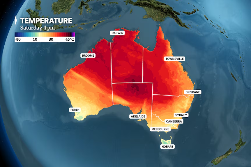
Saturday afternoon is forecast to bring record high winter temperatures across central Australia. (ABC News)
The result was previous winter records were obliterated, including:
- Oodnadatta with 38.5C, breaking its former record of 36.5C in 1946
- Coober Pedy with 36.4C, breaking its former record 35.0C in 1970
- Roxby Downs with 36.0C, breaking its former record of 34.6C in 2017
- Woomera with 34.1C, breaking its former record 32.6C from 1995
As the simmering air mass continues to intensify during the coming days, maximums will again climb to record high levels across the interior and north, placing numerous state and national records under threat.
Parts of the Kimberley could even exceed 40C from Sunday, challenging the all-time Australian winter record of 41.2C.
State Winter Records Under Threat
| Territory | Winter Record | Location and Date | August 2024 Extreme | Forecast Sat to Mon |
|---|---|---|---|---|
| WA | 41.2C | West Roebuck 23/08/2020 | 38.0C Wyndham | 40C Fitzroy Crossing |
| NT | 39.7C | Timber Creek 13/08/2013 | 37.9C Bradshaw | 40C Newry |
| Queensland | 38.5C | Bedourie 29/08/2009 | 37.0C Palmerville | 38C Birdsville |
| NSW/ACT | 37.8C | Mungindi 24/08/2009 | 32.3C Smithville | 35C Tibooburra |
| SA | 36.5C | Oodnadatta 12/08/1946 | 38.5C Oodnadatta | 39C Oodnadatta |
| Victoria | 29.9C | Mildura 30/08/2007 | 27.1C Mildura | 28C Mildura |
| Tasmania | 25.0C | Campania 31/08/2006 | 21.0C Hobart | 19C East Coast |
ABC News Source: BOM Get the data
While the north and interior bakes, a north-westerly airstream this weekend will also spread abnormally warm air to eastern states, driving temperatures as much as 12C above the average in northern Victoria and NSW.
While the storm generating cold front will lower temperatures a few degrees by Monday across SA, Victoria, and inland NSW, a renewed bust of north-westerly winds will arrive on Tuesday.
This will allow the heat to continue building along the east coast through the week, reaching a peak of 27C in Sydney on Wednesday and 32C in Brisbane on Monday, Wednesday and again on Thursday.
Along with daily records the prolonged spell of above average temperatures could also set new longevity records, including:
- 10 consecutive days above 22C in Sydney, passing the old winter record of eight days in 1995
- Five consecutive days above 30C in Brisbane, passing the old winter record of three days in 2009

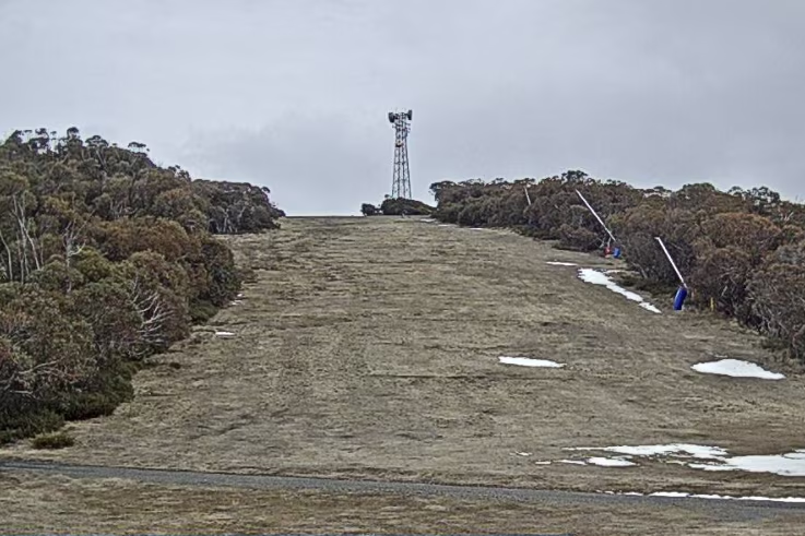
Snow has already melted on many alpine ski slopes following abnormal August warmth and rain. (Supplied: Mt Buller)
Winter to strike back with gale force ferocity
As temperatures along the east coast are peaking, a second, stronger cold front on the leading edge of a polar air mass will advance north from the Southern Ocean – setting up an epic battle of contrasting air masses over southern Australia next week.
The windiest days in the mid-latitudes often occur near powerful fronts, and the greater the variation in temperature on either side of the system, the higher the wind speeds.
As the front approaches on Tuesday, winds will rapidly build and trigger warnings for damaging gusts along parts of the coast and ranges of SA, Victoria, and Tasmania.
The front should then sweep towards the NSW coast on Wednesday, leading to a temperature variance of 10C over a stretch of only 300 kilometres – enough to drive strong to gale force westerly winds over a broad swathe of southern Australia and trigger further warnings for damaging gusts.
The front will also generate a noticeable cool change, widespread showers, the odd pocket of hail in Tasmania, and hopefully a fresh dump of snow across the depleted alpine slopes
Modelling for late next week indicates a second front may follow around Friday and possibly bring another burst of strong winds and highland snow, ensuring a winterly feel returns for the last days of the season.
For ski resorts, next week’s colder weather could not arrive soon enough after Mount Hotham on Friday measured the lowest snow depth on record for August 23.
And while snow is on the forecast from Wednesday, unfortunately the damage to the cover has been so severe this August, it’s unlikely, at least initially, the cover will be fully restored to the heights of July.
Here are more “ETs” recorded from around the planet the last couple of days, their consequences, and some extreme temperature outlooks, as well as any extreme precipitation reports:
Here is more new August 2024 climatology (More July 2024 can be found on each prior daily post during August):
Here is More Climate News from Saturday:
(As usual, this will be a fluid post in which more information gets added during the day as it crosses my radar, crediting all who have put it on-line. Items will be archived on this site for posterity. In most instances click on the pictures of each tweet to see each article. The most noteworthy items will be listed first.)