The main purpose of this ongoing blog will be to track planetary extreme, or record temperatures related to climate change. Any reports I see of ETs will be listed below the main topic of the day. I’ll refer to extreme or record temperatures as ETs (not extraterrestrials).😉
Main Topic: New Study Indicates That Hurricanes Are Slowing Down
Dear Diary. Most climatologists have suspected since stalling Harvey made landfall in Texas during 2017 that organized tropical systems are moving slower due to climate change. Now a new study confirms their suspicions. Slower moving hurricanes produce far more damage than quick moving systems due to associated prolonged wind and wave action and heavier rainfall.
Here are more details from the Washington Post:
More hurricanes are lingering for days, a new study found. Here are the places most at risk.
New research found hurricanes are stalling more often along vulnerable coastlines, increasing the danger from prolonged rainfall and winds.

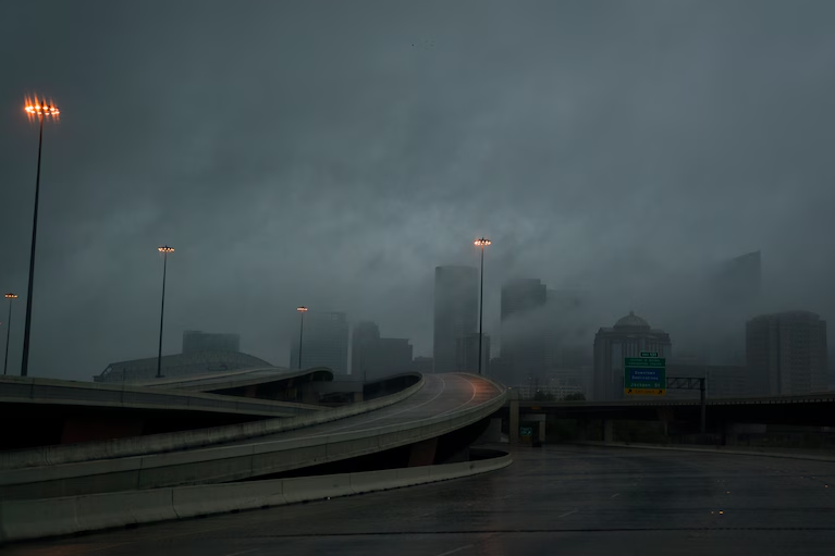
Downtown Houston as rising waters from Hurricane Harvey pushed thousands of people to rooftops or higher in August 2017. (Jabin Botsford/The Washington Post)

By Scott Dance
September 18, 2024 at 1:41 p.m. EDT
Soon after Hurricane Harvey made landfall in Texas in 2017 as a major storm, it weakened — and then lingered. As a tropical storm with relatively low-end winds, it stalled over Houston for four days, drenching the region with rains and winds that would be so destructive, Harvey would tie Hurricane Katrina as the country’s costliest tropical cyclone on record.
It exemplified a growing risk, according to new research: More tropical cyclones are stalling for days at a time along that stretch of Gulf Coast, as well as off the Southeast U.S. and around Mexico’s Yucatán Peninsula. That’s especially true in September and October, the study found, months when Atlantic waters are warm, more storms develop and steering patterns that might otherwise speed them along tend to calm.
That is raising threats that even weaker storms, the kind hardy residents might shrug off, could unleash outsize impacts as they batter communities with uninterrupted downpours and unrelenting winds. The findings add to proof that human-caused global warming is intensifying rainfall and encouraging hurricanes to rapidly strengthen, revealing yet another sign of storms’ increasing potential for destruction.
“It doesn’t have to be a Category 4 [storm] to do major damage,” said Jill Trepanier, a professor at Louisiana State University who led the study. “It’s really about these consistent, unrelenting conditions, over and over, day after day.”
The study, published this month in the Journal of Applied Meteorology and Climatology, defined stalling storms as tropical systems that remained within a circular area about 250 miles wide for at least 72 hours. The frequency of stalls increased by 1.5 percent per year from 1966 to 2020, it found.
The new findings are in line with previous research, including a 2018 study that found Atlantic tropical cyclones’ forward speed decreased by 10 percent between 1949 and 2016 because of uneven planetary warming: As polar regions warm up fastest, they contrast less with tropical warmth, a change that slows down circulation patterns.
The latest study mapped out stalling storms and found clusters of them along some stretches of Atlantic coastline. In the United States, that included frequent stalls on the Gulf Coast from Texas to Louisiana; along Florida’s western coastline; and just off the Southeast coast near northern Florida, Georgia and South Carolina, an area where the largest number of stalls have occurred.
There were also clusters of stalled storms around Mexico’s Yucatán, including in the Bay of Campeche and the western Caribbean Sea.
About 15 percent of Atlantic storms in records going back to 1900 stalled at least once, but the chances were highest later in the storm season, which runs from June through November. In October and November, more than 20 percent of storms stalled; in December, when there are far fewer storms, a third experienced stalls. Stalling storms are most frequent in September and October, when tropical cyclones are more numerous, in general.

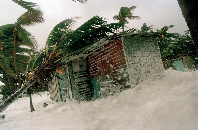
A house is flooded by the sea on the coast of La Ceiba, Honduras, on Oct. 28, 1998. Hurricane Mitch paused in its whirl through the Caribbean to punish Honduras with 120-mph winds, sweeping away bridges, flooding neighborhoods and killing at least 32 people. (Victor R. Caivano/AP)
Before Harvey, many storms with slow movement contributed to devastating impacts.
Hurricane Easy dumped 45 inches of rain across a swath of Florida in September 1950, and in October 1998, Hurricane Mitch killed nearly 12,000 people in Central America, the most of any modern storm.
More recently, Hurricane Joaquin devastated the Bahamas in September and October of 2015. Hurricane Jose became one of the longest-lived tropical storms on record in September 2017, but did not cause significant damage. Both stalled multiple times.
Thenew study did not investigate the reasons tropical storms stall when and where they do. Trepanier said theories that may explain the increase tie back to atmospheric patterns that develop along the coast, where differences in temperature over land and sea can affect air flow. Storms’ slower movement because of warming polar temperatures, which previous research has found, may also play a role.
Additional analysis to understand stalling storm trends could help back up the research and show it’s not just occurring by chance, said Karthik Balaguru, a climate scientist at the Pacific Northwest National Laboratory.
This new research, he said, is “posing a lot of questions.”
But the study nonetheless underlines the importance of better preparation for long-lasting tropical storm impacts, researchers said.
In areas where storms are known to stall frequently, emergency managers should be urging people to prepare for multiple days of power outages and sheltering in place, rather than just a day or two, Trepanier said. Public warnings should stress the dangers of flooding from slow-moving storms, especially if soil moisture is high ahead of time, she added.
The threats of extreme winds and storm surge are often top of mind, but when slow-moving storms approach, authorities need to stress to coastal residents the risks of enduring day after day of heavy rain and strong winds.
“They’re not always thinking about, what if it sits in one spot?” Trepanier said.
While there is consternation over how much planetary warming is increasing hurricane intensity, the study adds to a growing body of research on how tropical storms’ track may also be changing, said James Kossin, a science adviser for First Street Foundation who co-authored studies in 2018 and 2019 on stalling storms.
The research underscores how changes to storms’ tracks “have the potential to be much more dangerous” than rising intensity alone, Kossin said. For example, while hurricanes are expected to dump about 7 to 10 percent more rain for each degree Celsius (1.8 degrees Fahrenheit) of warming, the difference in rainfall between a fast-moving storm and a stalled one could be even greater.
That was the case with Harvey, whose rains — which surpassed 5 feet in some parts of Texas — are believed to be the nation’s most extreme ever.
“We’ve all seen firsthand now the devastating effects of these [stalled] storms,” Kossin said. “It’s clear that the slower a storm moves, the worse things are on the ground.”
Here are more “ETs” recorded from around the planet the last couple of days, their consequences, and some extreme temperature outlooks, as well as any extreme precipitation reports:
Here is more new August 2024 climatology. (More can be found on each daily post during September.):
Here is More Climate News from Friday:
(As usual, this will be a fluid post in which more information gets added during the day as it crosses my radar, crediting all who have put it on-line. Items will be archived on this site for posterity. In most instances click on the pictures of each tweet to see each article. The most noteworthy items will be listed first.)