The main purpose of this ongoing blog will be to track planetary extreme, or record temperatures related to climate change. Any reports I see of ETs will be listed below the main topic of the day. I’ll refer to extreme or record temperatures as ETs (not extraterrestrials).😉
Main Topic: Climate Changed Blocky Pattern Will Produce Catastrophic Flooding Across Nation’s Mid-Section
Dear Diary. Many times over the past couple of years in my weather section I gave added notes pertaining to catastrophic flooding around the world. One event that comes to mind was Brazilian flooding in the city of Port Alegre, which affecting thousands of people in 2024:
https://www.cbsnews.com/news/floods-southern-brazil-death-toll-rescue-efforts-continue-porto-alegre

A drone view shows the flooded city center of Porto Alegre, Rio Grande do Sul state, Brazil, May 5, 2024. Renan Mattos/REUTERS
Now it is the United State’s turn, unfortunately. A meteorological blocky weather pattern at the jet stream level will cause a front to stall and wave around the mid-Mississippi and Ohio River Valleys from late Wednesday through the end of the week:
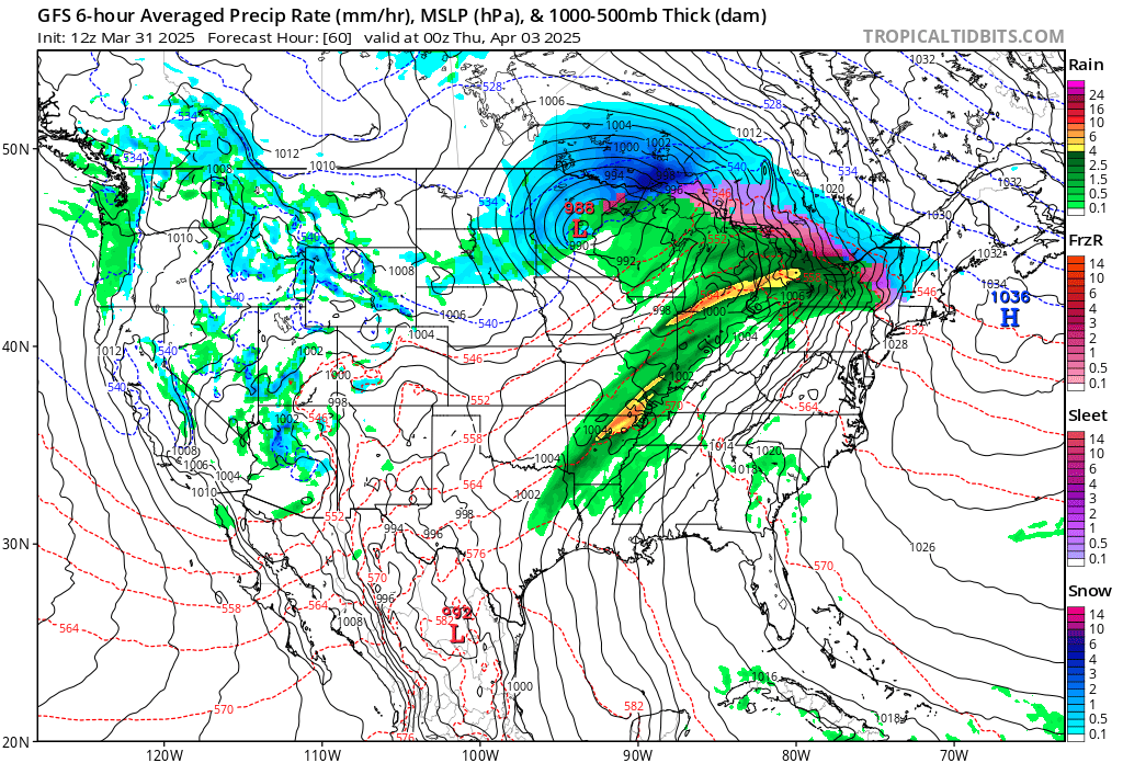
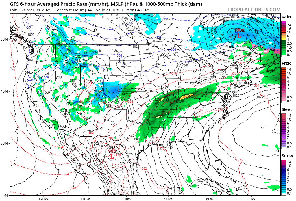
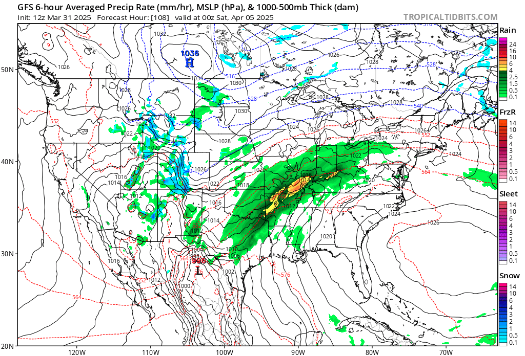
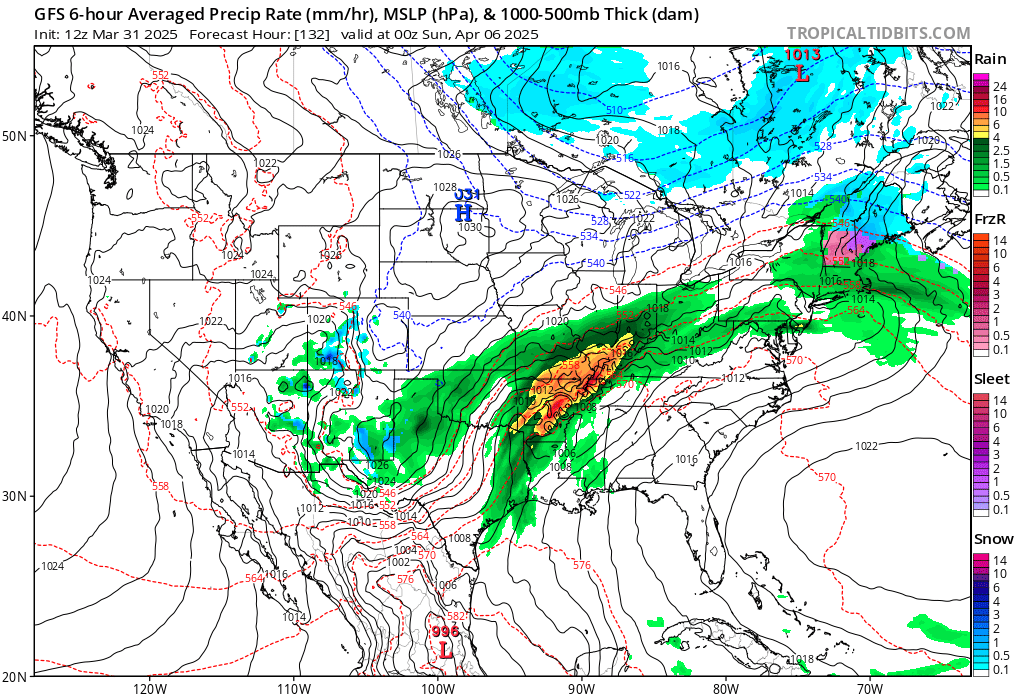
My oh my! What is forecast by the GFS is a stalled front with heavy rainfall in about the same spot for four consecutive days. We could see a wide swath of severe storms and flooding anywhere from Missouri southward into Arkansas and eastward through the Ohio Valley region. Amounts in excess of a foot are possible with some places seeing a one in one-thousand-year event.
Why will this event be climate change related? Because the atmosphere will be very warm for this time of year as a heat dome interacts with and stalls the front:
Also, a warm climate changed atmosphere can be squeezed on by a front to produce heavier amounts of precipitation than would happen in a colder atmosphere. South of the front we will see record warmth where I live in Atlanta:
Here are more details from the Washington Post:
Multiple days of hazardous weather will hit a stretch of central states this week
A week of weather extremes will come with flooding rainfall, severe thunderstorms, heavy snow and ice and high heat. Here’s where it will hit hardest.
March 31, 2025
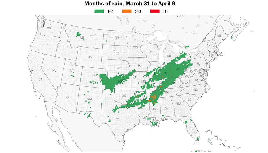
Up to three months’ worth of rain will fall across some states and probably cause dangerous flooding from Wednesday to Sunday. (Ben Noll/Data source: ECMWF/ERA5)

By Ben Noll
A multiday episode of hazardous weather will hit a stretch of central states this week, bringing severe thunderstorms, as well as the potential for snow, ice and flooding rainfall.
It comes as a bowling ball of spin in the upper atmosphere moves ashore in the western states, bringing valley rain and mountain snow, before stalling as it moves eastward. This will put the Plains, Midwest and Great Lakes at risk for dangerous weather, occurring in several rounds from Tuesday to Sunday. In the hardest-hit areas, conditions may be destructive or life-threatening at times.
There’s a moderate risk for excessive rainfall from Arkansas to Ohio, including the part of Kentucky that experienced deadly flooding in February — covering a population of more than 8 million.
Tornadoes are also possible in the Plains late Tuesday and the Midwest and Mid-South on Wednesday, with the threat probably continuing until the end of the week.
A separate weather system also threatens strong storms and tornadoes in the Southeast and southern Mid-Atlantic on Monday.
Meanwhile, temperatures will be summerlike at times across the South and Mid-Atlantic.
A week of weather extremes
Dozens of states could experience dangerous weather this week.
Here’s a breakdown of what to expect and where:
Flooding rainfall

A moderate risk (Level 3 out of 4) for excessive rainfall covers several states from Wednesday to Saturday, where flooding has the highest chance of occurring. (Ben Noll/Data source: NOAA/WPC)
Up to three months’ worth of rain could fall in a corridor from northeastern Texas to Ohio from Wednesday to Sunday, bringing a significant risk for flooding.
The places most likely to be affected include northeastern Texas, southeastern Oklahoma, northern Louisiana, northern Mississippi, Arkansas, western Tennessee, eastern Missouri, western Kentucky, Illinois, Indiana and Ohio.
In the hardest-hit areas, rainfall amounts could exceed a foot, with three or four surges of heavy rain possible overall.
NOAA’s Weather Prediction Center has outlined an area with a moderate risk for excessive rainfall, expressing concern not just about rainfall amounts but rainfall rates of greater than 2 inches per hour, which can lead to flash flooding.
The center also warned that “high risks” — the greatest threat level for storms — can’t be ruled out in coming outlooks as the forecast becomes clearer.
“This is an increasingly significant setup approaching with potential for high impacts and life-threatening flash flooding spanning the course of several days,” the center wrote.
Severe thunderstorms

There’s an enhanced risk (Level 3 out of 5) for severe thunderstorms on Monday along the Eastern Seaboard and Wednesday in the central states. (Ben Noll/Data source: NOAA/SPC)
On Monday, tornadoes, damaging winds and hail are possible along the Eastern Seaboard, including Washington, as a cold front crosses the region and collides with an unusually warm and humid air mass. An enhanced risk (Level 3 out of 5) for severe storms extends from Alabama to Virginia.
This comes from a weather system separate from the one that will affect the central states later in the week.
Severe thunderstorms are likely to develop across the Plains late Tuesday, with eastern Nebraska, Iowa, Illinois, eastern Kansas, Missouri, Oklahoma and northern Texas at risk for damaging winds, large hail and a few tornadoes.
The risk will shift eastward on Wednesday and potentially become even more serious as the storm taps into abundant fuel and moisture from the Gulf of Mexico.
The severe storm threat will overlap with many states that have a flooding risk, including a stretch from northeastern Texas to southern Michigan.
Strong to severe storms may continue across that corridor into the late week before shifting eastward on Sunday.
Wintry precipitation
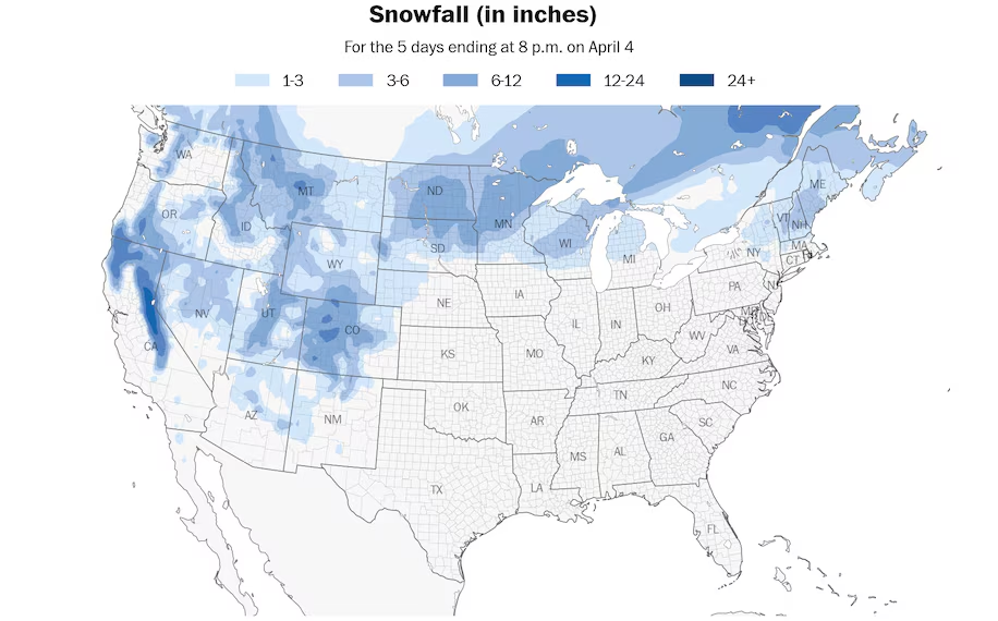
Accumulating snow and ice, some heavy, will occur across the western and northern states this week. (Ben Noll/Data source: ECMWF)
The storm will also come with wintry weather on its northern flank, from the Dakotas to northern New England, including Ontario, Quebec and New Brunswick, Canada, where significant amounts of ice are possible.
Parts of Ontario north of Toronto experienced an incredible ice storm over the weekend, with significant damage to trees and power lines. More than 300,000 people lost power, according to local reports.
Freezing rain is also possible in parts of Wisconsin, Michigan, northern New York, Vermont, New Hampshire and Maine on Wednesday and Thursday.
The combination of snow and wind will cause whiteout conditions in the Dakotas and Minnesota, with accumulations expected across northern Wisconsin and Michigan as well on Tuesday and Wednesday.
Some areas may receive more than 6 inches of heavy, wet snow, potentially leading to power outages and tree damage.
High heat
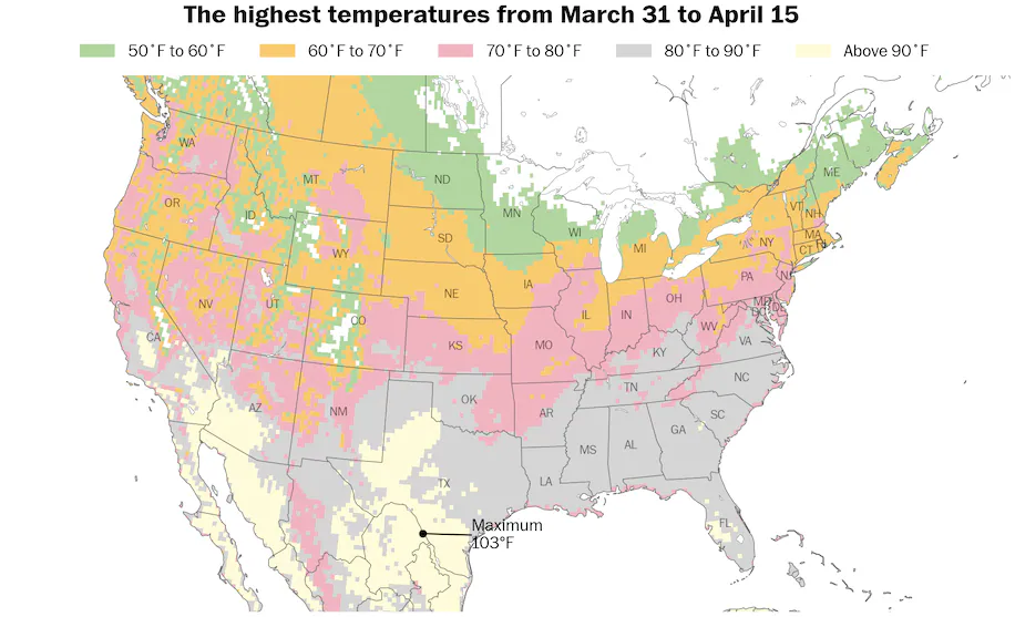
Dozens of record-breaking temperatures are forecast across the southern states during the week ahead. (Ben Noll/Data source: ECMWF)
As the unsettled weather swirls to the north and west later in the week, an early season heat dome will develop over the Southeast.
Heat domes are expansive areas of high pressure under which temperatures soar because of abundant sunshine.
It will feel more like June than April from South Texas to the Carolinas, where dozens of temperature records are expected to be broken — both during the day and at night.
Atlanta may experience its earliest 90-degree temperature reading on record late in the week — which would beat the previous record by more than two weeks. Friday has the best chance to reach the mark. Early-season heat extremes like this are becoming more common in a warming world.
If it surges past 92 degrees in Tampa, which is possible late in the week, it will become the city’s hottest temperature on record so early in the year.
What’s causing the wild weather
A mass of spinning air in the middle and upper atmosphere will stagnate over the west-central states this week.
The feature may become cut off from the typical west-to-east flow of air and weather systems across the United States.
Such patterns are known to produce weather extremes, because they often cause weather systems to become stuck in place and affect the same regions for extended periods.
This event is particularly extreme because it will dredge up warmth, moisture and thunderstorm fuel from the western Gulf of Mexico and Caribbean Sea, which are experiencing a marine heat wave — areas of excessive ocean heat that are becoming more common with climate change.
The storm will harness this higher octane fuel into next weekend.
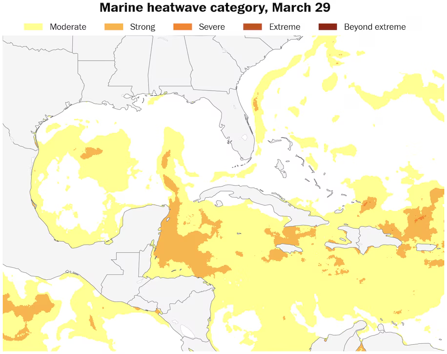
A marine heat wave covers the Caribbean Sea and parts of the Gulf of Mexico, a high-octane fuel source for this week’s storm. (Ben Noll/Data source: NOAA)
By Ben Noll Ben Noll is a meteorologist with a passion for communicating the ‘why behind the weather,’ extreme events and climate trends. He has extensive experience working with meteorological data and creating weather graphics on a supercomputer, developing meteorological services in the Pacific Islands, and short, medium and long-range weather prediction. follow on X@BenNollWeather
Here are more “ETs” recorded from around the planet the last couple of days, their consequences, and some extreme temperature outlooks, as well as any extreme precipitation reports:
Here is More Climate News from Monday:
(As usual, this will be a fluid post in which more information gets added during the day as it crosses my radar, crediting all who have put it on-line. Items will be archived on this site for posterity. In most instances click on the pictures of each tweet to see each article. The most noteworthy items will be listed first.)