The main purpose of this ongoing blog will be to track planetary extreme, or record temperatures related to climate change. Any reports I see of ETs will be listed below the main topic of the day. I’ll refer to extreme or record temperatures as ETs (not extraterrestrials).😉
Main Topic: Heatwave Shell Likely to Bake Eastern U.S. Second Half of June
Dear Diary. For well over a week meteorological guidance has been suggesting that there will be a pattern flip such that the western U.S. will cool and a very strong heat dome will build over the eastern half of the nation. Since this forecast guidance appeared well after 240 hours out in time I didn’t report it because usually going past that point models are quite faulty, but now that the pattern flip is due around 144-168 hours out, we can take it seriously.
Looking back over the course of the past eight years that I have kept up this website, you will find that my favorite tool for looking at forecast weather pattern is the Penn State ensemble portal. Here is what we find by late this week:

Indeed, that pattern flip has already occurred by next Sunday. Notice that many ensemble members making up the above panel forecast a better than 594 decameter ridge centered over the Southeast looking at brown counters on the chart. We should get a major CAT3 heatwave from this, with the next oil company name on our list being Shell.
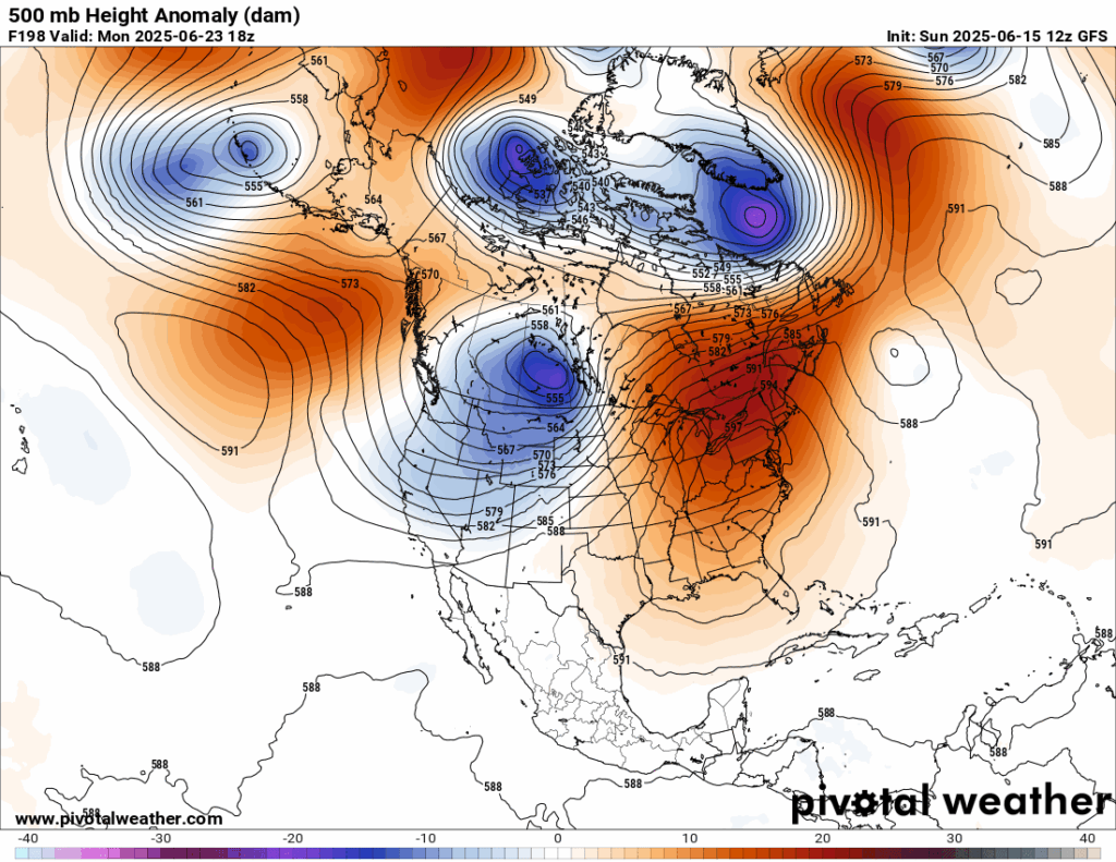
The GFS has had a tendency of being too hot with heat domes, but forecasts a monster by a week from Monday:
By contrast, here is the European model valid for the same time:
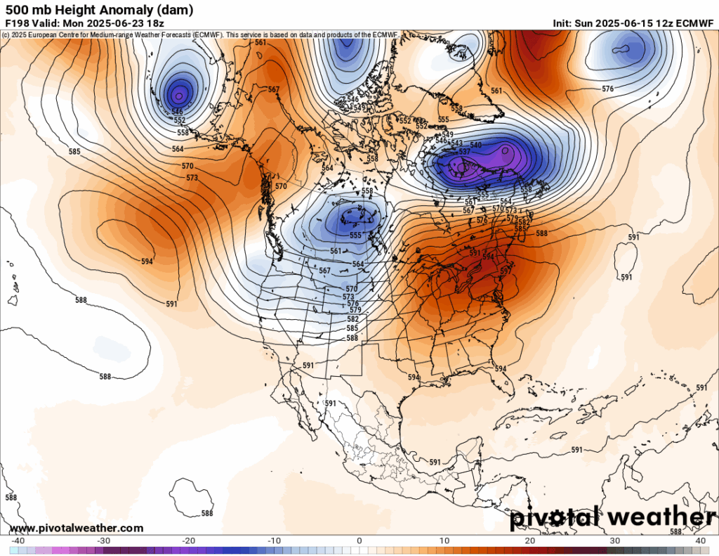
Both operational models forecast the same overall pattern, but the European model is slightly weaker with the dome. Many times, if a heat dome gets above 597 decameters in the lower 48 sates an associated heatwave will become historic in nature.
I’m very concerned that we will see a long-lasting heatwave for the Northeast and Southeast that could be responsible for in excess of 500 deaths. Whether or not Shell becomes a historic CAT4 remains to be seen, so stay tuned.
Here are more “ET’s” recorded from around the planet the last couple of days, their consequences, and some extreme temperature outlooks, as well as any extreme precipitation reports:
Here is More Climate News from Sunday:
(As usual, this will be a fluid post in which more information gets added during the day as it crosses my radar, crediting all who have put it on-line. Items will be archived on this site for posterity. In most instances click on the pictures of each tweet to see each article. The most noteworthy items will be listed first.)
One thought on “Extreme Temperature Diary- Sunday June 15th, 2025/Main Topic: Heatwave Shell Likely to Bake Eastern U.S. Second Half of June”