The main purpose of this ongoing blog will be to track planetary extreme, or record temperatures related to climate change. Any reports I see of ETs will be listed below the main topic of the day. I’ll refer to extreme or record temperatures as ETs (not extraterrestrials).😜
Here is a new feature for this blog, which I will add daily. This is the latest inciteful Green News Report from my friends Desi Doyen and Brad Friedman at Progressive Voices. Hit ‘continue reading,’ listen, then hit return to see my daily topics:
Main Topic: Heatwave ConocoPhillips Produces Unhealthy Smoke Across Southern Canada and the Northern U.S.
Dear Diary. The heatwave that I’ve dubbed ConocoPhillips is moderating as of today, but when it was at its peak about a week ago it was hot enough across Ontario and other parts of southern Canada to spark large wildfires. Those in turn produced widespread unhealthy smoke that wafted southeast through the Midwest and Northeast just like what happened in the summer of 2023.
Of course, all of this is climate crisis related and would not have happened unless a record strong heat dome had formed and become elongated in the northern U.S. Heatwave ConocoPhillips got up to my historic CAT4 level on a scale from 1 to 5 because it produced hundreds of all-time records mainly in the Intermountain West area. Smoky skies are just one more facet of the system.
Here are more details from the Washington Post. (For an animation and some graphics that I did not post, click the following link.)
Wildfire smoke will worsen in the Northeast and Mid-Atlantic through Friday – The Washington Post
Wildfire smoke will worsen in the Northeast and Mid-Atlantic through Friday
More than 115 million people could be exposed to unhealthy air quality. See the forecast for 20 cities.
By Ben Noll
Dangerous wildfire smoke is filling the skies from the Midwest to the Mid-Atlantic.
And in some areas, conditions are expected to worsen.
Through Friday, more than 115 million people are forecast to be exposed to air quality levels that are unhealthy or worse as winds funnel smoke south from out-of-control fires in Canada and Minnesota — and a heat dome traps that smoke near the ground.
From late Wednesday into early Thursday, Chicago, Detroit, Minneapolis and New York had some of the worst air quality of the world’s major cities, according to data from IQAir. In Detroit, the air quality index reached a value of 728 late Wednesday, far worse than the peak of 465 in New York during the apocalyptic June 2023 fires.
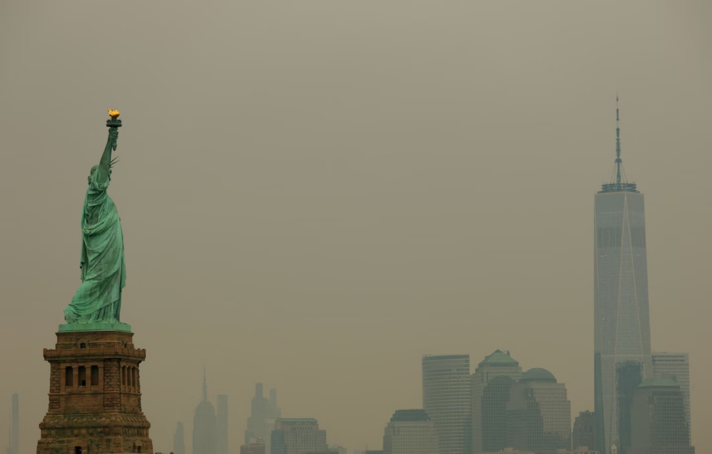
The Statue of Liberty and the One World Trade Center tower in New York are seen through wildfire smoke on Thursday. (Mike Segar/Reuters)
The smoke drifted into Philadelphia and Wilmington, Delaware, during the early hours of Thursday morning and was tracking southward along a path that roughly followed Interstate 95.
However, shifting winds closer to Baltimore and D.C. may keep the worst of the smoke out for most of the day Thursday — but not Thursday night. That’s when unhealthy air quality levels are forecast to abruptly develop, as the smoke plume accelerates south, engulfing much of Virginia and parts of North Carolina — conditions that are forecast to last through Friday night.
Meanwhile, a second strong smoke plume is also forecast to waft toward New York and Boston on Thursday afternoon and evening, with the New York City Emergency Management Office warning that “this could become the most significant smoke event in New York City since 2023, and conditions will be closely monitored for any deterioration.”
The city is making free KN95 masks available at all police precincts and public library branches across the five boroughs.
Farther north and west, air quality reached hazardous levels — the worst on the scale — in parts of northern Minnesota, Michigan and northern Wisconsin on Wednesday. These dangerous conditions show no signs of abating on Thursday, although a wind shift on Friday could cause some brief improvements before more smoke may pour south from Canada over the weekend.
Lowest air quality levels predicted through 2 a.m. Saturday

Hazardous: Magenta Very unhealthy: Purple Unhealthy: Red Unhealthy for sensitive groups: Orange Moderate: Yellow Source: NOAA
Air quality index levels
| Category | Value | Risk |
|---|---|---|
| Hazardous | 301+ | Health warning of emergency conditions |
| Very unhealthy | 201 to 300 | The risk of health effects is increased for all |
| Unhealthy | 151 to 200 | Members of the general public may experience health effects |
| Unhealthy for sensitive groups | 101 to 150 | Sensitive groups may experience health effects |
| Moderate | 51 to 100 | Risk for people unusually sensitive to air pollution |
Source: EPA
It is recommended that, when possible, you avoid strenuous outdoor activities, especially those with heart disease and respiratory conditions like asthma,” the Michigan Department of Environment, Great Lakes, and Energy wrote in a statement Wednesday.
“Keep windows closed overnight to prevent smoke from getting indoors and, if possible, run central air conditioning with MERV-13 or higher rated filters,” the department said.
When will the smokey skies clear?
In New England and the Northeast, dense smoke is forecast to clear on Friday. In the Mid-Atlantic, that clearing may not occur until Saturday, when increasing winds and rain may briefly blow away and dampen the smoke.
Changing winds again on Sunday could usher smoke back into the Northeast, although its intensity is uncertain. That’s when the World Cup final is scheduled to begin, at 3 p.m. in East Rutherford, New Jersey.
Some rain on Friday in the areas where fires are burning could bring short-lived decreases to smoke concentrations, but dry weather will follow for the weekend, possibly allowing them to grow once more.
More passing rain is forecast across Ontario on Monday, but sustained wet weather is not expected across the province where around 20 large and out-of-control fires are burning.
The largest fire, about 150 miles north of Lake Superior in the remote Wabakimi Provincial Park, has exploded in size to more than 867,000 acres.
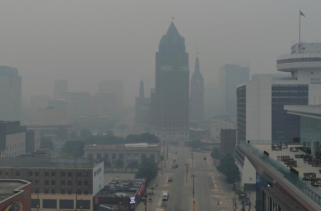
Smoke from wildfires in Canada and northern Minnesota hangs over downtown Milwaukee. (Mike De Sisti/Milwaukee Journal/Reuters)
NOAA satellite tracking wildfires experiences ‘anomaly’
On Wednesday afternoon, a National Oceanic and Atmospheric Administration satellite, GOES-19, which provides real-time imagery of conditions across North and South America and the Atlantic Ocean, experienced an ”anomaly” and stopped transmitting data.
NOAA wrote that engineers were working to recover the satellite and that a timeline would be provided when available.
At the time it went down, the satellite was providing imagery that helped with tracking of wildfire smoke.
Another NOAA satellite, called GOES-18, is still capturing wildfire activity, but its view isn’t as central to the fires as that of GOES-19.
About this story
The forecast low-level smoke concentration data used in this story comes from NOAA’s High-Resolution Rapid Refresh model. That forecast smoke data was translated into air quality categories defined by the EPA using the thresholds described here.

By Ben Noll Ben Noll is a meteorologist passionate about explaining the why behind the weather, extreme events and climate trends. He has expertise in data analysis, supercomputer-driven graphics and forecasting weather worldwide. follow on X@BenNollWeather
Related:
Here are some “ETs” recorded from around the U.S. the last couple of days, their consequences, and some extreme temperature outlooks, as well as any extreme precipitation reports:
Here is More Climate News from Thursday:
(As usual, this will be a fluid post in which more information gets added during the day as it crosses my radar, crediting all who have put it on-line. Items will be archived on this site for posterity. In most instances click on the pictures of each tweet to see each article. The most noteworthy items will be listed first.)