Monday June 11th… Dear Diary. The main purpose of this ongoing post will be to track United States extreme or record temperatures related to climate change. Any reports I see of ETs will be listed below the main topic of the day. I’ll refer to extreme or record temperatures as ETs (not extraterrestrials)😊. Here is today’s main climate change related hot topic:
Early June U.S. Temperature Trends
Around the tenth of each month I have started the habit of presenting my ” NCEI record count scoreboard” and presenting temperature trends for the rest of the month, which I will present on this post for June 2018. I’m like a laundry machine on wash, rinse, repeat mode.😉
First, let’s look at that scoreboard of counts of National Center for Environmental Information daily high maximum and low minimum records (updated through 6/11):
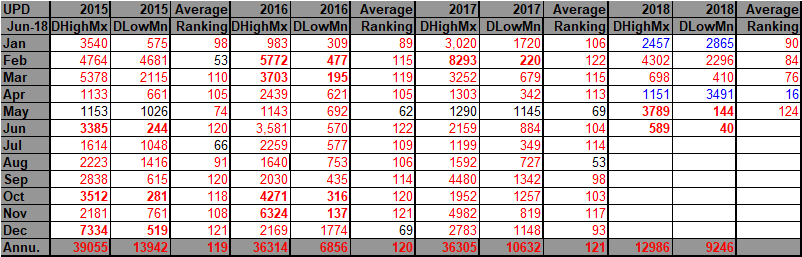
For this data set all monthly ratios of > 10 to 1 DHMX to DLMN or > 10 to 1 DLMN to DHMX are in bold type. The rankings are for the lower 48 states with the warmest ranking since 1895 of average temperatures being 124 and 1 being the coldest as of 2018. Blue colors represent cold months and red warm. Those months with counts close to a 1 to 1 ratio of highs to lows are colored black. Since presenting this chart last time I’ve added that tip top ranking of 124 for May 2018. Notice that so far we have another bold red month for June. If we see another couple of thousand record high maximums this June, as well as another bold red month, a deadly heat wave will have occurred. Any of the three summer months with a ten to one ratio of DHMX to DLMN would be historically hot provided that we see more than 2,000 reports, an arbitrary figure based on prior history from the NCEI records site. We are in danger of seeing historic heat now more than ever because of carbon pollution. There are no guarantees, though, that somewhere along the line of a small cool wave anywhere in the U.S. may prevent June 2018 from having a dreaded 10 to 1 or more ratio. I’m fairly certain that June will get catalogued as a red month, however. Here is why:

As we approach the first day of astronomical summer next week, models (with Euro more aggressive than GFS) predict amplified ridging will bring to many Central and Eastern US cities an early season #heatwave.
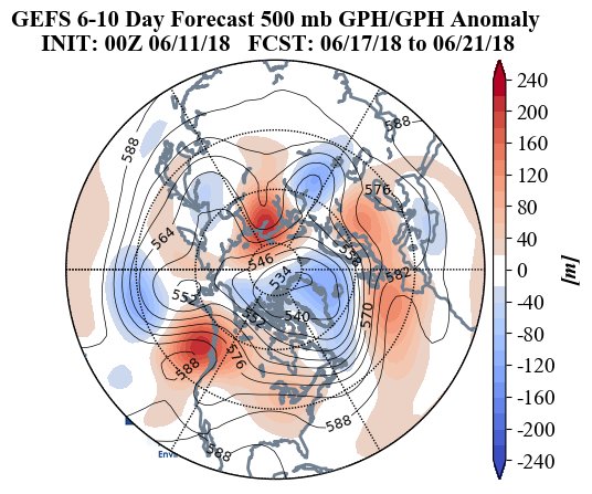
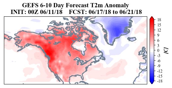
This evening I checked the Penn State ensembles to see if we may get a major 500 millibar ridge over the country in a few days just before the first official day of summer. Here is the chart for Monday the 18th:
 Initially we will see the opposite pattern of last summer with a trough in the West and a ridge in the East, which means that we will have hot weather east of the Rockies. Remember the heat dome discussions on this site from 2017? I’m not sure how strong or how long a heat dome centered over the heart of the CONUS will last, but the European Model has an impressive looking ridge centered over the middle Mississippi Valley Sunday:
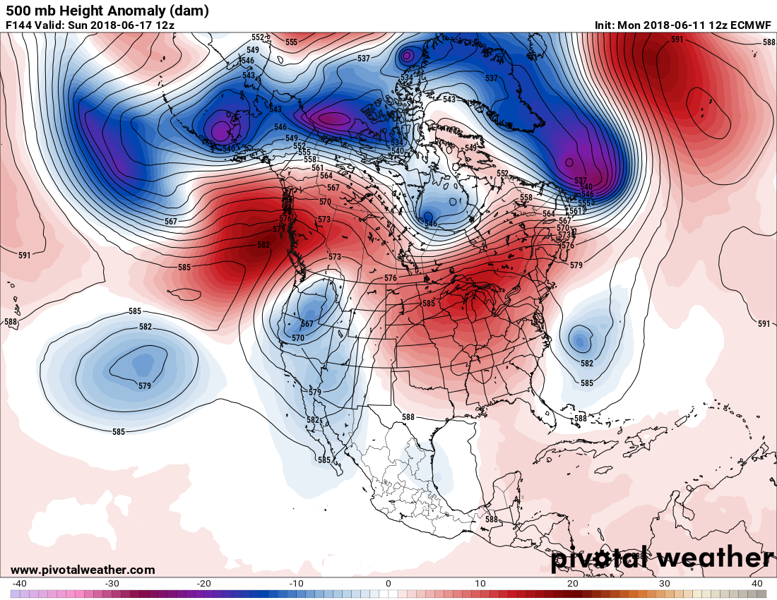
The heat dome center needs to be at least near 594 decameters to get a lot of record reports this time of the year, and so far most model ensemble members don’t forecast this, luckily.
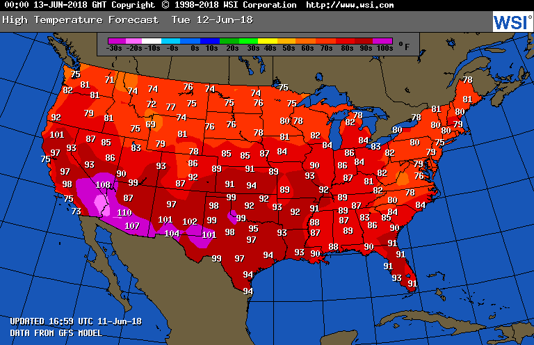
Tomorrow heat wave #3 will be hanging on un the central and southern Plains, and the Southwest and southern Rockies will be cooking. When it gets to 110F in Phoenix residents there start to take notice of excess heat. New wildfires in the Rockies are a real threat with one huge blaze breaking out near Durango Colorado earlier today. Portions of the Southeast should see easterly flow from the Atlantic taking the edge off heat there:
Should I see some relevant information I’ll add it to this post later this evening.
(If you like these posts and my work please contribute via the PayPal widget, which has recently been added to this site. Thanks in advance for any support.)
The Climate Guy
One thought on “Extreme Temperature Diary- June 11, 2018/ Hot Topic: Early June U.S. Temperature Trends”