Tuesday February 20th… Dear Diary. The main purpose of this ongoing post will be to track United States extreme or record temperatures related to climate change. Any reports I see of ETs will be listed below the main topic of the day. I’ll refer to extreme temperatures as ETs (not extraterrestrials)😊. Here is today’s climate change related topic:
(If you like these posts and my work please contribute via the PayPal widget, which has recently been added to this site. Since I am a paraplegic I can definitely use any funds for medical expenses. Thanks in advance for any support.)
February Flood of 2018 Day One
Why would a weather event, such as a flood in February, be a climate change related topic? Can the old Climate Guy prove attribution? In this case absolutely! A synoptic pattern in which there may be significantly flooding has already developed over the eastern and central states inducive for flooding, but I’ve not heard of a catastrophe yet. What set’s this U.S. potential historic flood apart from any others that might occur in late February?
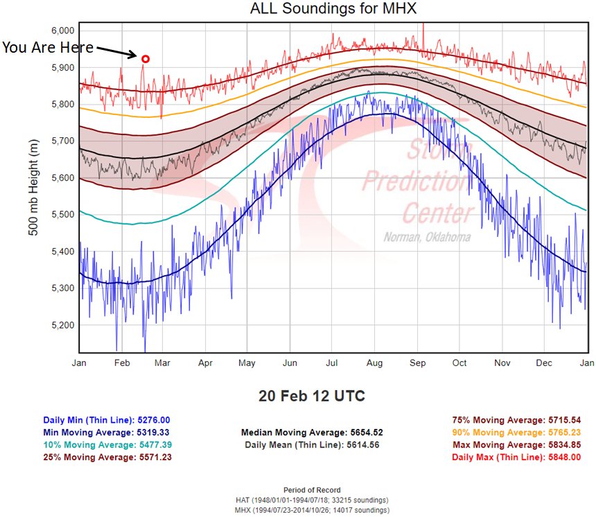
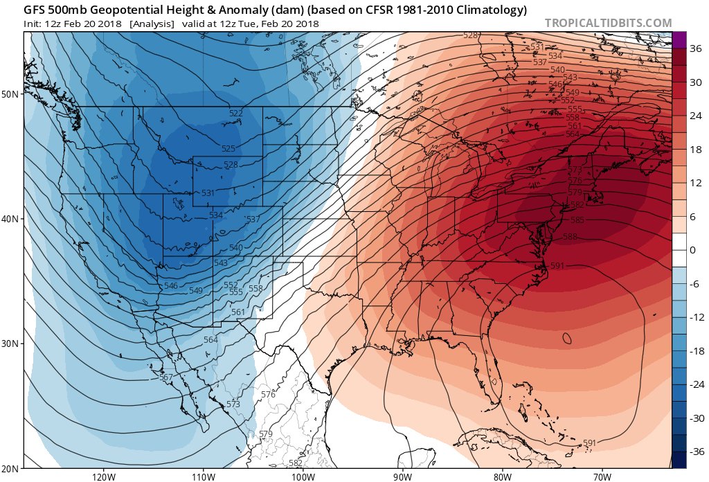
To start peeling back the onion of complicated weather events most meteorologists will turn to 500 milibar geopotential heights and patterns. Right off the bat I see a red flag off the Southeast-Atlantic Coast…a record highest height anomaly near 596 decameters:

Here is Peter Mullinax’s confirmation from this morning:


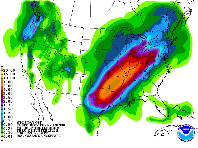
During the winter blocking ridges of high pressure are usually relatively weak allowing fronts to zip across the nation. Flooding across the nation’s heartland is mostly associated with stationary fronts during the cold months, but these usually start to move after a day or two. Still, during a one to two day period even in winter flooding can occur along a stalled or slow moving front. The one in the Midwest this time around won’t move for days. Think of high, blocking heights as the skin of a balloon, and cold, polar air masses what’s contained inside of that balloon. Climate change, via more warming aloft is making the skin of these balloons thicker, slowing down cold air masses trying to escape, which is slowing down fronts.
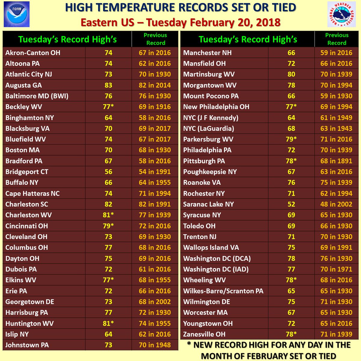
Secondly, at the surface ahead of this particular front that has become stationary there will be plenty of record heat up and down the East Coast, and likewise high moisture content in the atmosphere to be wrung out along the boundary:
 Ryan Maue | weather.usVerified account @RyanMaue

I typically post records (or ETs) at the end of each daily topic, but I’m making an exception today to emphasize how warm this air mass is for this time of the year here is what we saw today:
 NWS Eastern RegionVerified account @NWSEastern


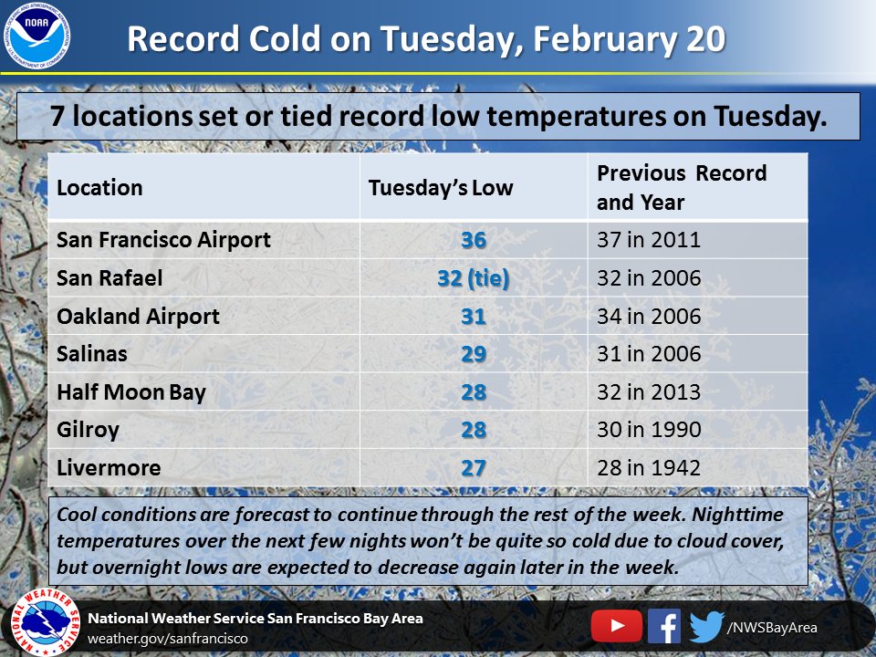
After multiple days of record highs at the start the month, today we transitioned to record cold temperatures. #CAwx #bayareawx #brrr


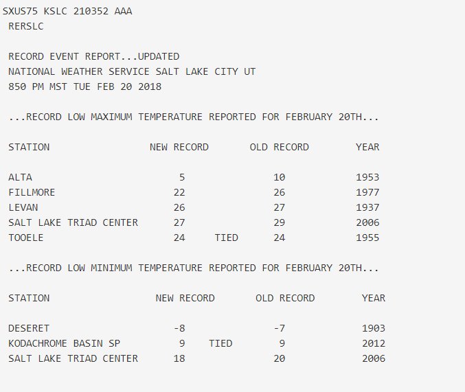
In a nice (I guess?) change of pace from most of our records so far this winter we actually had some cold temperature records today. Our Alta observer reported a high of only 5 degrees today! #utwx

NWS Oxnard Ca reported a LOW Temp of 35 degrees so far today. This ties the record of 35 degrees set in 1961. Santa Maria Ca Airport reported a LOW Temp of 28 degrees so far today. This ties the record of 28 degrees set in 1971 . #cawx #laheat