Wednesday February 21st… Dear Diary. The main purpose of this ongoing post will be to track United States extreme or record temperatures related to climate change. Any reports I see of ETs will be listed below the main topic of the day. I’ll refer to extreme temperatures as ETs (not extraterrestrials)😊. Here is today’s climate change related topic:
(If you like these posts and my work please contribute via the PayPal widget, which has recently been added to this site. Since I am a paraplegic I can definitely use any funds for medical expenses. Thanks in advance for any support.)
February Flood and Warm Wave of 2018 Day Two
Today climate change signals in association with the current weather pattern across the United States remain strong, so I’m going to continue to report ramifications of the thing, As expected from yesterday flooding will be the most serious issue. This is what I am seeing so far from The Weather Channel’s Greg Diamond:
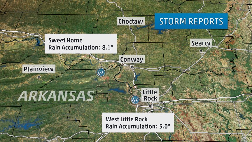
8.1″ reported in Sweet Home
Still at least another 3-5″ to fall through the weekend #arwx
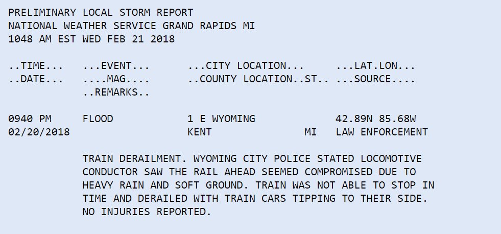
A train derailed near Grand Rapids, MI after a “locomotive conductor saw the rail ahead seemed compromised due to heavy rain and soft ground.”
No injuries reported thankfully
Today we can narrow down the area with the greatest treat for mire flooding, which would be where our front is stalling…from central Texas eastward into the lower and middle Mississippi Valley south of St. Louis:

As mentioned yesterday precepitable water totals will be at record levels for this time of the year at some locations near the front. Precipitable water is another meteorological atmospheric measure indicating how much moisture an air mass is holding. In a warming world air masses at higher temperatures hold more moisture, which this system has in spades:
 Jonathan ErdmanVerified account @wxjerdman
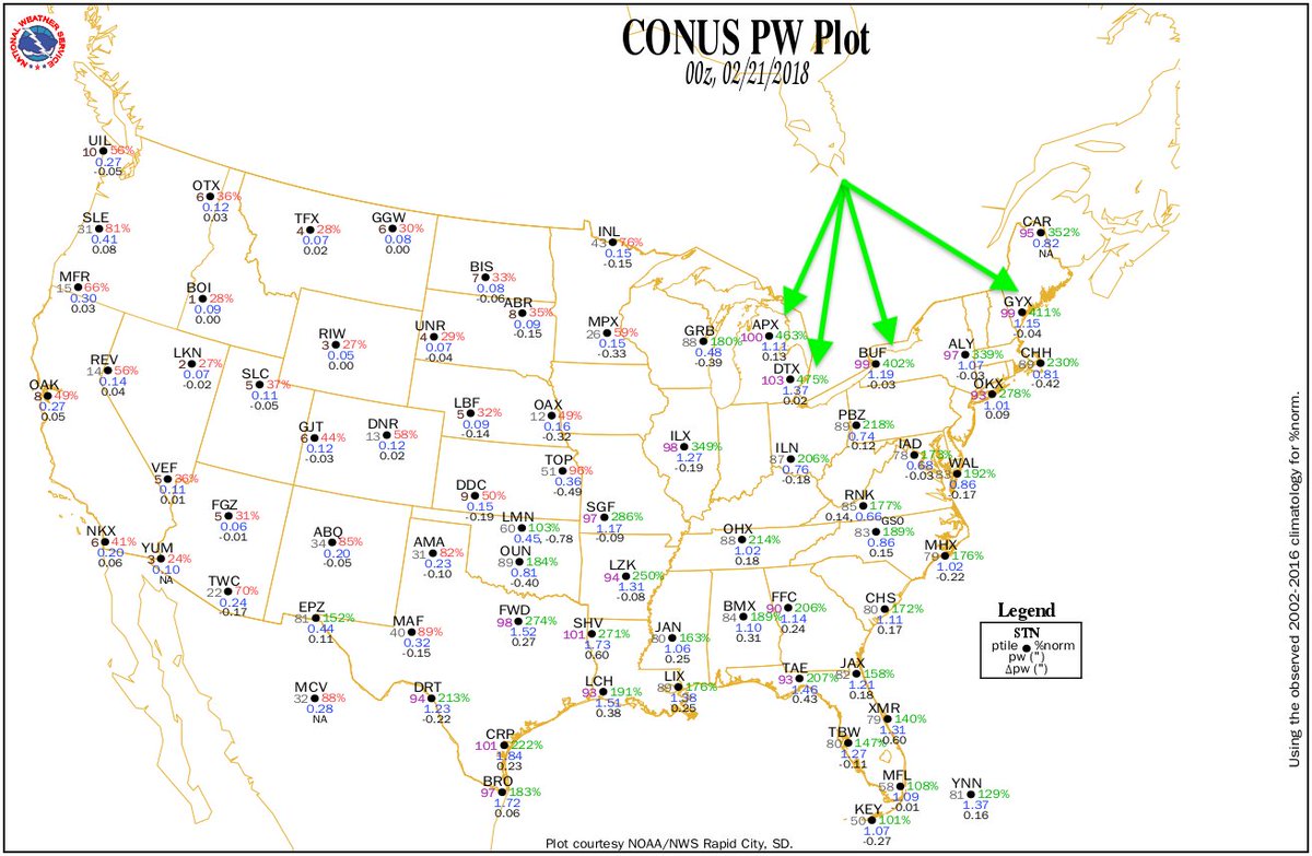
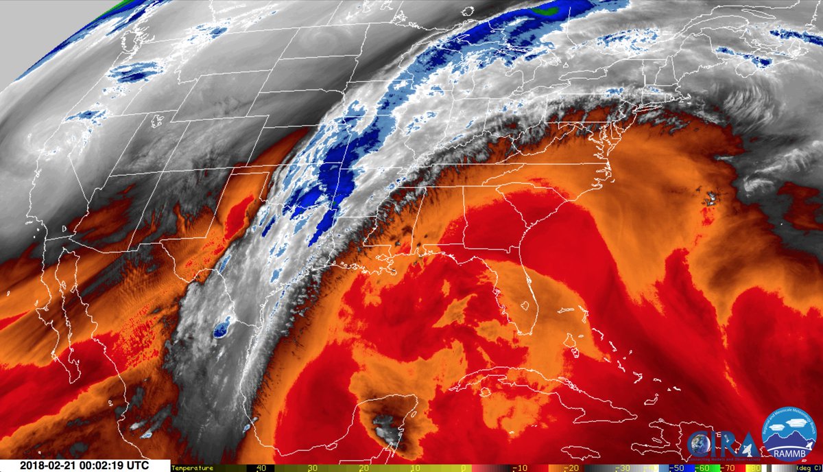
This would be off the meter for the summer, so imagine why this is getting our attention in February….for the non meteorologist..Strong ridge = very warm
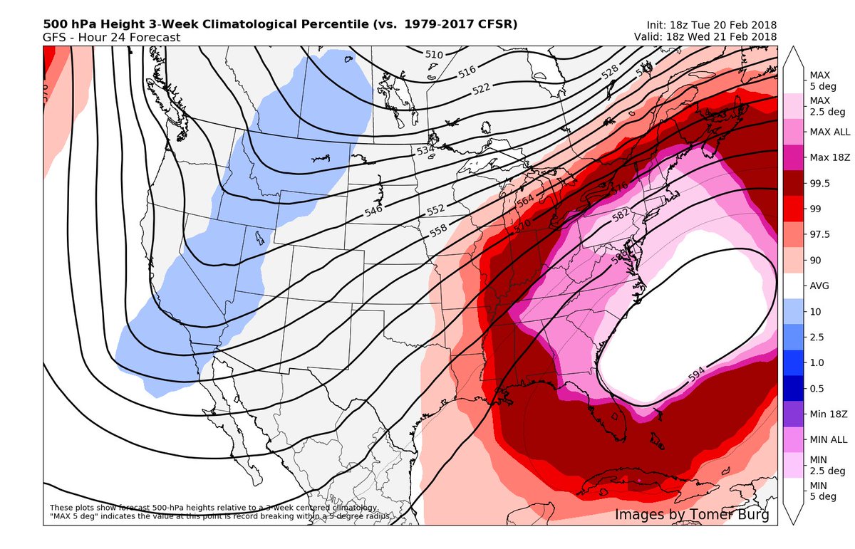
 Bob HensonVerified account @bhensonweather
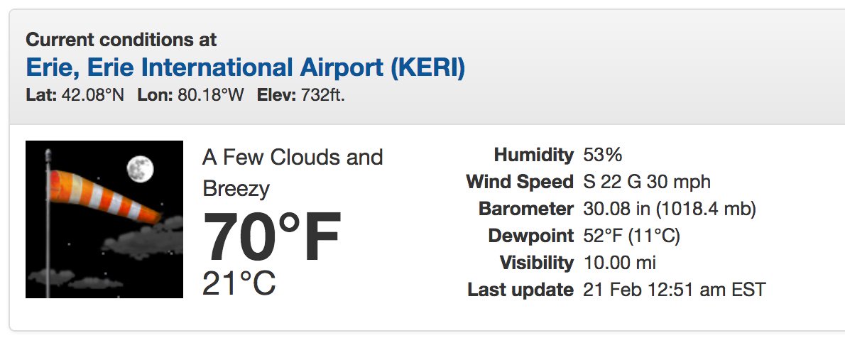
 Bill KarinsVerified account @BillKarins
Son : “Dad why is 80 degrees in winter?”
Me: “all the warm air from Florida and the tropics came over us.”
Son: “this isn’t normal is it?”
Me: “I hope not”
Now putting bathing suits on & heading to backyard for water ballon fight. I  winter.
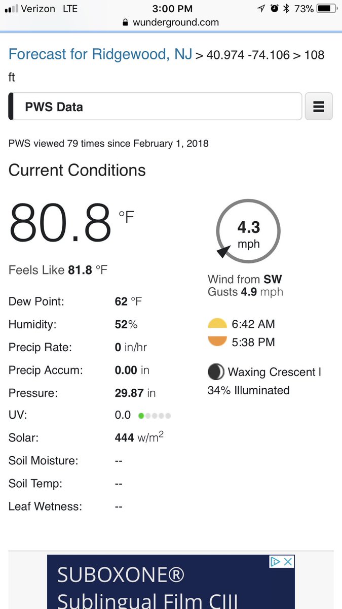
 Bill KarinsVerified account @BillKarins


 Eric HolthausVerified account @EricHolthaus
Earliest 80°F day in DC history now locked in. For perspective, that’s the “normal” high on May 31st.
 Andrew FreedmanVerified account @afreedma
The record high on Mt Washington in NH ties the all time winter high temperature record, doesn’t set a new one (at least not yet). Still remarkable.


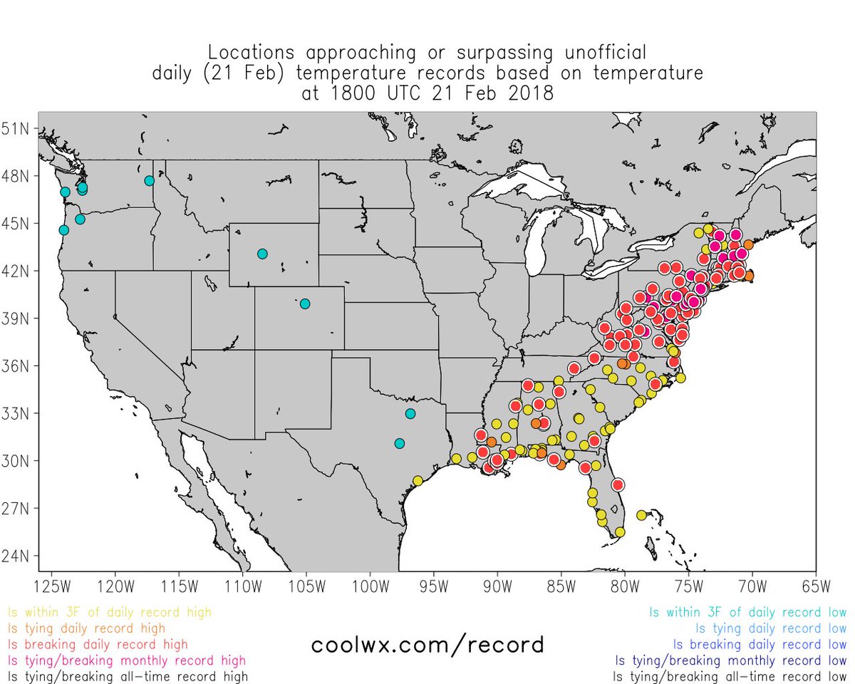
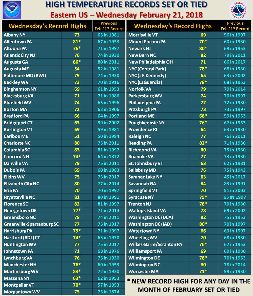
 NWS AtlantaVerified account @NWSAtlanta
Athens reached 80 (previous record: 76 in 1981)
Atlanta reached 77 (previous record: 75 in 1976)
Columbus reached 83 (previous record: 81 in 1922)
Macon reached 83 (previous record: 81 in 1976)
Here are some cold records from the flip side of this very amplified weather pattern, the now frigid West:
#Phillipsburg tied the record low temperature of -12 this morning! Last time it was this cold on today’s date was 1993 #mtwx
 NWS MissoulaVerified account @NWSMissoula


Hi Guy!
This is great work. I’ll be donating a ittle bit monthly (or you can call that a subscription ;).
BR Aarne G. from Finland