Tuesday May 8th… Dear Diary. The main purpose of this ongoing post will be to track United States extreme or record temperatures related to climate change. Any reports I see of ETs will be listed below the main topic of the day. I’ll refer to extreme or record temperatures as ETs (not extraterrestrials)😊. Here is today’s main climate change related topic:
Early May Trends
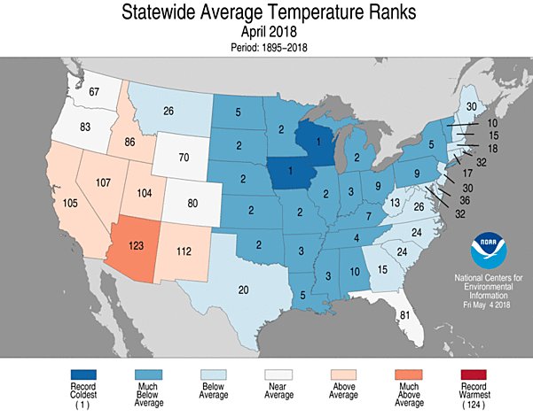
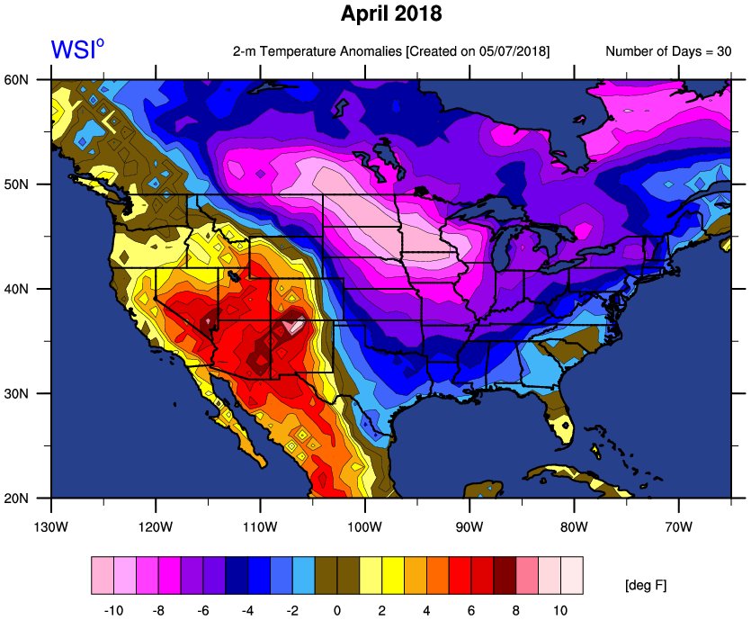
After the first week of each month usually meteorologists can tell how that current month will shape up temperature wise across most of the country unless there is a sharp weather pattern change. Last month we had indications by 4/8 that the weather would be cold east of the Rockies, which verified. In fact, average temperatures were anomalously cold more than any month since November 2014 for the lower 48 states. Two states, Wisconsin and Iowa, had their coldest Aprils on record:

It’s official. Per @NOAANCEIclimate, April was the coldest on record in both Wisconsin & Iowa. Both states shattered their previous records from 1907 by ~1.5˚F, an impressive crushing as monthly mean temps go. #climate #wiwx #iawx


 Michael VentriceVerified account @MJVentrice

 Eric HolthausVerified account @EricHolthaus
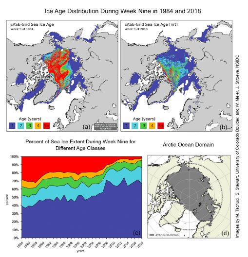
Multi-year sea ice is essentially gone over large parts of the Arctic. Just 2% of ice is older than 5yrs.
Carry on with banging pots and pans, warning everyone who can hear you.
This is an emergency.
(Now with updated graphic.)
https://nsidc.org/arcticseaicenews/2018/05/arctic-winter-warms-up-to-a-low-summer-ice-season/ …


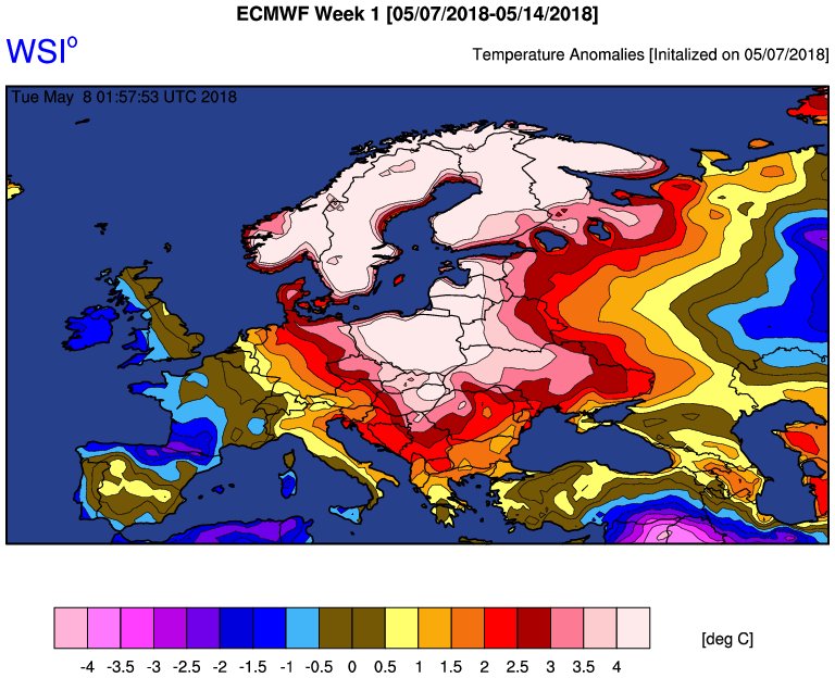
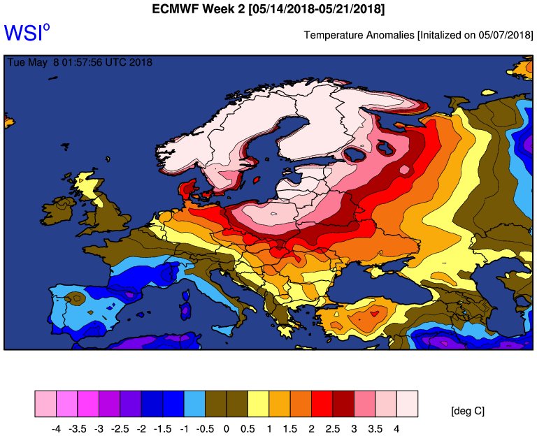
Highly anomalous Scandinavia Warmth expected this week into next. The Scandi Block finally manifested
(If you like these posts and my work please contribute via the PayPal widget, which has recently been added to this site. Thanks in advance for any support.)
The Climate Guy