Sunday July 22nd… Dear Diary. The main purpose of this ongoing post will be to track United States extreme or record temperatures related to climate change. Any reports I see of ETs will be listed below the main topic of the day. I’ll refer to extreme or record temperatures as ETs (not extraterrestrials)😊. Here is today’s main climate change post related hot topic:
Return of the Dipole and Western Heat
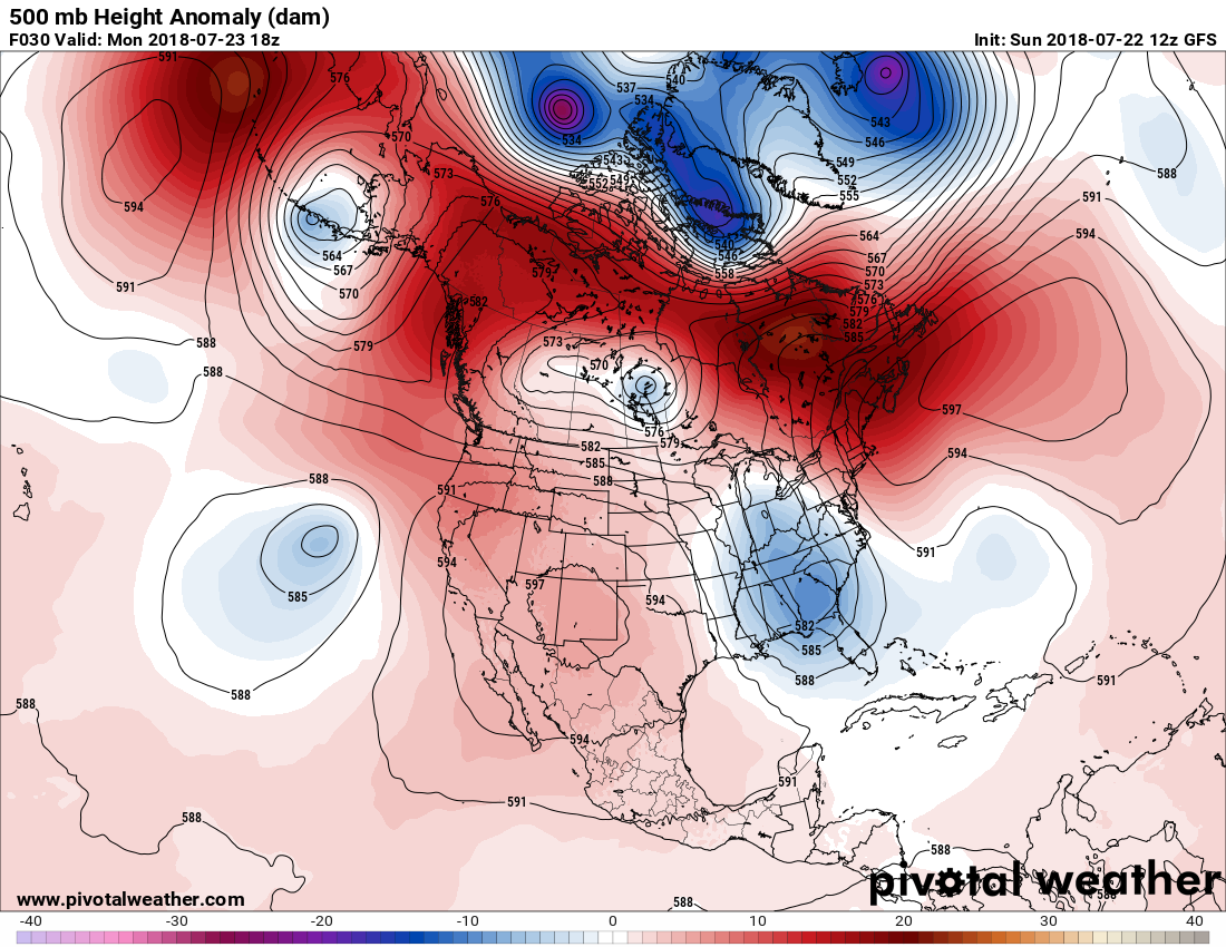
The extra heat juiced atmosphere due to carbon pollution is in the process of flipping to an all too familiar pattern this weekend with yet another western heat dome moving towards California. This would be Dr. Daniel Swain’s Dipole pattern http://weatherwest.com/archives/5982 with a ridge extending all the way from Alaska southward through British Columbia and the Pacific Northwest into California and the Great Basin. There is a corresponding cold trough in the eastern U.S. making up the Dipole. I believe that that atmosphere flipping to this Dipole pattern more often than not is why the West the last few decades has been warming faster than the East. In the world of climate science we are just now beginning to identify and study relatively new regional weather patterns of which the Dipole is one.
It’s no wonder that California seems to be getting the brunt of climate change due to the Dipole. In contrast locations like my home town of Atlanta in the East has not seen temperatures above 94F in over two years due to the persistence of cold troughs during the summer season extending from the Great Lakes into the South since 2016. Unless one was told that climate change was happening across the planet in Atlanta, one might never know.
By Monday here is the forecast 500 millibar pattern across North America:
 A week from Monday this is the forecast weather pattern by the GFS:
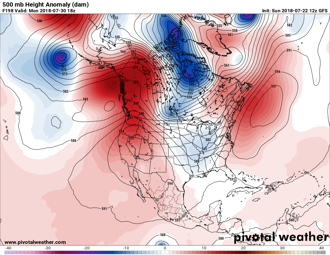
Get the picture? There is no real change in the long wave pattern across North America for a whole week. The western heat dome will wax and wane and oscillate slightly across the West, but it isn’t going away. Subtle changes will diminish or ramp up heat, but well above average if not record heat will persist for an extended period of time. Meanwhile east of the Rockies conditions may get cool enough for record lows to be set with no threat at all from near record heat. This week will be a week of extremes from coast to coast.
Here is Dr. Swain’s assessment of this season’s California heat: http://weatherwest.com/archives/6381
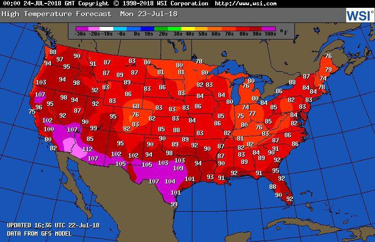
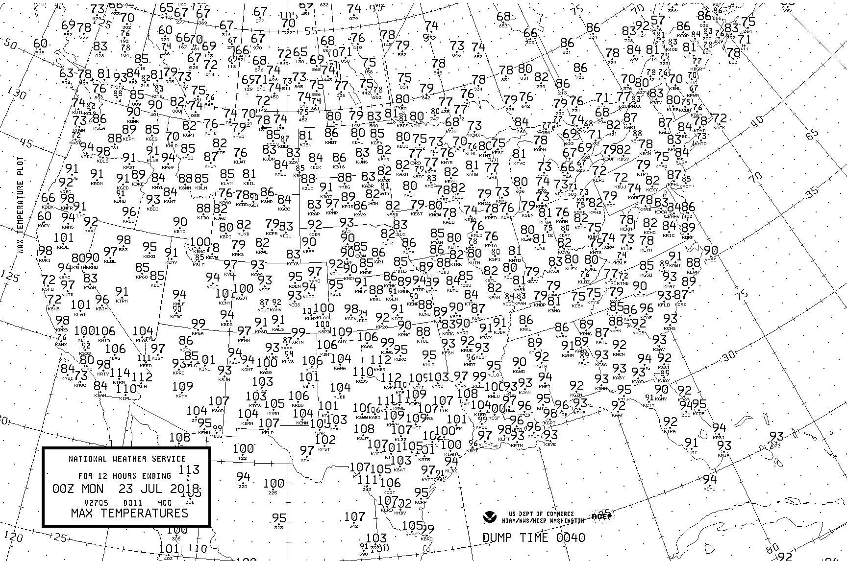
Here is the national temperature profile for Monday:
As the Texas heat starts to diminish the western heat will be increasing big time. Here current national advisories for heat:
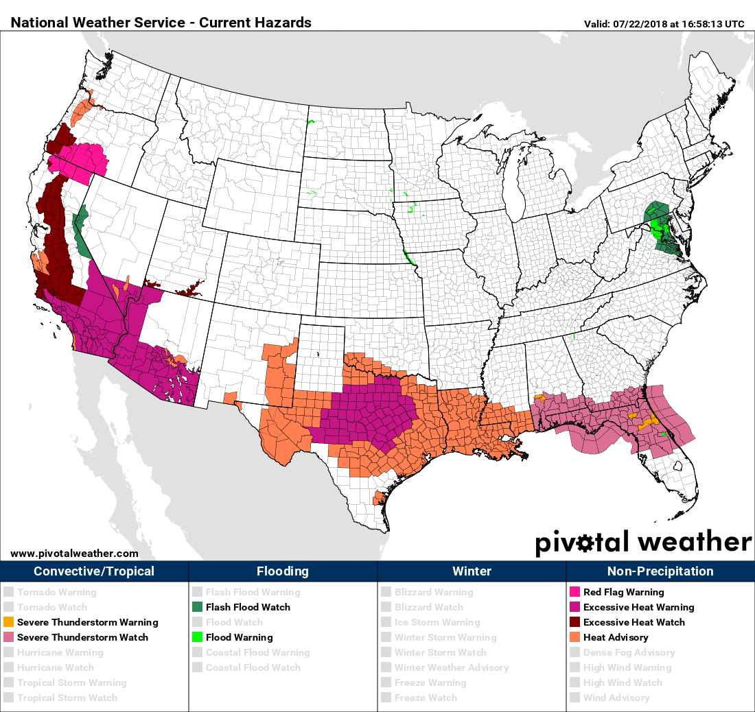
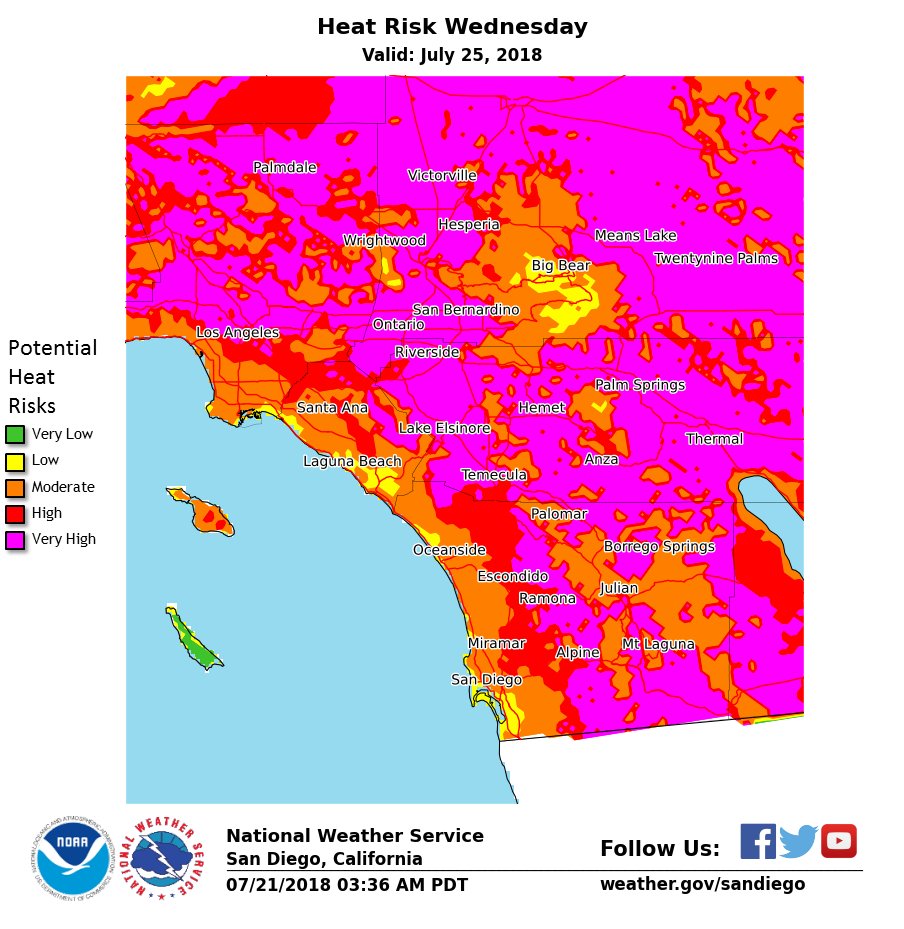
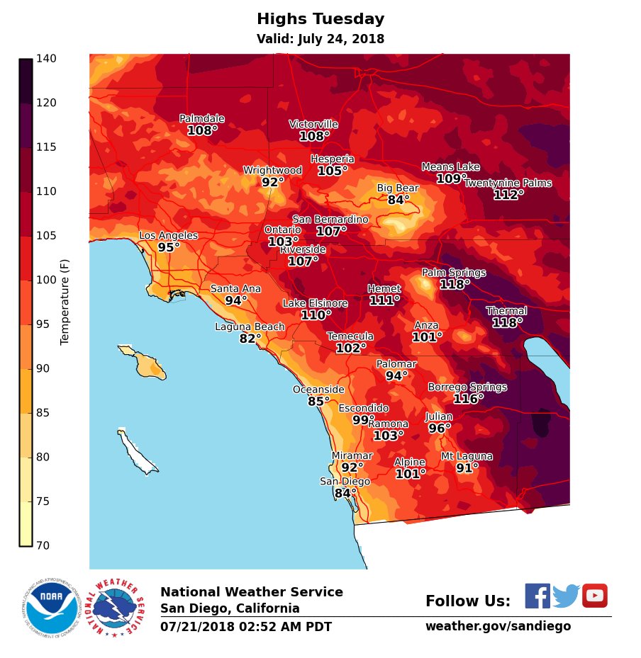
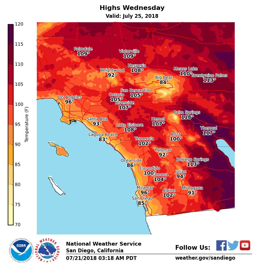
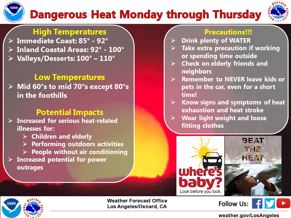
Since I posted this graphic yesterday heat advisories and watches have been extended northward into Oregon. If you are keeping count this Sunday is the fifth day of historic heat in Texas. I’ll also arbitrarily state that the coming western heat will also be a part of this historic heat wave. Here are what a few California NWS offices are anticipating this week:
 NWS San DiegoVerified account @NWSSanDiego

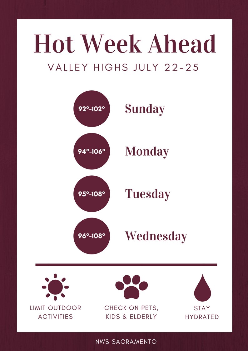
 NWS SacramentoVerified account @NWSSacramento

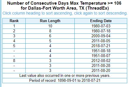
When (not if) #DFW hits 106F today, it will be the 5th consecutive day of 106+ temps. This has only happened 4x previously. Two separate times in 1980, and of course in 2011. Streak should stop here, w/a “cool off” to 103F tomorrow. #txwx


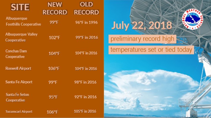
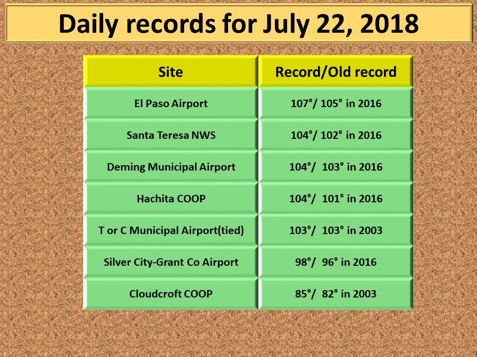
 NWS AlbuquerqueVerified account @NWSAlbuquerque

 Nick Engelfried @nickengelfried


(If you like these posts and my work please contribute via the PayPal widget, which has recently been added to this site. Thanks in advance for any support.)
Guy Walton