Monday July 23rd… Dear Diary. The main purpose of this ongoing post will be to track United States extreme or record temperatures related to climate change. Any reports I see of ETs will be listed below the main topic of the day. I’ll refer to extreme or record temperatures as ETs (not extraterrestrials)😊. Here is today’s main climate change post related hot topic:
Oh Canada! Global Warming Targets Ontario
With each passing year I am seeing stranger and stranger weather patterns that can definitely be associated with climate change. While subtle at first during the start of my career during the 1980s, like U.S. heat waves and droughts from that decade, now we are seeing phenomena at higher latitudes that can only be chalked up to a warming Earth. Attribution with these newer events, which I will describe on this post, should be much easier than those of thirty years ago. Today let’s look at three such events from this month.
First, my how hot Ontario and, in general, eastern Canada got this July. Check out this article describing widespread wildfires occurring in northeast Ontario near Hudson Bay:
Quoting from this article:
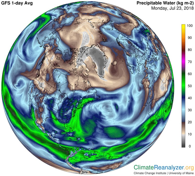
Notice how warm it is across Canada and in particular James bay and Ontario. It’s no wonder that at the surface we are still getting reports like this:


 Rebekah Amosah @RebekahAmosah
How is Climate Change Affecting Canada? https://bit.ly/2LwiRiS @climatereality @cathmckenna @ec_minister
 Robert Fanney@robertscribbler
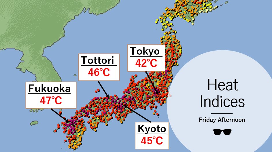
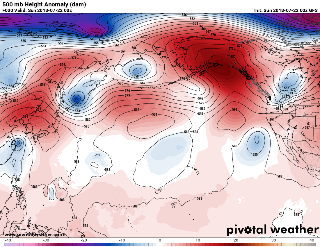
The 47 C heat index in Fukuoka is equivalent to a ‘feels like’ temperature of 116 F. This is deadly heat capable of inflicting serious injury or death. However, if we keep burning fossil fuels places on Earth’s surface will start seeing heat indexes of 150 to 190 (F).
 Eric HolthausVerified account @EricHolthaus
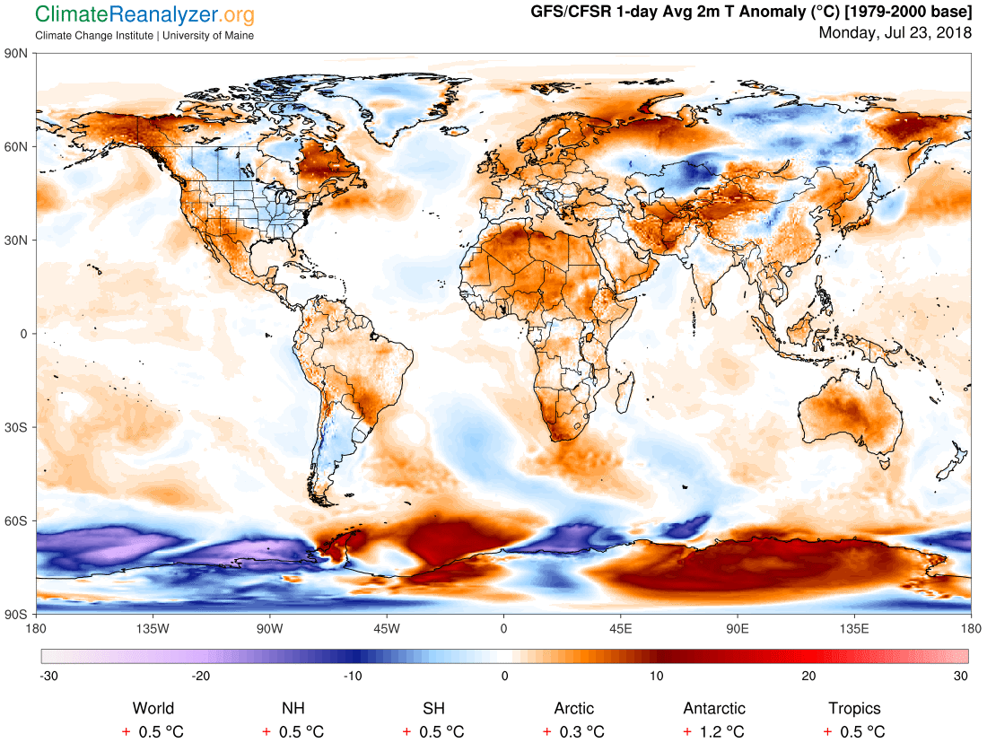
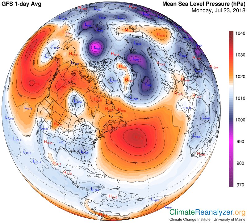
Where is it hot? Everywhere except central and SE North America, Argentina, Kazakhstan, central Siberia, and Greenland. https://climatereanalyzer.org/wx/DailySummary/#t2anom …
 Michael E. MannVerified account @MichaelEMann

 Bob HensonVerified account @bhensonweather
 NWS San AngeloVerified account @NWSSanAngelo
 NWS PhoenixVerified account @NWSPhoenix
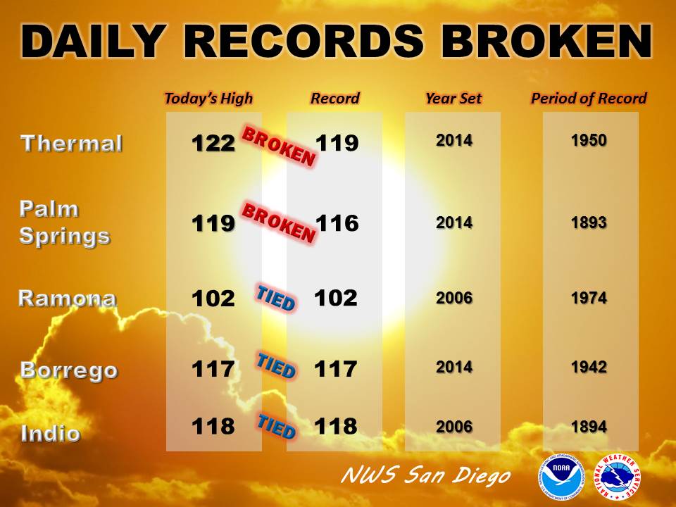
 NWS San DiegoVerified account @NWSSanDiego
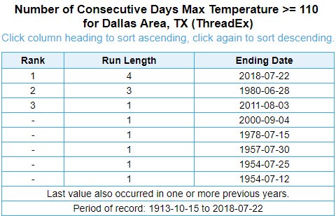
 Bill KarinsVerified account@BillKarins


(If you like these posts and my work please contribute via the PayPal widget, which has recently been added to this site. Thanks in advance for any support.)
The Climate Guy


