Sunday August 26th… Dear Diary. The main purpose of this ongoing post will be to track United States extreme or record temperatures related to climate change. Any reports I see of ETs will be listed below the main topic of the day. I’ll refer to extreme or record temperatures as ETs (not extraterrestrials)😊. Here is today’s main climate change related topic:
Heating Up Through Labor Day
Today its time for the old Climate Guy to come back to Earth (or at least the Earth of today and not the distant future) and report on short term weather and temperature trends across the United States. The pattern that I am seeing on models does have climate change implications being very hot going into the last holiday weekend of summer. As alluded to last week North America will be experiencing a big jet stream pattern change with the predominant ridge over the West breaking down allowing a heat ridge to set up over the East.
Initially this weekend we are already seeing heat build in the Plains with a slight cooling trend across the West. This is great news for the West particularly in the Pacific Northwest where onshore flow has broken the heat wave there and gotten rid of a lot of that harmful, pesky smoke, which has been seen across Portland and Seattle for weeks. By Monday more heat will surge northward through the Mississippi Valley. There will, however, be a taste of fall in Montana in the wake of a front:
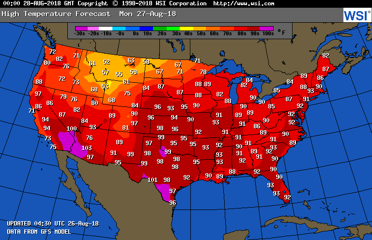
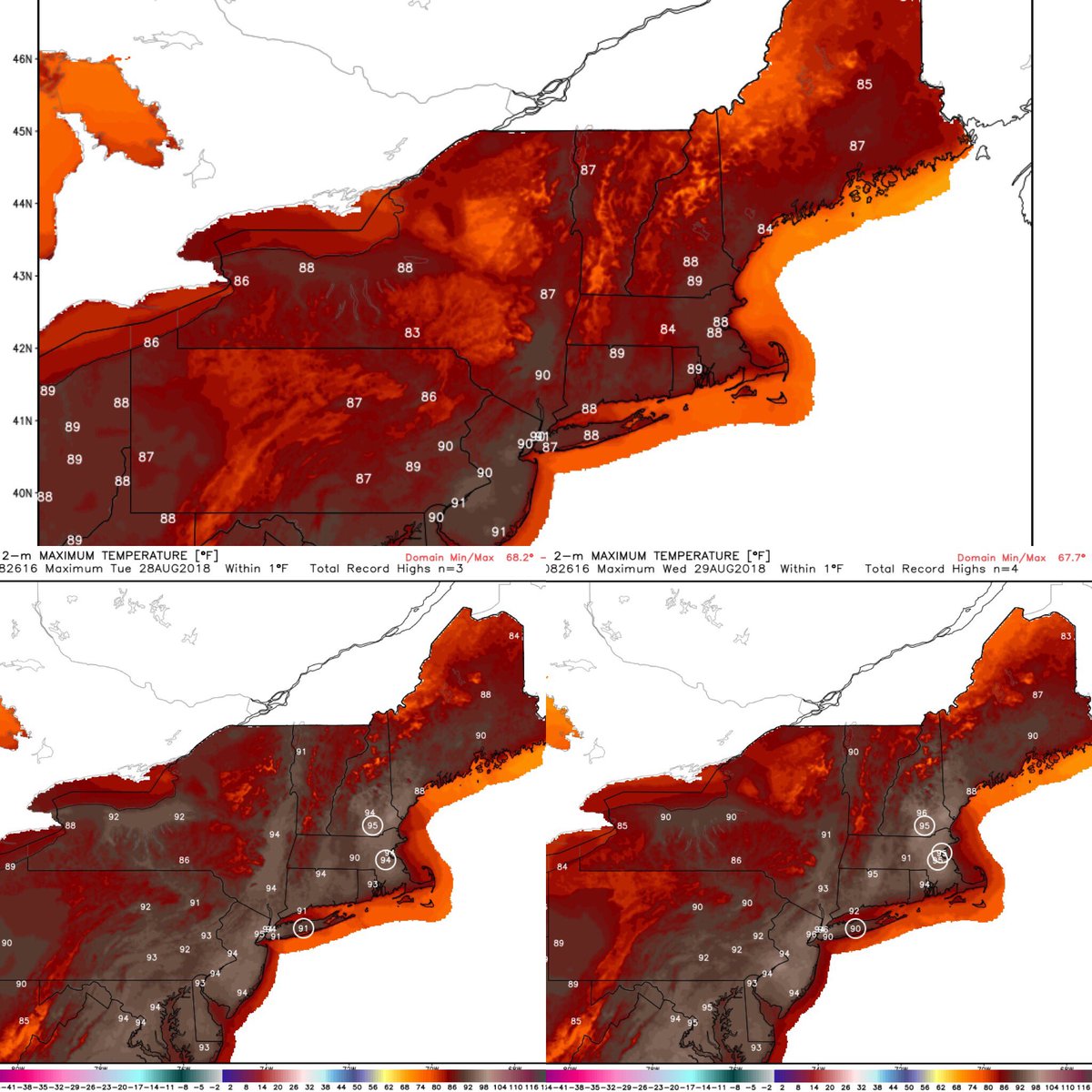
Hotter temperatures above 90F will also surge northward into the Atlantic Seaboard area. Uncomfortable weather with plenty of record “ETs” are forecast through Wednesday:
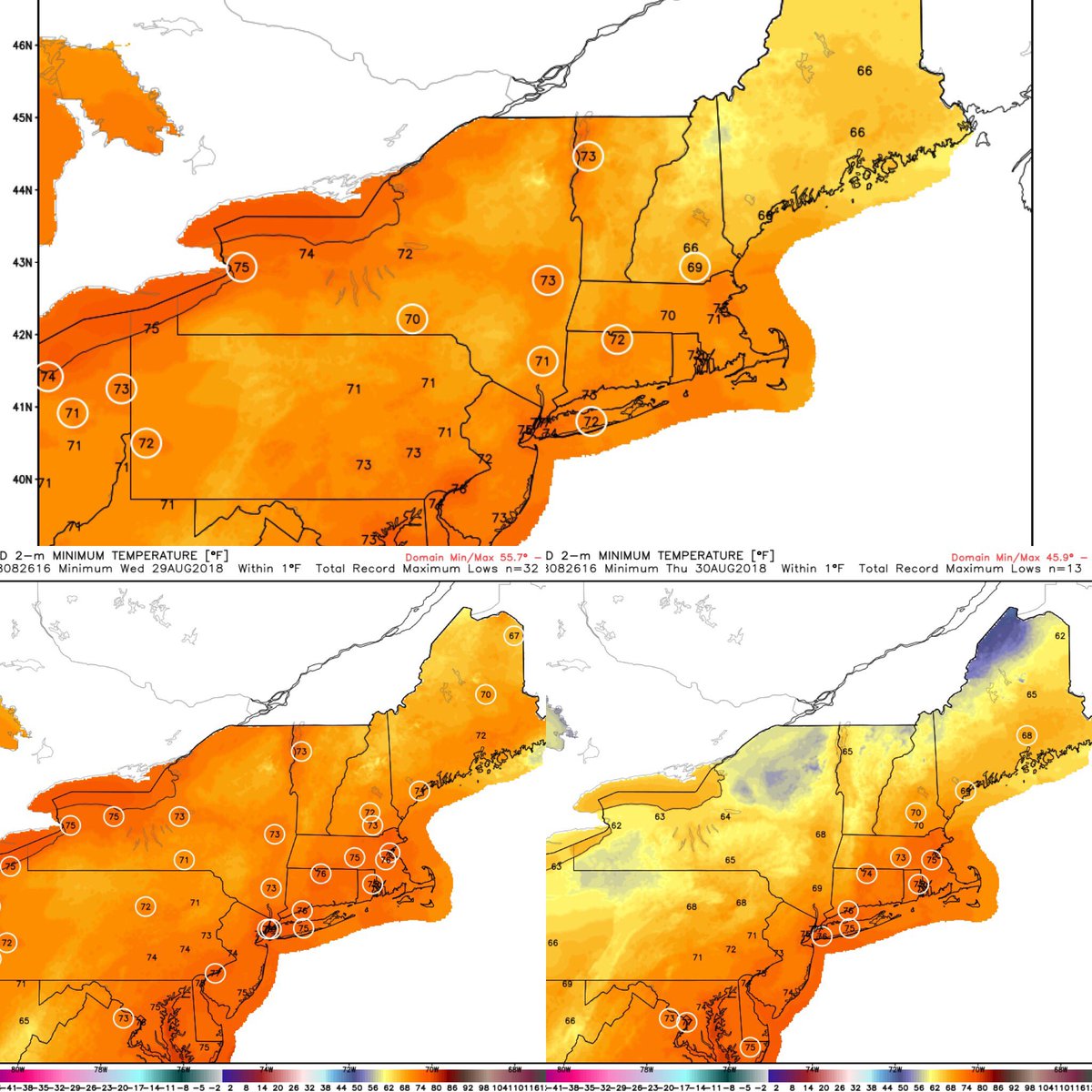
NWS high temps Monday (top), Tuesday (bottom L), Wednesday (bottom R). What would be record highs are circled. HOT!
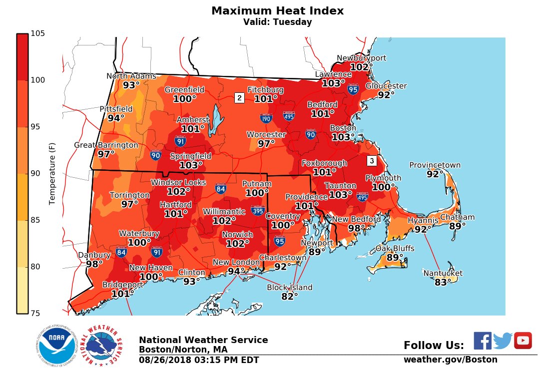
 NWS BostonVerified account @NWSBoston
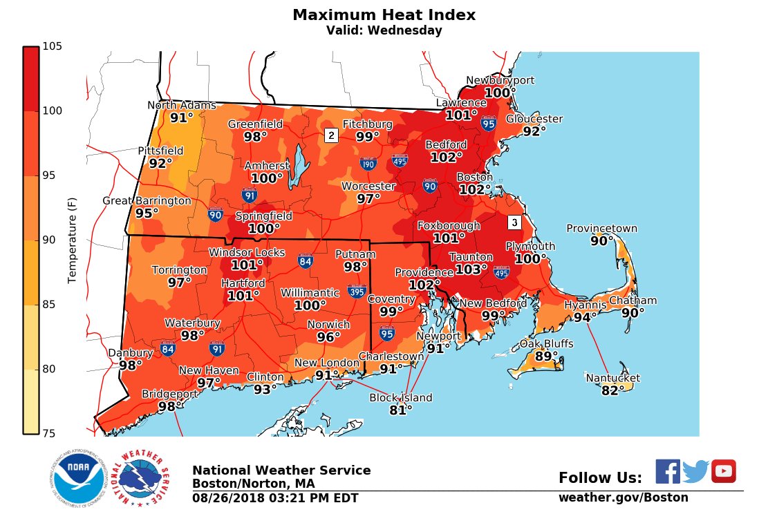
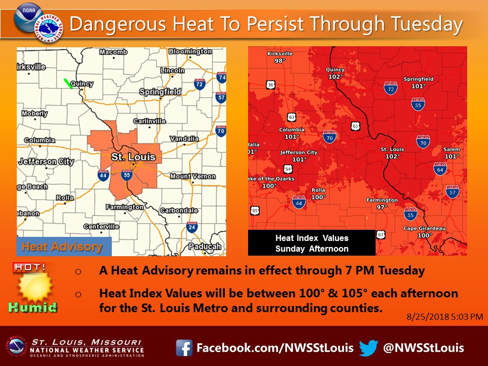
Usually in the Midwest during a heatwave the first large city to be affected is St. Louis. Indeed looking at the NWS advisory map heat warnings are in place for that city:

Unfortunately due to climate change St. Louis will be a hard city to live in as it gets hotter in the summer due to climate change. Here is what is expected there this week:
 NWS St. LouisVerified account @NWSStLouis
Will many records be set this week? Yes, some east of the West Coast area, but we won’t have a historic heat wave. What might be historic is the weather pattern setting up after Labor Day. This operational GFS model panel forecasts a nation under a highly extreme pattern with fall occurring in the West and a July type heat wave east of the Rockies:
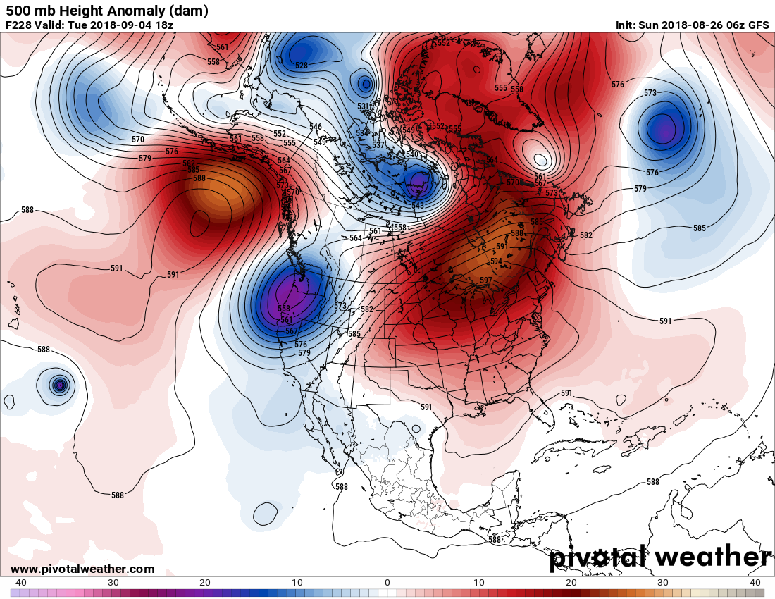
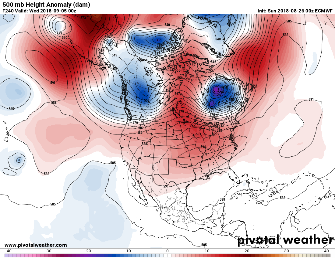
We’ll see how this verifies. I’ve never seen a ridge with 597 decameter heights parked over the Midwest to this extent. The more reliable European model is still hot but much more sane looking:
Of course, I will be reporting any major extreme temperatures that come from this weather pattern going into September.
..……………………………………………………………………………………………………………………………………
(As usual, this will be a fluid post in which more information gets added during the day as it crosses my radar, crediting all who have put it on-line.)
Here is some of today’s climate news:
 Bill McKibbenVerified account @billmckibben
(If you like these posts and my work please contribute via the PayPal widget, which has recently been added to this site. Thanks in advance for any support.)
The Climate Guy
