Thursday September 27th… Dear Diary. The main purpose of this ongoing post will be to track United States extreme or record temperatures related to climate change. Any reports I see of ETs will be listed below the main topic of the day. I’ll refer to extreme or record temperatures as ETs (not extraterrestrials)😊. Here is today’s main climate change related topic:
Rosa- Ominous Tumultuous Similarities To Florence And Harvey
I’d like to remind my readers that I am a meteorologist with 30+ years of experience forecasting weather, which was my bread and butter profession going all the way back to The Weather Channel’s inception during the early and mid 1980s. I’ve seen my share of wet weather patterns over the years, but what I’ve witnessed since creating this web site in early 2017 takes the proverbial cake. I really don’t like what I’m seeing on models in association with a new hurricane, Rosa, which is likely to make landfall in Baja California then deluge portions of the U.S. Southwest. Rosa is a weather event, so what will be any tie ins from this system to climate change? As the system traverses the United States what should we look for as far as attribution to carbon pollution goes?
First, what follows here in this post is a forecast, which I need to emphasize. At this point in time in my diary there are no guarantees that we will see locally heavy rain from Rosa in the Southwest or much wetness when the system is a post tropical low racing through the Midwest. The key word here is “racing.” It appears that Rosa will be a fast mover once it lifts out of the Southwest, getting picked up by the jet. Usually systems that are slow movers put down copious amounts of rain. Still, as we have seen in the last couple of years, it doesn’t take too long for even minor systems to produce flash floods, inundating areas not used to getting hit by walls of water with rainfall rates getting close to if not exceeding three inches per hour.
Yesterday I saw an AP article indicating that Harvey and Florence delivered the nation’s biggest one-two punch of flooding rainfall in United States history. Dr. Michael Mann replied to my associated note here (Please look at the two linked articles):
 Michael E. MannVerified account @MichaelEMann
In the absence of human-caused planetary warming? To quote Tom @Yulsman & @DiscoverMag “A snowball’s chance in hell” http://blogs.discovermagazine.com/imageo/2017/08/11/record-global-warming-streak-of-2014-2016-snowball-chance-in-hell-that-it-was-natural/#.W6vsaFJRfy8 …

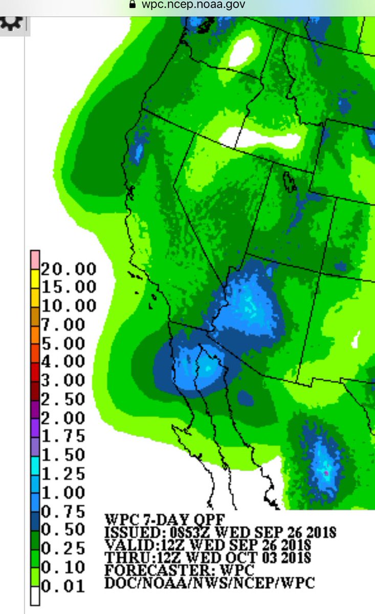
Definitely watching the heavy rain potential with #Rosa or its remnants next week in the SW United States- notable upward trend in the @NWSWPC forecast since yesterday.
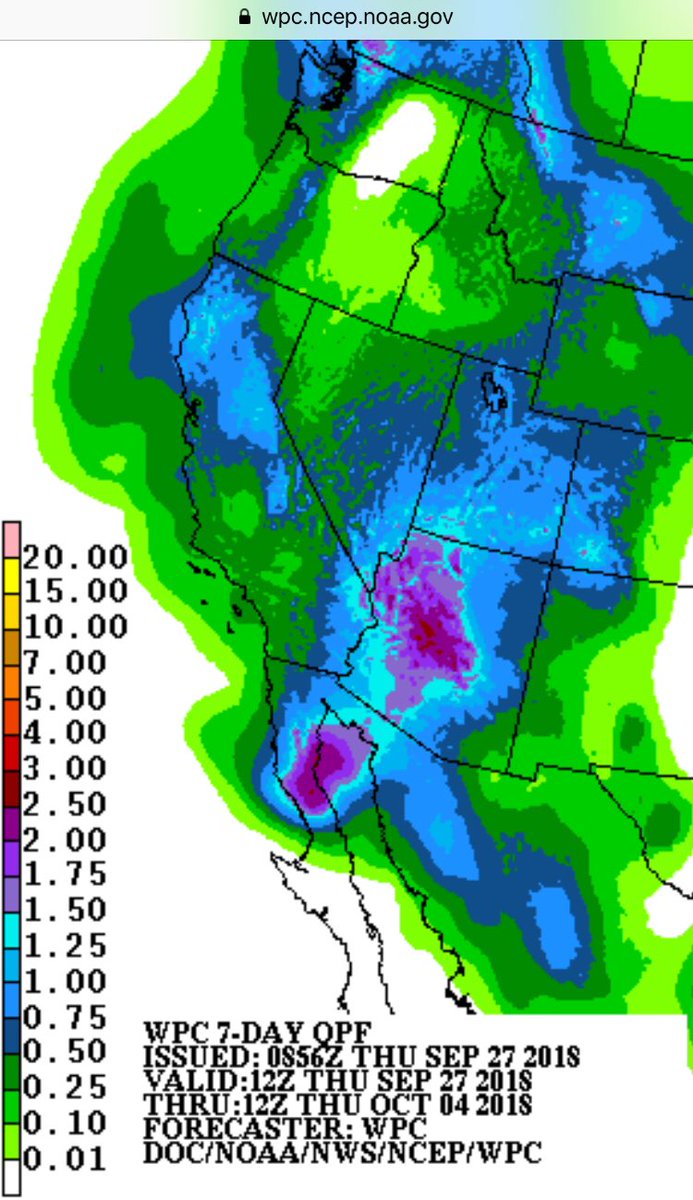
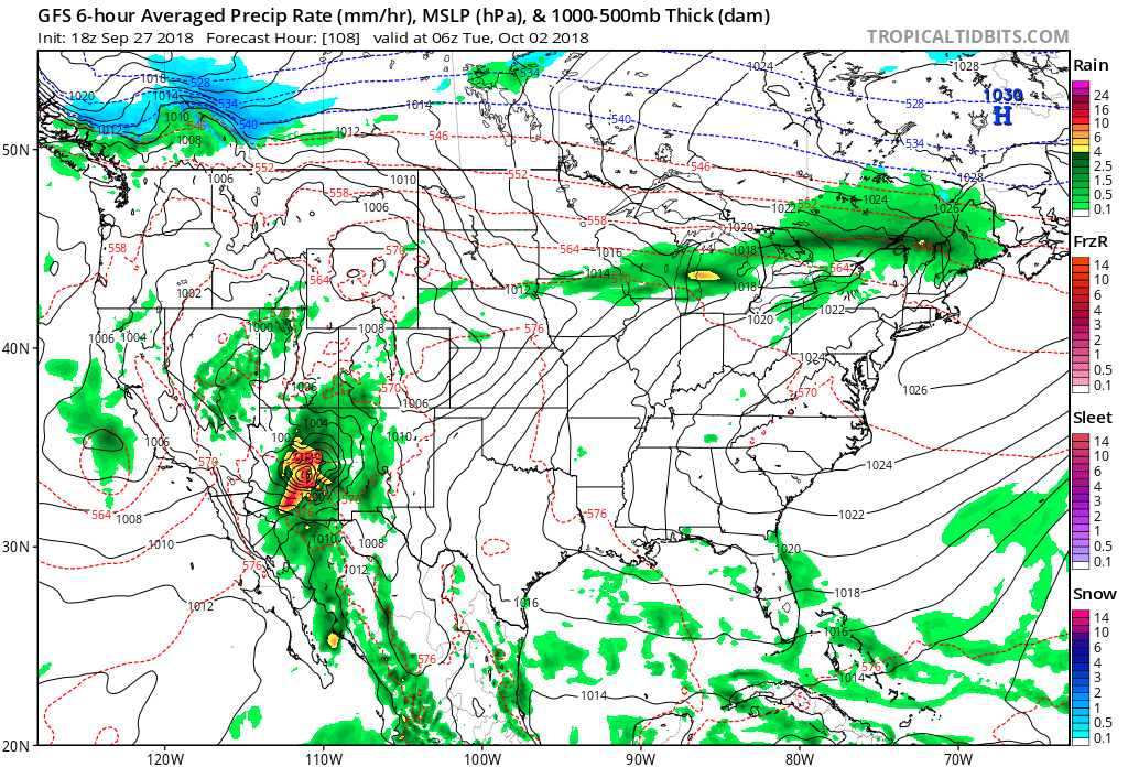

GFS 10 day total accumulated precipitation in inches forecast model for continental U.S. 9/27 12 pm EST. Hurricane Rosa and subtropical Rosa pic.twitter.com/yuMb6p5bEu
— Scott Cook (@scook2214) September 27, 2018
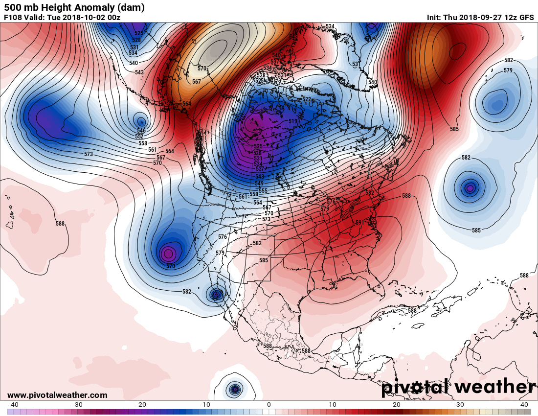
Here is another loop of Rosa potentially traversing the U.S. heartland:
GFS 10 day forecast model. Continental U.S. 9/27 12 pm EST, for surface pressure(mb) and 10m wind speed in kilometers. Hurricane Rosa and subtropical Rosa pic.twitter.com/ZyiKrInlHK
— Scott Cook (@scook2214) September 27, 2018
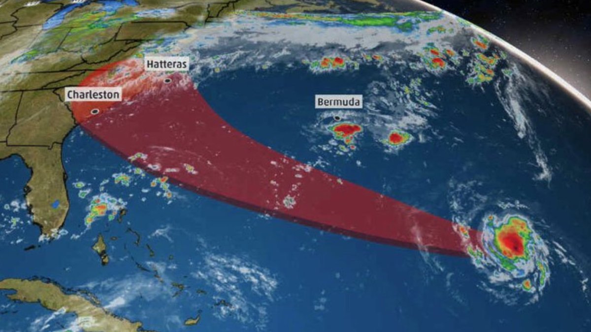
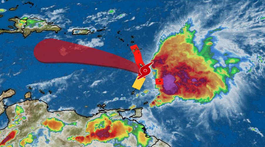
#Rosa in the east Pacific has intensified into a major hurricane with 125mph winds. Moisture from this storm could bring flooding rains to the southwest next week. pic.twitter.com/t6oaNSXyqr
— Collin Gross (@CollinGrossWx) September 28, 2018
My eyebrows are definitely raised from what I am seeing on the models in association with Rosa. I’m hoping that I can point back to this post in the next few days and say that any ominous prediction for Rosa did not materialise. We will see.
………………………………………………………………………………………………………….
(As usual, this will be a fluid post in which more information gets added during the day as it crosses my radar, crediting all who have put it on-line. Items will be archived on this site for posterity.)
Here is some other weather and climate news from today:

#Kirk‘s heaviest rains will arrive in the Windward Islands into the overnight hours even as Kirk’s center moves into the Caribbean. Forecast: https://wxch.nl/2OcStz3

The aftermath of hurricane #Florence: polluted coastal waters with inky runoff–filled with “soils, sediments, decaying leaves, pollution, and other debris”.
https://earthobservatory.nasa.gov/images/92786/a-broad-view-of-flooding-in-the-carolinas
I have seen one report of ETs from a hot Florida this evening:

Happy HOT Thursday! We set a record warm low temperature at RSMAS today (84°… the previous record was 82.6° set in 2000). Also, Miami Int’l set a record warm low at 82° today (previous record was 81° set in 1989). #flwx #climate #miami

(If you like these posts and my work please contribute via the PayPal widget, which has recently been added to this site. Thanks in advance for any support.)
The Climate Guy