Friday September 28th… Dear Diary. The main purpose of this ongoing post will be to track United States extreme or record temperatures related to climate change. Any reports I see of ETs will be listed below the main topic of the day. I’ll refer to extreme or record temperatures as ETs (not extraterrestrials)😊. Here is today’s main climate change related topic:
Three Simultaneous Threats: Trami, Rosa, and a Medicane
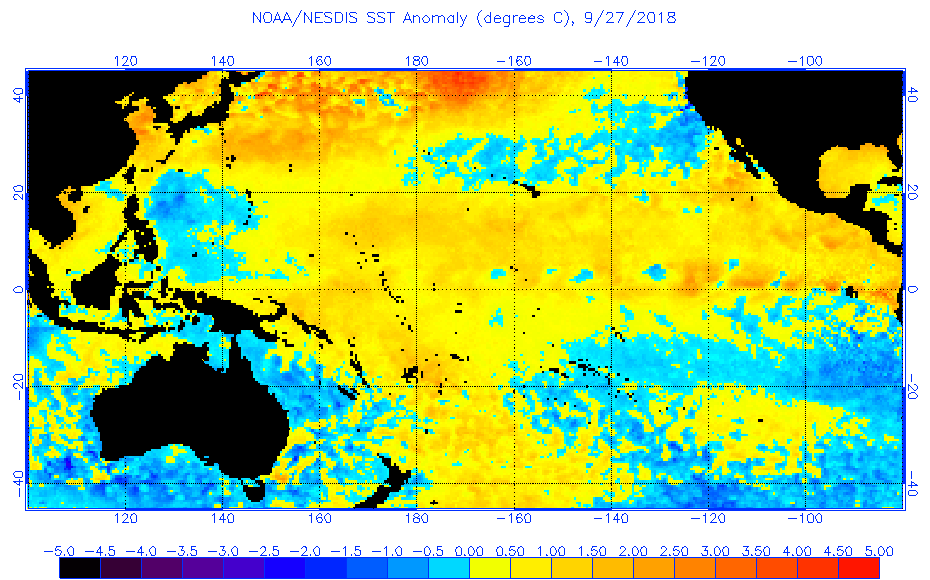
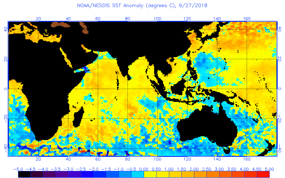
I’ve listed three worldwide storm threats in the title of today’s post with Trami getting top billing because it appears to have the potential to do the most damage among the trio. For good details on each see this great post: https://www.wunderground.com/cat6/Kirk-Drenches-Barbados-Rosa-Cat-4-Medicane-Threatens-Greece I didn’t mention Kirk thinking it will be a relatively minor player as it rolls through the Caribbean. Yesterday we linked three systems, Harvey, Florence and potentially Rosa to climate change. In truth all current storms and those going back to at least 1980 in one way or another have been influenced by the growing radiation imbalanced in the atmosphere linked to carbon pollution. The hotter the atmosphere and even more importantly sea surface temperatures surrounding and in the path of storms the more potential energy can be released in the form of heavy rain and wind on us poor humans. This is not rocket science. It’s basic high school physics. As far as attribution to climate change goes today let’s concentrate on the SST’s beneath and ahead of all three systems.
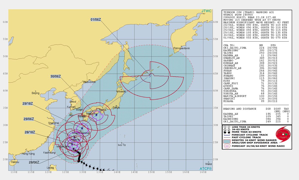
First let’s look at Trami in the northwest Pacific. Here is its forecast track, which would take the system through the heart of Japan:
Typhoon Trami & T.D. 30. ECMWF 10 day forecast model for the West Pacific. 9/28 12 pm EST, Wind speed at 850 hPa in kilometers and Mean Sea Level Pressure(mb) (MSLP). Models can vary near the end of the forecast pic.twitter.com/WfjrpQ4R43
— Scott Cook (@scook2214) September 28, 2018
6 am 9/28 update from the Joint Typhoon Warning Center from the U.S. Navy for Typhoon Trami. Showing it’s current position NE of the Philippines. Moving at 315 degrees true (NW) at 7 knots, 8 mph. Max wave height 43 feet. Max sustained winds 105 mph. Gusts 125 mph.
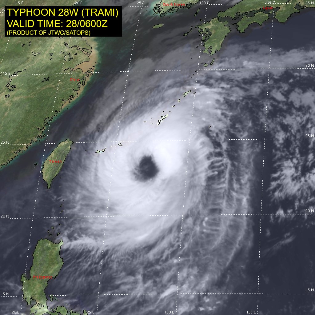
This is a 4 kilometer height GIF of Typhoon Trami. Wind shear forecast still favorable at this time with light mid-level winds. Trami will continue picking up forward speed to the NW then North over very warm water. pic.twitter.com/WIZS6x8BKx
— Scott Cook (@scook2214) September 28, 2018
Wow! It is extra warm near Japan and also along the entire coast of Mexico with anomalies of +1.0C to +3.0C.
Let’s take a gander at Rosa:
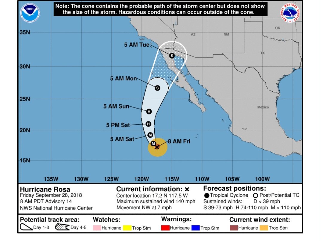
Tracking #HurricaneRosa as the system moves towards the desert southwest. Localized parts of southern California and southern Arizona may see tropical-storm force conditions. Flash flooding will be the greatest threat for the region.
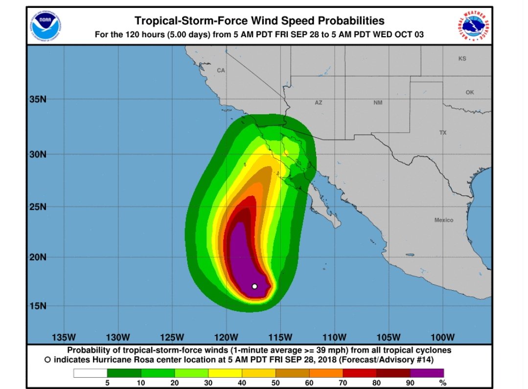
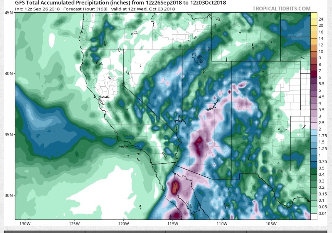
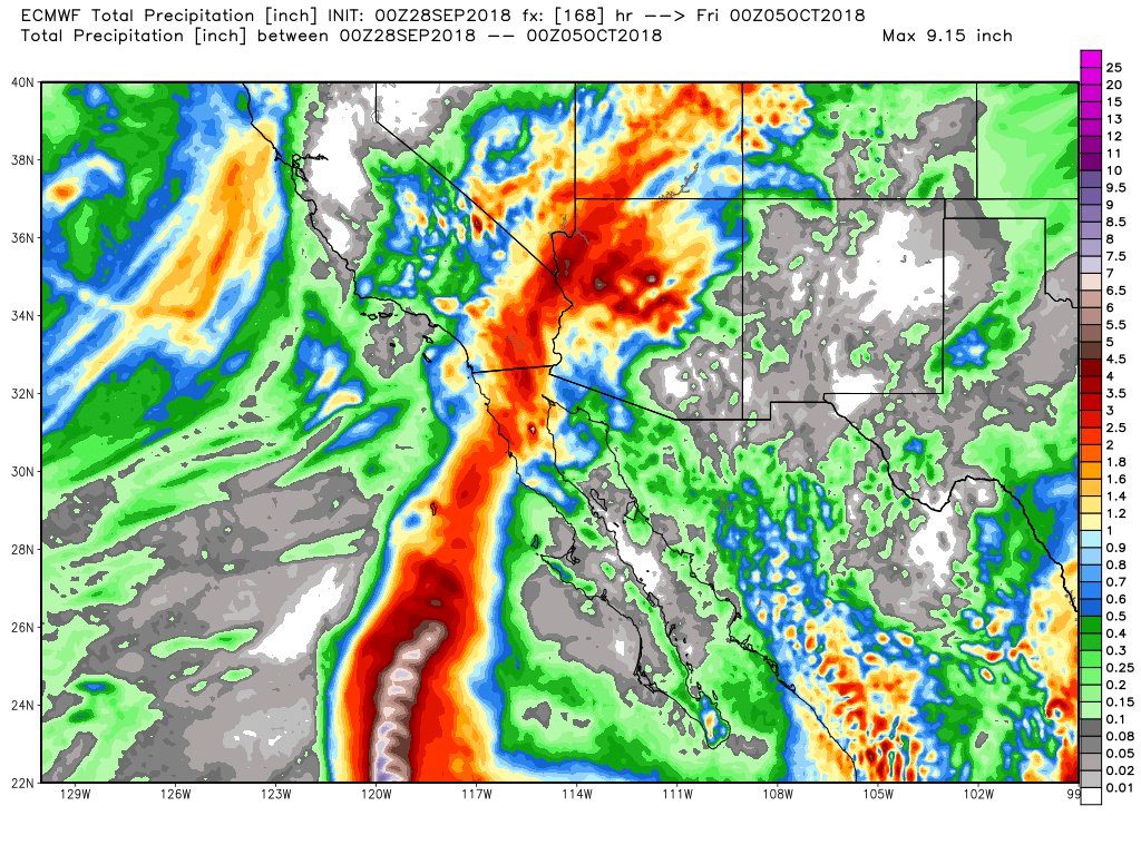
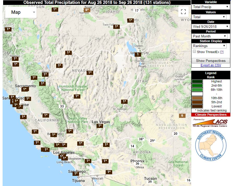
Rosa will produce 6-12 months of rain in 1-2 days! Widespread 2-4 inches possible. Isolated 6″. To put into perspective Avg. annual rain in Vegas is ~4″, Death Valley ~2″, Phoenix ~8″ ,Palm Springs ~6″. 2nd graphic raking map for Sept. Tied for 1 in many instances.
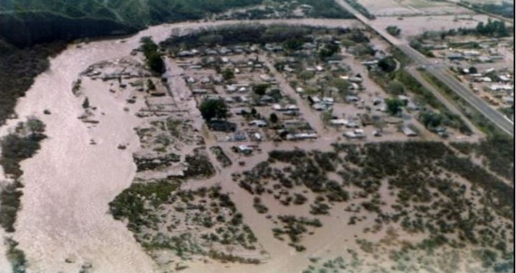
While parts of Arizona brace for heavy rain and flooding by early next week we reflect back to 1983 when Tropical Storm Octave triggered catastrophic and deadly flooding across the state.
My “Something Moore” weather history article for this week.
https://www.weatherconcierge.com/octave-was-the-worst-tropical-cyclone-in-arizona-history/ …
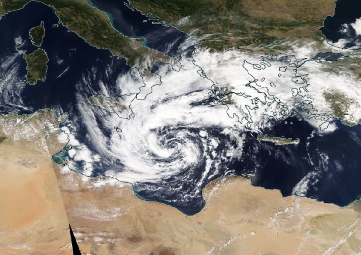
Satellite loop of the developing storm in the #Mediterranean – sometimes referred to as a #medicane. Our blog explains more about this phenomenon: https://t.co/9EX7pAxJbr pic.twitter.com/x11VyUfXtA
— Met Office Storms (@metofficestorms) September 28, 2018
A #Medicane is going to bring gusty winds and heavy rain to Greece and Turkey this weekend. The strange forecast: https://wxch.nl/2DFzsRM
ECMWF 5 day forecast model. Europe 9/28 12 pm EST "Medicane"
A strong "Tropical Storm" moves NNE and makes landfall in South Greece, and immediately weakens to a depression through the North Aegean Sea then dissipates. Water temperature in that area is 26.5 C so T.S. could apply pic.twitter.com/df4b8zh1rB— Scott Cook (@scook2214) September 28, 2018
GFS 5 day total accumulated precipitation in mm forecast model. Europe 9/28 12 pm EST. Medicane pic.twitter.com/i0ESi3qavn
— Scott Cook (@scook2214) September 28, 2018
Here is some of today’s other climate and weather news:
 Brian L KahnVerified account @blkahn

Tesla Indicates 80,000 EVs in Q3 as Trump’s SEC Produces Questionable Filing: http://youtu.be/oCmkaLQVii0?a via @YouTube
11:34 AM – 28 Sep 2018
(As usual, this will be a fluid post in which more information gets added during the day as it crosses my radar, crediting all who have put it on-line. Items will be archived on this site for posterity.)
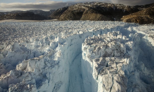
Warnings about dangers 1.5–2C temp rises could trigger irreversible loss of Greenland ice & raise sea levels 1–2 m
1:09 PM – 28 Sep 2018
Our marginalized brothers and sisters will face the brunt of climate change.
http://www.seattleweekly.com/news/report-reveals-inequities-of-climate-change-in-washington/

11:05 AM – 28 Sep 2018
Today is the 29th consecutive day with above normal temps in Anchorage. This is the longest stretch since Aug-Sep 2016. There were 4 such streaks in 2016. #akwx @AlaskaWx
(If you like these posts and my work please contribute via the PayPal widget, which has recently been added to this site. Thanks in advance for any support.)
The Climate Guy


