Wednesday December 26th… Dear Diary. The main purpose of this ongoing post will be to track United States extreme or record temperatures related to climate change. Any reports I see of ETs will be listed below the main topic of the day. I’ll refer to extreme or record temperatures as ETs (not extraterrestrials)😊.
Looking Into 2019… U.S. Weather And Temperature Trends
I hope everyone had a great Christmas. The final holiday we look to on every 26th of December is New Years, which is now well within credible meteorological model’s predictions for weather trends. We also now have an idea what the first few days of 2019 will be like weather wise. And yes, bleeding over from yesterday’s post the one word to describe the overall pattern into early 2019 is “mild.”
First, most of the nation will experience the wrath of what The Weather Channel has dubbed Eboni on big travel days from tomorrow through Saturday:

As of this writing Eboni is producing a whole host of problems as denoted by current National Weather Service advisories:

Here are 4 things to know about #WinterStormEboni: https://t.co/VKLpAS13k8 pic.twitter.com/1UktFpclew
— The Weather Channel (@weatherchannel) December 26, 2018
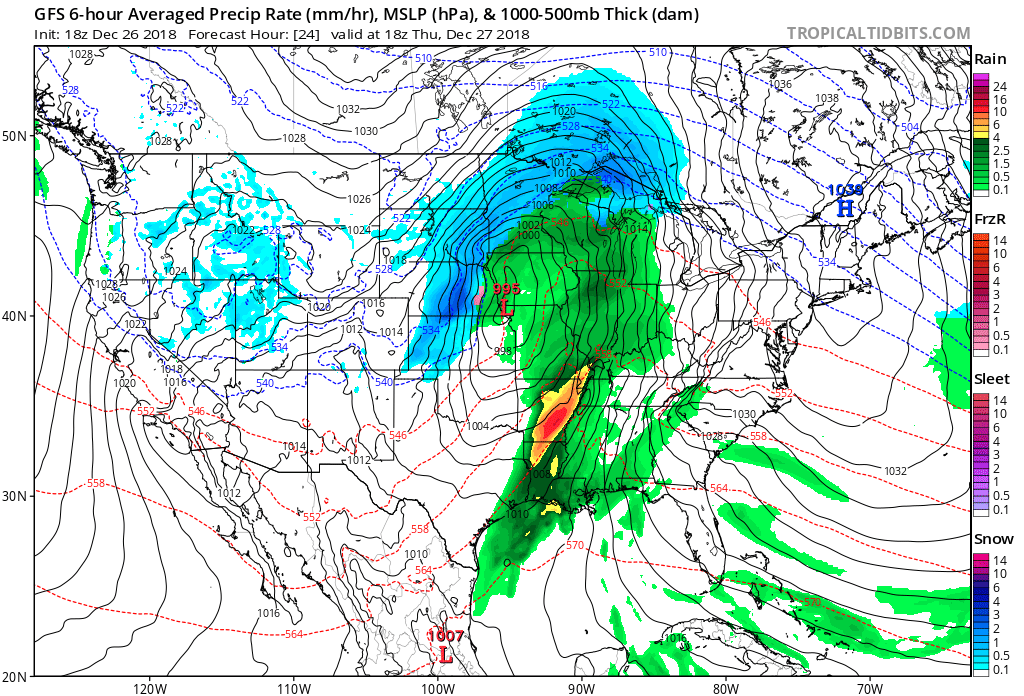
A blizzard in the Dakotas is quite common for late December, but what strikes me is how mild the air temperature will be outside of the northern Plains. Note the flooding expected across the mild to warm Southeast. Here is what is forecast for Thursday:

Fifty degrees Fahrenheit for Chicago is quite balmy for December. Even temperatures in the Dakotas in association with our blizzard aren’t forecast to be below zero, which I have often seen in the heart of monster winter storms. Temperatures in the northern Plains will fall below zero finally in the wake of Eboni, though, after Thursday. Today’s departure from average chart shows a lot of mild air fueling a severe threat from Texas through much of the South:
![]()

Damaging wind gusts, a couple of tornadoes and large hail will threaten portions of Texas and Oklahoma tonight. Be sure to have a way to receive #severe weather warnings and alerts overnight: https://t.co/ObtIrBAeHp pic.twitter.com/wXymw4hh8J
— The Weather Channel (@weatherchannel) December 26, 2018
As we know a warmer atmosphere from carbon pollution leads to heavier precipitation. I expect heavy amounts from Eboni’s warm side across the South and in its cold sector over the Dakotas:
The bulls-eye of heaviest snow the next 2 days looks to be eastern South Dakota
Aberdeen, SD could see their biggest December snowstorm on record pic.twitter.com/WkJB0o2B0b
— Greg Diamond (@gdimeweather) December 26, 2018
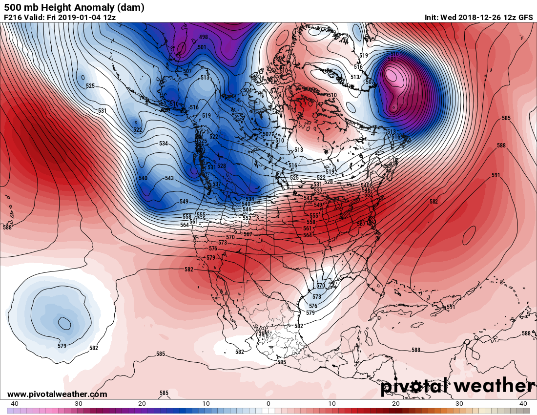
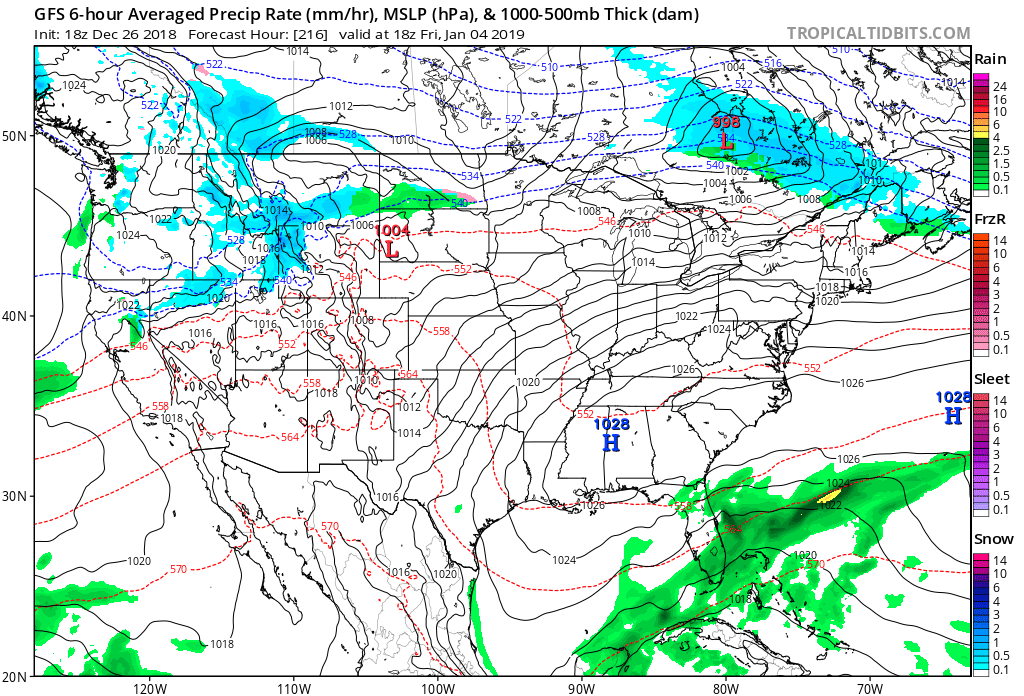
Another mild, wet system will get its act together in the South before year’s end, and we should see a more “traditional” Arctic air outbreak on the 1st in the wake of that storm:

For the first time this season we may see below 504 decameter thickness air enter the CONUS noting the above panel. That cold air is forecast to moderate quickly if these model pabpnels are close to being right on the 4th:


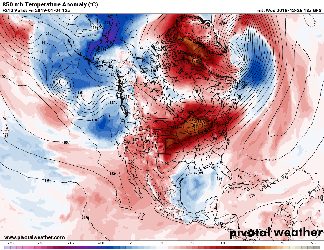
In between cold spurts there may be some mild intrusions that will work there way into the Midwest, Northeast, and South warm enough for records to be broken. We’ll see if this warm 850 millibar departure chart verifies:

Certainly I will be reporting on theses should they occur at major reporting sites. Another word I will use in reference to this upcoming pattern is “volatile.” Yes, the current weather pattern resembles current stock market trends. Watch for a wild roller coaster ride of temperatures going from frigid to mild and back as we move into 2019. I’ll be watching to see how many climate change ties will come from the week leading into New Years.
………………………………………………………………………………..
Here is some other climate and weather news from Wednesday:
(As usual, this will be a fluid post in which more information gets added during the day as it crosses my radar, crediting all who have put it on-line. Items will be archived on this site for posterity.)
'Climate grief': The growing emotional toll of #ClimateChange
"Extreme weather & dire climate reports are intensifying the #MentalHealth effects of #GlobalWarming: depression & resignation about the future"https://t.co/S3FBgLGTiu via @NBCNews#MentalHealthAwareness
— Prof Peter Strachan (@ProfStrachan) December 26, 2018
NASA Shows 2018 Tracking Toward 4th Hottest Year on Record: https://t.co/ZJSNpBU4ge via @YouTube
— Robert Fanney (@robertscribbler) December 26, 2018
Our planet was hammered this year by ten Category 5 storms, the second-largest total on record–and that's not even counting the runners-up, including Hurricane Michael. https://t.co/XimtzETcoh pic.twitter.com/7cgKxfPT7E
— Weather Underground (@wunderground) December 26, 2018
Rising temperatures, disappearing sea ice and thawing permafrost are threatening Arctic ecosystems and coastal communities. Here's the latest from the Arctic Report Card:https://t.co/H5Lbz9jz7x
— InsideClimate News (@insideclimate) December 23, 2018
As animal populations crash and the planet heats, we see that the climate crisis and ecological collapse are heavily linked. When one gets worse, so does the other. Canaries in the coal mine dropping like flies. High time we got out of this death trap.https://t.co/VyMll2L8Ik
— Extinction Rebellion (@ExtinctionR) December 26, 2018
"You may have heard that we have 12 years to fix everything. This is well-meaning nonsense, but it’s still nonsense. We have both no time & more time. #ClimateChange isn’t a cliff we fall off, but a slope we slide down." More eloquence from @DrKateMarvel: https://t.co/Zj7uPAL8J9
— Daniel Swain (@Weather_West) December 27, 2018
(If you like these posts and my work please contribute via the PayPal widget, which has recently been added to this site. Thanks in advance for any support.)
The Climate Guy