Saturday July 11th… Dear Diary. The main purpose of this ongoing blog will be to track United States extreme or record temperatures related to climate change. Any reports I see of ETs will be listed below the main topic of the day. I’ll refer to extreme or record temperatures as ETs (not extraterrestrials). 😉
Prolonged Historic U.S. Heat Wave…Update #7…How Far North And East Will Dangerous Heat Spread?
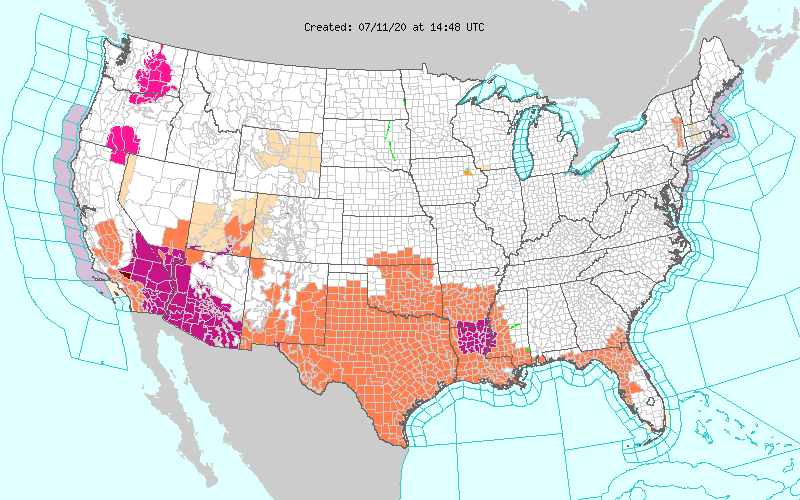
Dear Diary. I’ve added a big question to today’s main topic, which I’ll try to answer for this particular heat wave. As usual to start this particular post, let’s have a heat checkup for the United States for the next couple of days. Our mid level CAT 2 heat wave from Friday is continuing to intensify across the Southwest and south-central states with numerous advisories posted on this Saturday morning. Excessive heat warnings have popped up in Louisiana. The heat wave will peak in the Southwest today and Sunday:
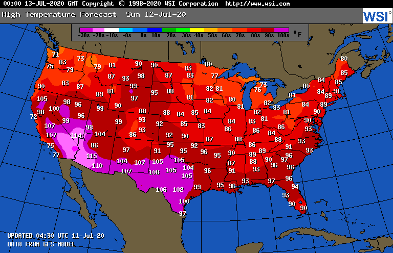
Maxes on Sunday will be similar to those of Saturday across the country:
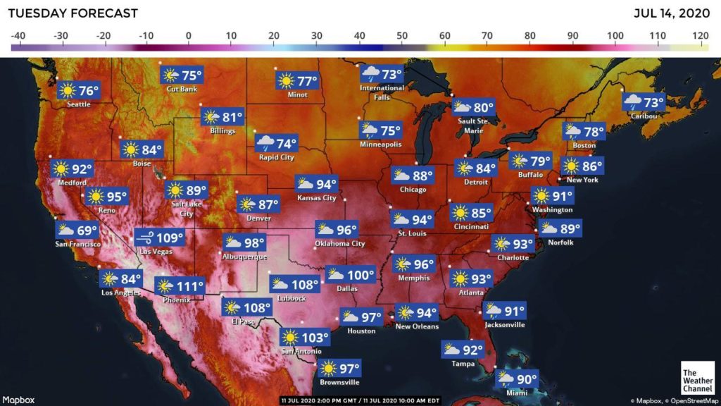
As expected, by Tuesday the worst of the high heat will shift eastward into the central and southern Plains:
It will also be getting hotter across the Southeast.
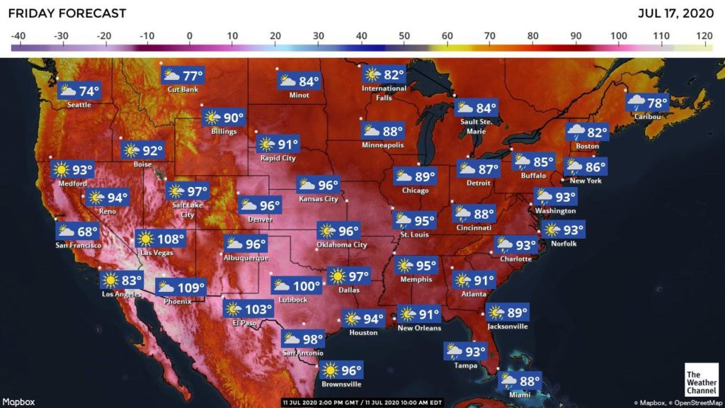
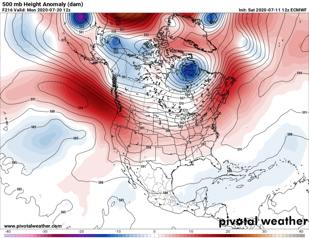
So the big question is whether or not dangerous levels of heat will spread into the Upper Midwest and Northeast and when. Of course, this will depend upon the strength of the ridge or heat dome building into the Ohio and Tennessee Valleys late next week. As discussed yesterday models have backed off on 500 millibar heights getting above 597 decameters in that area, which should limit near record heat some. Here is this mornings forecast for Friday:
Indeed the ridge will strengthen enough such that mid 90s will be getting as far north as St. Louis and Washington D.C. but at least not too much further north than those cities prior to next weekend:
With the ridge shifting north and east at least extreme heat will be abating in the Southwest.
So, will this historic heatwave wane after the ridge peaks again in Friday? The operational GFS since yesterday has been insisting that a front will put an end to any heat wave across the Midwest and most of the Southeast. High levels of heat would continue for the south-central states:

The European model is beginning to forecast a trough in the East, as well, but about 48 hours slower than the GFS:
The above two panels might be too optimistic for breaking the heat wave in the South and Midwest looking at ensembles. We will have better guidance as next weekend approaches, of course:

More on this heat wave:
Here are some of Saturday’s “ET’s” listed in the space below:
Here is more climate and weather news from Saturday:
(As usual, this will be a fluid post in which more information gets added during the day as it crosses my radar, crediting all who have put it on-line. Items will be archived on this site for posterity. In most instances click on the pictures of each tweet to see each article. The most noteworthy items will be listed first.)
Now here are some of today’s articles and notes on the horrid COVID-19 pandemic:
(If you like these posts and my work please contribute via the PayPal widget, which has recently been added to this site. Thanks in advance for any support.)