The main purpose of this ongoing blog will be to track United States extreme or record temperatures related to climate change. Any reports I see of ETs will be listed below the main topic of the day. I’ll refer to extreme or record temperatures as ETs (not extraterrestrials).😉
Main Topic: Colder Times Ahead For Much Of The United States…But Just Down To Typical Conditions
Dear Diary. The calendar is just about to flip from November to December, which means that winter weather should be taking hold across most of the United States. Like most years this century, though, the transition from fall to winter has been delayed in November with the scale by any measure being tipped towards warmth rather than chill due to climate change. This November has been extraordinarily warm with a near 8 to 1 ratio of daily high maximum to low minimum temperature records reported by the National Center For Environmental Information.
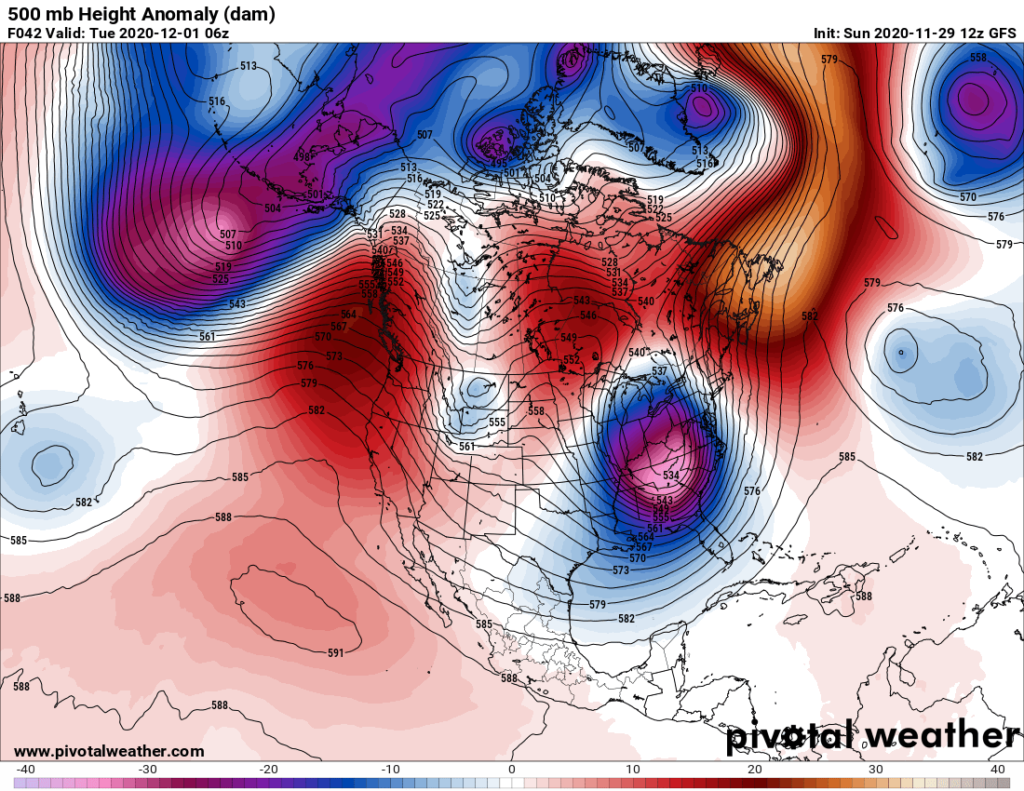
The last day of November going into early December should be quite a different animal though, as there will be a big change in the jet stream, producing a winter storm in the Midwest and Appalachians, flooding the South with the first widespread below freezing air mass of the cold season:
A ball of extremely cold air aloft will work its way down to 500 millibars with some of this air making its way down to the surface from Monday into Tuesday (as noted by the blue and purple colors):

This system will punch the southern branch of the jet stream, paralleling near the 576 decameter line, southward to a more typical position for early December. The northern branch, which typically parallels the 546 decameter height line, will briefly be south of our Midwest system, but will quickly retreat into Canada later this week:

The above pattern is typical for an El Niño pattern and not the current La Niña regime in the planet, which is very odd:
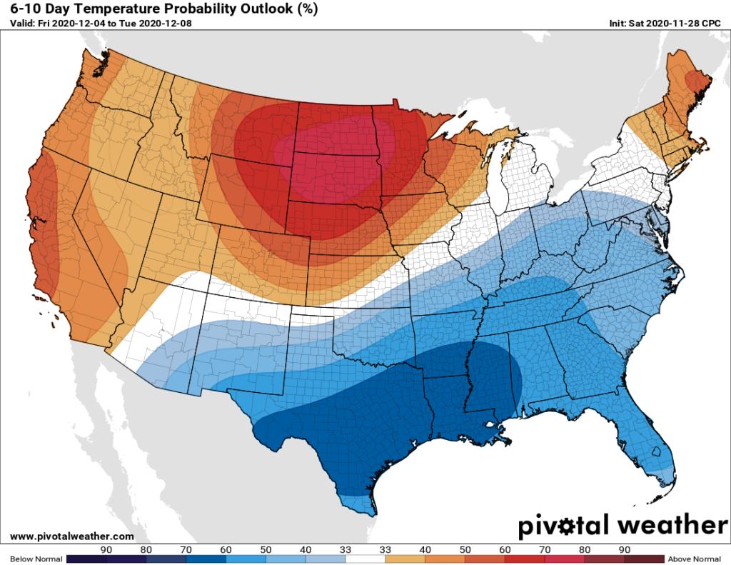
You will see on all of the 500 millibar charts that I have presented so far a big slug of “red” heights across Canada representing anomalous warmth. This is another sign of climate change and the biggest reason for a delay to cold, snowy weather this fall. Still, one cold system will manage to punch through this warmth into the lower 48 states Monday followed by a series of weaker systems through next weekend producing this temperature regime:

Will we see many records from this coming weather pattern? Probably not on both the cold and warm ends of the spectrum. People will be complaining about the big cold snap across the South, not getting more of a transition from above average warmth to below average chill during the fall. Across the northern tier of states, mainly west of the Midwest, temperatures will be above average but not near record levels. A “snow drought” will continue in the northern Plains.
I’ll be adding some Twitter tidbits about this weather pattern as we go through this week.
Here is more climate and weather news from Sunday:
(As usual, this will be a fluid post in which more information gets added during the day as it crosses my radar, crediting all who have put it on-line. Items will be archived on this site for posterity. In most instances click on the pictures of each tweet to see each article. The most noteworthy items will be listed first.)
Notes on Heatwave Koala:
Other material:
Now here are some of today’s articles and notes on the horrid COVID-19 pandemic:
(If you like these posts and my work please contribute via the PayPal widget, which has recently been added to this site. Thanks in advance for any support.)
Guy Walton “The Climate Guy”