Dead Diary. Happy Groundhog Day to everyone. Residents of the Midwest and Northeast are really hoping that Punxsutawney Phil would not see his shadow, thus forecasting that there won’t be another six weeks of winter after near record snow amounts from Winter Storm Orlena. Alas, the little rodent did:
Looking at today’s meteorological models I can’t disagree with my rodent competition’s forecast. Darn. And Brrr! Take a look at these current snow totals:
Well, do I have egg on my face after writing this post a year ago?
Here is what I teasingly tweeted at the beginning of last year’s post:
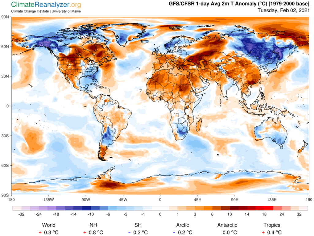
This year’s Climate Reanalyzer February 2nd chart is much colder across North America and Europe but still mostly above average:

Notice the blue area stretching from the Southeast into the Northeast. That is the area encompassed by winter storm and cold wave Orlena for February 2nd. Also:
One lesson we can learn here is that on land global warming is occurring in fits and spirts. Usually if one day of the calendar year sees near record warmth, that same day the following year usually sees cooler conditions. This general rule of thumb decently works for seasons for specific locations, as well.
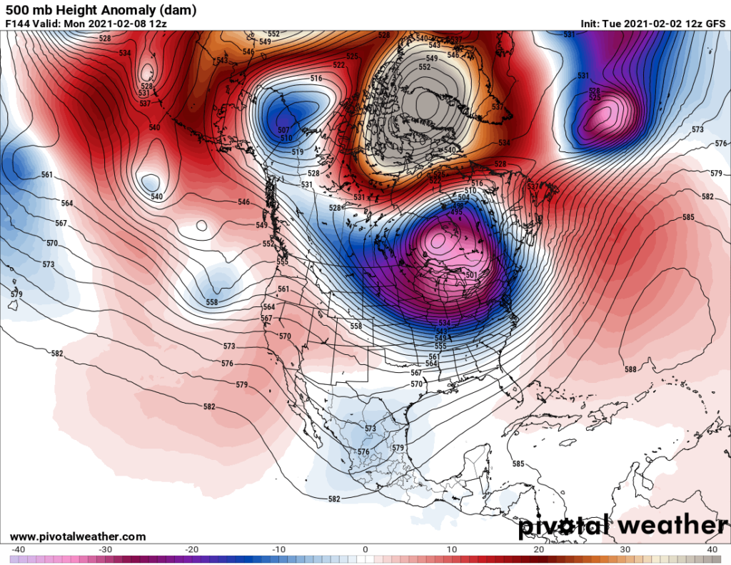
The Hudson Bay low will be at full strength going well into February, pivoting cold air masses into the United States, so be prepared for more bone chilling weather this month:

And in Alaska😉:
Here is more January 2021 climatology:
Here is some more weather and climate news from Tuesday:
(As usual, this will be a fluid post in which more information gets added during the day as it crosses my radar, crediting all who have put it on-line. Items will be archived on this site for posterity.
Now here are some of today’s articles and notes on the horrid COVID-19 pandemic:
(If you like these posts and my work please contribute via the PayPal widget, which has recently been added to this site. Thanks in advance for any support.)
Guy Walton…”The Climate Guy”