The main purpose of this ongoing blog will be to track planetary extreme, or record temperatures related to climate change. Any reports I see of ETs will be listed below the main topic of the day. I’ll refer to extreme or record temperatures as ETs (not extraterrestrials).😉
Main Topic: Dangerous Heat from Draco and More Flooding Going into August
Dear Diary. Welcome to August. Most of the United States has been seeing the effects of a changing climate this summer, and August will be no different. On the plus side, the tropics remain quieter than forecast (at least through the early part of this month), and heat has finally relented on the immediate Pacific Northwest coast. The minuses are numerous though, with dangerous Pacific Northwest CAT3 Heatwave Draco shifting eastward through the northern Rockies out into the Plains. Flooding in the hard-hit state of Kentucky could occur again this week and perhaps in other portions of the Ohio Valley.
Over the weekend the Plains saw a break from extreme summer heat with no National Weather Service advisories in effect. That changed Monday morning:

Granted, the area of heat advisories is fairly typical for early August, but the heat from Draco will build through the Plains and Upper Midwest this week producing a larger area of advisories and probably warnings, as well.
On Tuesday there will be widespread readings above 100°F across the Plains. Most of Texas over the weekend really never saw much of a break from temperatures above the century mark:

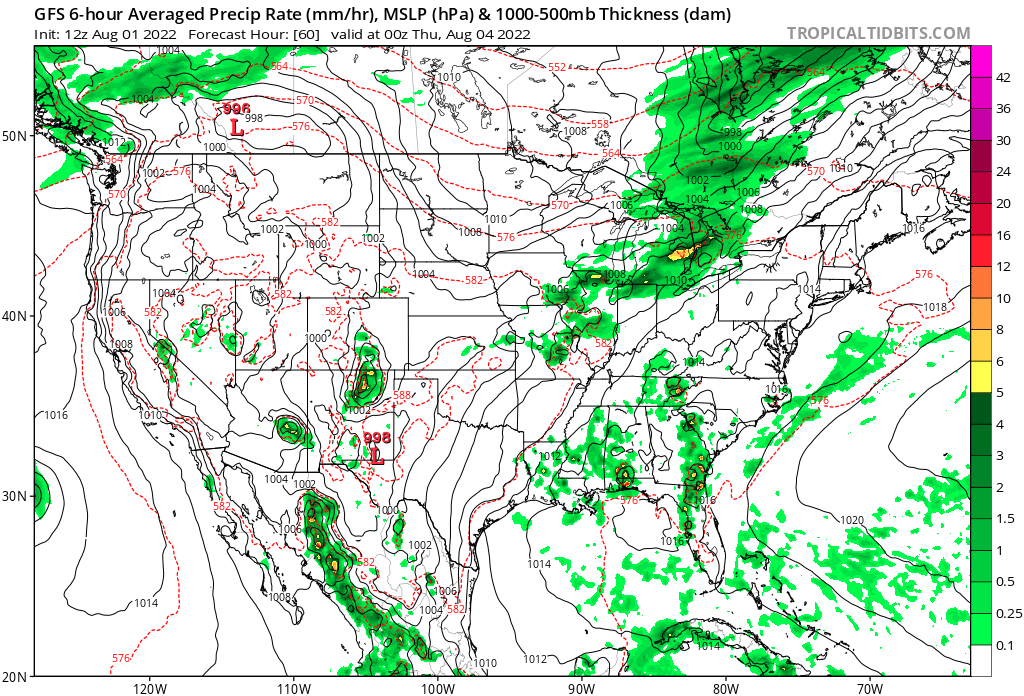
A front will temporarily moderate temperatures in the Upper Midwest by the middle of this week but could exacerbate rain potential where we don’t need it across Kentucky and the Ohio Valley:


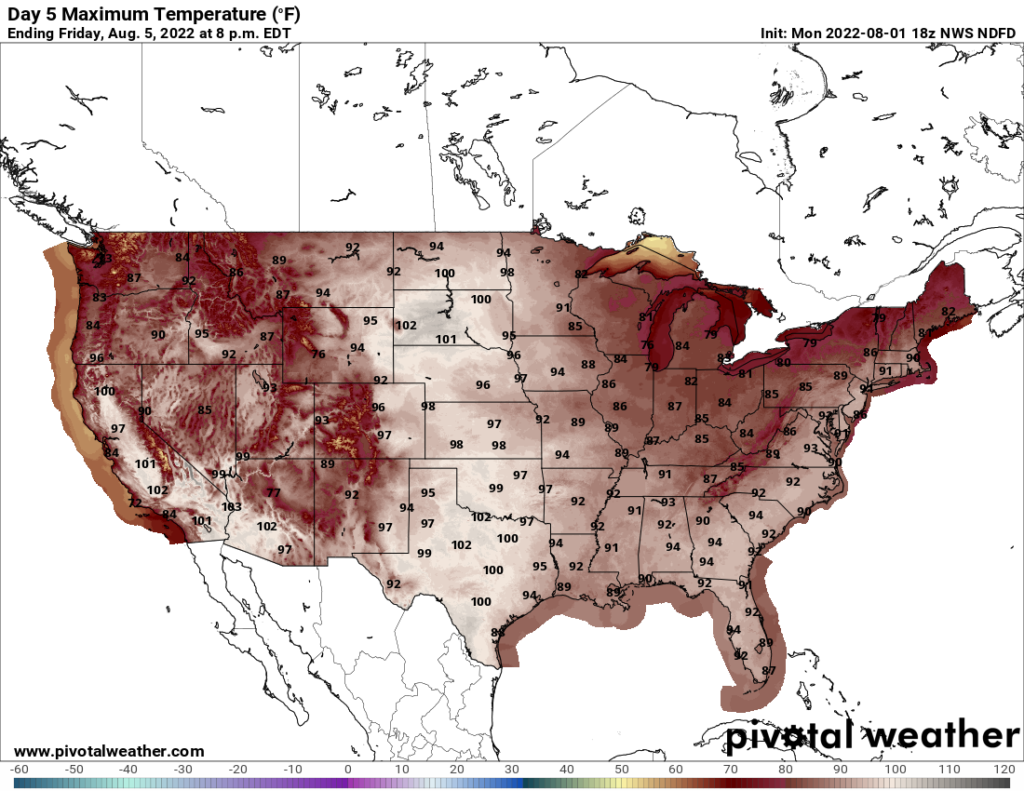
High heat will rebound across the northern Plains on Friday:

So, some more good news is that models have over forecast the heat dome that will be over the continental U.S. during early August, so Heatwave Draco at least won’t become a top ranked catastrophic CAT5. The GFS continues to over forecast 500 millibar heights. Here is what was seen from an earlier July post:

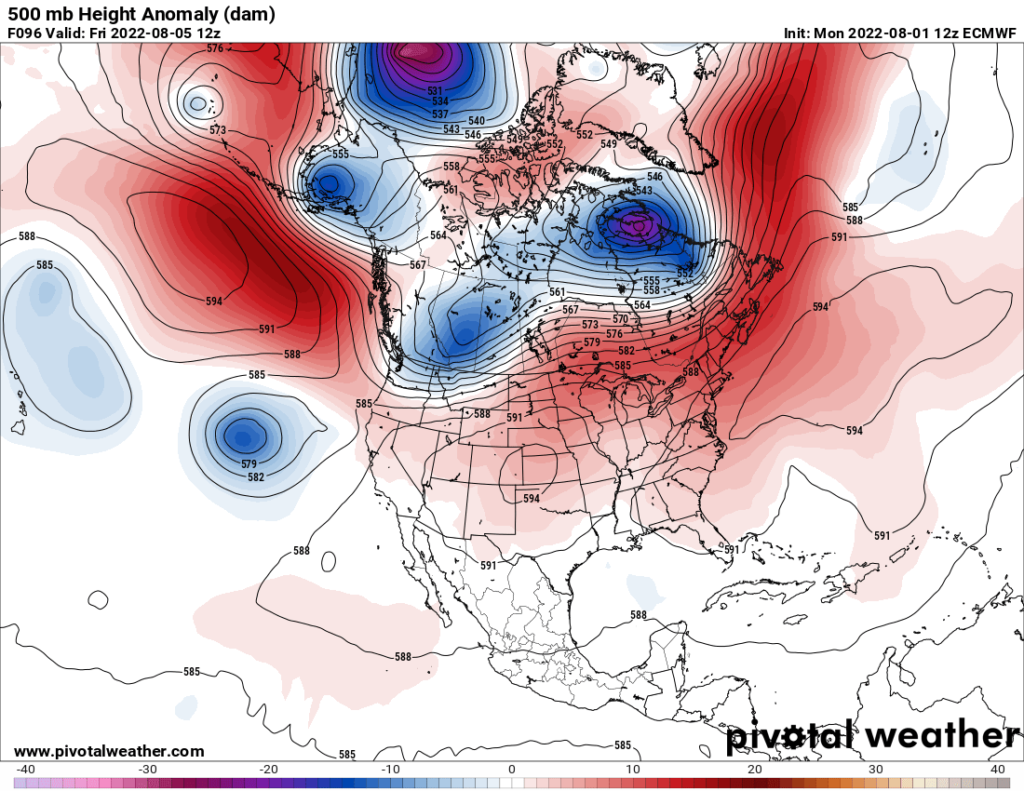
Note the 597-decameter contour over West Virginia on the above chart. Here is the same model valid for Friday:

Well, that older 240 hour out model will be way off, which is often the case. Still, it looks like dangerous heat will spread into the Northeast corridor later this week looking at the heights on the above Pivotal chart,
Will Draco ever get to my historic CAT4 level? That’s uncertain, but I’ll continue to have daily updates at @climateguyw.
Here are more “ET’s” recorded from around the planet the last couple of days, their consequences, and some extreme temperature outlooks:
Here is some July 2022 climatology:
Here is more climate and weather news from Monday:
(As usual, this will be a fluid post in which more information gets added during the day as it crosses my radar, crediting all who have put it on-line. Items will be archived on this site for posterity. In most instances click on the pictures of each tweet to see each article. The most noteworthy items will be listed first.)
(If you like these posts and my work, please contribute via this site’s PayPal widget. Thanks in advance for any support.)
Guy Walton “The Climate Guy”