The main purpose of this ongoing blog will be to track planetary extreme, or record temperatures related to climate change. Any reports I see of recently reported ETs will be listed below the main topic of the day. I’ll refer to extreme or record temperatures as ETs (not extraterrestrials).😉
Main Topic: Active U.S. Weather Pattern with a Late Season Hurricane Possible for Florida
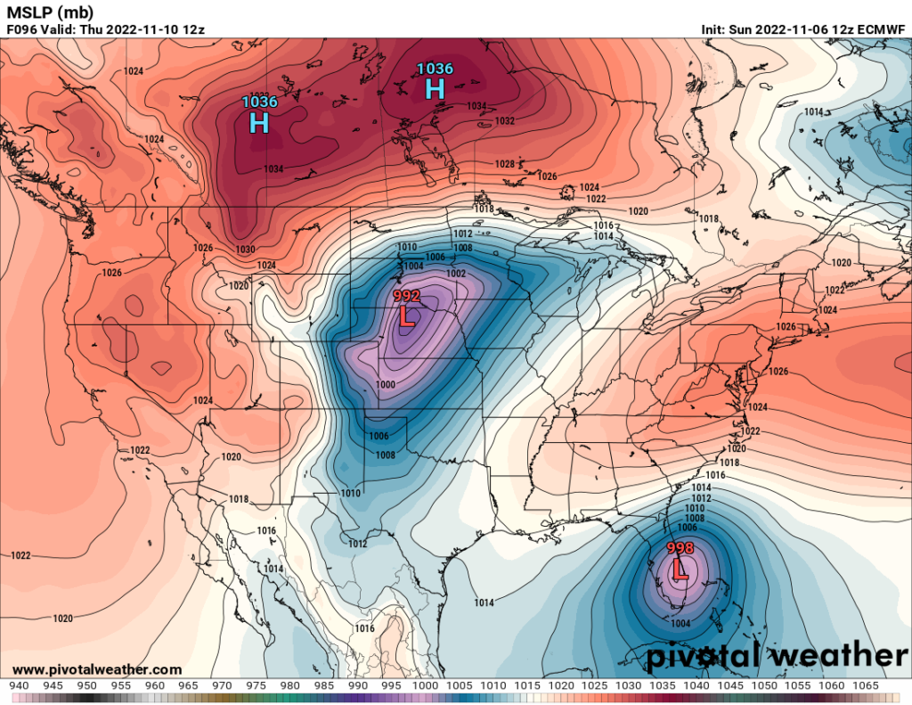
Dear Diary. My heart sank this morning when I saw that the latest operational GFS was similar to the one I saw last night before turning in:
The bad news is that we are now about 96 hours out for verification, so models are very good at that range. The good news is that the GFS this season has consistently been ramping up tropical systems too high. The European model, on the other hand, has been too low. All model’s paint a similar scenario of driving a system westward into Florida, which in itself is highly unusual for mid-November:
This afternoon the system is rapidly organizing north of the Leewards:
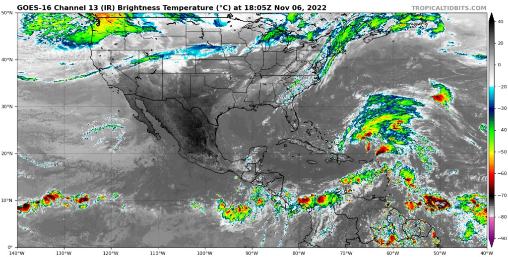
(Satellite image from Tropical Tidbits.)
The National Hurricane Center has given the system a greater than 70% chance of developing:
Tropical Weather Outlook
NWS National Hurricane Center Miami FL
100 PM EST Sun Nov 6 2022

For the North Atlantic...Caribbean Sea and the Gulf of Mexico:

Southwestern Atlantic:
An area of low pressure located more than 200 miles north of Puerto
Rico is producing a large area of disorganized showers and
thunderstorms. This system is forecast to move northward and then
northwestward into the southwestern Atlantic where environmental
conditions appear conducive for additional development, and a
subtropical or tropical storm is likely to form in the next day or
so. The system is then forecast to turn westward or
west-southwestward over the southwestern Atlantic by the middle part
of this week where additional development is possible.

Regardless of development, there is an increasing risk of coastal
flooding, tropical-storm-force winds, heavy rainfall, rough surf,
and beach erosion along much of the southeastern United States
coast, the Florida east coast, and portions of the central and
northwestern Bahamas beginning in the early to middle part of this
week.  Interests in those areas should continue to monitor the
progress of this system as tropical storm, hurricane, and storm
surge watches could be required for a portion of these areas by
early Monday. Additional information on this system, including gale
warnings, can be found in High Seas Forecasts issued by the National
Weather Service and in products from your local weather office.
* Formation chance through 48 hours...high...80 percent.
* Formation chance through 5 days...high...90 percent.
The upper-level pattern over the Southeast has been unusually warn for early November and will continue to be so this week:

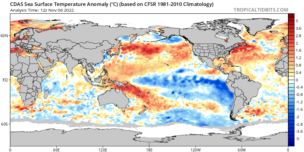
What we have here across the eastern U.S. is a 500 millibar pattern resembling one from about August 15th to September 15th, not one for November. This is a big factor that will drive 98L towards the Southeast Cost and will be one huge point for climate people to make about this system this week. We can only hope that shear or other factors do not turn 98L into a hurricane, but I have an uneasy feeling about this looking at sea surface temperature anomalies:
A CAT2 hurricane striking the east coast of Florida would be the last thing this nation needs. A landfall near Miami or between that populous city and Jacksonville would cause millions of dollars’ worth of damage, not to mention many thousands of lives that would be upended, perhaps as many as occurred with Hurricane Ian earlier this season.
I’ll have many more updates on this blog as we move through this week.
As promised, here is more latest thinking about 98L:
Here are some “ET’s” recorded from around the planet the last couple of days, their consequences, and some extreme temperature outlooks:
Here is some new October 2022 climatology:
Here is more climate and weather news from Sunday:
(As usual, this will be a fluid post in which more information gets added during the day as it crosses my radar, crediting all who have put it on-line. Items will be archived on this site for posterity. In most instances click on the pictures of each tweet to see each article. The most noteworthy items will be listed first.)
If you like these posts and my work please contribute via the PayPal widget, which has recently been added to this site. Thanks in advance for any support.)
Guy Walton… “The Climate Guy”