The main purpose of this ongoing blog will be to track planetary extreme, or record temperatures related to climate change. Any reports I see of ETs will be listed below the main topic of the day. I’ll refer to extreme or record temperatures as ETs (not extraterrestrials).😉
Main Topic: Death Toll from Winter Storm and Cold Wave Elliot
Dear Diary. Unfortunately, over the week of Christmas, what the Weather Channel and I have dubbed as Category 4 Winter Storm and Cold Wave Elliot has been responsible for 48 deaths as of this writing, most from the Buffalo area due to extreme lake effect snow. Update: 57 deaths as of 6:00 PM EST according to NBC news.
Yes, the cold wave was historic, but not quite as bad as the Christmas CAT5 cold wave of 1983, which set most records for this time of the year, making December 1983 the coldest December in U.S. history. That Arctic cold outbreak was responsible for 151 deaths:
The Cold Air Outbreak of December 1983 (weather.gov)
Even in this day and age of advancing global warming, we can still get deadly, destructive cold waves. As I’ve reported, the work of Dr.’s Jennifer Francis and Dr. Michael Mann demonstrates that climate change has weakened the jet stream such that it can become highly amplified during winter, allowing cold air to move into mid latitude locations despite an overall warming trend. At some point, climate change will negate any significant cold waves, but probably not for the rest of this decade.
Here is a Washington Post articles summing up the destruction left in the wake of Elliot now that it is about over for most of the eastern half of the United States:
At least 26 dead in New York amid historic blizzard – The Washington Post
At least 26 dead in Buffalo’s worst blizzard in 50 years

By Sarah Kaplan
Updated December 26, 2022
At least 26 people have died in this weekend’s catastrophic snowstorm, officials announced Monday, marking this blizzard as Western New York’s deadliest in at least 50 years.
Roads remain impassable and more than 12,000 people are still without power as the unrelenting storm is forecast to drop as much as a foot of additional snow, Erie County Executive Mark C. Poloncarz said during a Monday morning news conference. Rescuers are struggling to free people trapped in their cars, while people stuck in shelters and nursing homes are running out of food.
“This is the worst storm probably in our lifetime and maybe in the history of the city,” Poloncarz said. “And this is not the end yet.”
The National Weather Service warned that a “reinforcing shot” of cold air from Canada could cause more snow across the Great Plains and Midwest on Monday, and the eastern half of the country would remain in a deep freeze.
A Christmas-week winter storm and Arctic blast for the ages, by the numbers
In Erie County, where the death toll almost doubled overnight from 13 to 25, the dead range in age from 26 to 98. They have been found in their cars, homes and in snowbanks. Several suffered cardiac arrests while shoveling — an all-too common consequence of the cold, which can cause arteries and veins to constrict and blood pressure to skyrocket.
In nearby Niagara County, officials said Sunday that a 27-year-old man died from carbon monoxide poisoning when heavy snow covered the vents on his external furnace. A second victim was hospitalized.
Winter storm and Arctic blast, by the numbers
Poloncarz warned residents relying on generators to ensure the machines are positioned at least 20 feet from their homes, with the exhaust pipe pointed away from the house.
Poloncarz expects the death toll to keep rising as first responders eventually reach victims who may have been dead for days.

John Waller/AP
Buffalo is the nexus of a powerful Arctic blast that has wreaked havoc from Washington to Florida, subjecting more than half the country to some form of winter weather warning or advisory. The Associated Press reported that there have been at least 48 storm-related deaths around the country.
During the peak of the Arctic blast, more than 1.7 million customers were without power on Friday across the country. On Monday, about 200,000 people in Washington state, Maine, Texas and Virginia were also without power Monday, according to PowerOutage.us.
As the frigid cold began to ease in some areas, utilities lifted restrictions aimed at conserving electricity. In the Carolinas, Duke Energy said Monday it had restored power to thousands and no longer needed customers to curb their energy use.
In Western New York, the snow is slowing down but refuses to stop. A National Weather Service station at the Buffalo airport has recorded 49.2 inches of snowfall in the past three days. With months to go before the end of winter, the city has already surpassed its normal snowfall average for the entire season.
“Some of the areas that were already clear are getting hit again,” Poloncarz said.
Thousands of flights canceled as weather continues to upend holiday travel
There have been heartwarming moments amid the brutal cold, he added. When a woman coping with pregnancy complications had to be rushed to the local children’s hospital, a heavy-duty snow plow accompanied her ambulance to clear the way amid near white-out conditions.
The woman was able to reach the hospital, and her baby was born on Christmas, Poloncarz said. Both mother and child are doing well.

By Sarah Kaplan Sarah Kaplan is a climate reporter covering humanity’s response to a warming world. She previously reported on Earth science and the universe. Twitter
A Christmas-week winter storm and Arctic blast for the ages, by the numbers – The Washington Post
A Christmas-week winter storm and Arctic blast for the ages, by the numbers
By Ian Livingston and Jacob Feuerstein
Updated December 26, 2022
A winter storm rolls through western New York Saturday. (Jeffrey T. Barnes/AP)
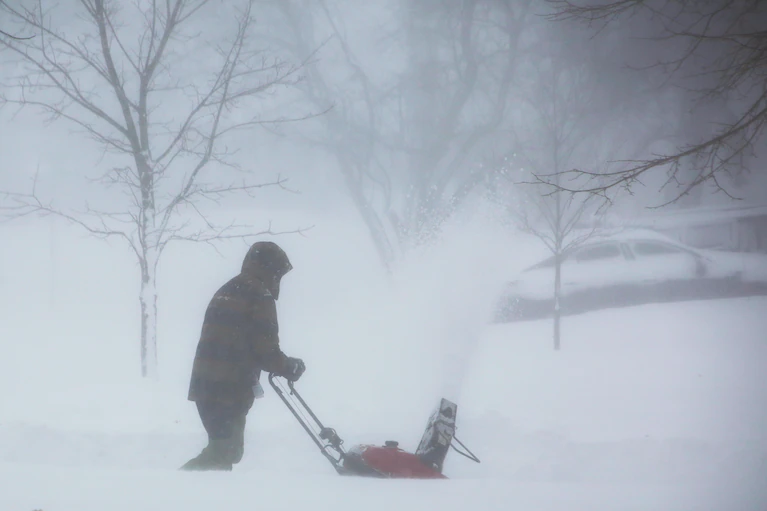
An extraordinary bout of wintry weather entangled much of the United States during Christmas week. Historic cold and a huge footprint of strong winds and fierce blizzard conditions affected hundreds of millions of Americans during one of the busiest travel weeks of the year.
Nowhere was the weather so destructive as it was in Buffalo. There, nearly two full days of severe blizzard conditions dropped visibility to zero and forced snow into massive drifts, shuttering the snow-hardened city and leaving hundreds stranded.
“Worst blizzard I have ever covered,” wrote veteran storm chaser Reed Timmer.
Why this blizzard could be the worst in Buffalo’s history
While the astounding and even unprecedented facets of the massive storm will be examined for a long time, key raw numbers can help convey its power.
200 million people under alert — Almost two-thirds of the U.S. population was under either a wind chill warning or wind chill advisory between Wednesday and Saturday. Including the winter storm warnings in effect at the same time, well over two-thirds of the population was under weather alerts.
1.5 million customers without power — An unusually large number of customers for a winter storm were without power at peak. Large portions of the Mid-South and the Carolinas dealt with managed power cuts to prevent grid failure. The Tennessee Valley Authority was among electric providers that instituted rolling blackouts. The Tennessee Titans football game was even postponed by an hour on Christmas Eve.
16,000-plus flights canceled — More than 16,000 flights were canceled from Thursday through Monday morning, a period encompassing some of the busiest travel days of the year. Several airports were shut at times, including Buffalo Niagara, which closed down Friday and is not scheduled to reopen until 11 a.m. Tuesday.
600-plus motorists stranded — Erie County, home of Buffalo, reported that about 500 motorists were stranded Friday night and Saturday morning. Conditions were so bad that many first responders also required rescue.
On Wednesday, another incident stranded more than 100 motorists near Rapid City in southwest South Dakota. These are just some of the larger disruptions. Multiple interstates and highways, from the Plains to the Midwest and the Northeast, were closed at times during the storm.
25 Buffalo-area deaths — At least 25 people have died in the Buffalo area, officials said, making this one of the city’s deadliest modern-day weather events since a 1977 blizzard that killed 29. The toll could still rise. Additional fatalities have been reported in 16 states from the wintry weather.
10 states under blizzard warnings — Nearly a dozen states saw blizzard warnings issued from the storm, including Montana, North Dakota, South Dakota, Minnesota, Iowa, Indiana, Michigan, Nebraska, Wisconsin and New York.
Dozens of records — Record low temperatures and record low maximums entered the northern Plains early in Christmas week and spread southeastward, ultimately leaving few areas untouched.
Casper, Wyo., saw its lowest temperature in recorded history on Thursday morning at minus-42 degrees. On Christmas Eve, much of the East Coast between New York and Florida saw records fall. Even most of Florida, where sleet fell in a few locations, spent Christmas Day in the 40s, with numerous records set. In Miami, a high of 50 was the lowest on record for the date.
2,235 minutes of blizzard conditions — That’s 37.25 hours of nonstop blizzard conditions in Buffalo. Blizzard conditions are defined as a concurrence of wind gusting at or above 35 mph blowing/falling snow, and visibility at or below 0.25 miles. For many hours, winds gusted over 60 mph as temperatures plummeted into the single digits. That smashed the previous record for the city: 960 minutes in 1985.
71 mph peak gust — As the blizzard got going Friday morning, Buffalo clocked a top wind gust of 71 mph with heavy snow falling. Another gust of 70 mph was recorded during the afternoon. Numerous gusts above 60 mph continued into the night. Visibility was as low as zero miles at times.
Wind gusts of near or above 50 mph were recorded all over the place, including in Atlanta, Washington, D.C. and New York City. Boston gusted to 60 mph and Providence to 64 mph.
Here are some top gusts by state:
- Mount Washington, N.H. — 151 mph
- Elk Mountain, Wyo. — 83 mph
- Lackawanna, N.Y. — 79 mph
- Frenchville, Maine — 74 mph
- Fairview Lanes, Ohio — 72 mph
- Yarmouth, Mass. — 72 mph
- Rolla, N.D. — 71 mph
- Copper Harbor, Mich. — 71 mph
- Barton, Md. — 69 mph
- Bristol, R.I. — 69 mph
- Burlington, Vt. — 64 mph
- New Haven, Conn. — 64 mph
43 inches of snow — The total amount in Buffalo. Winds blew some of it into drifts of 10 feet or more. The three-day storm snowfall was the second-largest in the city’s modern history.
Some other top-end snowfall totals include:
- Snyder, N.Y. — 56.5 inches
- Baraga, Mich. — 42.8 inches
- Watertown, N.Y. — 34.2 inches
- Reliance, Wyo. — 22 inches
- Grand Rapids, Mich. — 19.3 inches
- Ashland, Wis. — 15.6 inches
- Eldora, Colo. — 13 inches
- Tofte, Minn. — 12 inches
- Edgartown, Mass. — 9 inches (from rare ocean effect snow on Martha’s Vineyard)
75-degree swing — In Denver, the temperature plummeted from 51 degrees on Wednesday to minus-24 on Thursday — one of the biggest swings on record. A similar drop was observed at Wind River in Wyoming, where it went from 33 to minus-38 in 24 hours.
Record and near-record 24-hour temperature drops progressed eastward with the front, reaching up to 50 degrees in the Ohio Valley and the Mid-South, then to around 40 to 45 degrees on the East Coast. A 59-degree temperature difference — from minus-4 to 55 degrees — between Pittsburgh and Boston on Thursday afternoon was the largest on record between the two cities.
Minus-75 degrees wind chill — The coldest known wind chill in the outbreak occurred in Elk Park, Mont. before dawn Thursday. A temperature of minus-49 and a wind of 9 mph produced the reading.
In addition to Montana, locations in Wyoming, both Dakotas and Nebraska saw wind chills dip to at least minus-55. Denver’s minus-42 wind chill was its second-lowest on record.
135-degree-temperature difference — On Thursday, a massive temperature difference occurred between the Lower 48 states’ warmest and coldest locations. Elk Park’s minus-50 tied for the second-lowest temperature in the Lower 48 since 2011. On the same day near Florida City, Fla., it was a balmy 85.
963 millibar pressure — The winter storm’s central pressure dropped over 31 millibars in 24 hours as it wrapped up in the Great Lakes before bottoming out at 963 millibars — which is comparable to a Category 2 or 3 hurricane. The pressure exceeded the criteria for the storm to be considered a “bomb cyclone,” the most intense breed of mid-latitude storm.

By Ian Livingston Ian Livingston is a forecaster/photographer and information lead for the Capital Weather Gang. By day, Ian is a defense and national security researcher at a D.C. think tank. Twitter
Here are some “ET’s” recorded from around the planet the last couple of days, their consequences, and some extreme temperature outlooks, as well as some extreme precipitation reports:
Here is more climate and weather news from Monday:
(As usual, this will be a fluid post in which more information gets added during the day as it crosses my radar, crediting all who have put it on-line. Items will be archived on this site for posterity. In most instances click on the pictures of each tweet to see each article. The most noteworthy items will be listed first.)
If you like these posts and my work please contribute via the PayPal widget, which has recently been added to this site. Thanks in advance for any support.)
Guy Walton… “The Climate Guy”