The main purpose of this ongoing blog will be to track planetary extreme record temperatures related to climate change. Any reports I see of ETs will be listed below the main topic of the day. I’ll refer to record temperatures as ETs (not extraterrestrials).😉
Main Topic: Midwest Flooding Tied to Warm Start to November
Dear Diary. Happy election day. If you have not voted yet, do your civic duty for humanity’s sake and vote for Kamala Harris.
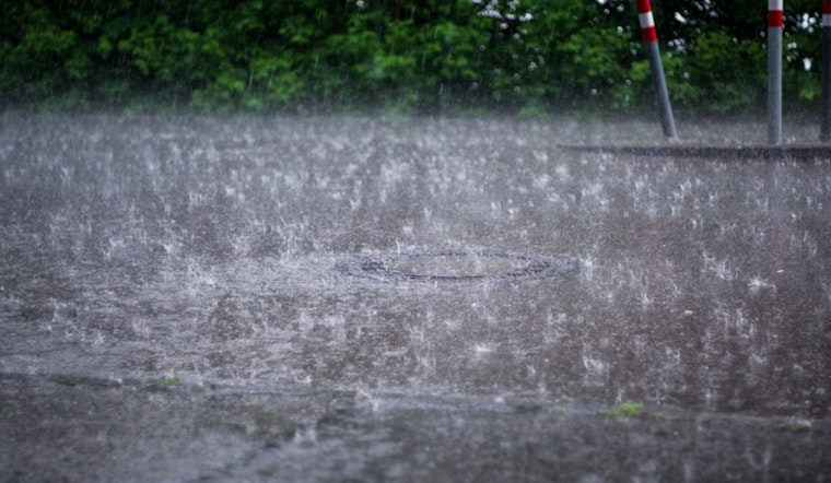
Overnight flooding from Arkansas northward to St. Louis was bad enough to require water rescues. This flooding is nowhere nearly as severe as what occurred at Valencia Spain, but it can also be tied into our warming world due to long term carbon pollution. Today I will demonstrate why meteorologically.
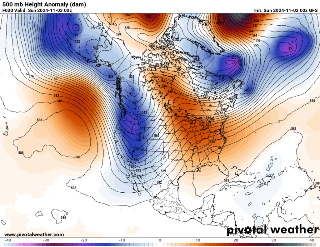
First, flooding is likely when a front stalls and precipitation starts to train over one area for many hours. Any front will stall when it encounters a heat dome that won’t break down or very slowly retreats. A stubborn heat dome over the eastern U.S. has been present from October into early November producing many warm records east of the Rockies. Here was the state of the heat dome centered over Florida with a strong system digging into the West going into Sunday:

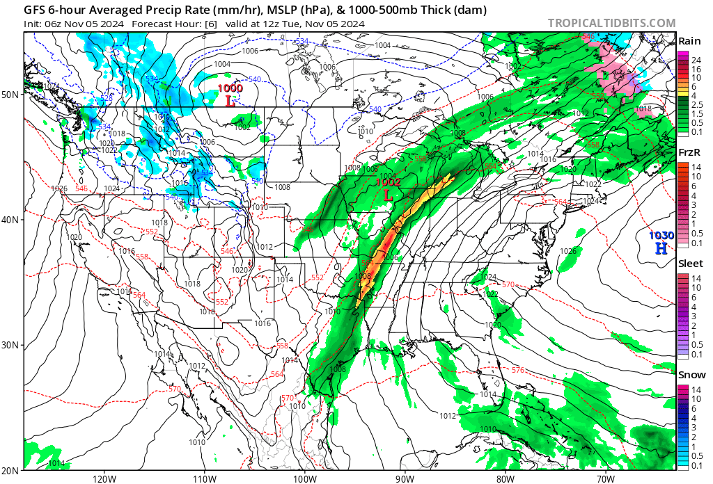
As of this Tuesday morning this ridge/trough configuration has not changed that much from Sunday. By the way, that small cold pocket in the Caribbean is Tropical Storm Rafael’s signature. That system will probably interact with the front that will be moving into the Southeast, where I do expect more flooding rain:

The system moving into the southern Plains is the culprit which produced both severe storms and then flooding as it interacted with a record warm airmass over the South from this Monday into Tuesday.
As of this writing flood watches and warnings continue across the region due to a front moving at a snail’s pace eastward:


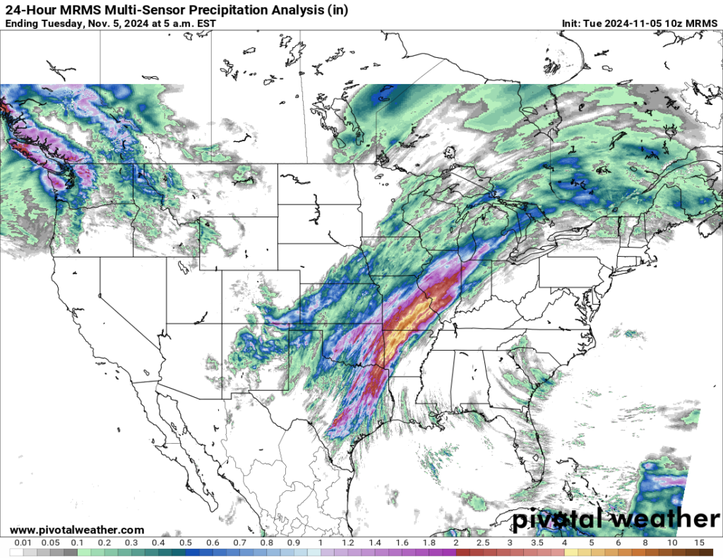
More than a month’s worth of rainfall has fallen across a large area from Arkansas into western Illinois, in some instances up to about 8 inches:

This meteorological scenario is not normal since fronts typically zip across the U.S. this time of the year, being unimpeded by any blocking ridges. Blocking patterns have developed across the CONUS in November, but these are rare and not record setting. The 500 millibar heights over the Southeast have been summerlike, and at the surface many warm records were reported in the flood zone before a front produced heavy precipitation. Also, this is yet another case in which we see systems wringing out more available moisture due to climate change. A warmer atmosphere holds more moisture.
Here are more details from Hoodline News:
Flash Flood Warning Issued for St. Louis and Surrounding Areas Amidst Heavy Rainfall
Published on November 05, 2024

Today, St. Louis weather takes a turbulent turn with the National Weather Service issuing a flash flood warning for parts of Illinois and Missouri as persistent rains batter the region. The cities impacted include southern Madison, northwestern Monroe, and Saint Clair counties in Illinois, as well as Saint Louis County and the city of Saint Louis in Missouri, with local law enforcement reporting heavy rainfall causing concerns of flash flooding continuing until 7:15 AM CST, NWS reports.
Notably, the past few hours have seen downpours with amounts ranging from 2 to 3 inches and additional rain of 1 to 2 inches possible, certain to strain already swamped drainage systems, as the current system shows unyielding downpours and thunderstorms which are predicted to carry on through the early afternoon; this condition has created a hazardous scenario prompting warnings of possible flash floods that impact city infrastructure and highways, including several State Parks like Babler Memorial and Castlewood, also affecting major highways like Interstates 64, 55, 70, and 44 which could significantly disrupt travel and safety, the forecast advises caution, particularly in low-lying areas.
Meanwhile, looking ahead, the National Weather Service’s forecast for St. Louis after these storms promises a mostly sunny tomorrow with a comfortable high of 61 degrees and a slight respite with partly cloudy conditions expected through Friday, before another round of possible thunderstorms on the weekend – presenting a 70 percent chance of rain on Saturday, as we glean from the detailed forecast provided by the NWS‘s latest update.
For residents and travelers in these regions, the NWS outlines an urgent plea to heed flood warnings, emphasizing the life-threatening nature of flash floods and advising against driving through flooded roads, the adage “Turn around, don`t drown” stands as a stark reminder of the flood’s potent dangers still, despite warnings, every year flood waters claim lives, often due to the underestimation of the force and depth of moving water; safety officials urge maintaining awareness especially at night when visibility wanes further complicating perception of flooding risks.
St. Louis–Weather & Environment
Here are more “ETs” recorded from around the planet the last couple of days, their consequences, and some extreme temperature outlooks, as well as any extreme precipitation reports:
Here is more brand-new October 2024 climatology (More can be found on each past archived daily November post.):
Here is More Climate News from Tuesday:
(As usual, this will be a fluid post in which more information gets added during the day as it crosses my radar, crediting all who have put it on-line. Items will be archived on this site for posterity. In most instances click on the pictures of each tweet to see each article. The most noteworthy items will be listed first.)