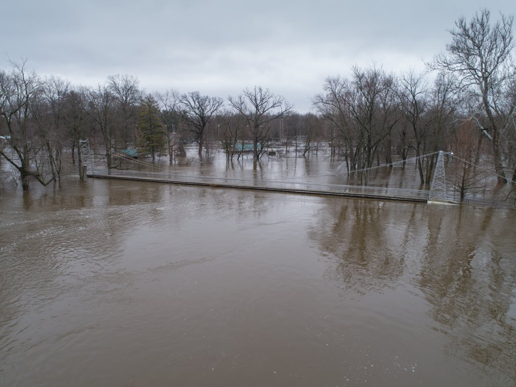
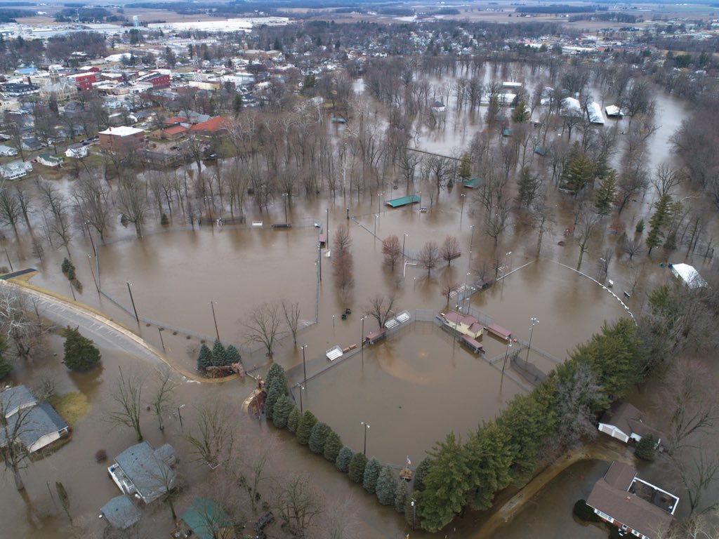
Saturday February 24th… Dear Diary. The main purpose of this ongoing post will be to track United States extreme or record temperatures related to climate change. Any reports I see of ETs will be listed below the main topic of the day. I’ll refer to extreme temperatures as ETs (not extraterrestrials)😊. Here is today’s climate change related topic: February Flood and Warm Wave of 2018 Day Five
(If you like these posts and my work please contribute via the PayPal widget, which has recently been added to this site. Since I am a paraplegic I can definitely use any funds for medical expenses. Thanks in advance for any support.)
Today into Sunday morning will be the last period of heavy rain across the Midwest, thank goodness, since our mega ridge that has been parked over the Southeast will break down. The stalled front, which has been the focusing mechanism for the Midwestern flooding rain, should begin moving south and east tonight. Of the five days that I have been reporting on this climate change induced event, today may be the moat volatile, however.
Tornado watches, such as this one, will be in effect for Saturday (Using Weather Channel Graphics):

Another tool that meteorologists have been using in the last five years is a high resolution model called the HRRR, which simulates future radar depiction. This shot indicates that by this evening severe weather will be rolling through the Mississippi Valley with heavy rain continuing across the water logged Ohio River Valley:

The above simulated radar depiction is what I would typically see during my 30+ career as a meteorologist from late March into April…not in February. This is an example of some of the flooding taking place today looking at “real time” radar:
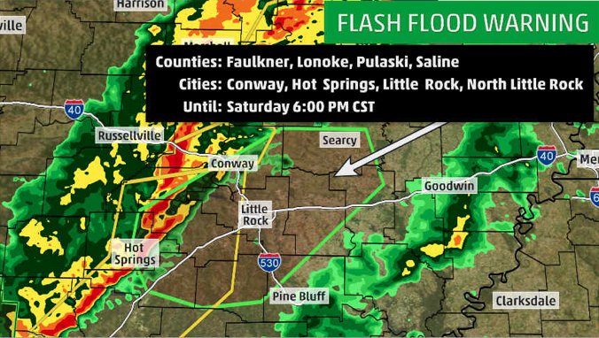
 NWS WPCVerified account @NWSWPC
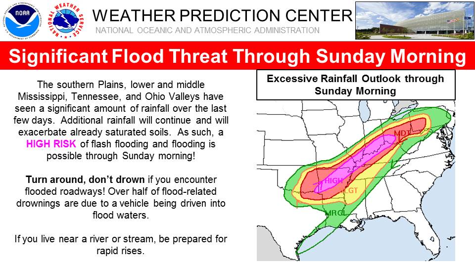
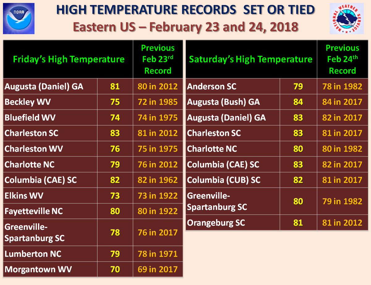
Today will be the last day of widespread record heat across the South:
Temperatures near 80°F in #Atlanta is the normal temperature in middle-May. Even thru March 31, the average temperature reaches the upper-60s. pic.twitter.com/o6EuEW5cQa
— Ryan Maue | weather.us (@RyanMaue) February 24, 2018
The first extreme temperature report I have seen today just so happens to be from my home town of Atlanta:
 NWS AtlantaVerified account @NWSAtlanta
 NWS MiamiVerified account @NWSMiami
The record breaking February warmth continues across the Southeast.
The Climate Guy


