Sunday July 1st… Dear Diary. The main purpose of this ongoing post will be to track United States extreme or record temperatures related to climate change. Any reports I see of ETs will be listed below the main topic of the day. I’ll refer to extreme or record temperatures as ETs (not extraterrestrials)😊. Here is today’s main climate change post related hot topic:
Historic U.S. Heatwave Day Four
Welcome everyone to July, which climatologically in the Northern Hemisphere is the warmest month of the year. If temperatures are above average during July for a few days or more at any one place outside of mountainous locations you can just about bet your last dollar that a heat wave is happening. The Northeast is the area getting hit the hardest on this July 1st with record heat and very high heat indices, but the good news for most of the Megalopolis area will see a cooling trend after Monday. We do see widespread excessive heat warnings (in purple) from the National Weather Service this afternoon in the Northeast, though:

Note that heat advisories from yesterday have been trimmed significantly out of the Midwest due to a front. Where there were once heat advisories in Wisconsin we currently see a severe thunderstorm watch (in yellow). Let’s not forget about our friends in northern California still dealing with heat and wildfire issues.
On Monday heat will be unrelenting in the Northeast except at Boston, which will see onshore flow:

The front will stall out in the Ohio Valley and “wash out,” or die while taking the edge off of temps as far south as St. Louis. Temps in the 90s will start to spread back north through the central Plains.
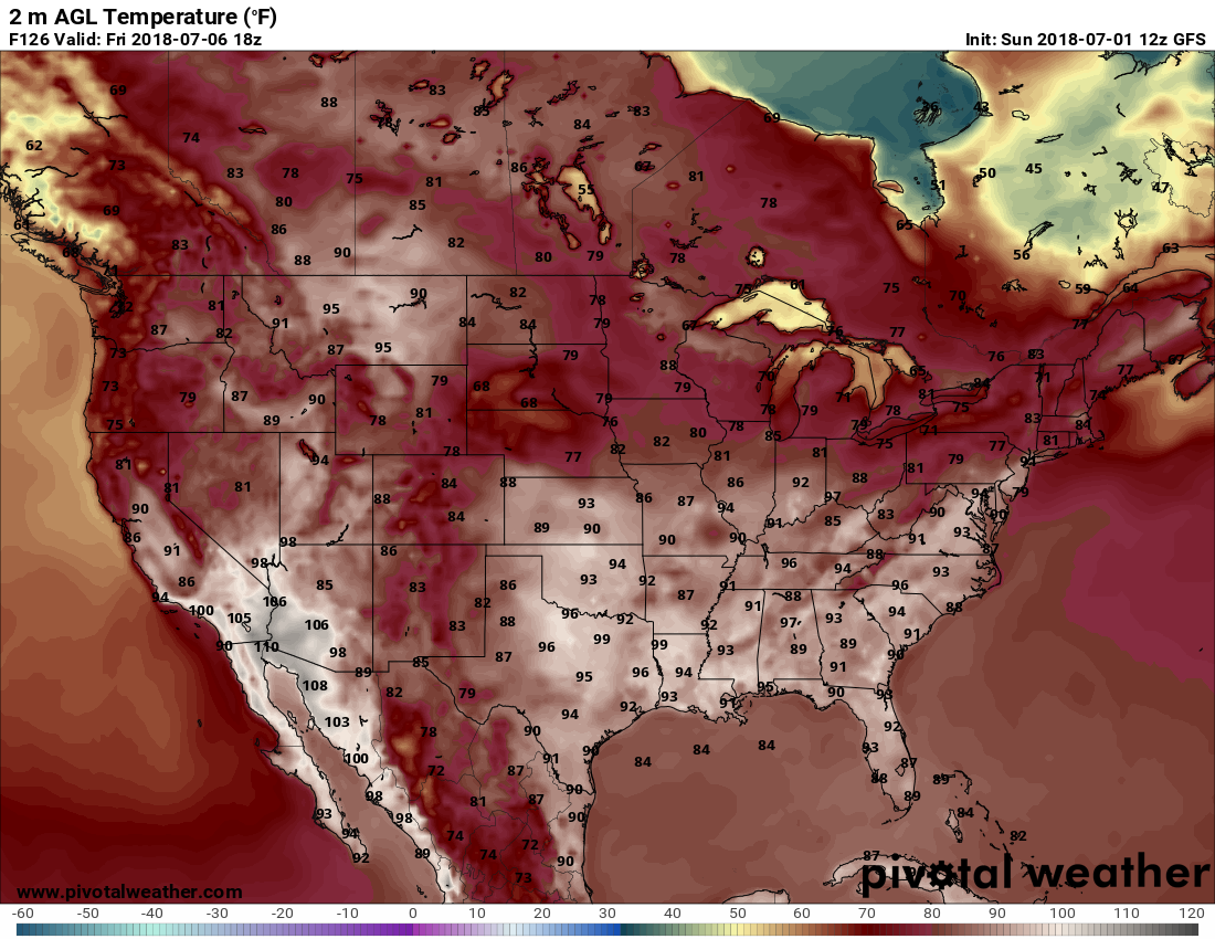
Our heat ridge should retrograde and max out on Friday of this week as ensemble meteorology models have been forecasting the last several days:

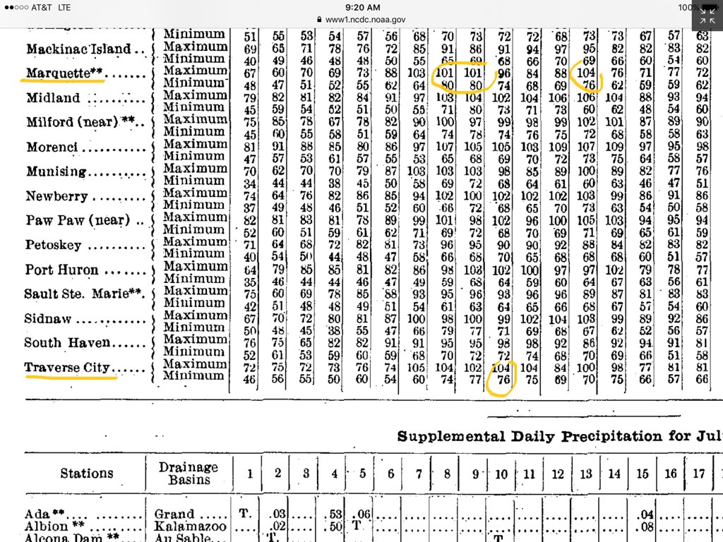
So, will this heat episode truly be historic as I’ve advertised? The answer to that question is yes depending upon the location in either the Midwest or Northeast. The easiest way for weather historians to determine whether or not a heat episode is “historic” in nature is how many records the thing will tie or set over a duration of time. The proverbial jury remains out on the heat going from late June 2018 into early July. Certainly in the Midwest and Plains some of the most severe heat episodes occurred during the 1930s. Richard “Heatwave” Berler dropped me a note reminding me just how hot in the past some conditions can get:
@climateguyw Hi Guy, here’s NCDC Monthly Michigan 1936 July data. 1936 was so amazing over such a large geographical area. Traverse City had a 90F mean on the 10th (104/76). Look at Marquette! ** means Midnight-Midnight obs.
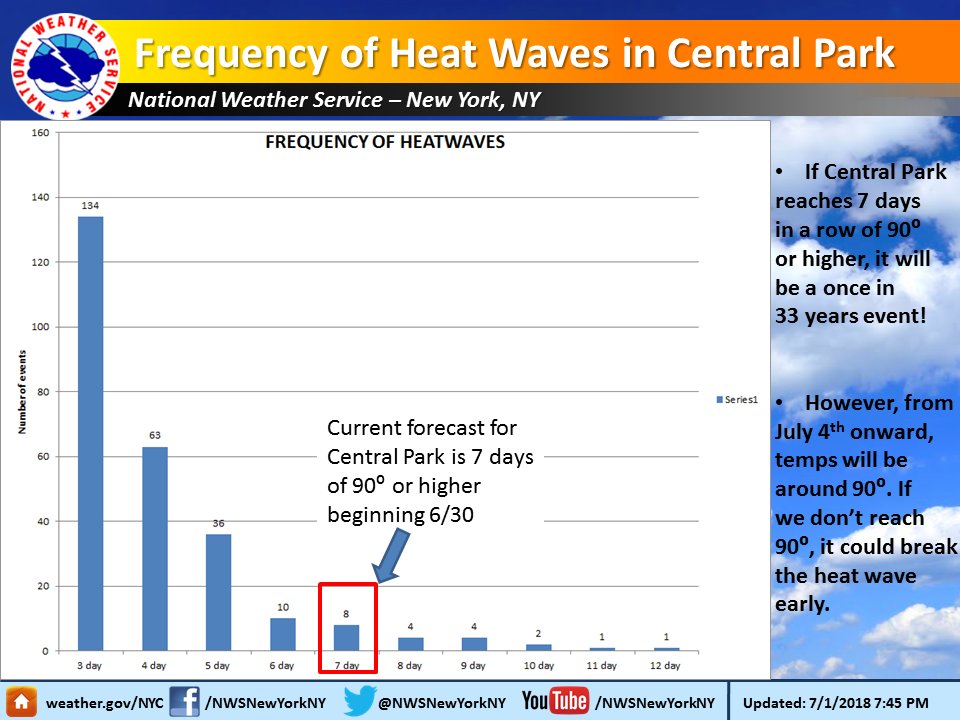
Once in 33 years! That’s what a 7 day heat wave is and it is in our current forecast beginning 6/30 at Central Park.
Get more heat wave Info here: https://www.weather.gov/okx/nycheatwave
Get more info about heat here:
https://www.weather.gov/okx/excessiveheat …
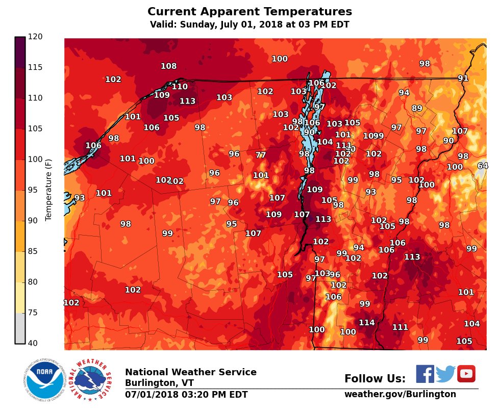
 NWS BurlingtonVerified account @NWSBurlington
 Bill KarinsVerified account @BillKarins
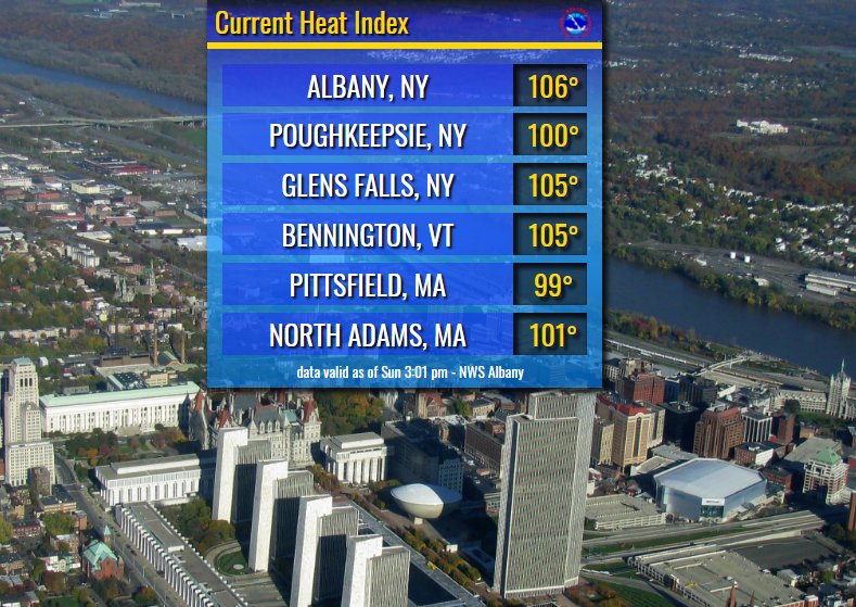
 Bill KarinsVerified account@BillKarins
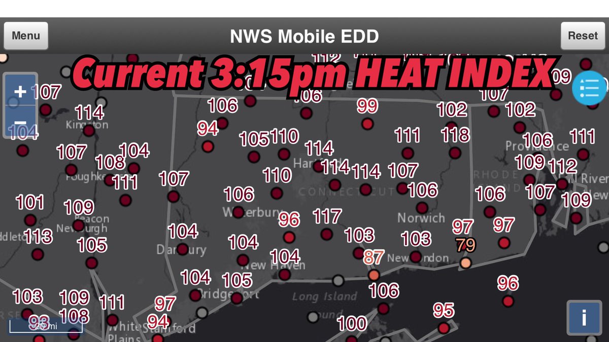
Is 114 in CT the clubhouse leader?
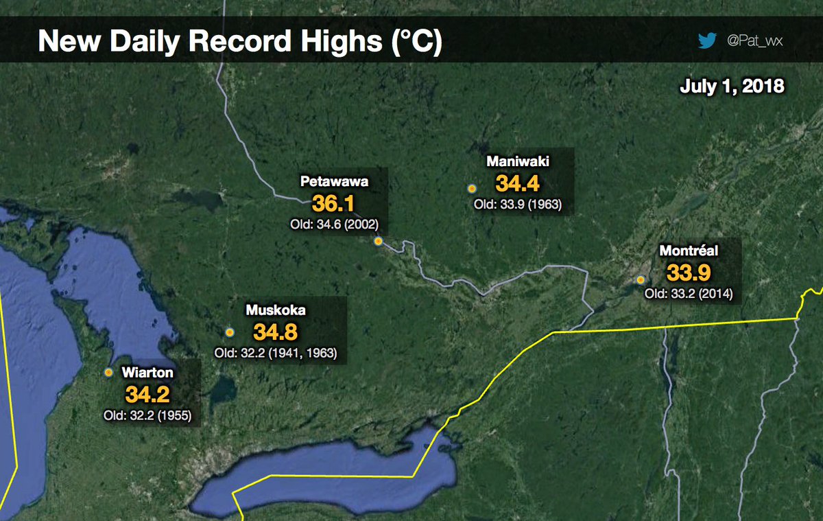
New record highs on this #CanadaDay in parts of Québec & #Ontario. 34°C in #Montréal and 36°C in Petawawa on the thermometer! The next few days will be more of the same… #ONwx #MeteoQC

(If you like these posts and my work please contribute via the PayPal widget, which has recently been added to this site. Thanks in advance for any support.)
The Climate Guy


