Saturday June 30th… Dear Diary. The main purpose of this ongoing post will be to track United States extreme or record temperatures related to climate change. Any reports I see of ETs will be listed below the main topic of the day. I’ll refer to extreme or record temperatures as ETs (not extraterrestrials)😊. Here is today’s main climate change post related hot topic:
Historic U.S. Heatwave Day Three
Overnight models and trends have not changed that much in association with a long lived heat wave now building along the Atlantic Seaboard. To recap what happened yesterday here are Friday’s maxes:

Dangerous heat was occurring from Minnesota to the Mexican border.
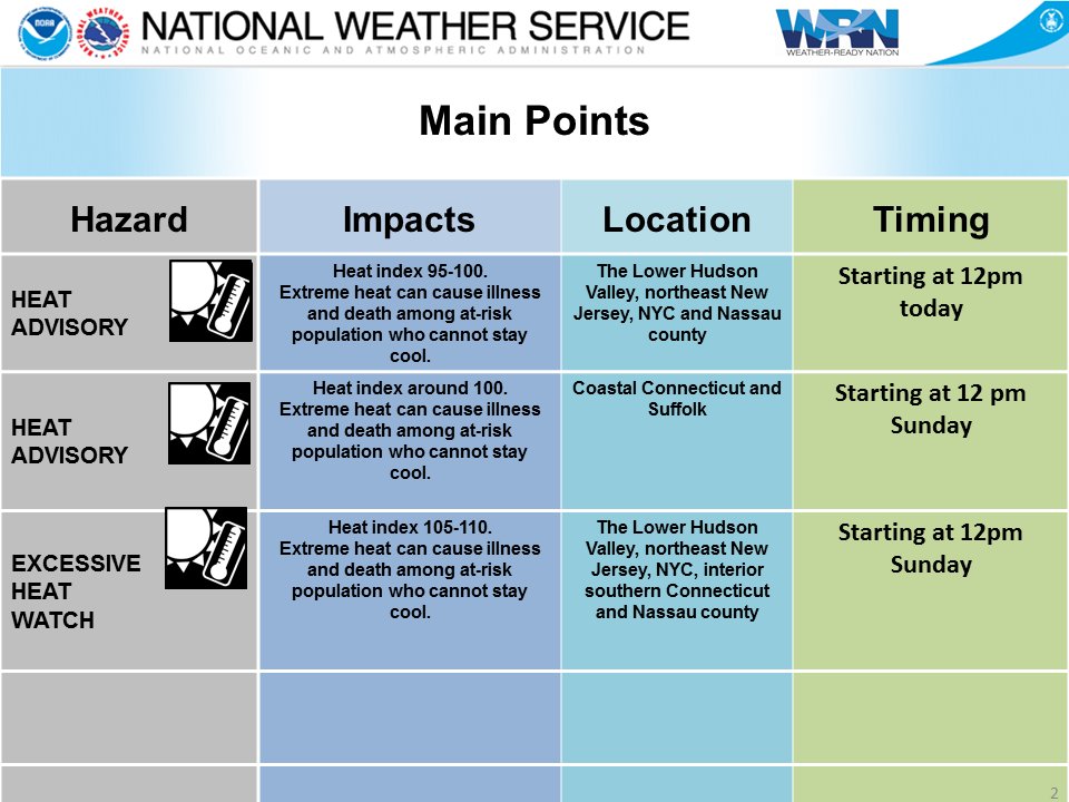
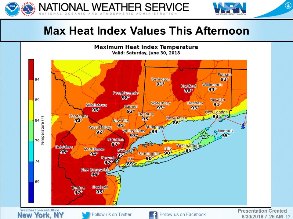
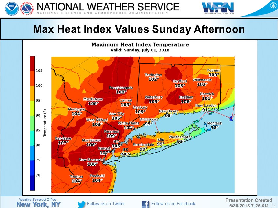
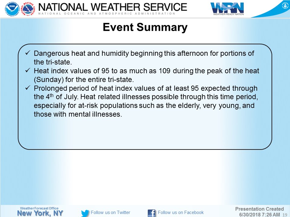
Today there are large “Keep the Families Together” immigrant matches occurring. I noticed uncomfortable conditions for the marchers in large cities across the Northeast. Thankfully rallies won’t be occurring in the Northeast tomorrow since maxes in the Megalopolis area will be around the century mark with heat indices above 105F in some instances:

There is some good news here in the a front will slice some of the heat out of the north and central Plains.
So about those heat indices in the Northeast tomorrow… pic.twitter.com/BPlsdvgCc1
— Greg Diamond (@gdimeweather) June 30, 2018
 NWS New York NYVerified account @NWSNewYorkNY
In eastern Canada:
Both #Montreal and #Toronto are predicted to have their hottest Canada Day (July 1) on record, with muggy temps possibly topping 35C (95F).
 Richard Heatwave Berler @HeatwaveKGNS
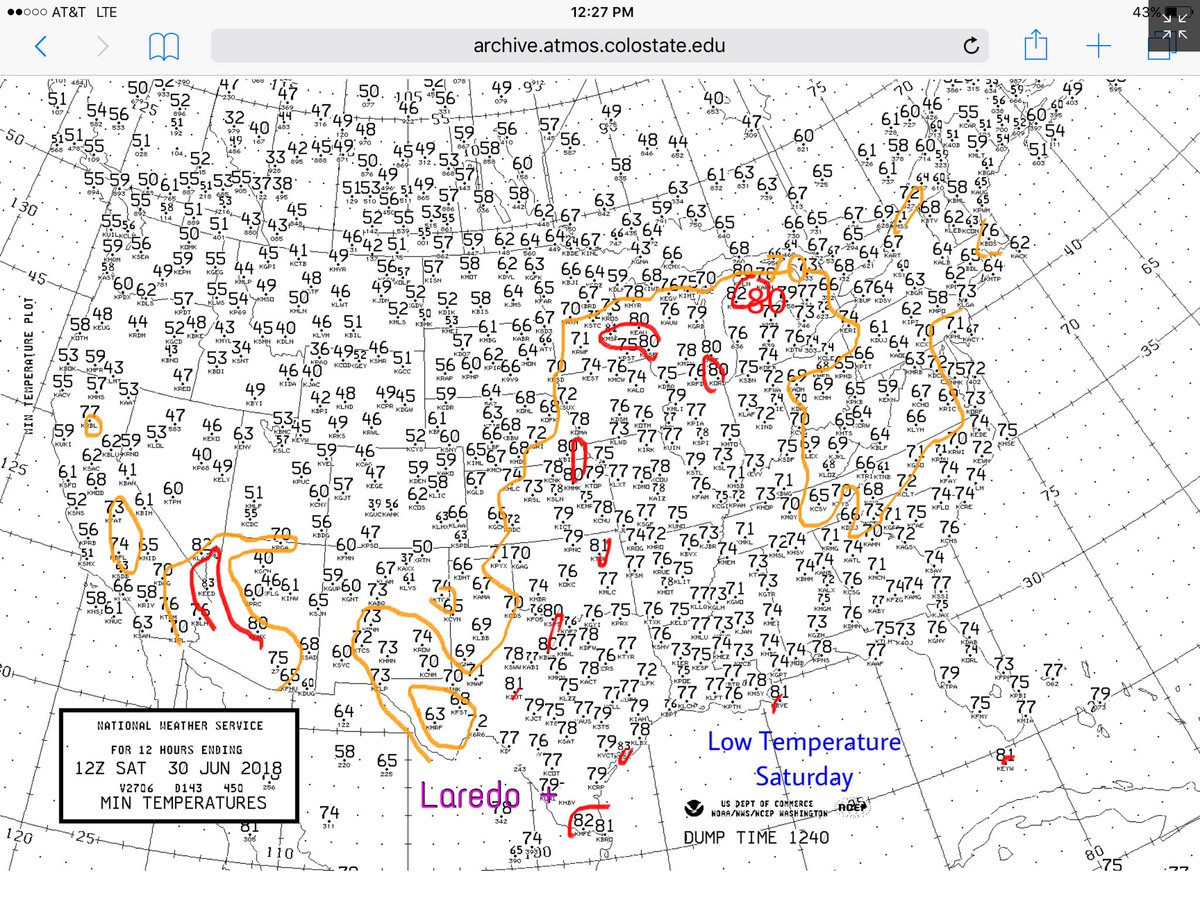
 Richard Heatwave Berler @HeatwaveKGNS
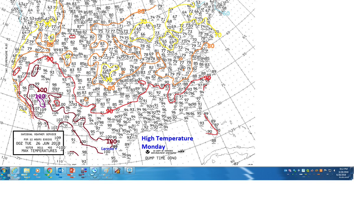
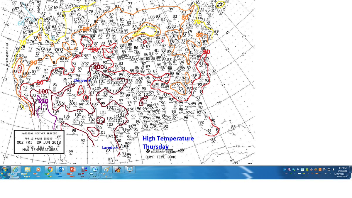
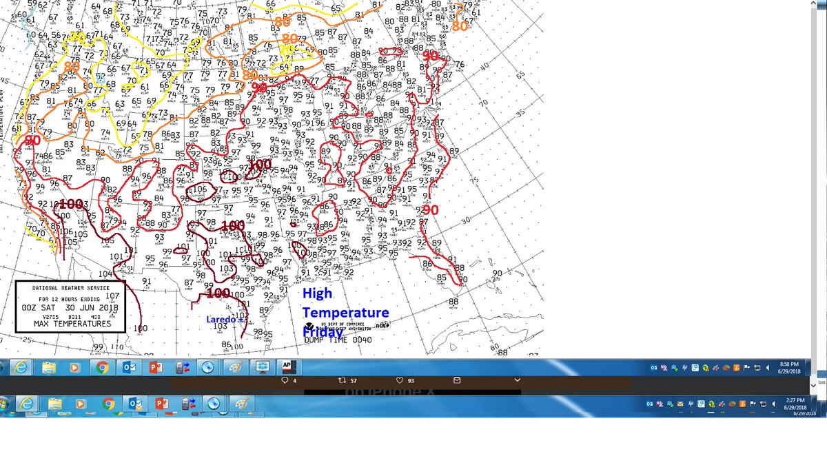


From the @NOAANCEIclimate database the U.S. is on track to tally the fewest # of record low minimums for consecutive months since OCT-NOV 1922. We’ll be watching to see if totals for MAY-JUN 2018 don’t surpass those of OCT-NOV 2016, the prior two months for attaining this stat.


(If you like these posts and my work please contribute via the PayPal widget, which has recently been added to this site. Thanks in advance for any support.)
The Climate Guy

