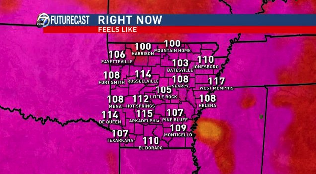
Friday July 20th… Dear Diary. The main purpose of this ongoing post will be to track United States extreme or record temperatures related to climate change. Any reports I see of ETs will be listed below the main topic of the day. I’ll refer to extreme or record temperatures as ETs (not extraterrestrials)😊. Here is today’s main climate change post related hot topic:
Texas Barbecue and Midwest Severe Weather
Arbitrarily today, Friday, is the third day of a historic heatwave for the south-central states centered on Texas. We can describe this event as historic not so much because of the duration of the event but because of how high temperature across many locations will exceed records. To start out today’s post let’s take a look at yesterday’s national maxes:

The heart of the heat Thursday was across north-central Texas into western Oklahoma where many sites exceeded 110F. Thankfully this year just like in 2017 intense, life threatening heat such as this has been confined to relatively small areas of the CONUS. The Midwest and Northeast saw pleasant temperatures for mid summer.
Temperatures across the south-central U.S. area will be similar today to those of Thursday, so it’s no wonder that we see widespread areas of excessive heat warnings and heat advisories:

Let’s look at some specific forecasts and advice from National Weather Service offices in the south-central United States:
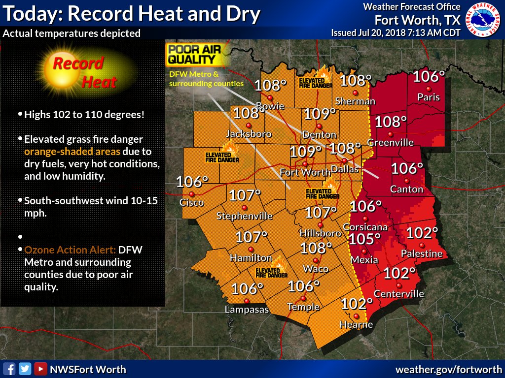
 NWS San AngeloVerified account @NWSSanAngelo
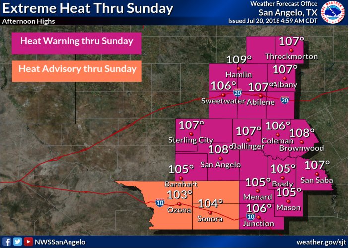
 NWS Fort WorthVerified account @NWSFortWorth
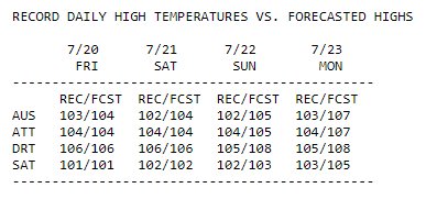
DFW: 105° (2000, 2012)
Waco: 104° (1969, 2000)
Our forecast? 108° for both. #TexasHeat #dfwwx #ctxwx

 NWS Austin/San AntonioVerified account @NWSSanAntonio
 NWS AmarilloVerified account @NWSAmarillo
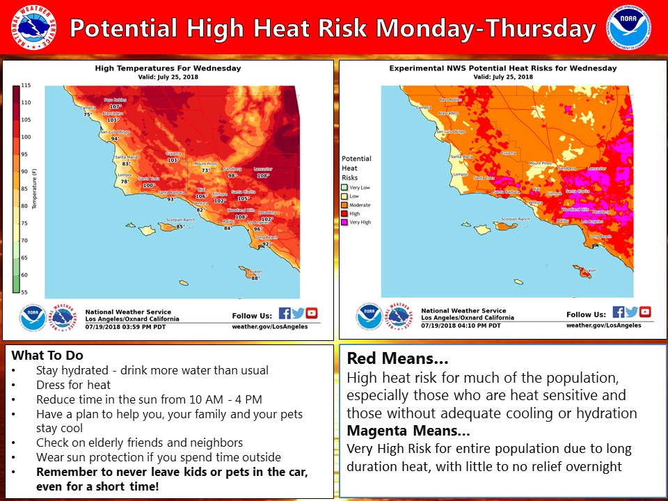
Notice that once more this season excessive heat warnings are posted for Southern California:
 NWS Los AngelesVerified account @NWSLosAngeles
 Matthew Cappucci @MatthewCappucci
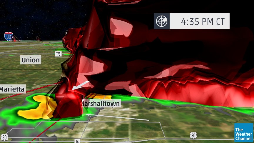
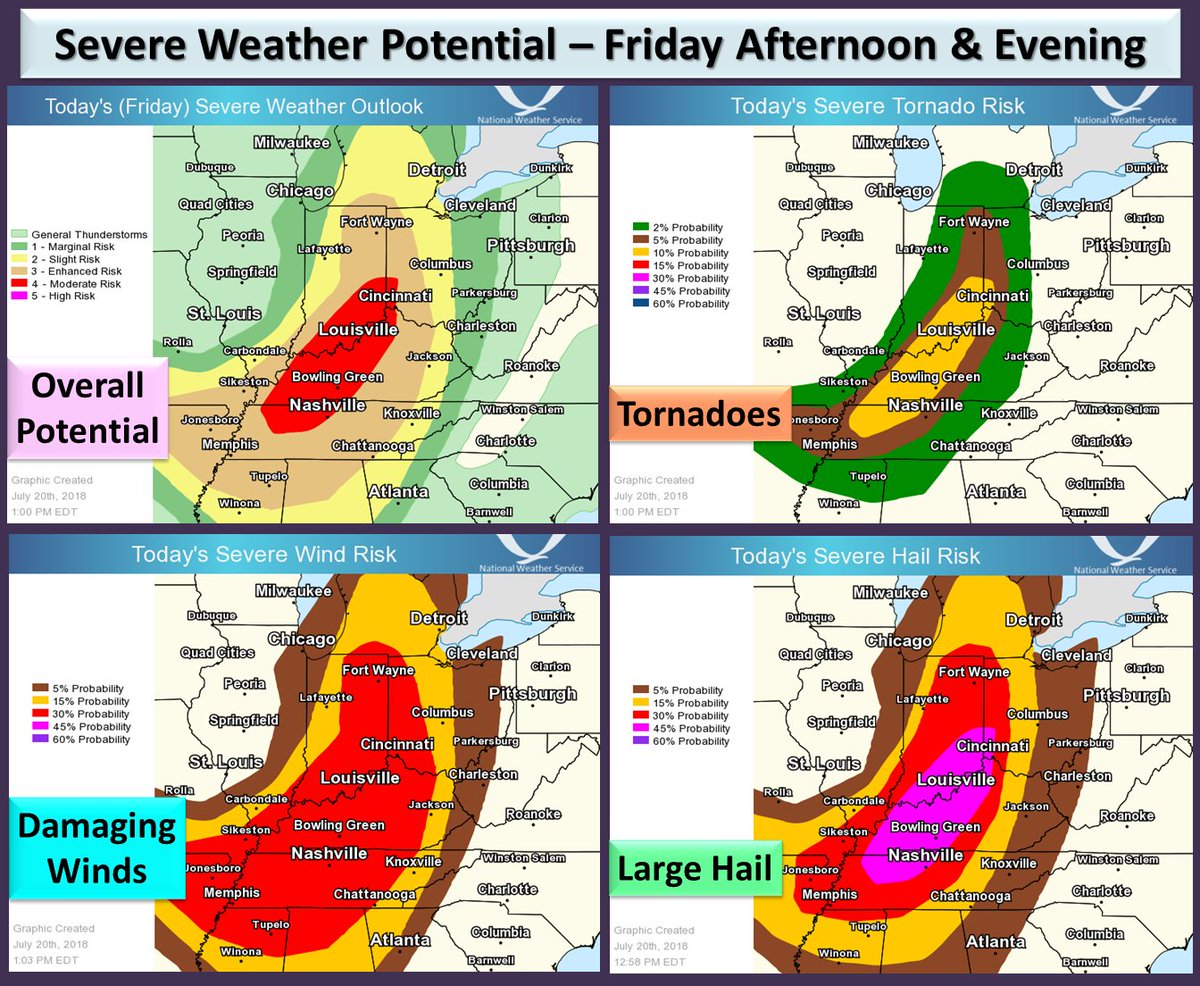
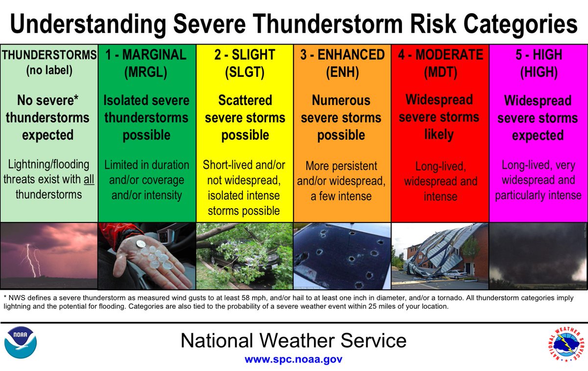
There is a moderate risk for severe thunderstorms this afternoon and evening across much of the Ohio and Tennessee Valleys. There is potential for tornadoes, widespread wind damage and large hail across this area.

 NWS Fort WorthVerified account @NWSFortWorth
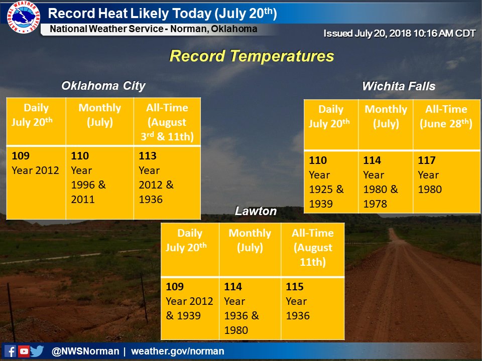
 NWS NormanVerified account @NWSNorman
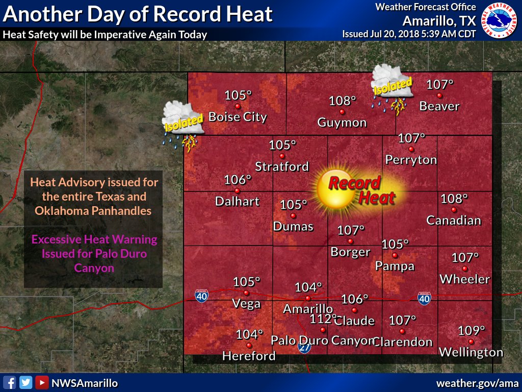
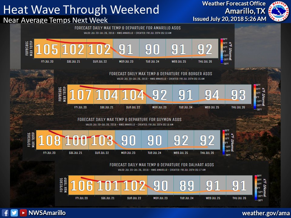
NEW RECORD HIGHS SET. So far Amarillo hit 105, previous record 103 in 1927 & 2011. Dalhart 107, previous record 104 in 1951. Borger hit 109, previous record 104 in 2011. Guymon hit 110 today, no official record yet, but 108 in 2011. #phwx #txwx #okwx
At 4:12 PM, San Angelo hit 108 degrees. This breaks the old record of 107 degrees set back in 1925. #recordheat #heatwave #SanAngelo #TXwx


