Thursday August 23rd… Dear Diary. The main purpose of this ongoing post will be to track United States extreme or record temperatures related to climate change. Any reports I see of ETs will be listed below the main topic of the day. I’ll refer to extreme or record temperatures as ETs (not extraterrestrials)😊. Here is today’s main climate change related topic:
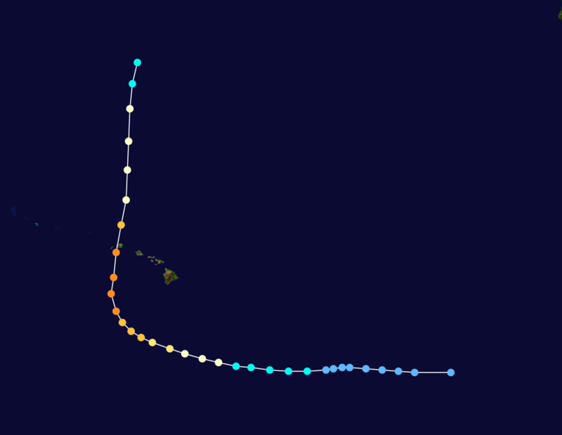
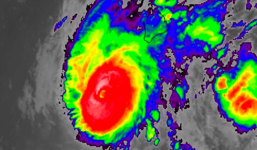
New Sitting Duck…Hawaii and Lane
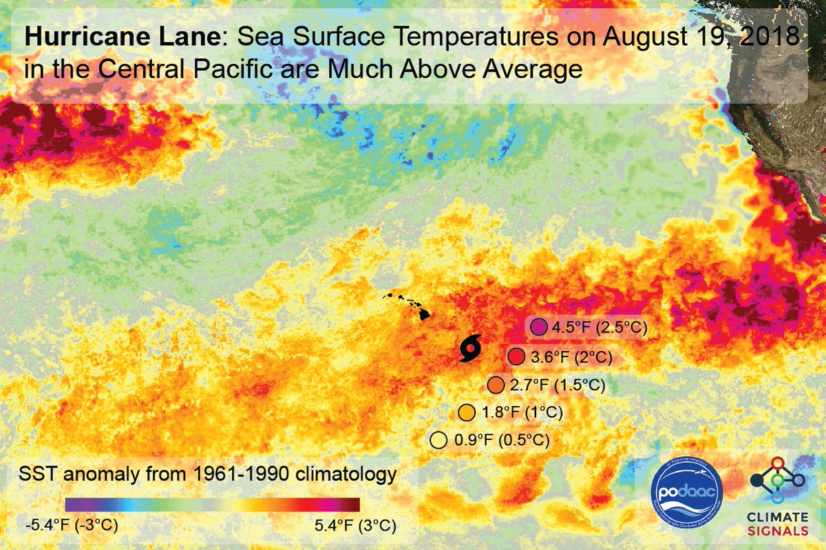
From any meteorology 101 class we know that hurricanes thrive and can grow stronger from warm ocean water. The threshold for water warm enough to support tropical storm and hurricane formation is about 80F. It makes sense that as ocean waters warm due to carbon pollution land masses whose shores had water too cool to support a storm will become susceptible to the ravages of the tropics.
Much is being written today about the effects of Lane on Hawaii, a hurricane that probably won’t be as devastating to that state as Maria was to Puerto Rico last year due to weakening from wind shear. Nevertheless, I contend that a storm like Lane, which is producing devastating flooding, would not get nearly as close to Hawaii a few decades ago due to warmer water brought about by climate change. Hawaii is becoming a sitting duck just like Puerto Rico. Category 3, 4 or even 5 storms are becoming more likely to make landfall along the chain of pearls, which traditionally sit far enough north to be protected due to relatively cool surrounding water but far enough south to be a tropical paradise.
This tweet depicts Hawaii’s new climate change problem:

#HurricaneLane is powered by unusually warm seas. #GlobalWarming is raising the power ceiling for hurricanes globally. And 2 fingerprinting studies have documented the role of #globalwarming in fueling Hawaiian hurricanes. Science run-down here: http://www.climatesignals.org/headlines/events/hurricane-lane-august-2018 …
 Philip KlotzbachVerified account@philklotzbach

 Alex LamersVerified account @AlexJLamers

 Weather UndergroundVerified account @wunderground


(If you like these posts and my work please contribute via the PayPal widget, which has recently been added to this site. Thanks in advance for any support.)
The Climate Guy