Saturday September 8th… Dear Diary. The main purpose of this ongoing post will be to track United States extreme or record temperatures related to climate change. Any reports I see of ETs will be listed below the main topic of the day. I’ll refer to extreme or record temperatures as ETs (not extraterrestrials)😊. Here is today’s main climate change related topic:
Is Intensification of Hurricanes Affected By Global Warming?
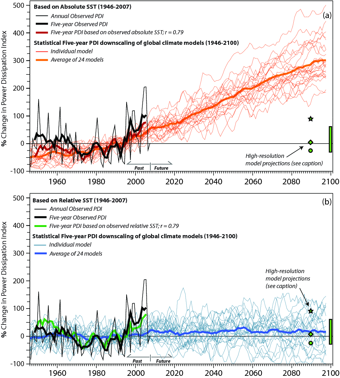
Yesterday before moving onto Florence data we briefly touched on recent hurricanes whose aspects could be attributed to global warming. Today let’s look at just one aspect, that of possible more rapid intensification. I’ve noticed during my 30+ met career that some of the worst, most damaging hurricanes rapidly intensify, usually much faster than the forecasts put out by the National Hurricane Center. If there is a trend due to both a warming atmosphere and higher sea surface temperatures rapid intensification would be yet more bad news since less ocean area and time would be required to generate a devastating storm. Hurricanes could form much closer to affected coastlines and require less time to be over water before doing their worst. Obviously the public would have less time to prepare in situations in which tropical storms ramp to intense hurricanes in no more than a few hours.
Thermodynamically it would make sense that under higher SSTs hurricanes would have “higher octane” for both peaking at a higher strength and revving up faster to higher speeds just like a well engineered race car. Have researchers uncovered any real trends recently? I did see this note this morning:

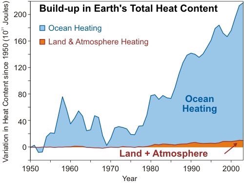
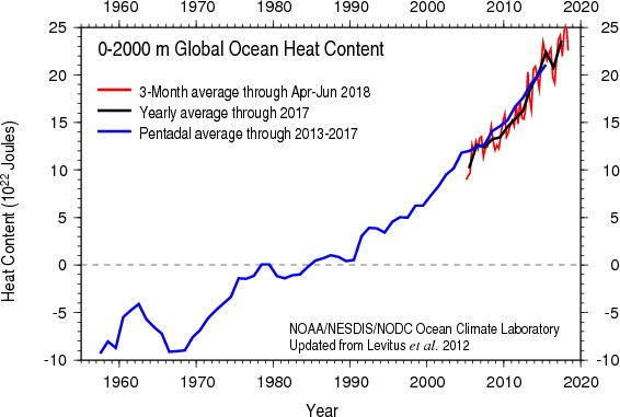
We have measured a large build up of thermal energy in the oceans.
There is an increasing amount of energy to dissipate.
Regardless, people, particularly in the Carolinas, should be preparing for the worst as of today. I have no doubt that at the very least heavy surf, swell and rip tides will be occurring up and down the East Coast soon.
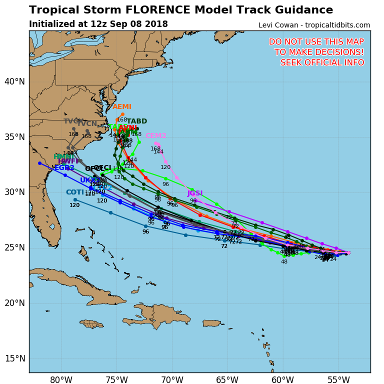
Hurricane Florence GFS model 10 day forecast 12 pm EST. High pressure building off Africa initial steers Florence to the WNW. A strong high pressure ridge coming off the N East coast dips down behind Florence from a low pressure trough in the E Central Atlantic and 👇👇 pic.twitter.com/1GKc1pIE8i
— Scott Cook (@scook2214) September 8, 2018
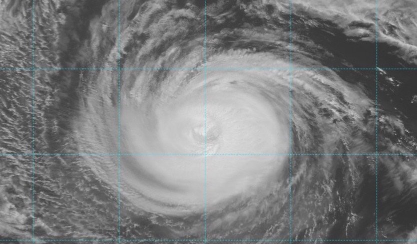
#Florence on visible satellite imagery this morning: Has ingested a lot of dry air esp. on SE side, but is healthy cirrus outflow to NW, and the storm has maintained a tight, rapidly spinning inner core and now with increasing convection around the center… pic.twitter.com/KT7s3RF5aD
— Stu Ostro (@StuOstro) September 8, 2018
Unfortunately, my money is on the more consistent and historically better European model though:

Having seen the weakness in the ridge caused by 94L, the 12z ECMWF came a bit farther NE with a landfall in NC. Seems like a reasonable scenario given strong ridge, but perhaps not as strong as previously modeled (due to 94L). Very latest forecasts http://wx.graphics/models/ecmwf_florence.png …
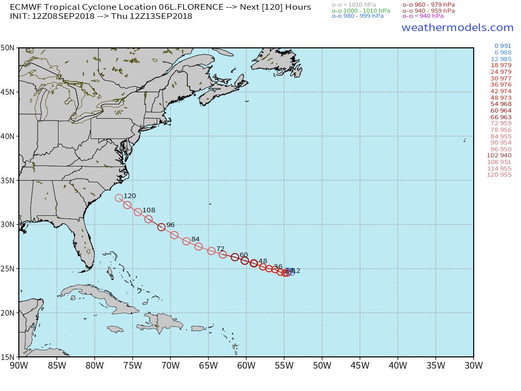
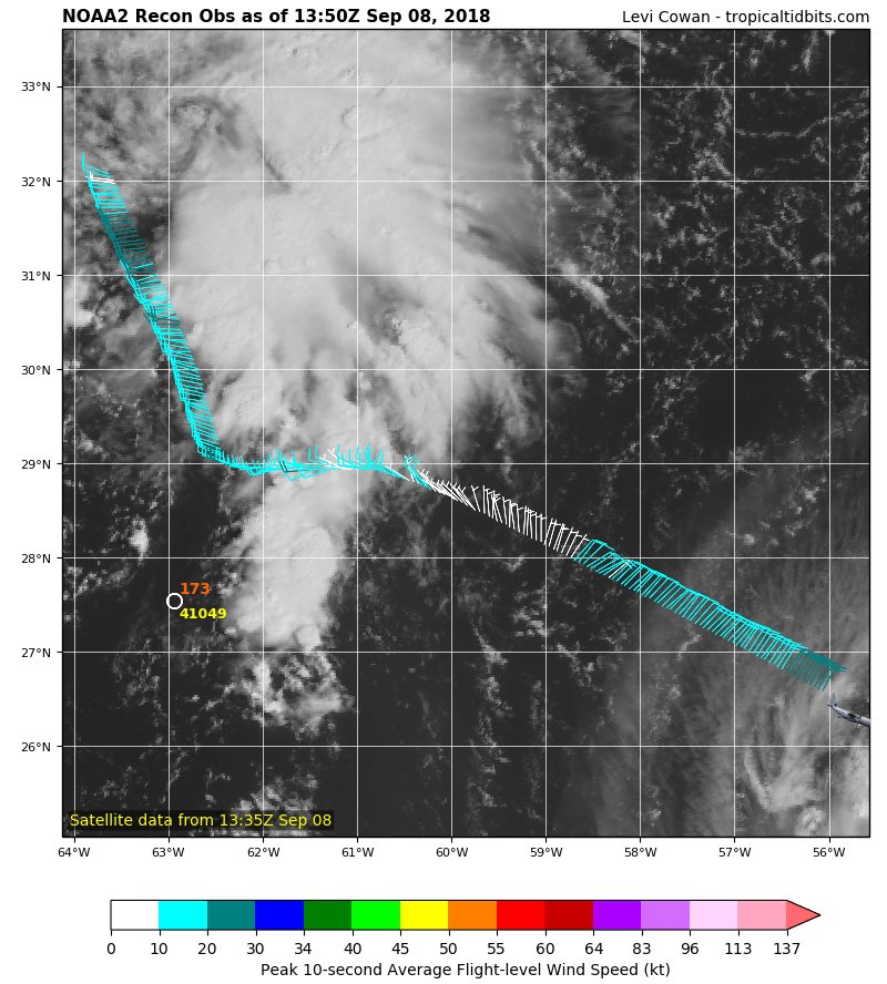
You can follow the data here: https://www.tropicaltidbits.com/recon/
6:58 AM – 8 Sep 2018

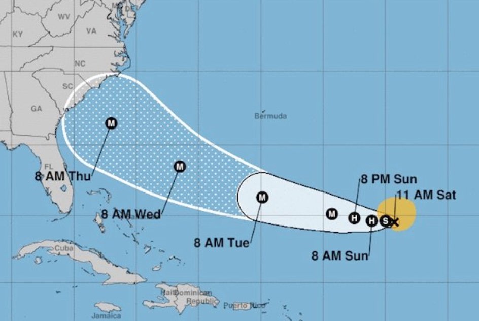
Here is the latest update on Florence.
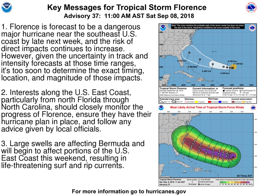

Wow, it’s the strongest wind forecast @NHC_Atlantic has put out for a tropical storm in 20 years. #Florence
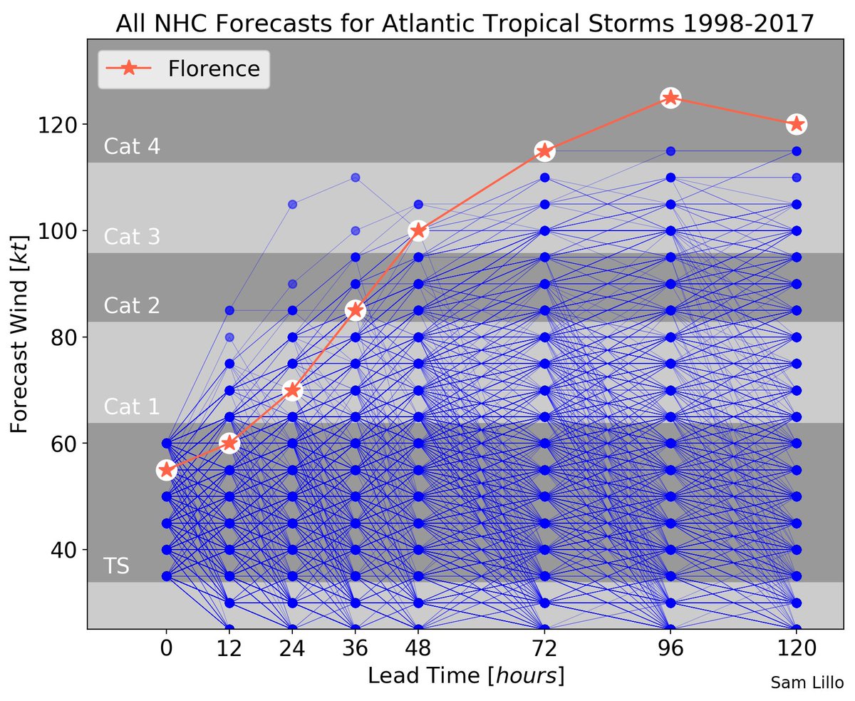
In the cone: Odds are rising that #Florence will reach the U.S. East Coast as a major hurricane https://bit.ly/2NnPfsb


 Weather UndergroundVerified account @wunderground
Dear Diary. Here are this evenings updates on Florence:

The 18Z SAT has an awful scenario for the Northeast. After stalling in eastern North Carolina a Canadian short ejects #Florence across all coastal areas through New England…a plausible scenario, but one which will change with each model run. Be prepared!
(As usual, this will be a fluid post in which more information gets added during the day as it crosses my radar, crediting all who have put it on-line.)
Hurricane Florence GFS model 10 day forecast 6 pm EST. High pressure building off Africa initial steers Florence to the WNW. A strong high pressure ridge coming off the N East coast dips down behind Florence from a low pressure trough in the E Central Atlantic and 👇👇 pic.twitter.com/s1sg5j0waD
— Scott Cook (@scook2214) September 8, 2018

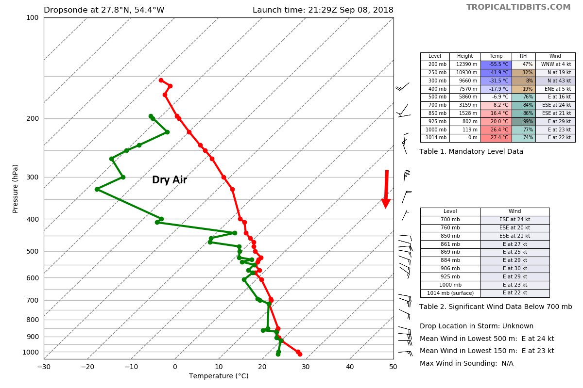
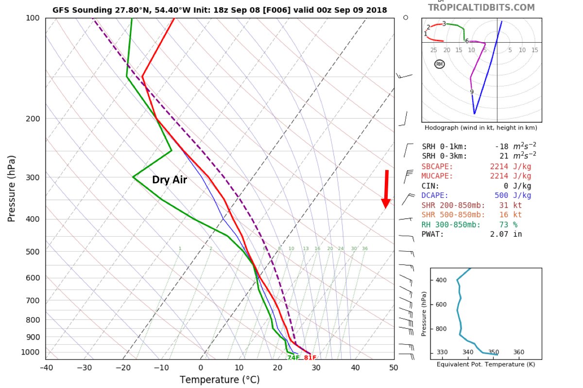
I’m struck by how well this #GFS fcast sounding matches a dropsonde so far. The 35kt N jet under the outflow layer may still be importing dry air into Florence’s core.
#Trippy #Florence imagery — but with meteorological significance, as it illustrates the consolidation of convection around the center, a step on the way to a lot of intensification… pic.twitter.com/pxnr6z0T0X
— Stu Ostro (@StuOstro) September 9, 2018
Information from the 00Z Sunday 9/9/2018 model run:
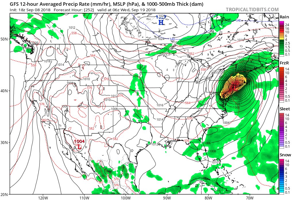
The 00Z SUN GFS has crazy low cat5 pressure at its closest point to land. The N.C. Cape will be gone if this model run verifies. The Northeast would be spared since #Florence would be kicked out to sea by a Canadian short wave. Watch for solutions to vary through at least Monday.
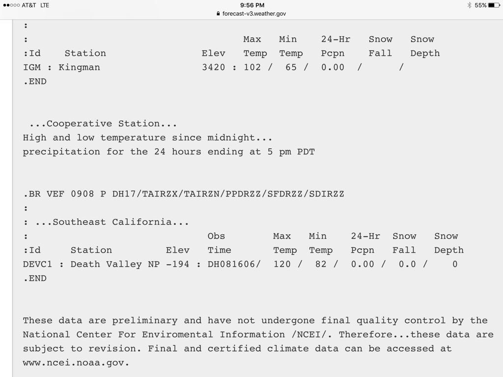
A late in the season 120F in Death Valley, California (breaking record of 118F for a September 8 set in 2012). Their latest 120F occurred on September 13, 1971. Hourly observations are on Pacific Daylight Time, 2 hours behind our time.