Wednesday October 24th… Dear Diary. The main purpose of this ongoing post will be to track United States extreme or record temperatures related to climate change. Any reports I see of ETs will be listed below the main topic of the day. I’ll refer to extreme or record temperatures as ETs (not extraterrestrials)😊.
Yutu And Willa…A Harsh Pattern Developing
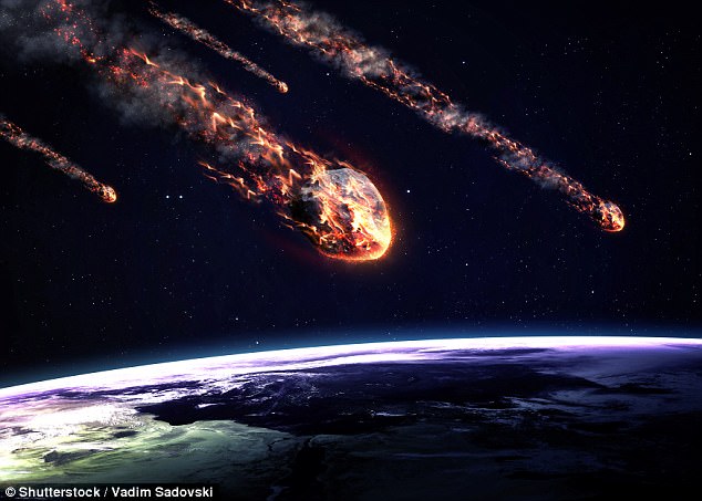
Not many people know that I am also a member of the Planetary Society having an interest in astronomy a few years before wanting to become a meteorologist as a child. I know that the Earth’s atmosphere also serves as a shield against meteorites preventing most from impacting the surface of the planet. Smaller stones break up and burn before casing any havoc creating “shooting stars” in the sky. Sometimes though, as happened in 1908 at Tunguska, Russia, a very large meteorite, or small asteroid will strike the planet producing loss of life and much damage. Such events are rare, probably occurring about every hundred years. Of course, my fellow Planetary Society friends are interested in tracking and perhaps due to new tech, thwarting another existential threat to civilization, killer asteroids. My calling, of course, is to thwart killer global warming.
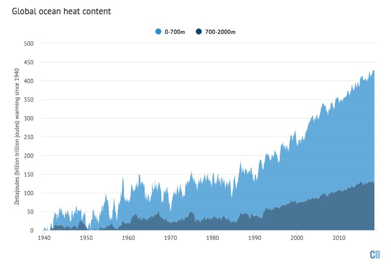
So where am I going here? Suppose that the solar system encountered a debris field of fairly large asteroids with the Earth interacting with some whoppers. These would not be the so called “planet killers,” though, just being Tunguska event size. What would happen would be similar to the World War II Blitz, an off and on barrage of stones acting like bombs, which could level cities, but not enough to snuff out civilization like atomic blasts. I believe that we are at a point now both meteorologically and climatologically that the ocean’s heat content has risen such that Tunguska size tropical cyclones are now being hurled randomly at Earth’s coastlines. What I’m writing is that the chances for a “city-killing” storm are going up.
We are seeing a new regime since the world got up to record warm levels in 2016, partially due to the last strong El Nino, in which the atmosphere and oceans are no longer cold enough to protect some coasts and islands from bigger catastrophic CAT 4 and 5 typhoons and hurricanes. I liken this to our atmosphere not being thick enough to vaporize Tunguska size rocks. Thankfully, our atmosphere is not getting thinner, just more filled with heat trapping greenhouse gasses. These stronger cyclones won’t destroy civilization, just make life more miserable for many while being much more life threatening, spurring a faster retreat from the coast, which was yesterday’s subject. Let’s look at a few details to support my claim.
I saw this information yesterday in association with the ocean’s heat content:
Ocean heat just reached the highest level on record
I’m starting to ask the question whether or not the climate has passed the Rubicon or tipping point in which most hurricanes in every ocean basin will rapidly become CAT 3-5s. My young friend Edgar makes a good point just about the United States alone:
Major Cat 3+ US landfalls in the past 14 months+
Harvey: Cat 4, Rockport, Texas. 8/26/2017
Irma: Cat 4, Cudjoe Key, Florida 9/10/2017
Maria: Cat 4, Puerto Rico 9/20/2017
Michael: Cat 4, Mexico Beach, FL 10/10/2018
Yutu: Cat 5, Saipan, Mariana Is. 10/24/2018
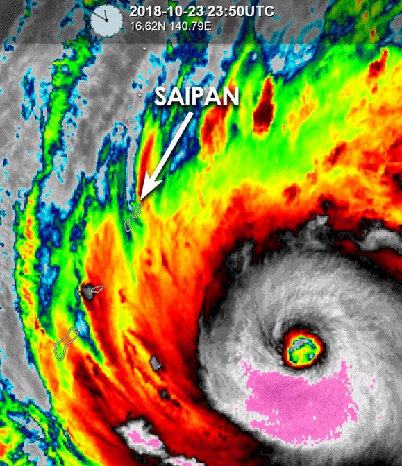
An extreme tropical cyclone — Super Typhoon #Yutu — and another one with an exceptional amount/rate of intensification in the past 48 hours.. Eyewall now unfortunately blasting across the Northern Mariana Islands pic.twitter.com/tseQEHnfbg
— Stu Ostro (@StuOstro) October 24, 2018
180 mph with gusts to 220 mph. Super Typhoon #Yutu is just about as strong of a hurricane/typhoon as you will ever see.
The islands Saipan and Tinian & their 50,000 inhabitants are taking a direct hit at this very moment. We can only hope for the best pic.twitter.com/HMYMmyZXKR
— Greg Diamond (@gdimeweather) October 24, 2018
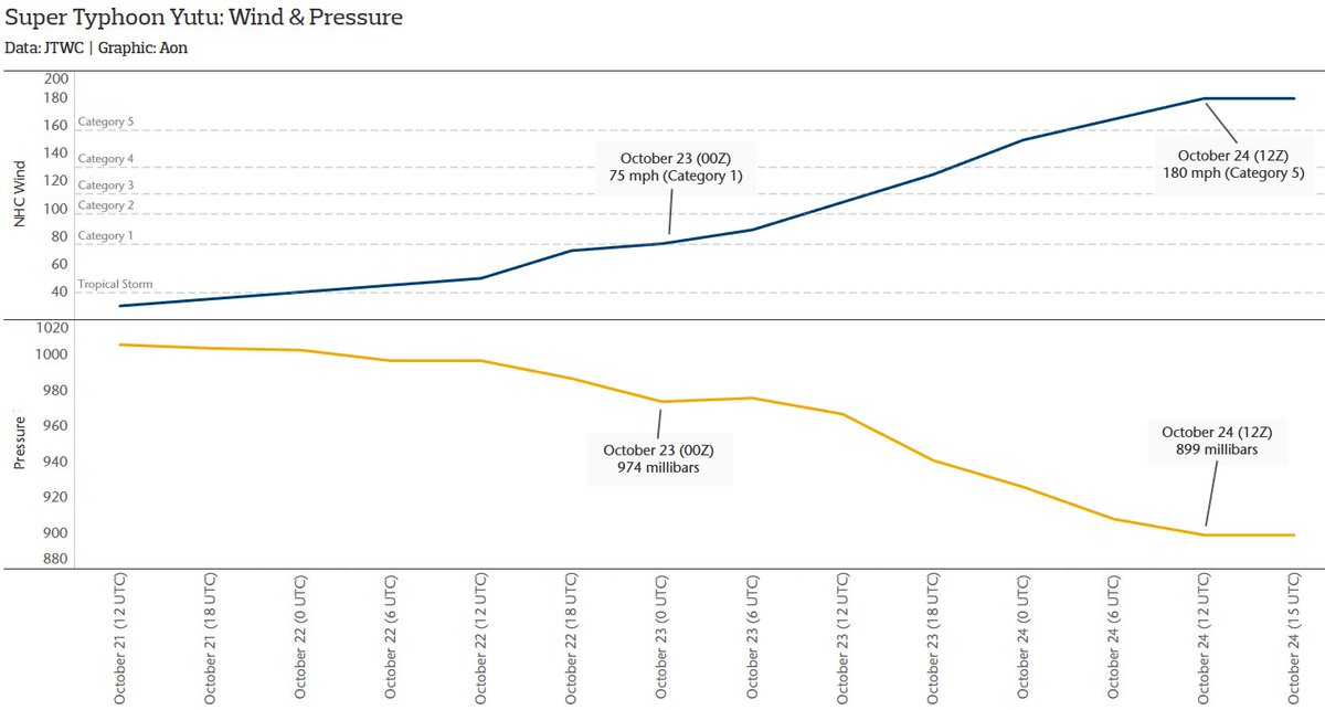
#Yutu is the latest global storm to undergo explosive rapid intensification. Unbelievable 36-hour stretch.
Oct. 23 (00Z): 75 mph; Cat. 1; 974 millibars
Oct. 24 (12Z): 180 mph; Cat. 5; 899 millibars
Data: JTWC Best Track
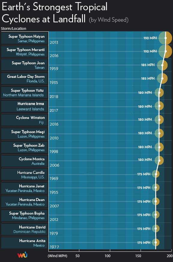
#Yutu is tied as the fifth strongest landfall ever recorded globally (180 mph sustained winds). The only stronger landfall in the U.S. or its territories was the Labor Day hurricane (Florida Keys, 1935). Ominously, 7 of the 10 strongest landfalls have occurred since 2006.
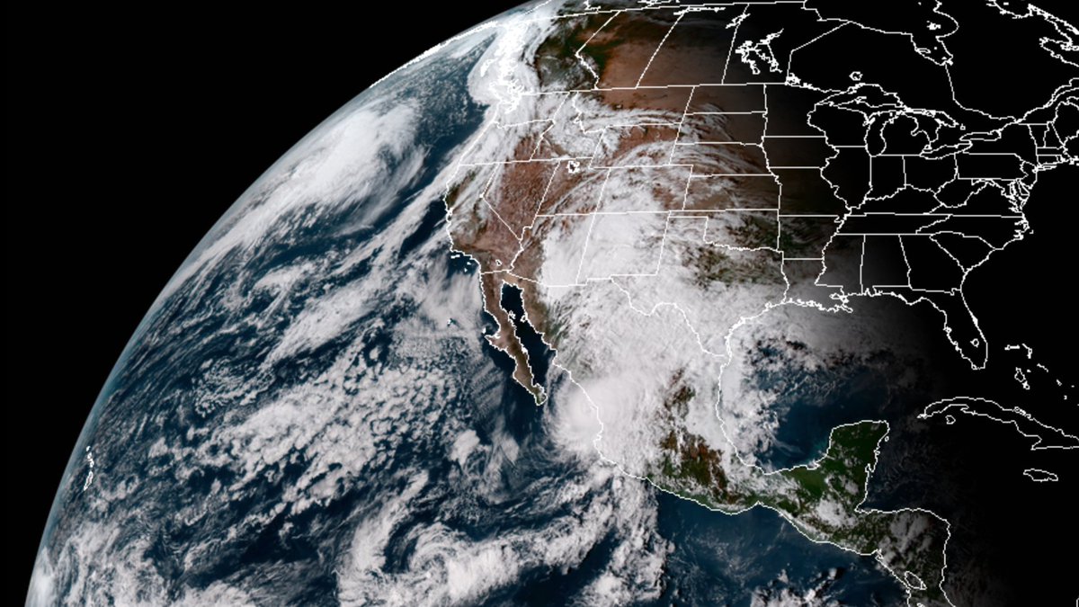
Just yesterday Willa made landfall in Mexico near Mazatlán as a CAT 3 in a strengthening phase:
5:45 PM CDT #HurricaneWilla Update: #Willa is presently at Cat. 3 status, but still remains to be a large and dangerous storm. Also, the latest infrared satellite imagery confirms that the storm is about to make landfall near #Mazatlan. #Mexico. (Imagery credit: @TropicalTidbits) pic.twitter.com/vwi55pIcXZ
— GlobalWeatherClimate (@gwccwx) October 23, 2018
At least Willa didn’t hang around Texas to give them too much more rain that could have led to more flooding problems per this old model run:
At the daily meeting of NWP:
ECMWF – "Okay group, what haven't we thrown at them yet for the end of October?"
CMC – "How about, wait for it, we take a Pacific hurricane and turn it into a Great Lakes blizzard?"
GFS – "I'm on it." pic.twitter.com/wfpbzqGoEn
— Sam Lillo (@splillo) October 16, 2018
Hit after hit after hit it appears that most landfalling hurricanes within “typical” threatened areas have been majors since 2016. Has the planet entered a climatological mine field of asteroid-like tropical activity? I think so. I haven’t seen this anomaly SST chart look this orange and red worldwide since perusing these things starting around 2005:
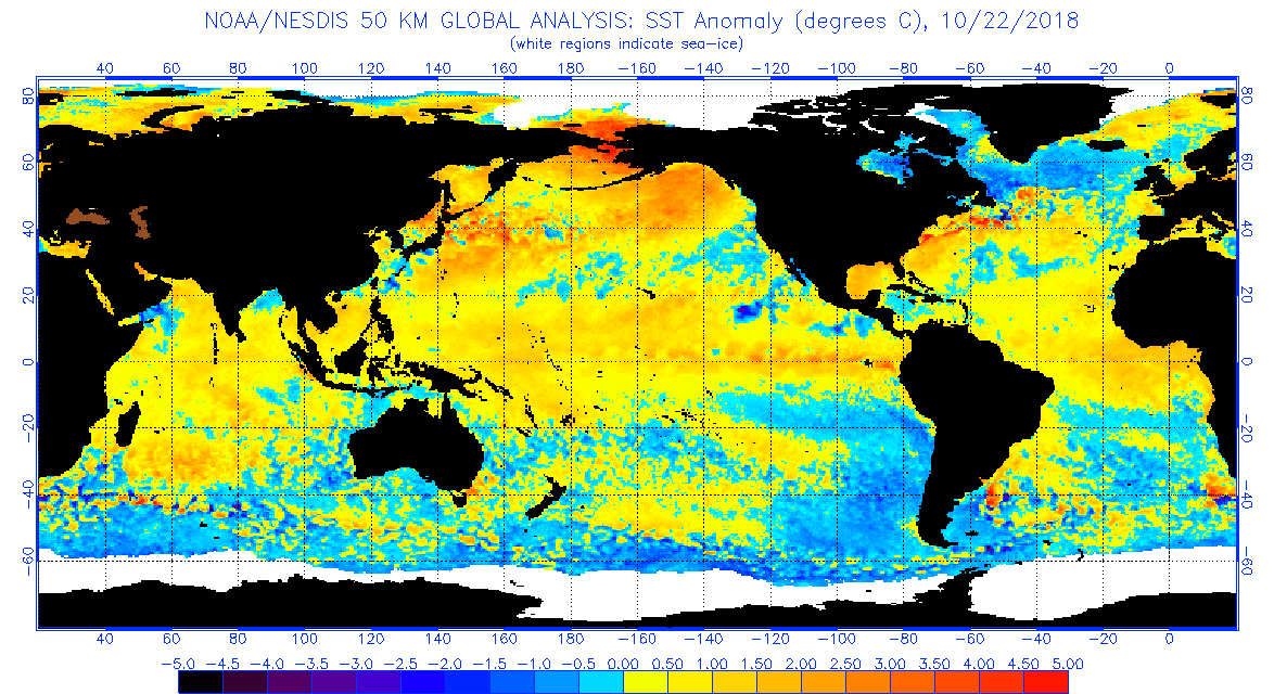
Oh, and there appears to be another El Nino in the works adding more heat fuel to the mix.
Why is more heat both in the seas and atmosphere part of the recipe for stronger, more violent storms? Let’s remind readers if the Clausius-Claperon relationship from high school physics:
Clausius-Clapeyron equation
The Clausius-Clapeyron equation allows us to estimate the vapor pressure at another temperature, if the vapor pressure is known at some temperature, and if the enthalpy of vaporization is known. The vapor pressure of water is 1.0 atm at 373 K, and the enthalpy of vaporization is 40.7 kJ mol-1.
For more click on this caption with a big purple font:
Kelp, I need somebody,
Kelp, not just anybody,
Kelp, you know I need someone, kellllp.
8:10 AM – 22 Oct 2018
We’ll be watching the West Coast and the Pacific Ocean in a new way by the end of the year: https://wxch.nl/2D4gGCA
(As usual, this will be a fluid post in which more information gets added during the day as it crosses my radar, crediting all who have put it on-line. Items will be archived on this site for posterity.)
(If you like these posts and my work please contribute via the PayPal widget, which has recently been added to this site. Thanks in advance for any support.)
The Climate Guy


