Current Highly Amplified North American Pattern…Another Sign Of Climate Change
The winter weather pattern across the Northern Hemisphere this week has been wild, and I’m not being hyperbolic. From heavy snow in the southwestern U.S. to flooding across the Deep South to extreme warmth in Europe this is not your typical granddad’s weather for late February. During my 35+ year career of being a meteorologist I have never seen a 500 millibar pattern across the Northern Hemisphere this amplified and strange looking during late winter. Today let’s describe why.
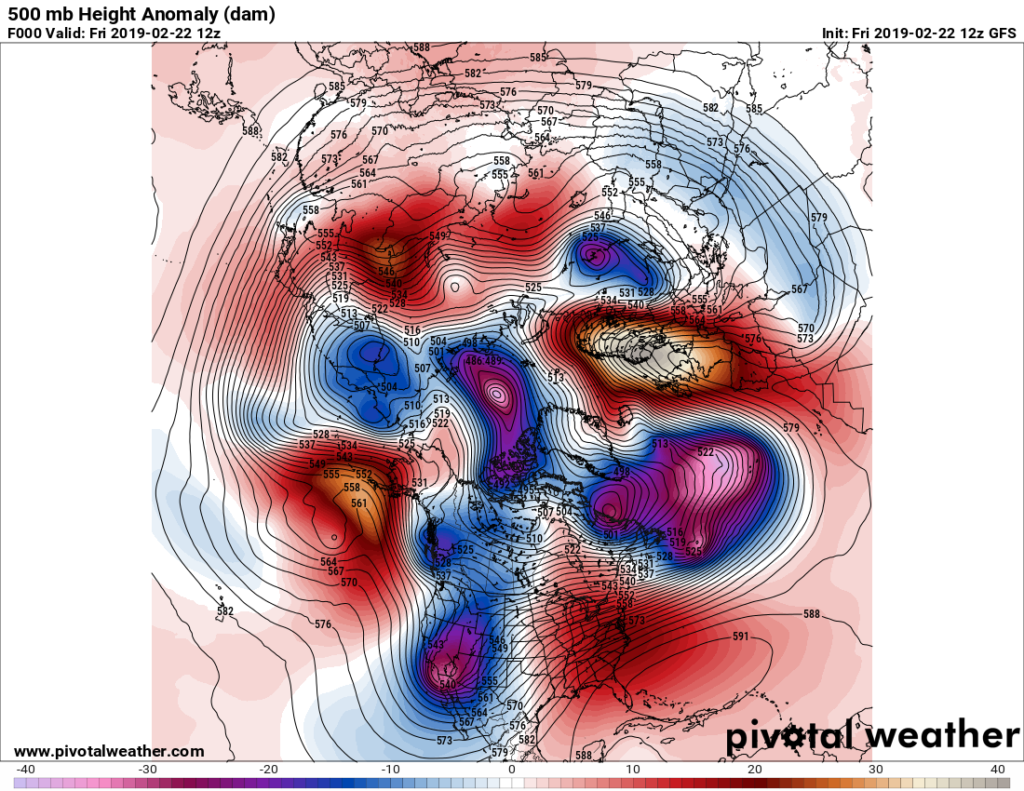
To start, here is what we see across North America:

To be fair I have seen deep troughs dig into the Southwest, but this one is rare looking at temperatures aloft. The ridge over the East aloft is warm, but not too uncommon for late February when there is a corresponding strong western system.
The weather across the United States is becoming deadly as of this writing:
Associated weather at the surface has ranged from record snow at Las Vegas and Flagstaff to flooding in the Mid-South.
The upper low over the Southwest will become a powerful winter storm from Friday into this coming weekend. The South will be bracing for a nasty severe weather outbreak on Saturday, which may extend anomalously far north into the Ohio Valley:
What looks very convoluted and strange is the pattern closer to the Arctic Circle. The polar vortex is being pinched on all sides be extreme warm pockets:
One of the strongest is occurring from across Europe, once again just like in 2018 jetting northward through Scandinavia:
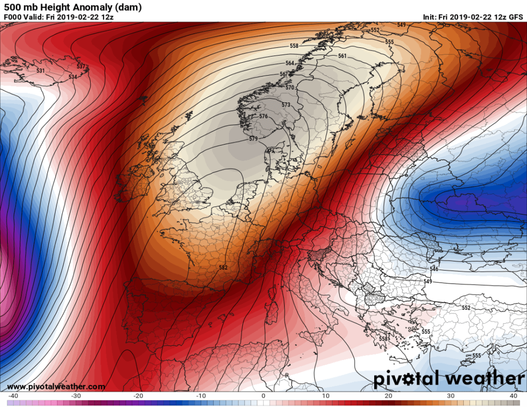
Here is one example just from today of record warmth being produced by this ridge:
We will post many more “ETs” from Europe tomorrow.
In a few days we will see an unusual pattern across North Africa as a cold pocket gets driven southward due to our mega European ridge:
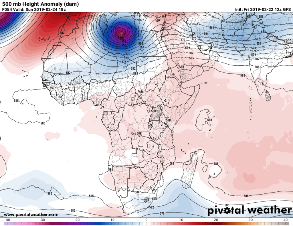
Will we see reports of some heavy snow and rain in Libya and perhaps surrounding territories in North Africa (which may be welcome I may add)? I think so.
Moving eastward into Asia we see a huge warm pocket from Siberia southward into northern China:

Aloft today we see an anomalously warm but flat ridge:
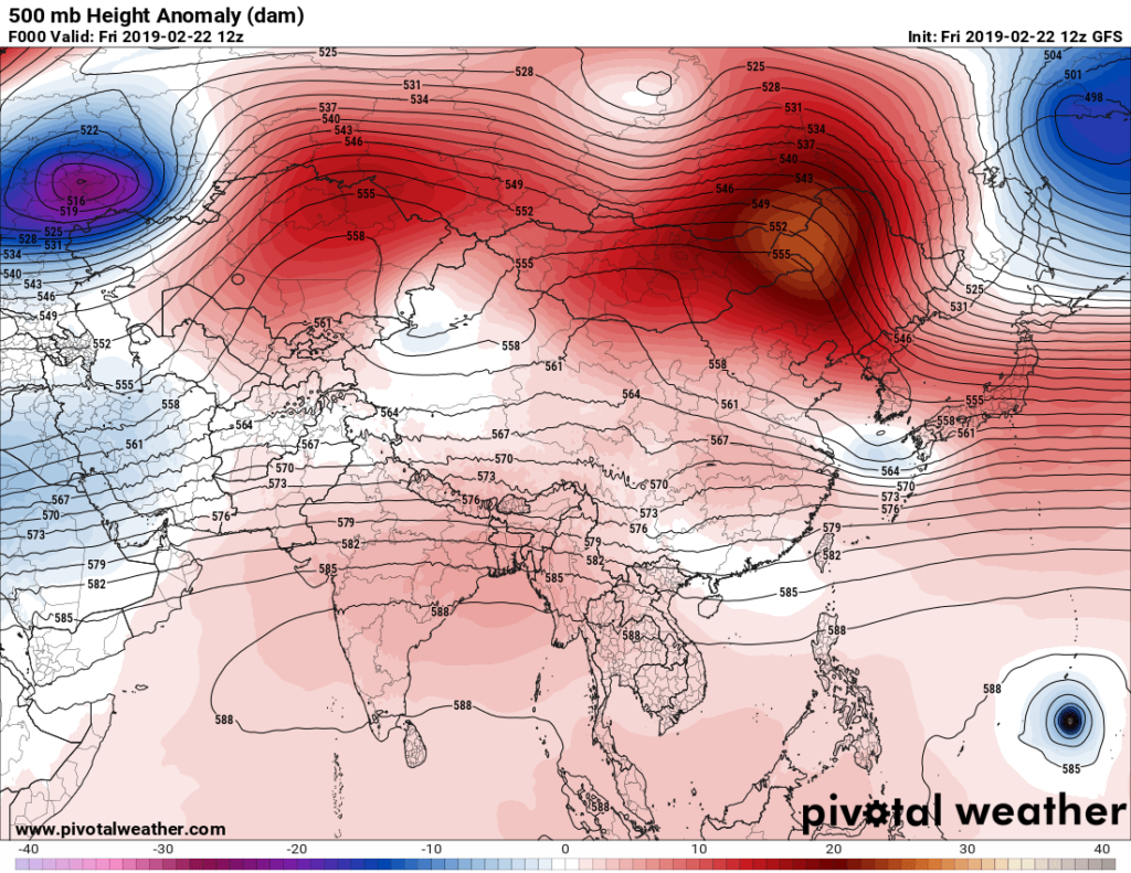
Disturbingly, by the way, that little upper low near Guam on the bottom right of the image is Typhoon Wutip, the first CAT 3 system of the 2019 tropical season in the western Pacific, which is unusually early for this time of year. Wind shear from cold troughs digging southward through Asia usually suppresses typhoon activity in late winter. The warmth to the north of Wutip cannot be a coincidence.
As researchers continue to connect the dots between “wild” destructive weather and carbon pollution they may use this period of time as another dot. For an old meteorologist this is both alarming but very interesting.
……………………………………………………………………………………………………..
Here is some more climate and weather news from Friday:
(As usual, this will be a fluid post in which more information gets added during the day as it crosses my radar, crediting all who have put it on-line. Items will be archived on this site for posterity.)
(If you like these posts and my work please contribute via the PayPal widget, which has recently been added to this site. Thanks in advance for any support.)
The Climate Guy