The main purpose of this ongoing blog will be to track planetary extreme, or record temperatures related to climate change. Any reports I see of ETs will be listed below the main topic of the day. I’ll refer to extreme or record temperatures as ETs (not extraterrestrials).😉
Main Topic: Halloween Week Will Be Wickedly Warm for Many Across the U.S.
Dear Diary. It looks like my anti-hurricane dance from yesterday has worked such that the U S. won’t be facing a third devastating storm this year going into November, although one could still form in the Caribbean and affect that area. What is a certainty is that the eastern U.S. will undergo record warmth ahead of a front through Halloween. Many cold weather haters might welcome this, but the event will be one more ominous hint that climate change is here.
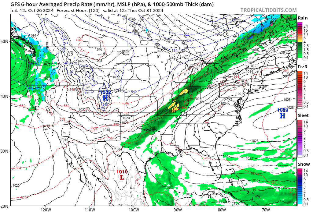
Like a monster coming out of the either, a heat dome of record proportions will develop the week of Halloween, which should cement October 2024 as being the warmest on record for the lower 48 states:
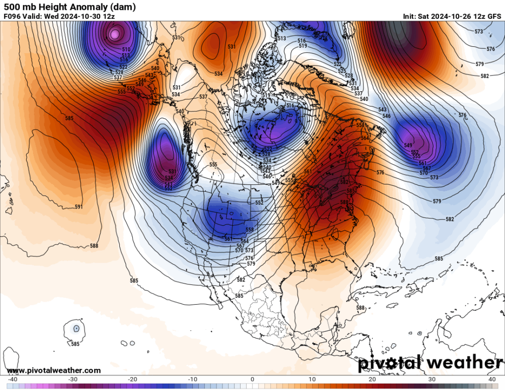
I have never witnessed a 591 decameter ridge this late in the year set up across the U.S. as far north as depicted on the above Pivotal Weather chart.
At the surface we will see a broad southerly flow with high warm thickness values as far north as southern Canada developing east of the Rockies:
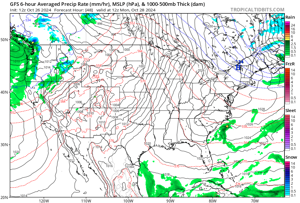
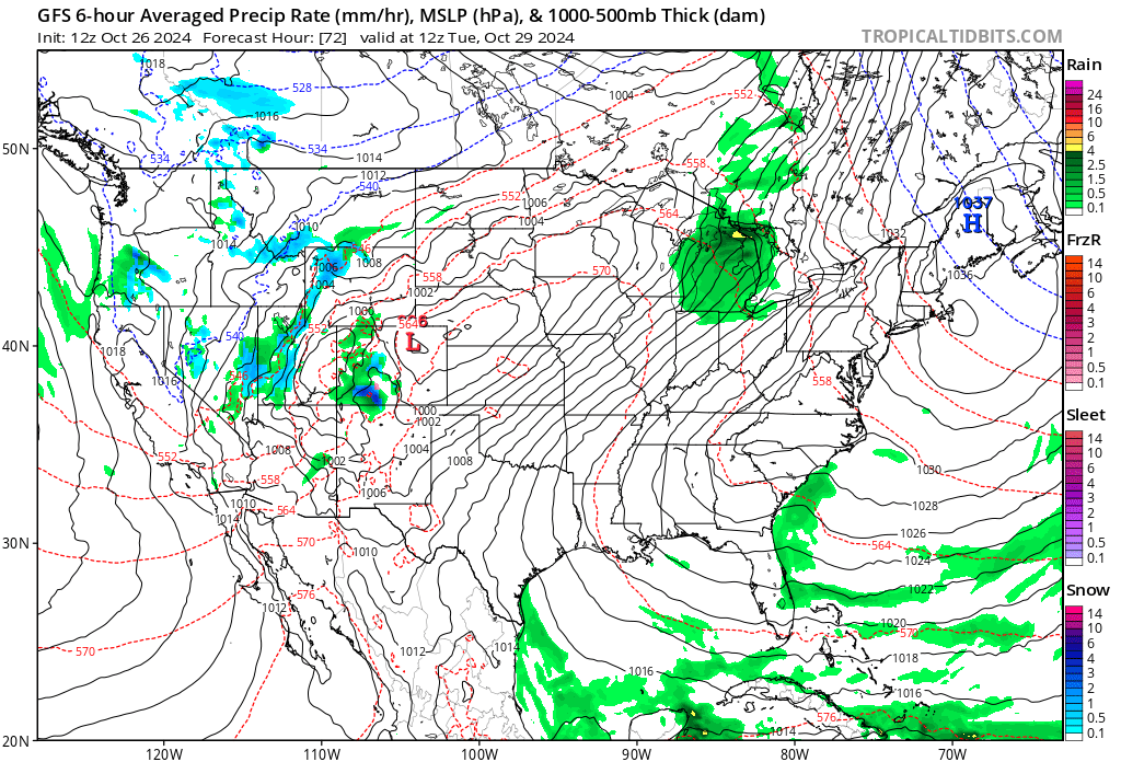
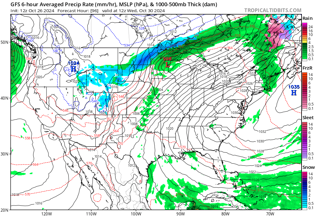
A cold front will be putting an end to record heat in the Midwest, but trick or treaters will see more eerie warmth across the Northeast:
By my estimation, another couple of thousand warm records will be set from major and minor stations next week.
We can get a sense of actual warmth from the Pivotal Weather site. Here are panels from Monday through Thursday of next week:
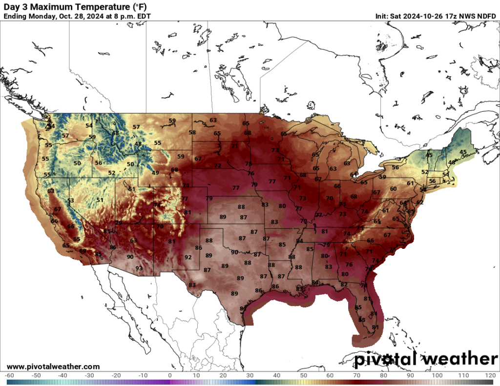
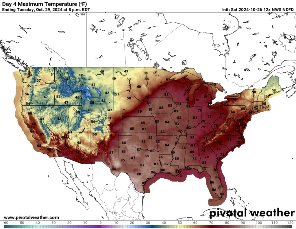
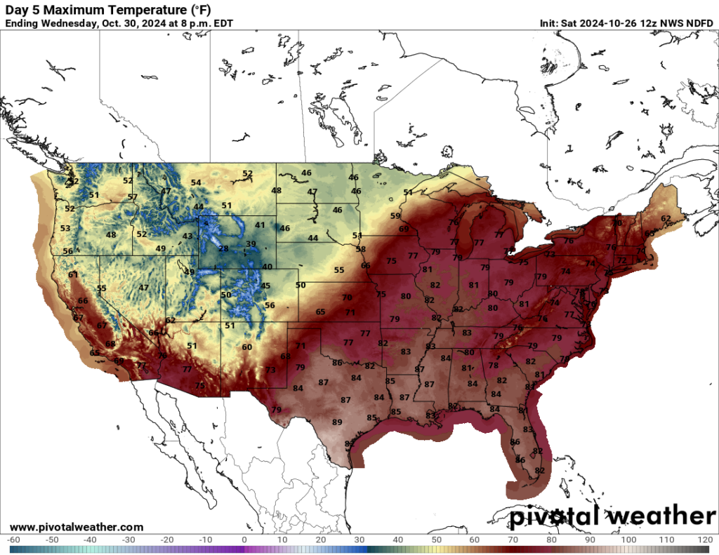
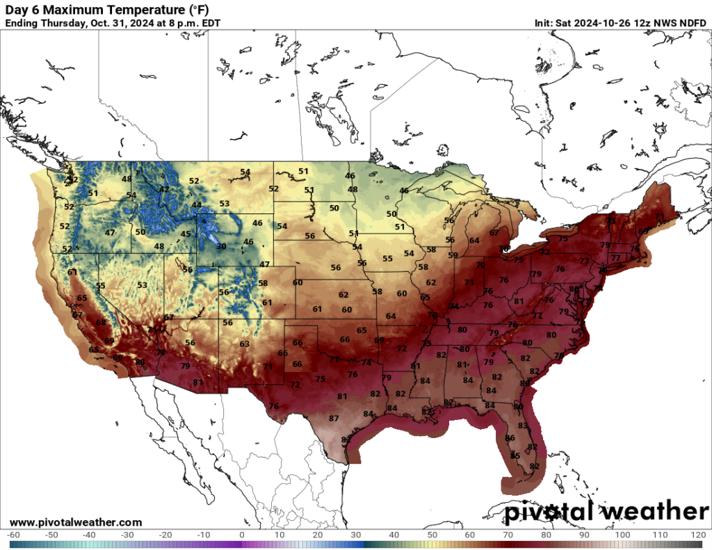
Values displayed across the Midwest and Northeast might be conservative.
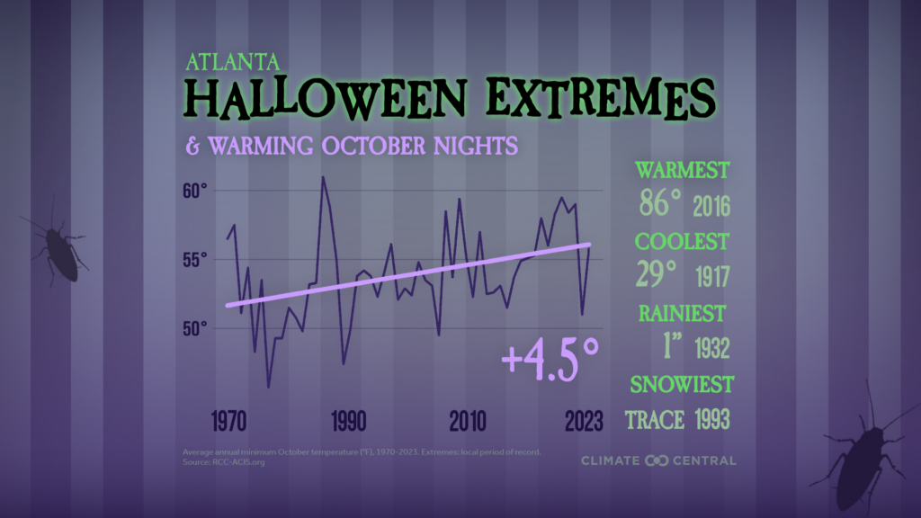
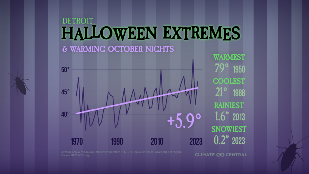
Here is more on how Halloween temperatures are trending warmer from Climate Central:
Halloween Extremes and Warming October Nights | Climate Central
Click on the above link to see graphics for individual large cities such as these:
I’ll have more on this wickedly warm Halloween weather over the next few days.
Here are more “ETs” recorded from around the planet the last couple of days, their consequences, and some extreme temperature outlooks, as well as any extreme precipitation reports:
Here is More Climate News from Saturday:
(As usual, this will be a fluid post in which more information gets added during the day as it crosses my radar, crediting all who have put it on-line. Items will be archived on this site for posterity. In most instances click on the pictures of each tweet to see each article. The most noteworthy items will be listed first.)