The main purpose of this ongoing blog will be to track planetary extreme, or record temperatures related to climate change. Any reports I see of ETs will be listed below the main topic of the day. I’ll refer to extreme or record temperatures as ETs (not extraterrestrials).😉
Main Topic: Investigating Whether or Not There Will Be Hurricane Trouble for the U.S. Going into November
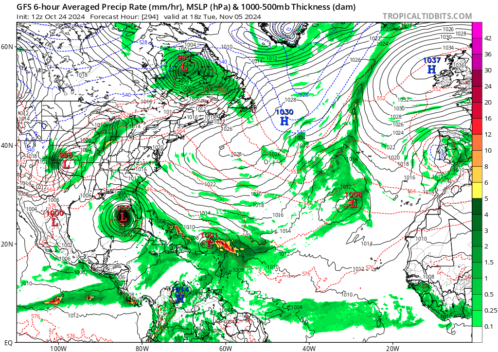
Dear Diary. Hopefully by highlighting today’s subject I have turned this item into a nothing burger. The bad news here is that a tropical cyclone is likely to develop in the Caribbean affecting somebody. The good news is that the reliable deterministic GFS has been trending weaker and much farther east such that the United States escapes from a direct impact entirely. So, we go from this solution a few days ago, which might be another dreaded Helene:
To this today:
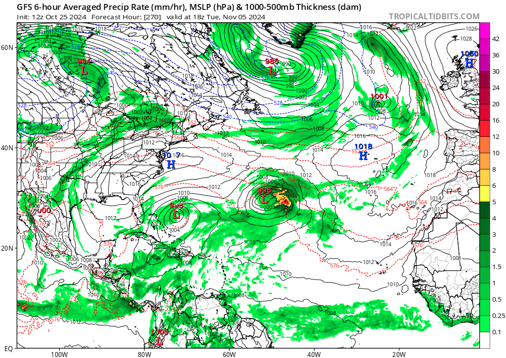
Still, what has me concerned is that we do have a record warm Carribean, and the Gulf has not cooled off much as is typical by Halloween, all due to climate change. U.S. mainland weather, as I have mentioned in prior posts, resembles that from climatological September, so the Gulf coastal area will be primed for a hurricane landfall that won’t weaken much should an organized system get into the Gulf. Thousands of warm and downright hot records have been set this month with October 2024 likely to be the warmest October on record.
The best source for determining if and then where a tropical cyclone will move are ensembles. Here is what we have today from Penn State University:
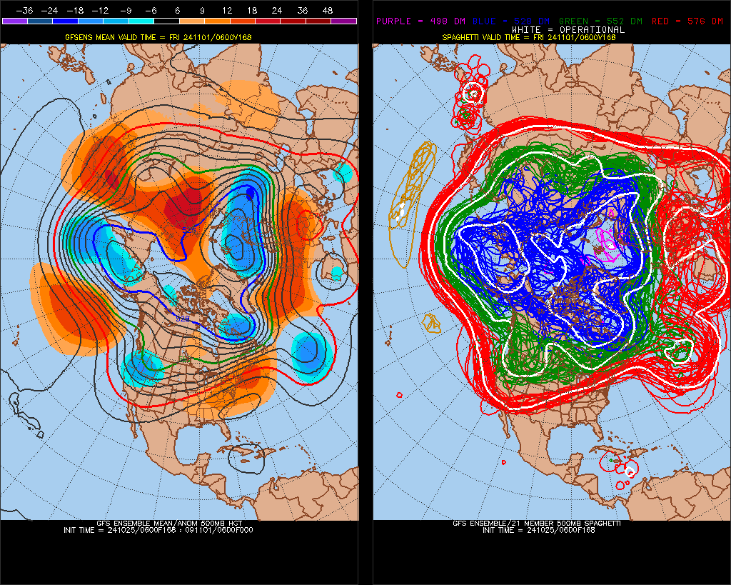
On the above image we see several circles in the Caribbean, which represent organized systems. Therefore, we can state that development is likely by November 1st or 2nd.
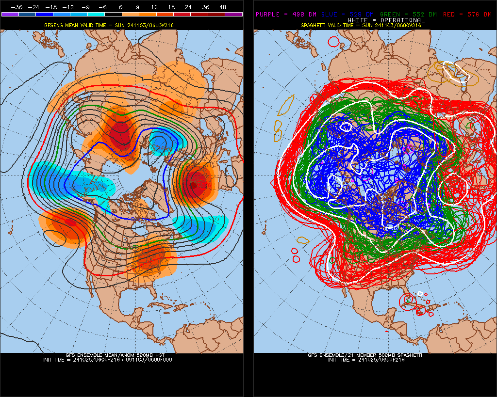
Going out to the 3rd and 4th we see that some circles get close to south Florida with the latest deterministic model being farthest east, so we can’t write off a Florida landfall yet. At least it is less likely for states west of Florida to be worried about any potential hurricane.
On the other hand, we can’t totally count on the GFS that forecasts a storm:
If necessary, I will be reporting on any Hurricane Patty that forms in the Caribbean in November on an ETD post.
Here are more “ETs” recorded from around the planet the last couple of days, their consequences, and some extreme temperature outlooks, as well as any extreme precipitation reports:
Here is More Climate News from Friday:
(As usual, this will be a fluid post in which more information gets added during the day as it crosses my radar, crediting all who have put it on-line. Items will be archived on this site for posterity. In most instances click on the pictures of each tweet to see each article. The most noteworthy items will be listed first.)