Sunday May 26th… Dear Diary. The main purpose of this ongoing blog will be to track United States extreme or record temperatures related to climate change. Any reports I see of ETs will be listed below the main topic of the day. I’ll refer to extreme or record temperatures as ETs (not extraterrestrials).😉
The Dreaded Ring Of Fire…Day Four
Sunday marks the fourth consecutive day that a strong ridge of high pressure has made its presence known in the Southeast, blocking fronts from moving east and south of the Plains and Midwest. Many heat records were shattered yesterday in the South due to this heat dome, and many more will be broken today and on Memorial Day. The worst effect of this weather pattern is not the heat, though. Heavy, severe thunderstorms have been forming day after day and night after night along fronts separating the southeastern ridge and cold trough in the West. Two people lost their lives from a tornado that hit El Reno, Oklahoma last night:
Just like I’ve been doing the last several days I will be posting more storm and flood related damage as Sunday rolls along here:
I’ll post any heat related messages here:
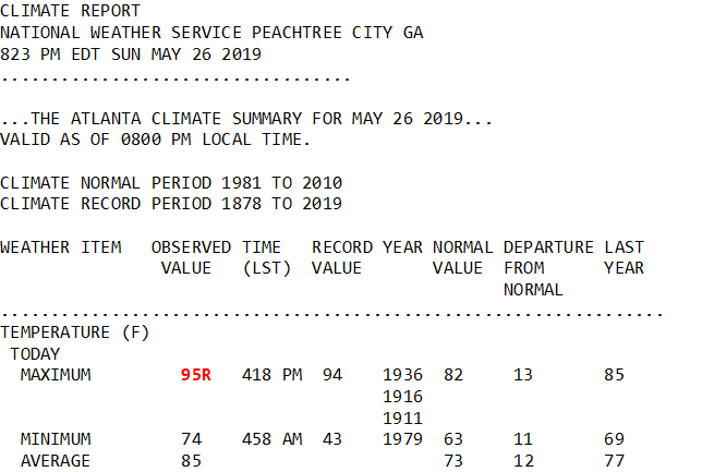
This is quite the toasty maximum chart for the Southeast for late May:

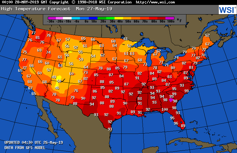
Here are the national maxes for Memorial Day:

Our Southeastern heat wave, thankfully, will peak today and on Memorial Day.
Any “ETs” from Sunday that cross my radar will be posted here:

Here is some more climate and weather news from Sunday:
(As usual, this will be a fluid post in which more information gets added during the day as it crosses my radar, crediting all who have put it on-line. Items will be archived on this site for posterity. In most instances click on the pictures of each tweet to see each article.)
(If you like these posts and my work please contribute via the PayPal widget, which has recently been added to this site. Thanks in advance for any support.)
Guy Walton- “The Climate Guy”