Sunday July 5th… Dear Diary. The main purpose of this ongoing blog will be to track United States extreme or record temperatures related to climate change. Any reports I see of ETs will be listed below the main topic of the day. I’ll refer to extreme or record temperatures as ETs (not extraterrestrials).😉
Main Topic: Will There Be A Historic Heat Wave?…Update #1
Dear Diary. 00Z Sunday operational models offered some hope that there might not be a historic heat wave enveloping the U.S. after all. 12Z Sunday models are somewhere between those of last night and the torrid guidance we saw on Saturday. So which guidance is most likely to verify?
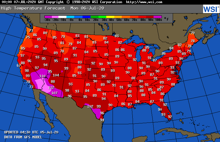
Before trying to answer this question, as usual, here is what we see from the National Weather Service as far as advisories go for Sunday:

Outside of the Minneapolis area there are no heat advisories so we don’t have a CAT 1 heat wave yet. On Monday we will see typical July heat, so there won’t be a categorized heat wave declared for that day either:
Here was our glimmer of hope from last night valid a week from today:
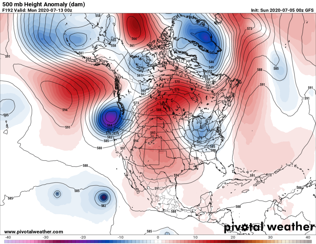
We’ve seen this rodeo before in June in which models tried to build a strong ridge in the Northeast only to verify with a closed upper low over the region. Any strong closed low would usher in cool air from Canada putting a kibosh on heat east of the western High Plains and north of the Southern Plains.
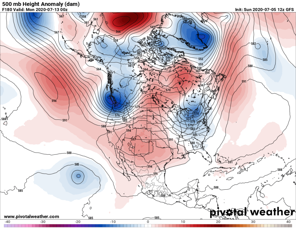
The above operational model is quite different from what we saw yesterday valid for next Sunday:

Models are having great difficulty trying to forecast the 500 millibar pattern in the Gulf of Alaska and Pacific Northwest, which will be key for any heat wave occurring this July. Also, over the course of my 30+ year career I’ve noticed that if a summer ridge forms near New Mexico, usually it gets anchored, not drifting too far north and east of the Southwest. This is part of traditional meteorological wavelength teleconnections science. Indeed, this is the forecast from the GFS 12Z Sunday run:
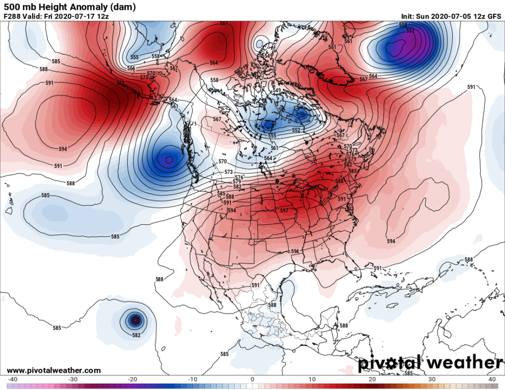
Now, if the Pacific Northwest cold pocket were to dig just a little more into California the ridge would get dislodged towards the east, enveloping the Midwest and probably the East, as well, with high heat. Going out beyond 240 hours into “fantasy land,” as far as models go, this is indeed the scenario:
Our latest ensemble guidance continues to suggest that our ridge will move out of the Southwest and grow as it moves north and east, but there us a marked trend towards more East Coast troughiness:

Of course, the situation will become more clear by Monday and Tuesday, so stay tuned for updates. One thing is clear. The Southwest will get wickedly hot this week as the ridge starts to build there. We will be following the development and path of this heat dome just like hurricane forecasters try to forecast hurricanes. As we have seen this century in this day and age of global warming both types of weather entities, if moving over highly populated areas, are very deadly. Let’s hope that this ridge stays put over the Southwest for the sake of people who can’t escape outdoor heat.
Here is more climate and weather news from Sunday:
(As usual, this will be a fluid post in which more information gets added during the day as it crosses my radar, crediting all who have put it on-line. Items will be archived on this site for posterity. In most instances click on the pictures of each tweet to see each article. The most noteworthy items will be listed first.)
Now here are some of today’s articles and notes on the horrid COVID-19 pandemic:
(If you like these posts and my work please contribute via the PayPal widget, which has recently been added to this site. Thanks in advance for any support.)
Guy Walton “The Climate Guy”