Wednesday July 22nd… Dear Diary. The main purpose of this ongoing blog will be to track United States extreme or record temperatures related to climate change. Any reports I see of ETs will be listed below the main topic of the day. I’ll refer to extreme or record temperatures as ETs (not extraterrestrials).😉
Main Topics: Low Level U.S. Heat Wave Continues To Simmer…Update #18/ Atlantic Tropics Awaken
Dear Diary. As feared, the tropical Atlantic didn’t stay quite for that long. Most of this July there has been very little organized tropical activity across the Northern Hemisphere:
Prior forecasts for the Atlantic were for a very active tropical season based on the advent of La Niña in the Pacific producing very low wind shear and well above average sea surface temperatures. Now the tropics are starting to pop with two systems in the process of organizing:

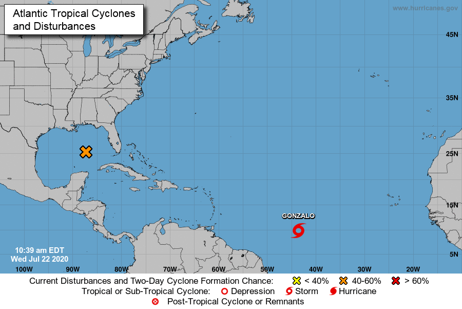
The latter system in the Gulf marked by the orange X (91L) is the most pressing threat, which may become Tropical Storm Hannah in the next 24 hours. Hannah is likely to move into Texas with some heavy rain. The system is not forecast to ramp up much beyond low end tropical storm status, so winds should not be much of a problem, but stay tuned to The Weather Channel for future updates for 91L.
Are Gonzalo and 91L portents of a horrendous tropical season in the Atlantic Basin similar to that of 2005, of which Katrina was the main event? It’s beginning to look so. Everyone is cringing at the thought of a major hurricane bearing down on a big coastal city during this pandemic.
Now let’s look at our heat wave, which will be with us for the rest of July regardless of what happens in the tropics.
As usual let’s access U.S. heat levels for the next two days. Our low level CAT 1 heat wave won’t change much through Thursday. Just a scant few heat advisories remain in place by the National Weather Service across the Middle Atlantic, where a front didn’t clear away dangerous levels of heat:
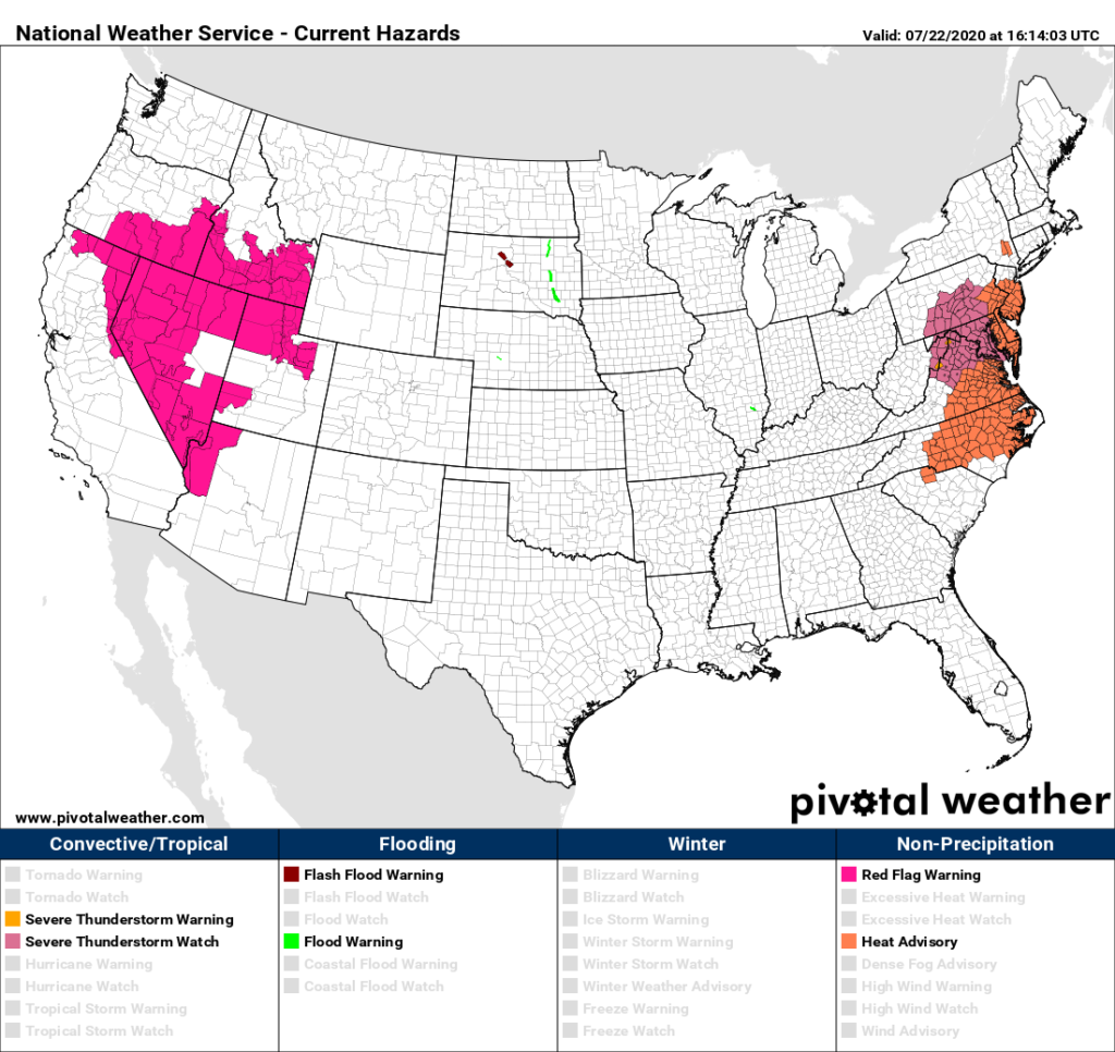
A system coming out of the Ohio Valley will interact with well above average temperatures and produce some severe storms in the Middle Atlantic Wednesday afternoon and evening.
On Thursday a slow warming trend will continue in the Plains:

The temperature regime of highs in the 90s will be about the same across the South and Middle Atlantic.
I’m beginning to see some signs from the ever reliable European model that our prolonged heat wave could be ending just before August begins:
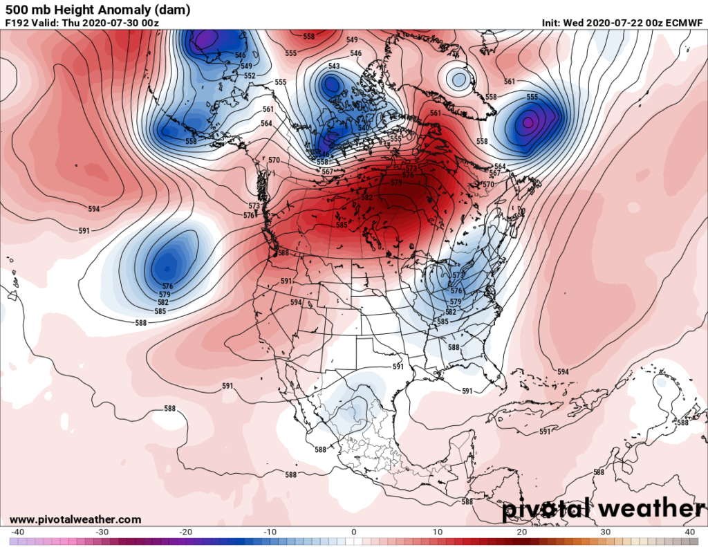
Our heat dome may retrograde into the West allowing a fairly deep trough for this time of the year to move into the Midwest and Northeast putting the kibosh on high heat east of the Rockies. If so, good riddance.
As usual, I’ll be posting more updates on this dangerous heat wave as the day progresses in the space below.
Here is more climate and weather news from Wednesday:
(As usual, this will be a fluid post in which more information gets added during the day as it crosses my radar, crediting all who have put it on-line. Items will be archived on this site for posterity. In most instances click on the pictures of each tweet to see each article. The most noteworthy items will be listed first.)
More hot times continue in Siberia:
Other Climate News:
Now here are some of today’s articles and notes on the horrid COVID-19 pandemic:
(If you like these posts and my work please contribute via the PayPal widget, which has recently been added to this site. Thanks in advance for any support.)
Guy Walton… “The Climate Guy”