The main purpose of this ongoing blog will be to track United States extreme or record temperatures related to climate change. Any reports I see of ETs will be listed below the main topic of the day. I’ll refer to extreme or record temperatures as ETs (not extraterrestrials).😉
Main Topic: The Strange Twisting Path of Eta…Another Sign Of Climate Change
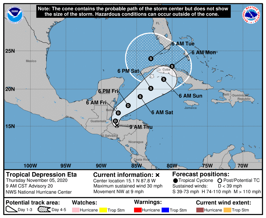
Dear Diary. While the U.S. election was going on, and while we were waiting for outstanding ballots to be processed, a climate crisis tragedy that most news outlets weren’t covering was in the process of unfolding in Central America. Category four strength Hurricane Eta slammed into the coast of Nicaragua on Monday releasing a deluge of rain that can be compared to that of Hurricane Mitch from 1998, which was supposed to be a once in 1200 year event but happened again after only 22 years. The media is still focused on the election, so most of the U.S. public won’t know how much carnage occurred for a few more days, if at all. We have a proverbial out of sight out of mind scenario being played out with Eta.
The public will pay attention to Eta, though, once the system threatens southern Florida over this coming weekend. Eta will be a ghost of its former self, but could get close to hurricane strength once the system nears Cuba. How much Eta will intensify once it moves northeast away from the Central American coast is very uncertain at this time. Mitch also worked its way northeast towards Florida, making landfall there in November 1998.
ETA could be affected by not one but two climate change factors. The most obvious are warmer than average sea surface temperatures, which has already happened, and the other is weak steering currents caused by a warmer than average November atmosphere, particularly across the eastern U.S.
A summer-like ridge should be interacting with ETA, which could actually force the system west or even southwest once the reformed storm approach the latitude of South Florida:
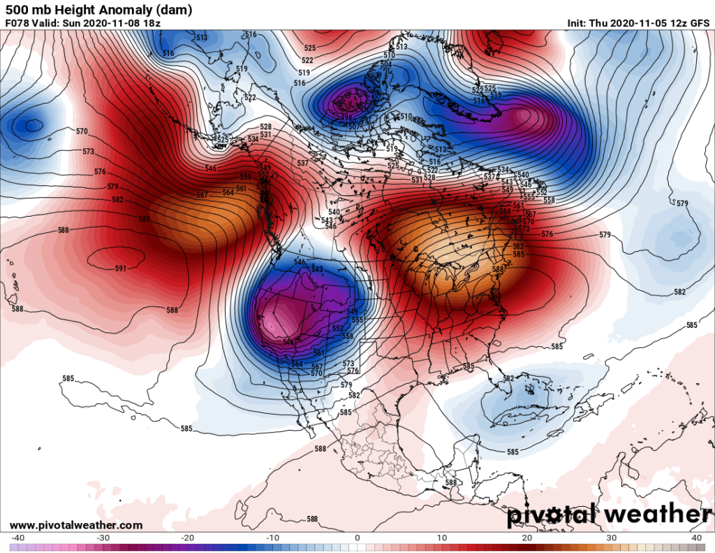
Please note the 588+ decameter ridge that is forecast to be located over the mid-Atlantic area over the weekend. This system should prevent ETA from going out to sea and may force the thing back west to the Gulf of Mexico per the latest National Hurricane Center forecast:
The zig-zag nature of the path of ETA is more indicative of a summer hurricane and not one that would occur in November. Typically once a tropical system gets to the latitude of Florida, it gets zipped east or northeast from a fall jet stream that has dug well southward over the lower 48 states. Not this time.
I’ll be posting much more on Eta as we move through this weekend and probably beyond.
Elsewhere:
Here is more climate and weather news from Thursday:
(As usual, this will be a fluid post in which more information gets added during the day as it crosses my radar, crediting all who have put it on-line. Items will be archived on this site for posterity. In most instances click on the pictures of each tweet to see each article. The most noteworthy items will be listed first.)
Now here are some of today’s articles and notes on the horrid COVID-19 pandemic:
(If you like these posts and my work please contribute via the PayPal widget, which has recently been added to this site. Thanks in advance for any support.)
Guy Walton “The Climate Guy”