Dear Diary. The main purpose of this ongoing blog will be to track global extreme or record temperatures related to climate change. Any reports I see of ETs will be listed below the main topic of the day. I’ll refer to extreme or record temperatures as ETs (not extraterrestrials).😉
Main Topic: Temperature Averages for December Are Likely to Be Historically Warm for The United States
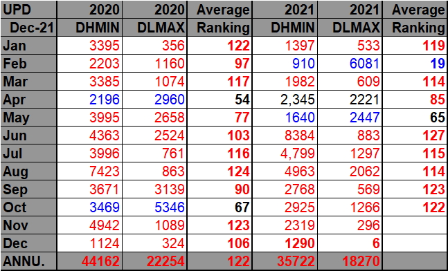
Dar Diary. Unless there is an unforeseen mega-cold outbreak the last week of December, this month is likely to be historically warm, temperature average wise, across the United States. Already we have seen a historic warm wave at the beginning of this month with thousands of records smashed through the first few days of December 2021. Take a look at my “record scoreboards,” which were last updated from data available through 12/3 by the National Center for Environmental Information:


DHMX= Daily High Max Reports. DLMN= Daily Low Min Reports. DHMN= Daily High Min Reports. DLMX=Daily Low Max Reports.
For these data sets all monthly ratios of > 10 to 1 DHMX to DLMN or > 10 to 1 DLMN to DHMX are in bold type. The rankings are for the lower 48 states with the warmest ranking since 1895 of average temperatures being 127 and 1 being the coldest as of 2021. Blue colors represent cold months and red warm. Those months and years with counts close to a 1 to 1 ratio of highs to lows are colored black. Boldly colored months, such as June 2021, have ratios of more than 10 to 1 daily record highs to lows or lows to highs, and are either historically hot or cold, most of which have made news.
So far, we see 3,580 daily warm records with just 10 daily cold records catalogued through 12/3 for December 2021. Thousands more will be catalogued through 12/6 when the first December warm wave ended.
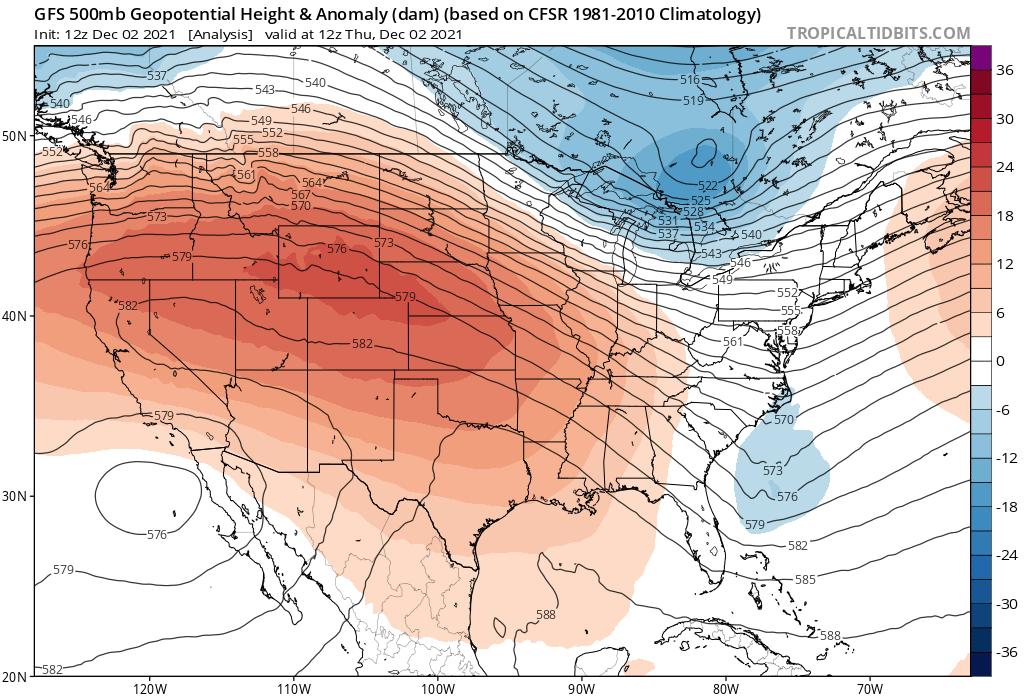
It’s no wonder looking at 500 millibar anomalies on 12/2:

A spring-like 582+ decameter ridge extended back into the West. That’s nothing compared with what should happen by the middle of the month after a brief cool spell in which not many records will be set:
At the surface this is what is expected during the mid-month period:
The above outlook could be made due to great model agreement for ensembles valid for 12/14:

So, we should see at least two historically warm periods this month, but what about the latter part of December?
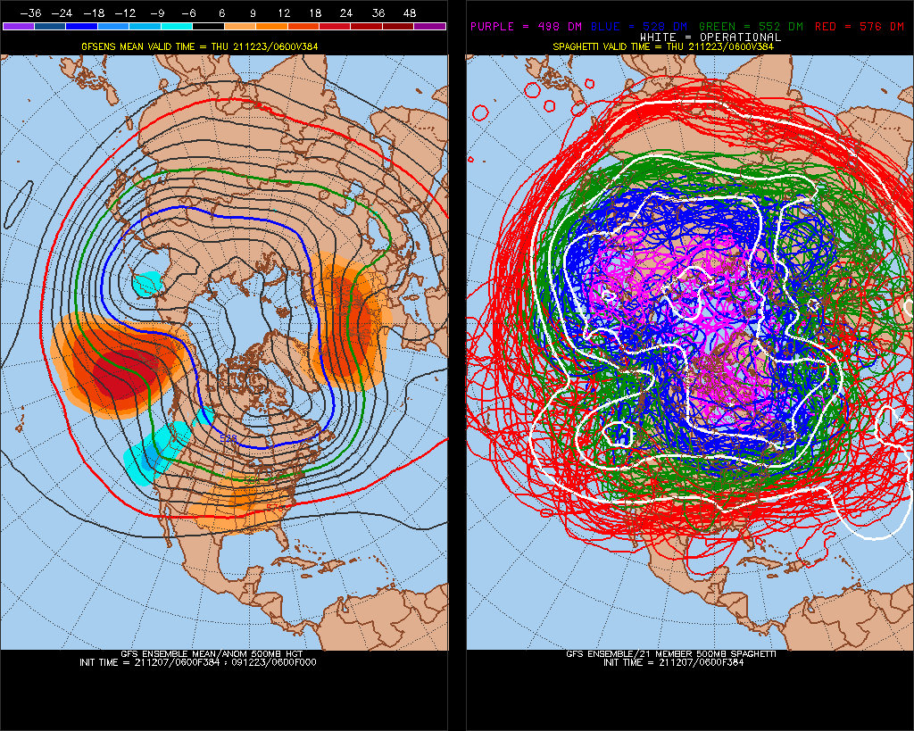
Looking at Penn State ensembles as far out in time as they go through 12/23, we still see a forecast warm anomaly signature over the eastern 2/3rds of the United States:

I seriously doubt that there will be pattern flip to cold during the last week of December for most of the United States, but we will see.
Over this month I expect some wild warm events to take place. You, dear reader, will find most catalogued here on guyonclimate.com.
Here are some “ET’s” reported from Tuesday:
Here is more November 2021 climatology:
Here is more climate and weather news from Tuesday:
(As usual, this will be a fluid post in which more information gets added during the day as it crosses my radar, crediting all who have put it on-line. Items will be archived on this site for posterity. In most instances click on the pictures of each tweet to see each article. The most noteworthy items will be listed first.)
Now here are some of today’s articles and notes on the horrid COVID-19 pandemic:
(If you like these posts and my work please contribute via the PayPal widget, which has recently been added to this site. Thanks in advance for any support.)
Guy Walton “The Climate Guy”